Interlachen is a town in Putnam County, Florida, United States. The population was 1,403 at the 2010 census. The town is part of the Palatka Micropolitan Statistical Area and was named by a gentleman named Mr. Berkelmann from Germany who lived in Interlachen when the town was being incorporated. He said that since the town was located between 2 lakes and there were more than 28 lakes in the town, Interlachen, which means “between the lakes” would be an appropriate name.
| Name: | Interlachen town |
|---|---|
| LSAD Code: | 43 |
| LSAD Description: | town (suffix) |
| State: | Florida |
| County: | Putnam County |
| Elevation: | 105 ft (32 m) |
| Total Area: | 6.45 sq mi (16.71 km²) |
| Land Area: | 6.10 sq mi (15.80 km²) |
| Water Area: | 0.35 sq mi (0.91 km²) |
| Total Population: | 1,441 |
| Population Density: | 236.23/sq mi (91.21/km²) |
| ZIP code: | 32148-32149 |
| Area code: | 386 |
| FIPS code: | 1233900 |
| GNISfeature ID: | 0305857 |
| Website: | www.interlachen-fl.gov |
Online Interactive Map
Click on ![]() to view map in "full screen" mode.
to view map in "full screen" mode.
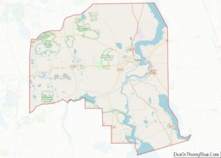
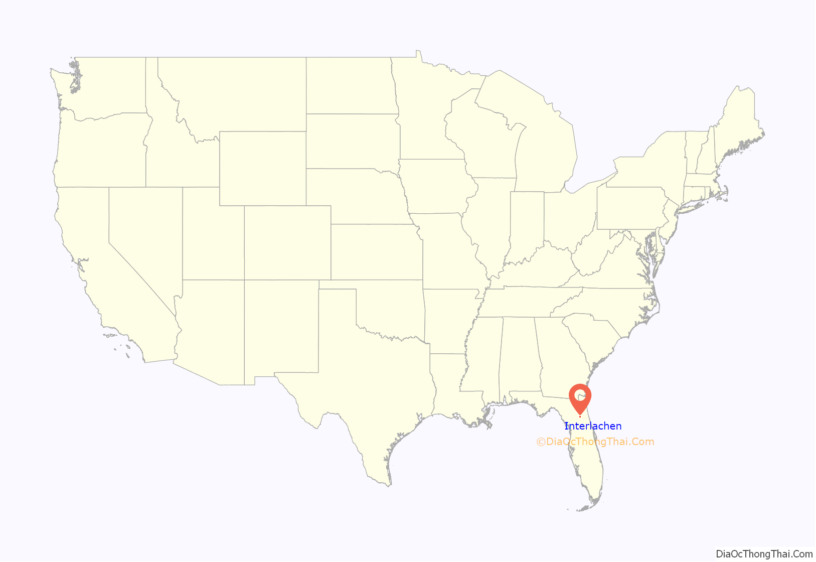
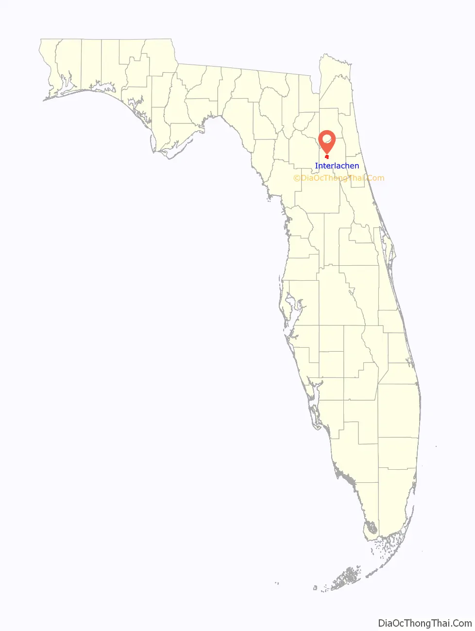
Interlachen location map. Where is Interlachen town?
History
From 1852 until 1892, the area was known as “Blue Pond”. When the Florida Southern Railway came through Interlachen in the 1870s, the area opened up to settlers. The town developed economically as a winter vacation spot and citrus growing area. The town of Interlachen was incorporated in 1888. The Hastings Seed House was organized in 1889, moving to Atlanta, Georgia ten years later. In 1891, the Interlachen Town Hall burned down. Another was built to replace it the following year and it still stands—now housing a museum—and is also used as a place for presentations for certain festivals. When the Great Freeze hit in 1895, the town’s tourism and citrus sharply declined. In 1895, Interlachen Academy was built; it is the oldest wooden school house in continuous use in Florida, which now serves as the location of the Interlachen High School’s JROTC program. In 1926, Interlachen first gained electricity and Route 14, now State Road 20, was constructed through Interlachen. In the 1930s a train came through the town every two hours. But in 1969, with the decline of railroads, the Interlachen Railroad depot was razed. Currently, a caboose sits in the middle of the town as a reminder of the tourist haven the town once was.
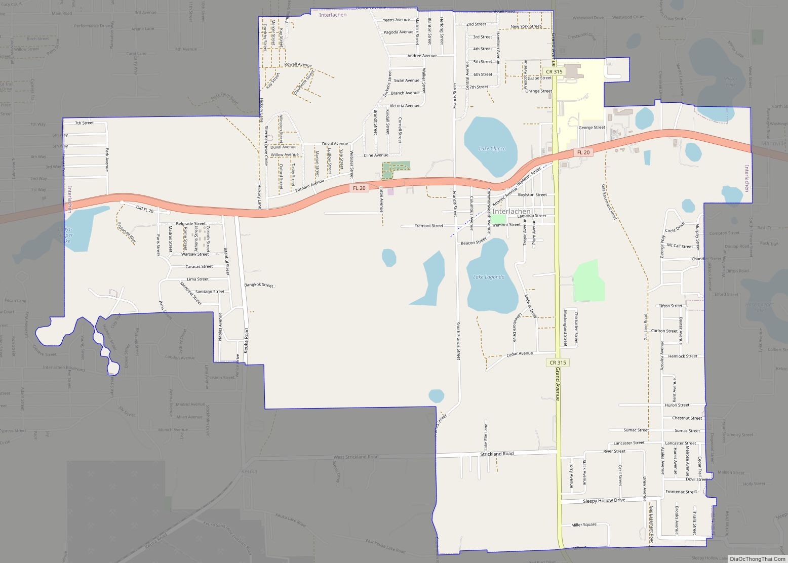
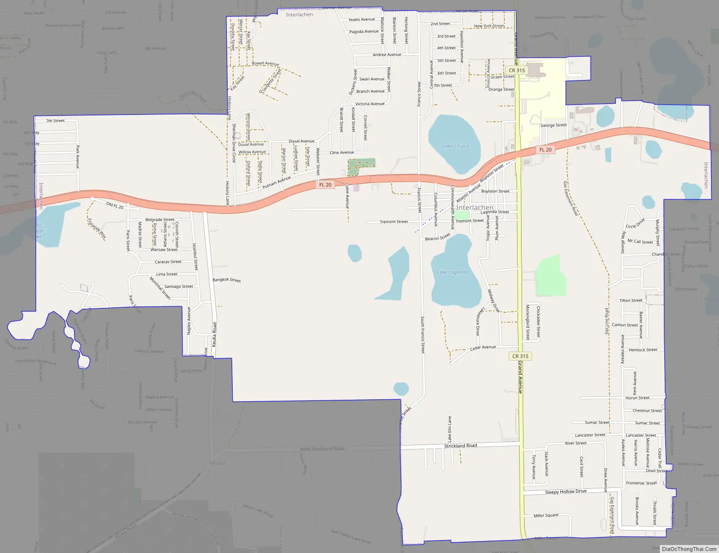
Interlachen Road Map
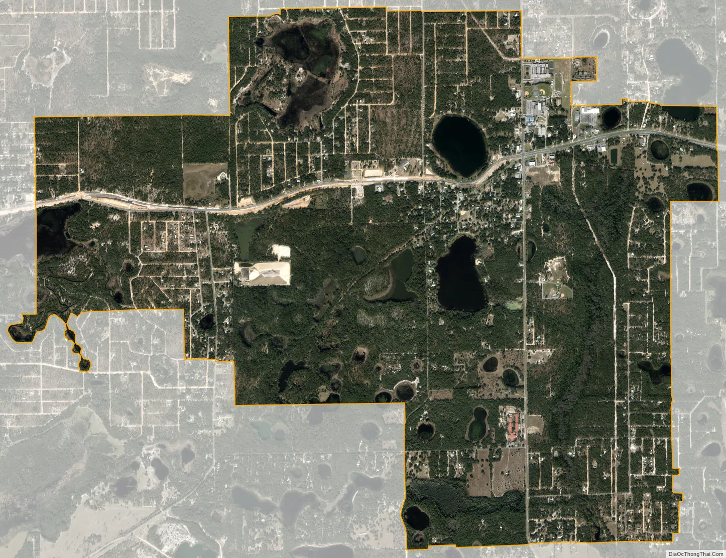
Interlachen city Satellite Map
Geography
Interlachen is located at 29°37′22″N 81°53′41″W / 29.62278°N 81.89472°W / 29.62278; -81.89472 (29.622709, –81.894680).
According to the United States Census Bureau, the town has a total area of 6.4 square miles (17 km), of which 5.8 square miles (15 km) is land and 0.6 square miles (1.6 km) (10.08%) is water.
See also
Map of Florida State and its subdivision:- Alachua
- Baker
- Bay
- Bradford
- Brevard
- Broward
- Calhoun
- Charlotte
- Citrus
- Clay
- Collier
- Columbia
- Desoto
- Dixie
- Duval
- Escambia
- Flagler
- Franklin
- Gadsden
- Gilchrist
- Glades
- Gulf
- Hamilton
- Hardee
- Hendry
- Hernando
- Highlands
- Hillsborough
- Holmes
- Indian River
- Jackson
- Jefferson
- Lafayette
- Lake
- Lee
- Leon
- Levy
- Liberty
- Madison
- Manatee
- Marion
- Martin
- Miami-Dade
- Monroe
- Nassau
- Okaloosa
- Okeechobee
- Orange
- Osceola
- Palm Beach
- Pasco
- Pinellas
- Polk
- Putnam
- Saint Johns
- Saint Lucie
- Santa Rosa
- Sarasota
- Seminole
- Sumter
- Suwannee
- Taylor
- Union
- Volusia
- Wakulla
- Walton
- Washington
- Alabama
- Alaska
- Arizona
- Arkansas
- California
- Colorado
- Connecticut
- Delaware
- District of Columbia
- Florida
- Georgia
- Hawaii
- Idaho
- Illinois
- Indiana
- Iowa
- Kansas
- Kentucky
- Louisiana
- Maine
- Maryland
- Massachusetts
- Michigan
- Minnesota
- Mississippi
- Missouri
- Montana
- Nebraska
- Nevada
- New Hampshire
- New Jersey
- New Mexico
- New York
- North Carolina
- North Dakota
- Ohio
- Oklahoma
- Oregon
- Pennsylvania
- Rhode Island
- South Carolina
- South Dakota
- Tennessee
- Texas
- Utah
- Vermont
- Virginia
- Washington
- West Virginia
- Wisconsin
- Wyoming