Mango is a census-designated place (CDP) in Hillsborough County, Florida, United States. The population was 11,313 at the 2010 census, up from 8,842 at the 2000 census.
| Name: | Mango CDP |
|---|---|
| LSAD Code: | 57 |
| LSAD Description: | CDP (suffix) |
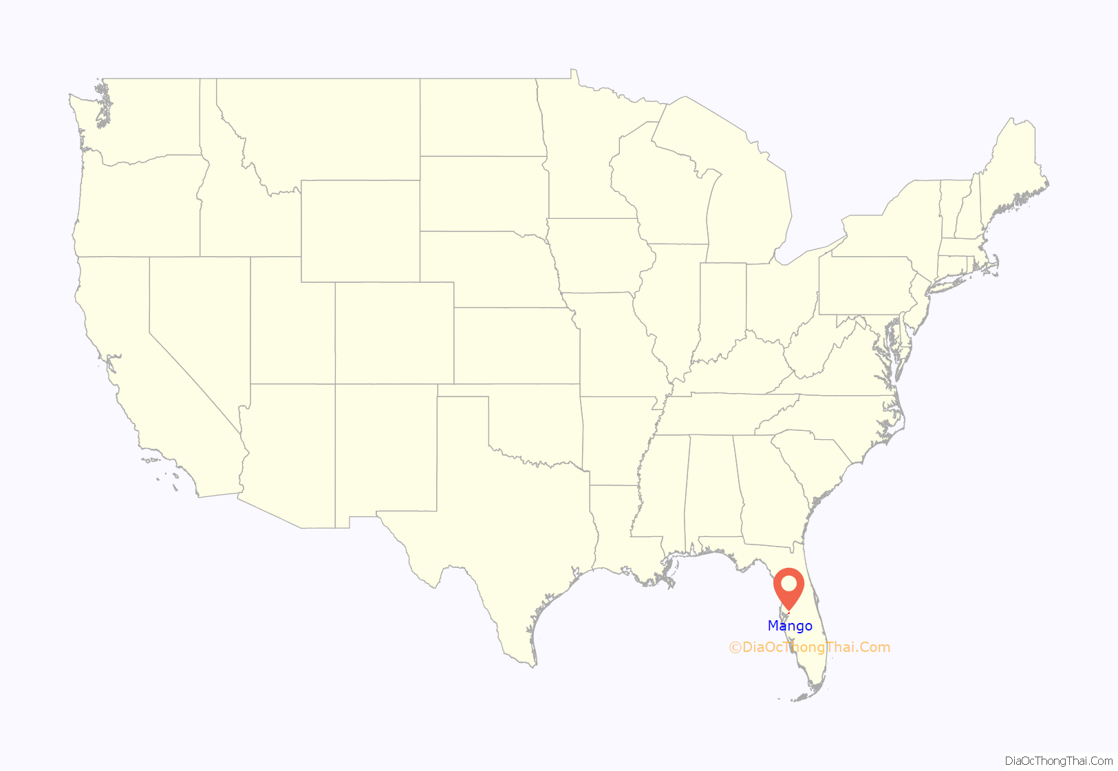
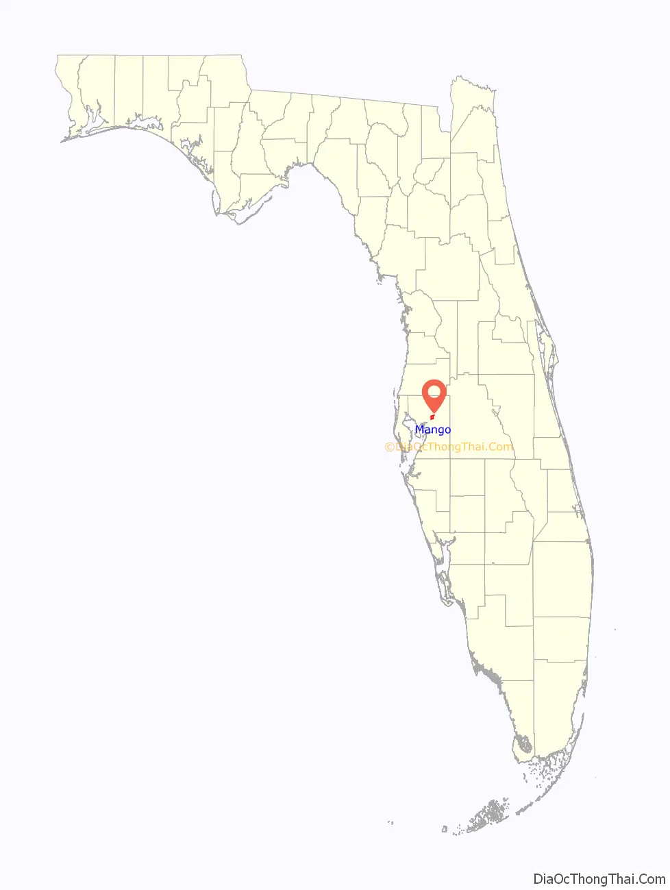
| State: | Florida |
| County: | Hillsborough County |
| Elevation: | 52 ft (16 m) |
| Total Area: | 4.81 sq mi (12.46 km²) |
| Land Area: | 4.67 sq mi (12.09 km²) |
| Water Area: | 0.14 sq mi (0.37 km²) |
| Total Population: | 12,699 |
| Population Density: | 2,720.44/sq mi (1,050.38/km²) |
| ZIP code: | 33550 |
| Area code: | 813 |
| FIPS code: | 1242850 |
| GNISfeature ID: | 0286372 |
Online Interactive Map
Click on ![]() to view map in "full screen" mode.
to view map in "full screen" mode.
Mango location map. Where is Mango CDP?
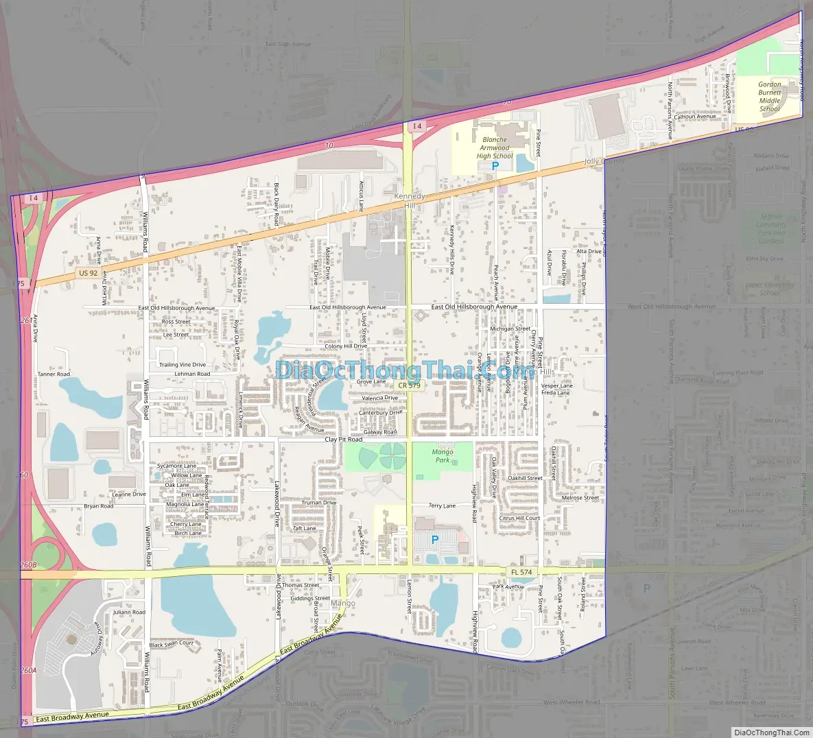
Mango Road Map
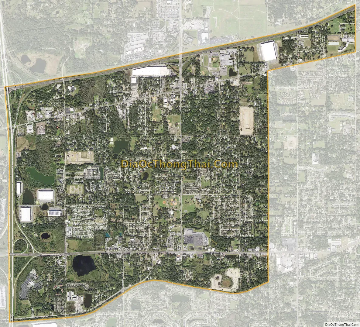
Mango city Satellite Map
Geography
Mango is located north of the geographic center of Hillsborough County at 27°59′22″N 82°18′16″W / 27.98944°N 82.30444°W / 27.98944; -82.30444 (27.989333, -82.304395). It is bordered to the north by Thonotosassa, to the east by Seffner, to the south by Brandon, and to the west by East Lake-Orient Park. Interstate 4 forms the northern boundary of the CDP, and Interstate 75 is the western boundary. The main road through the center of Mango is Dr. Martin Luther King Jr. Boulevard (Florida State Road 574). Downtown Tampa is 10 miles (16 km) to the west, and Plant City is 12 miles (19 km) to the east.
According to the United States Census Bureau, the Mango CDP has a total area of 4.8 square miles (12.4 km), of which 4.7 square miles (12.1 km) are land and 0.1 square miles (0.3 km), or 2.95%, are water.
See also
Map of Florida State and its subdivision:- Alachua
- Baker
- Bay
- Bradford
- Brevard
- Broward
- Calhoun
- Charlotte
- Citrus
- Clay
- Collier
- Columbia
- Desoto
- Dixie
- Duval
- Escambia
- Flagler
- Franklin
- Gadsden
- Gilchrist
- Glades
- Gulf
- Hamilton
- Hardee
- Hendry
- Hernando
- Highlands
- Hillsborough
- Holmes
- Indian River
- Jackson
- Jefferson
- Lafayette
- Lake
- Lee
- Leon
- Levy
- Liberty
- Madison
- Manatee
- Marion
- Martin
- Miami-Dade
- Monroe
- Nassau
- Okaloosa
- Okeechobee
- Orange
- Osceola
- Palm Beach
- Pasco
- Pinellas
- Polk
- Putnam
- Saint Johns
- Saint Lucie
- Santa Rosa
- Sarasota
- Seminole
- Sumter
- Suwannee
- Taylor
- Union
- Volusia
- Wakulla
- Walton
- Washington
- Alabama
- Alaska
- Arizona
- Arkansas
- California
- Colorado
- Connecticut
- Delaware
- District of Columbia
- Florida
- Georgia
- Hawaii
- Idaho
- Illinois
- Indiana
- Iowa
- Kansas
- Kentucky
- Louisiana
- Maine
- Maryland
- Massachusetts
- Michigan
- Minnesota
- Mississippi
- Missouri
- Montana
- Nebraska
- Nevada
- New Hampshire
- New Jersey
- New Mexico
- New York
- North Carolina
- North Dakota
- Ohio
- Oklahoma
- Oregon
- Pennsylvania
- Rhode Island
- South Carolina
- South Dakota
- Tennessee
- Texas
- Utah
- Vermont
- Virginia
- Washington
- West Virginia
- Wisconsin
- Wyoming


