Progress Village is a census-designated place (CDP) in Hillsborough County, Florida, United States. Per the 2020 census, the population was 11,188.
| Name: | Progress Village CDP |
|---|---|
| LSAD Code: | 57 |
| LSAD Description: | CDP (suffix) |
| State: | Florida |
| County: | Hillsborough County |
| Elevation: | 16 ft (5 m) |
| Total Area: | 3.25 sq mi (8.42 km²) |
| Land Area: | 3.03 sq mi (7.84 km²) |
| Water Area: | 0.22 sq mi (0.58 km²) |
| Total Population: | 11,188 |
| Population Density: | 3,697.29/sq mi (1,427.69/km²) |
| ZIP code: | 33619 |
| Area code: | 813 |
| FIPS code: | 1259050 |
| GNISfeature ID: | 0301139 |
Online Interactive Map
Click on ![]() to view map in "full screen" mode.
to view map in "full screen" mode.
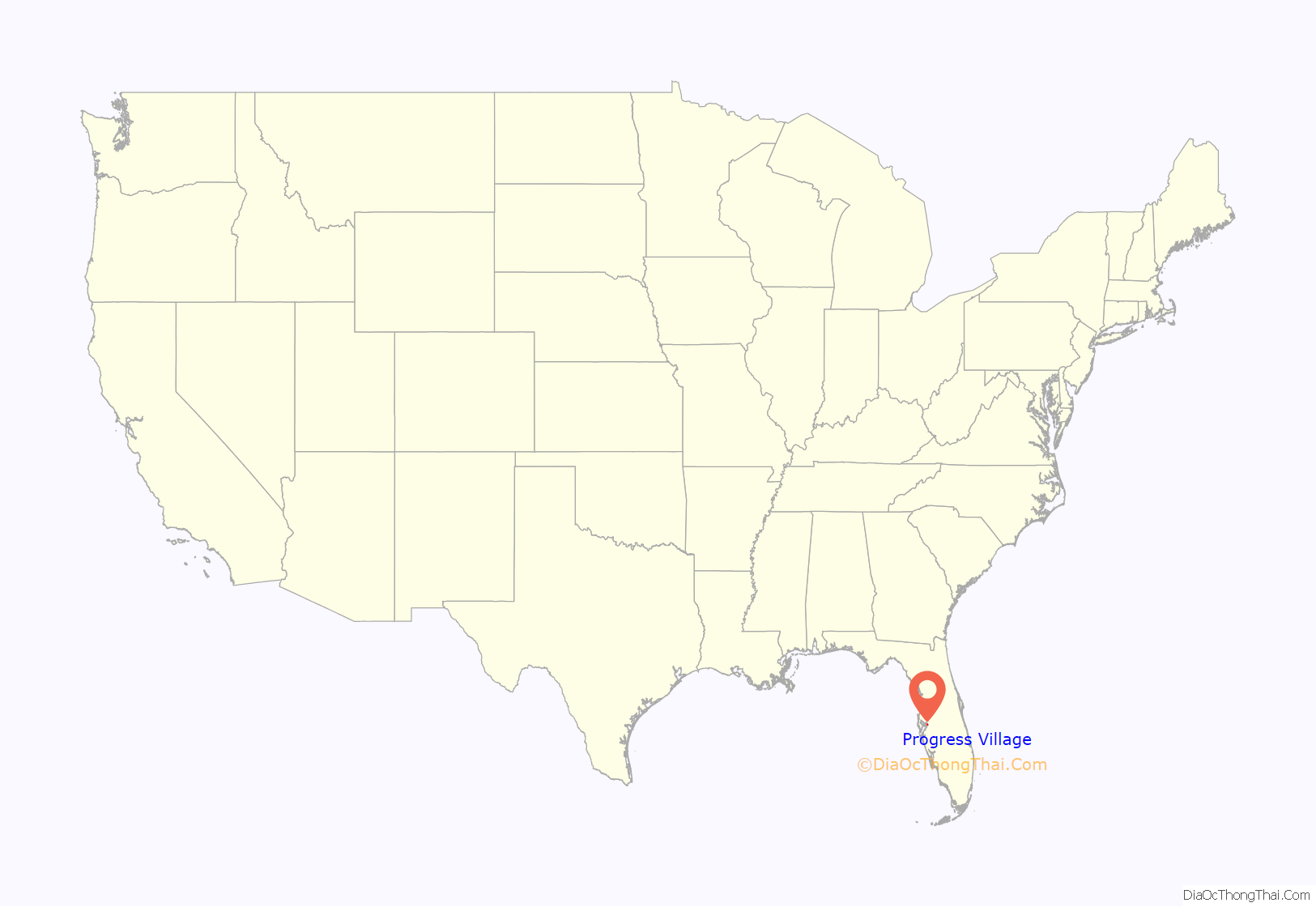
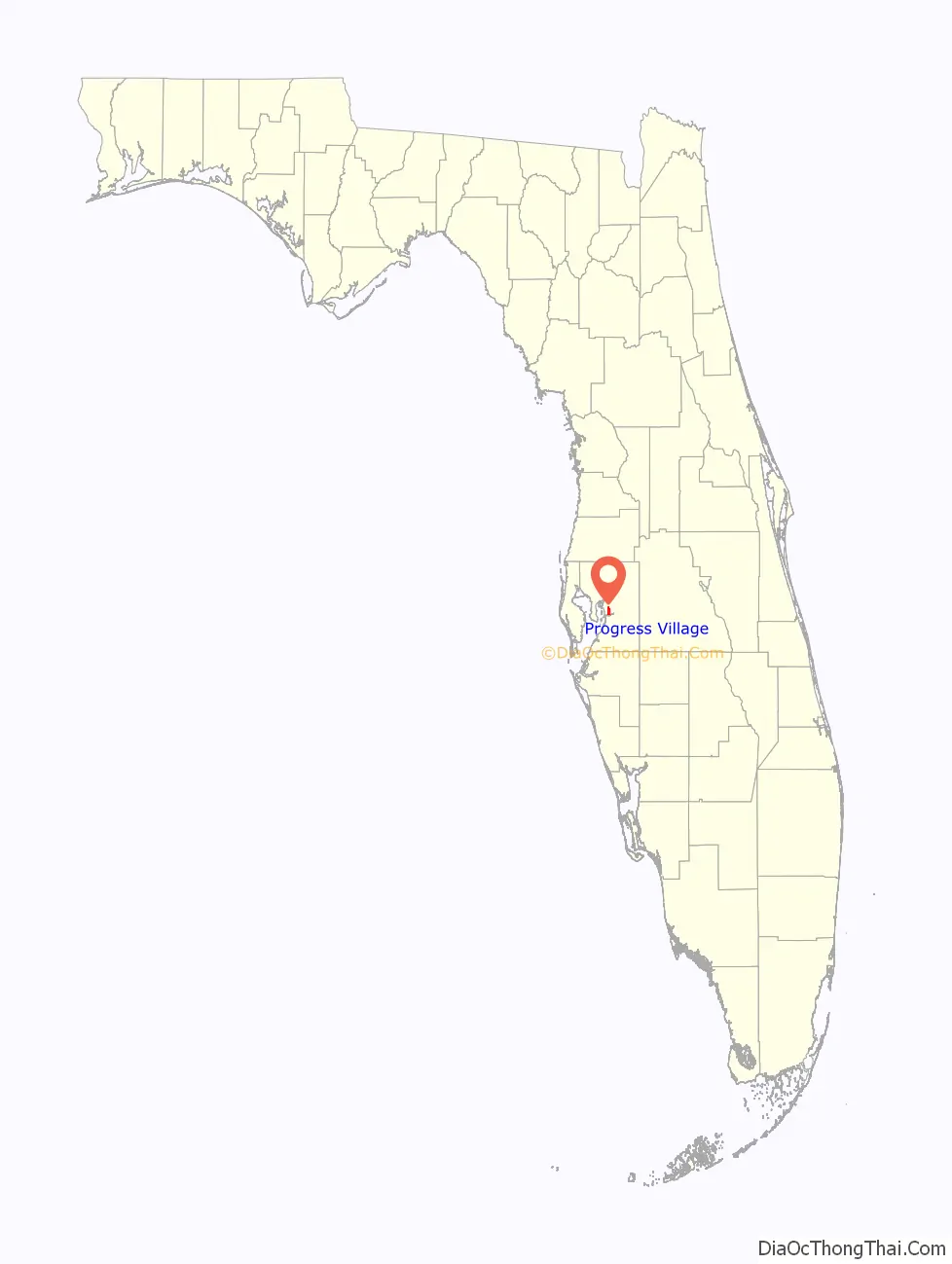
Progress Village location map. Where is Progress Village CDP?
History
Progress Village was Tampa’s first low-income housing suburb. It was planned as a neighborhood for low-income residents outside of the city limits.
Progress Village Middle Magnet School of the Arts and Jack Lamb Elementary School are on the southern edge of Progress Village.
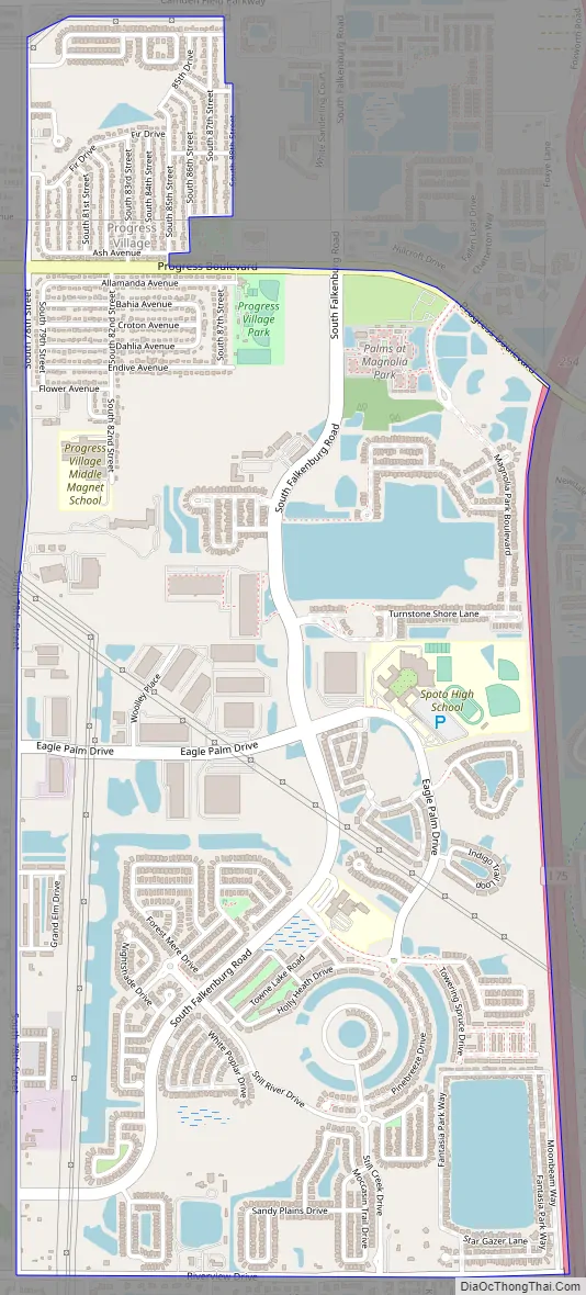
Progress Village Road Map
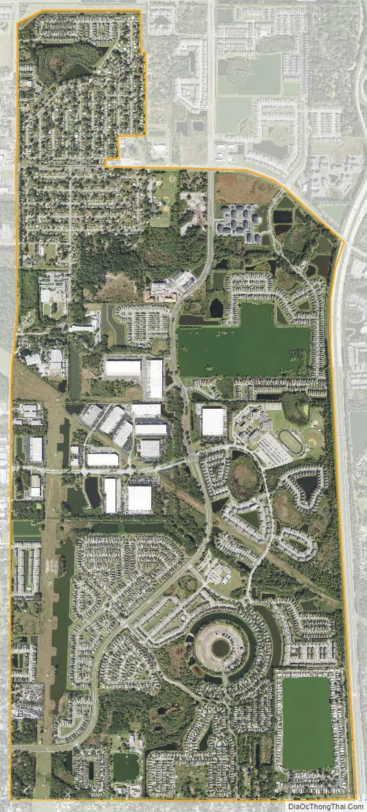
Progress Village city Satellite Map
Geography
Progress Village is located near the geographic center of Hillsborough County and is bordered by Palm River-Clair Mel to the north, Riverview to the east, and Gibsonton to the south. Interstate 75 forms the eastern edge of the CDP, and the western edge follows County Road 573. Progress Village is 9 miles (14 km) southeast of downtown Tampa.
According to the United States Census Bureau, the CDP has a total area of 3.2 square miles (8.4 km), of which 3.0 square miles (7.8 km) are land and 0.2 square miles (0.6 km), or 6.90%, are water.
See also
Map of Florida State and its subdivision:- Alachua
- Baker
- Bay
- Bradford
- Brevard
- Broward
- Calhoun
- Charlotte
- Citrus
- Clay
- Collier
- Columbia
- Desoto
- Dixie
- Duval
- Escambia
- Flagler
- Franklin
- Gadsden
- Gilchrist
- Glades
- Gulf
- Hamilton
- Hardee
- Hendry
- Hernando
- Highlands
- Hillsborough
- Holmes
- Indian River
- Jackson
- Jefferson
- Lafayette
- Lake
- Lee
- Leon
- Levy
- Liberty
- Madison
- Manatee
- Marion
- Martin
- Miami-Dade
- Monroe
- Nassau
- Okaloosa
- Okeechobee
- Orange
- Osceola
- Palm Beach
- Pasco
- Pinellas
- Polk
- Putnam
- Saint Johns
- Saint Lucie
- Santa Rosa
- Sarasota
- Seminole
- Sumter
- Suwannee
- Taylor
- Union
- Volusia
- Wakulla
- Walton
- Washington
- Alabama
- Alaska
- Arizona
- Arkansas
- California
- Colorado
- Connecticut
- Delaware
- District of Columbia
- Florida
- Georgia
- Hawaii
- Idaho
- Illinois
- Indiana
- Iowa
- Kansas
- Kentucky
- Louisiana
- Maine
- Maryland
- Massachusetts
- Michigan
- Minnesota
- Mississippi
- Missouri
- Montana
- Nebraska
- Nevada
- New Hampshire
- New Jersey
- New Mexico
- New York
- North Carolina
- North Dakota
- Ohio
- Oklahoma
- Oregon
- Pennsylvania
- Rhode Island
- South Carolina
- South Dakota
- Tennessee
- Texas
- Utah
- Vermont
- Virginia
- Washington
- West Virginia
- Wisconsin
- Wyoming


