Worthington Springs is a spring and town in Union County, Florida, United States. The population was 181 at the 2010 census. According to the U.S. Census Bureau’s 2018 estimates, the town had a population of 380.
| Name: | Worthington Springs town |
|---|---|
| LSAD Code: | 43 |
| LSAD Description: | town (suffix) |
| State: | Florida |
| County: | Union County |
| Elevation: | 118 ft (36 m) |
| Total Area: | 0.97 sq mi (2.51 km²) |
| Land Area: | 0.96 sq mi (2.48 km²) |
| Water Area: | 0.01 sq mi (0.03 km²) |
| Total Population: | 378 |
| Population Density: | 394.16/sq mi (152.22/km²) |
| ZIP code: | 32697 |
| Area code: | 386 |
| FIPS code: | 1278775 |
| GNISfeature ID: | 0293538 |
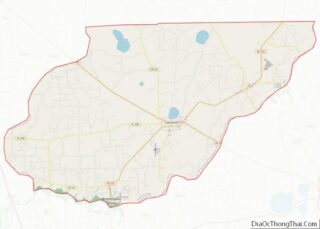
Online Interactive Map
Click on ![]() to view map in "full screen" mode.
to view map in "full screen" mode.
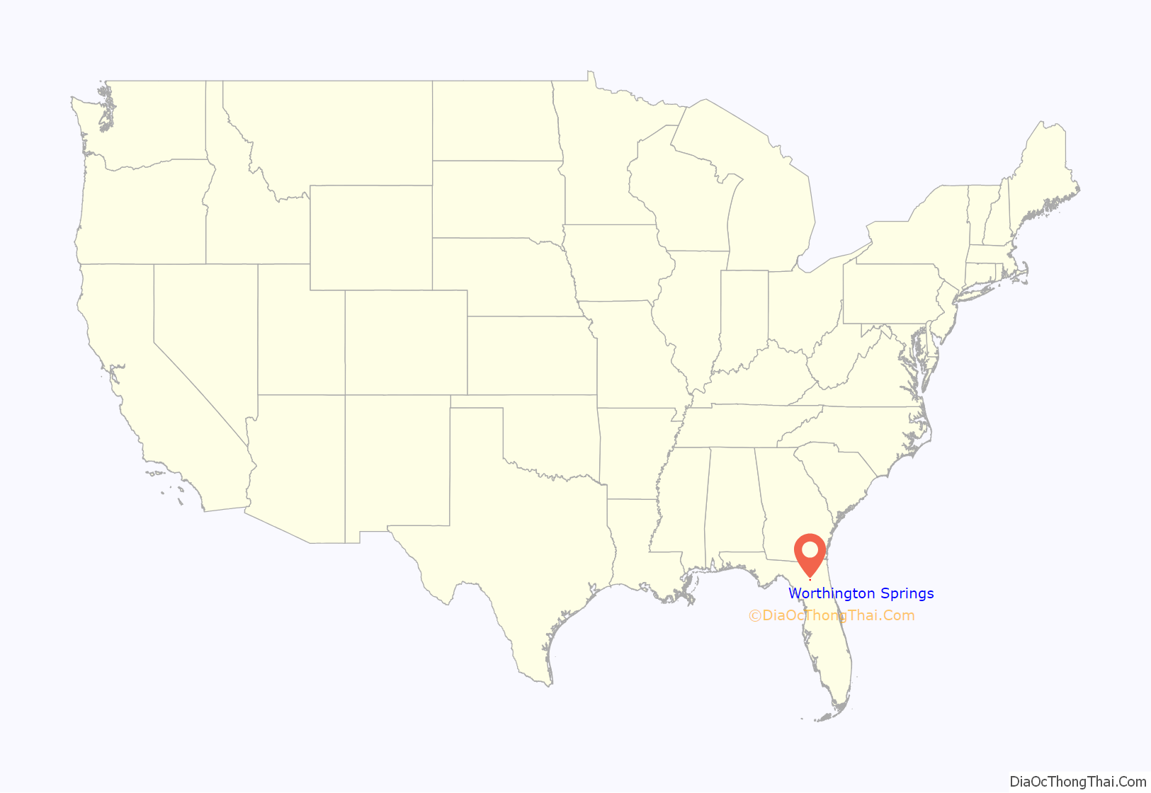
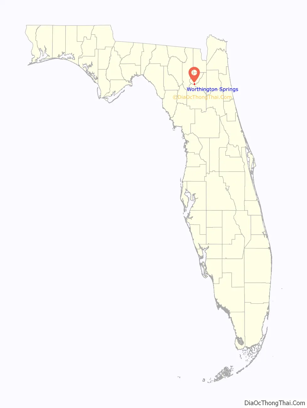
Worthington Springs location map. Where is Worthington Springs town?
History
The community was named for early settler Sam Worthington, who arrived prior to the first Seminole War of 1814–1819. The mineral spring on the Santa Fe River was alleged to have medicinal benefits, attracting people from the late 1800s to the early 1900s. In the early years, swimming was segregated, with men and women assigned specific time intervals. In 1906, the new owner constructed a 12’×12′ concrete box around the spring to divert water into a 90’×50′ concrete pool with a wall dividing the bathing area into sections for men and women. The complex included a hotel, recreation hall and bathhouse for the spring pool.
Independence Day was always a big celebration at the springs. Thousands of people from surrounding communities would converge on the springs to picnic, swim, politic and converse with friends and fellow Floridians. A special train transported people from Jacksonville for the holiday festivities. An iron and timber bridge was built across the river in 1908, facilitating access to and from the south. It was replaced in 1937 with the present concrete structure. In the mid-twentieth century, the outflow from the spring declined, and then stopped flowing completely. Activity at the resort likewise curtailed, and the facility was abandoned. The area around the Santa Fe river is subject to periodic flooding, just as the flow at the spring varies widely. In 1972, flow was measured at 233,280 gallons per day.
Worthington Springs was incorporated in 1963 with a Mayor–council government. Street lights were installed, and a playground was created in the town park. In 1975, a Community Center was built the included government offices for a City Hall.
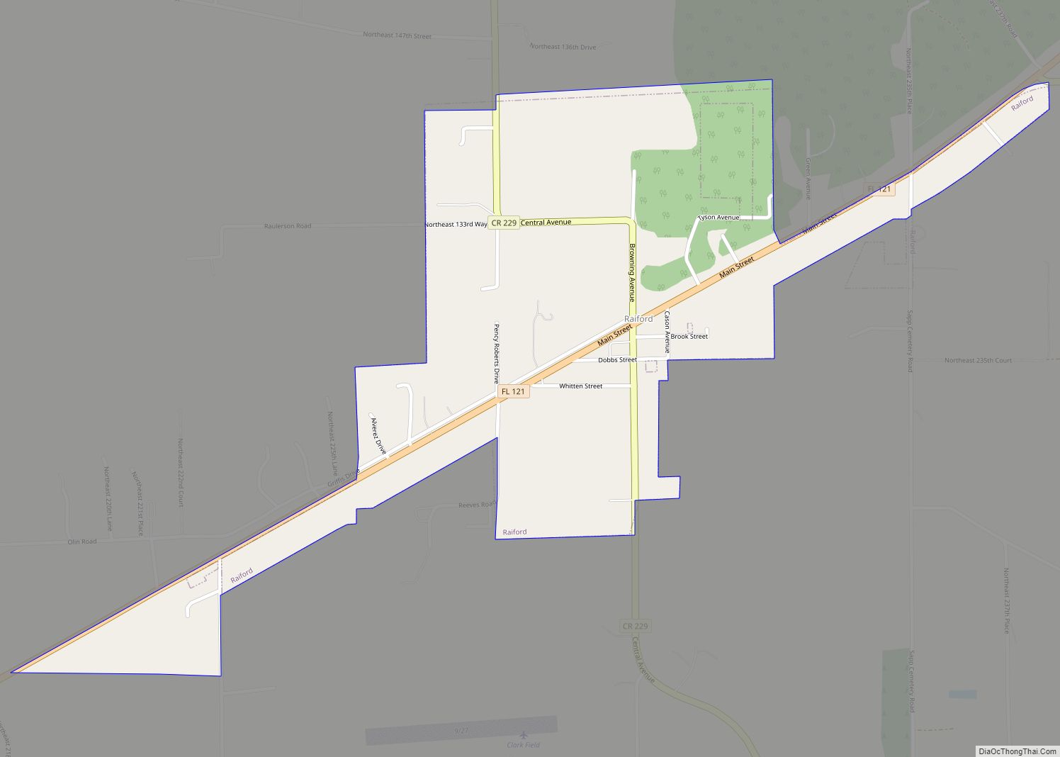
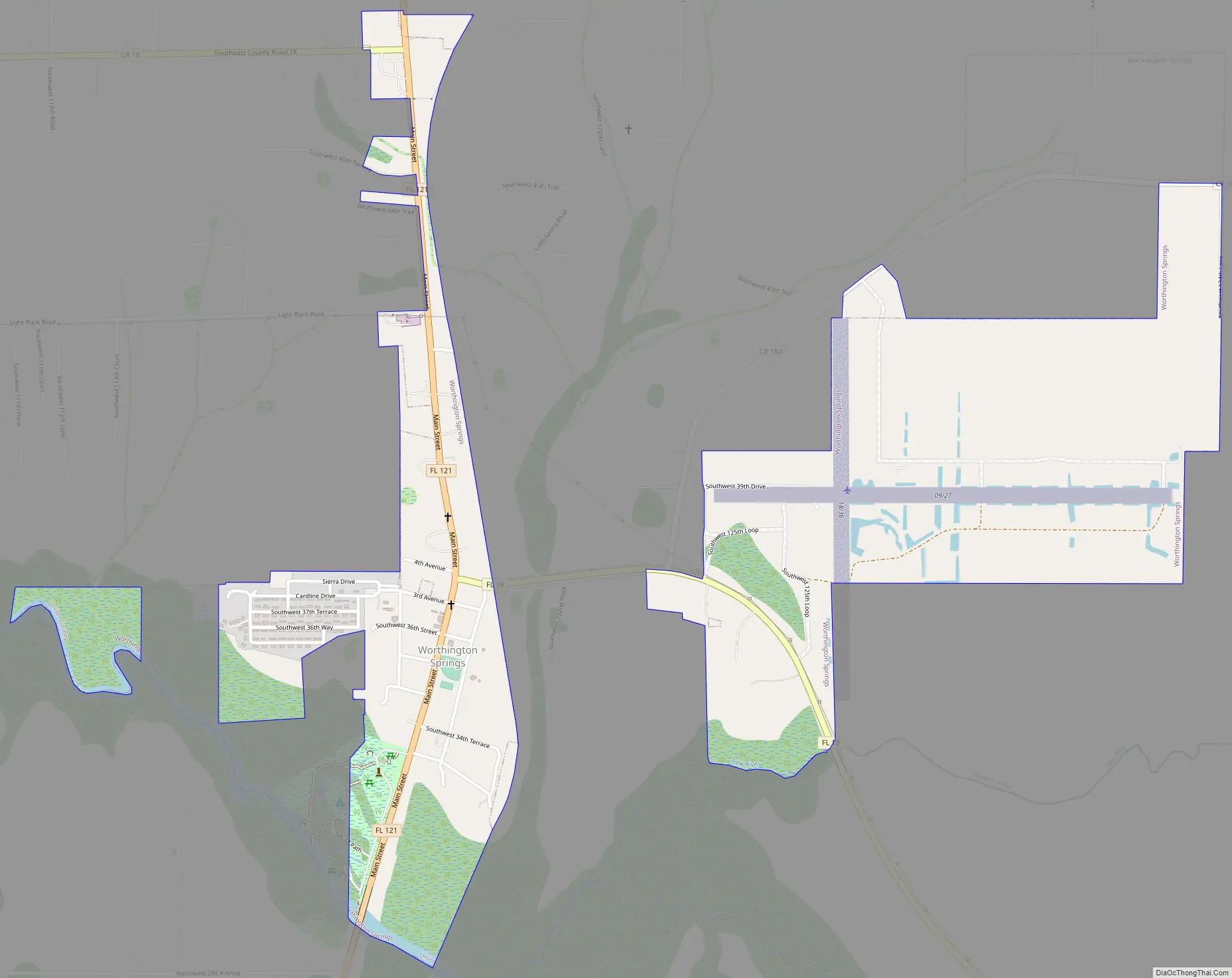
Worthington Springs Road Map
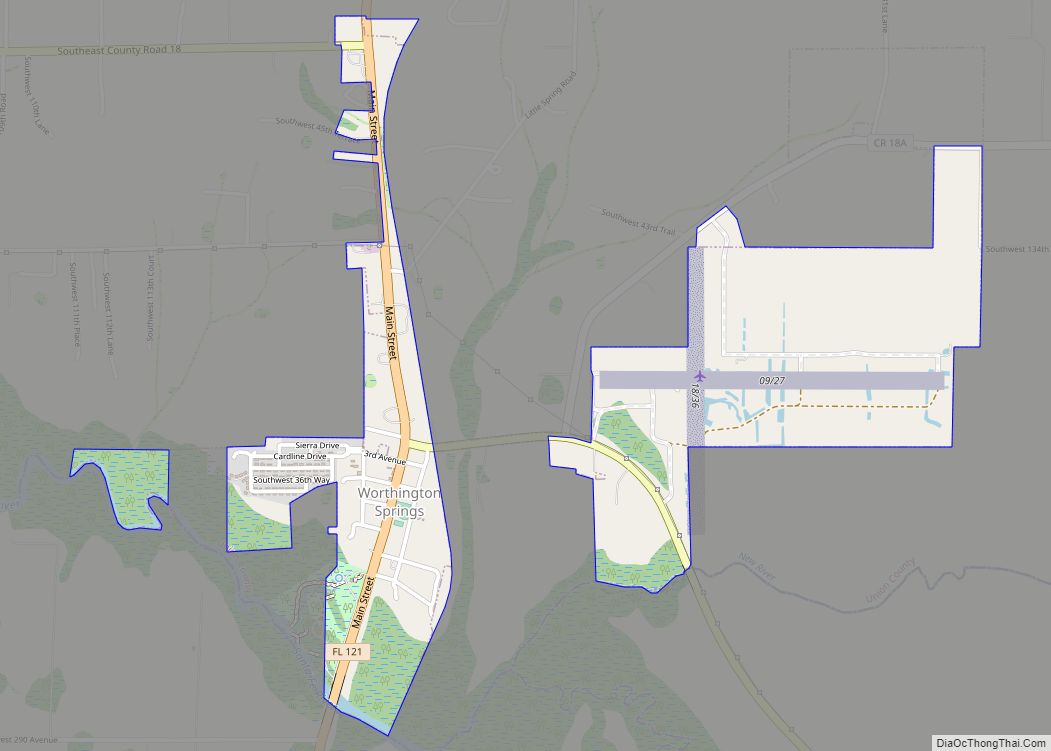
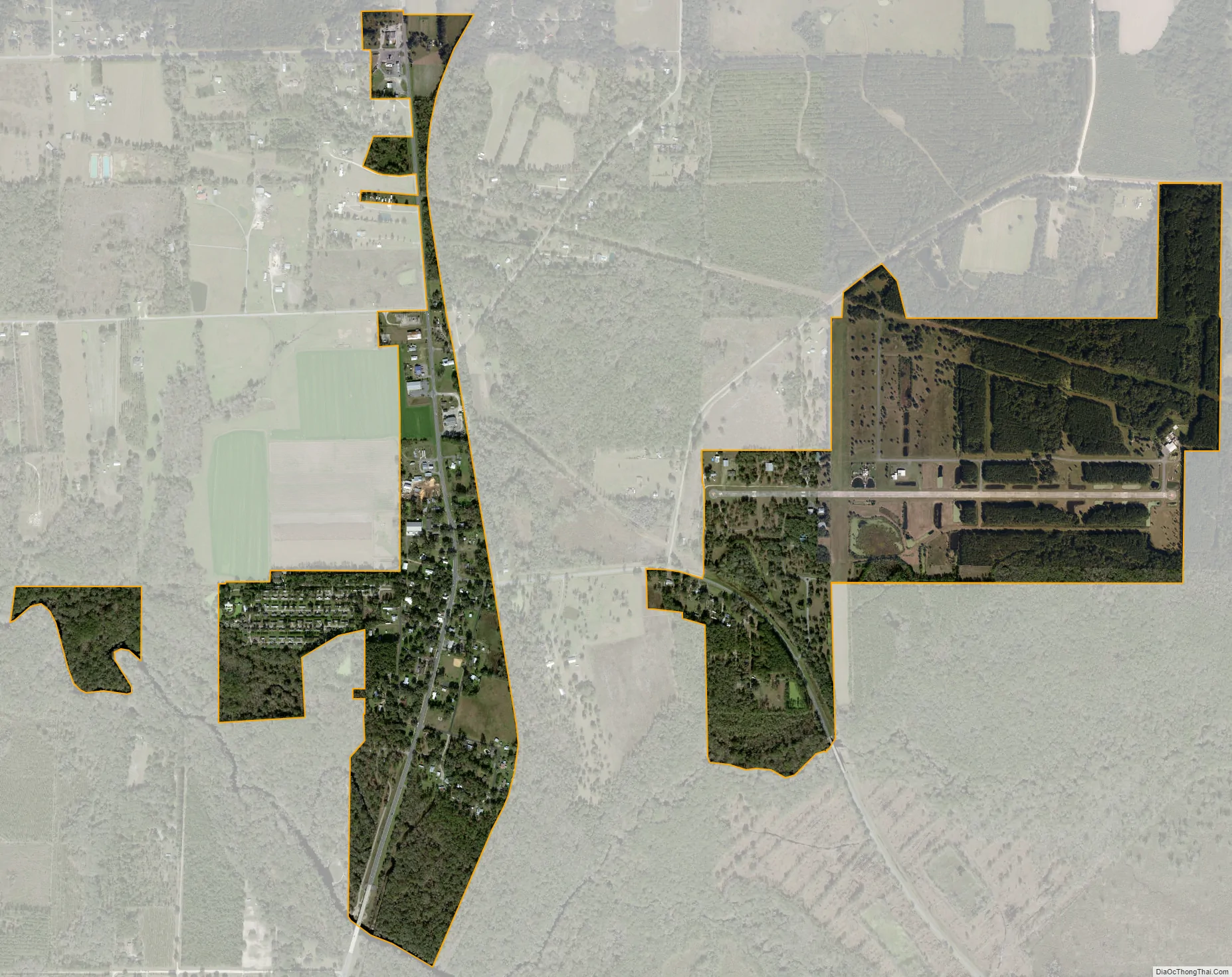
Worthington Springs city Satellite Map
Geography
Worthington Springs is located at 29°56′2″N 82°25′28″W / 29.93389°N 82.42444°W / 29.93389; -82.42444 (29.933836, –82.424370). The town is located along the Santa Fe River on the southern county line with Alachua. According to the United States Census Bureau, the town has a total area of 0.4 square miles (1.0 km), all land.
See also
Map of Florida State and its subdivision:- Alachua
- Baker
- Bay
- Bradford
- Brevard
- Broward
- Calhoun
- Charlotte
- Citrus
- Clay
- Collier
- Columbia
- Desoto
- Dixie
- Duval
- Escambia
- Flagler
- Franklin
- Gadsden
- Gilchrist
- Glades
- Gulf
- Hamilton
- Hardee
- Hendry
- Hernando
- Highlands
- Hillsborough
- Holmes
- Indian River
- Jackson
- Jefferson
- Lafayette
- Lake
- Lee
- Leon
- Levy
- Liberty
- Madison
- Manatee
- Marion
- Martin
- Miami-Dade
- Monroe
- Nassau
- Okaloosa
- Okeechobee
- Orange
- Osceola
- Palm Beach
- Pasco
- Pinellas
- Polk
- Putnam
- Saint Johns
- Saint Lucie
- Santa Rosa
- Sarasota
- Seminole
- Sumter
- Suwannee
- Taylor
- Union
- Volusia
- Wakulla
- Walton
- Washington
- Alabama
- Alaska
- Arizona
- Arkansas
- California
- Colorado
- Connecticut
- Delaware
- District of Columbia
- Florida
- Georgia
- Hawaii
- Idaho
- Illinois
- Indiana
- Iowa
- Kansas
- Kentucky
- Louisiana
- Maine
- Maryland
- Massachusetts
- Michigan
- Minnesota
- Mississippi
- Missouri
- Montana
- Nebraska
- Nevada
- New Hampshire
- New Jersey
- New Mexico
- New York
- North Carolina
- North Dakota
- Ohio
- Oklahoma
- Oregon
- Pennsylvania
- Rhode Island
- South Carolina
- South Dakota
- Tennessee
- Texas
- Utah
- Vermont
- Virginia
- Washington
- West Virginia
- Wisconsin
- Wyoming