Bel Aire is a city in Sedgwick County, Kansas, United States, and a suburb of Wichita. As of the 2020 census, the population of the city was 8,262.
| Name: | Bel Aire city |
|---|---|
| LSAD Code: | 25 |
| LSAD Description: | city (suffix) |
| State: | Kansas |
| County: | Sedgwick County |
| Founded: | 1955 |
| Incorporated: | 1980 |
| Elevation: | 1,394 ft (425 m) |
| Total Area: | 6.79 sq mi (17.60 km²) |
| Land Area: | 6.76 sq mi (17.52 km²) |
| Water Area: | 0.03 sq mi (0.08 km²) |
| Total Population: | 8,262 |
| Population Density: | 1,200/sq mi (470/km²) |
| ZIP code: | 67220, 67226 |
| Area code: | 316 |
| FIPS code: | 2005337 |
| Website: | belaireks.gov |
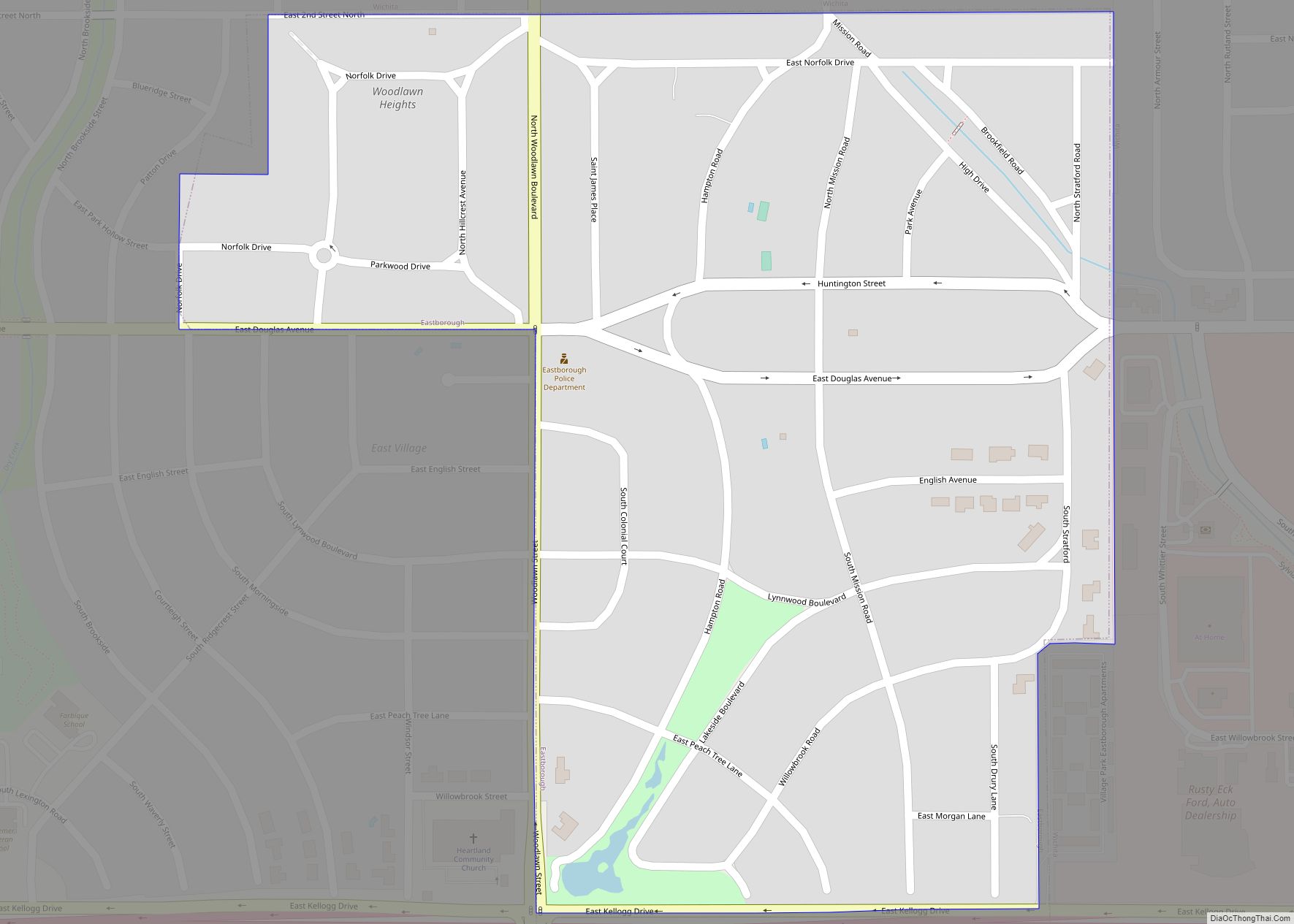
Online Interactive Map
Click on ![]() to view map in "full screen" mode.
to view map in "full screen" mode.
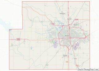
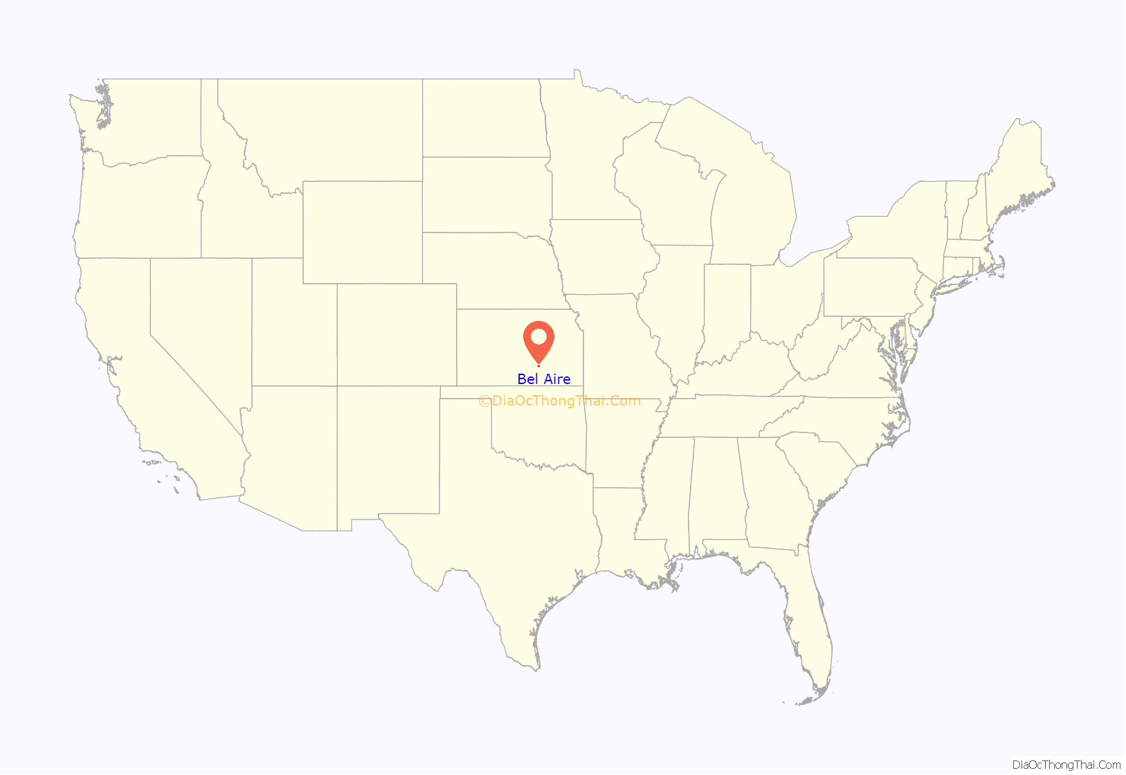
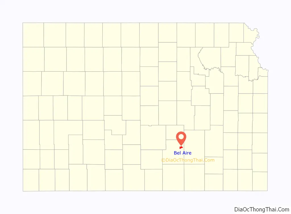
Bel Aire location map. Where is Bel Aire city?
History
Bel Aire was founded in January 1955 when a group of local residents petitioned the county government to create it as an improvement district for water.
On November 26, 1980, Bel Aire formally incorporated as a city. This was despite a two-year legal dispute with the Wichita city government over whether or not it had the right to do so. The case ultimately went to the Kansas Supreme Court which ruled in Bel Aire’s favor.
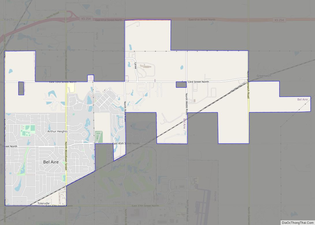
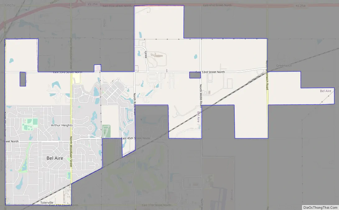
Bel Aire Road Map
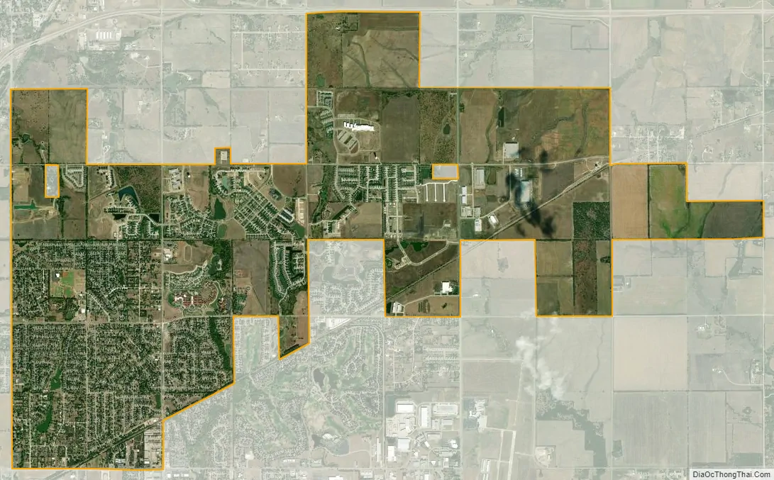
Bel Aire city Satellite Map
Geography
Bel Aire is located at 37°45′50″N 97°15′58″W / 37.76389°N 97.26611°W / 37.76389; -97.26611 (37.763758, −97.266177) at an elevation of 1,394 feet (425 m). It lies on the north side of the East Fork of Chisholm Creek roughly 6 mi (9.7 km) northeast of the Arkansas River in the Wellington-McPherson Lowlands region of the Great Plains. Located on the south side of K-254 in south-central Kansas, Bel Aire is within the Wichita metropolitan area, bordered by Wichita to the south and west and bordered by Kechi to the north.
According to the United States Census Bureau, the city has a total area of 6.86 square miles (17.77 km), of which, 6.83 square miles (17.69 km) is land and 0.03 square miles (0.08 km) is water.
See also
Map of Kansas State and its subdivision:- Allen
- Anderson
- Atchison
- Barber
- Barton
- Bourbon
- Brown
- Butler
- Chase
- Chautauqua
- Cherokee
- Cheyenne
- Clark
- Clay
- Cloud
- Coffey
- Comanche
- Cowley
- Crawford
- Decatur
- Dickinson
- Doniphan
- Douglas
- Edwards
- Elk
- Ellis
- Ellsworth
- Finney
- Ford
- Franklin
- Geary
- Gove
- Graham
- Grant
- Gray
- Greeley
- Greenwood
- Hamilton
- Harper
- Harvey
- Haskell
- Hodgeman
- Jackson
- Jefferson
- Jewell
- Johnson
- Kearny
- Kingman
- Kiowa
- Labette
- Lane
- Leavenworth
- Lincoln
- Linn
- Logan
- Lyon
- Marion
- Marshall
- McPherson
- Meade
- Miami
- Mitchell
- Montgomery
- Morris
- Morton
- Nemaha
- Neosho
- Ness
- Norton
- Osage
- Osborne
- Ottawa
- Pawnee
- Phillips
- Pottawatomie
- Pratt
- Rawlins
- Reno
- Republic
- Rice
- Riley
- Rooks
- Rush
- Russell
- Saline
- Scott
- Sedgwick
- Seward
- Shawnee
- Sheridan
- Sherman
- Smith
- Stafford
- Stanton
- Stevens
- Sumner
- Thomas
- Trego
- Wabaunsee
- Wallace
- Washington
- Wichita
- Wilson
- Woodson
- Wyandotte
- Alabama
- Alaska
- Arizona
- Arkansas
- California
- Colorado
- Connecticut
- Delaware
- District of Columbia
- Florida
- Georgia
- Hawaii
- Idaho
- Illinois
- Indiana
- Iowa
- Kansas
- Kentucky
- Louisiana
- Maine
- Maryland
- Massachusetts
- Michigan
- Minnesota
- Mississippi
- Missouri
- Montana
- Nebraska
- Nevada
- New Hampshire
- New Jersey
- New Mexico
- New York
- North Carolina
- North Dakota
- Ohio
- Oklahoma
- Oregon
- Pennsylvania
- Rhode Island
- South Carolina
- South Dakota
- Tennessee
- Texas
- Utah
- Vermont
- Virginia
- Washington
- West Virginia
- Wisconsin
- Wyoming