Dighton is a city in and the county seat of Lane County, Kansas, United States. As of the 2020 census, the population of the city was 960. Dighton is named for Dick Dighton, a surveyor.
| Name: | Dighton city |
|---|---|
| LSAD Code: | 25 |
| LSAD Description: | city (suffix) |
| State: | Kansas |
| County: | Lane County |
| Founded: | 1879 |
| Incorporated: | 1887 |
| Elevation: | 2,766 ft (843 m) |
| Total Area: | 0.87 sq mi (2.25 km²) |
| Land Area: | 0.87 sq mi (2.25 km²) |
| Water Area: | 0.00 sq mi (0.00 km²) |
| Total Population: | 960 |
| Population Density: | 1,100/sq mi (430/km²) |
| ZIP code: | 67839 |
| Area code: | 620 |
| FIPS code: | 2018050 |
| Website: | dightonkansas.com |
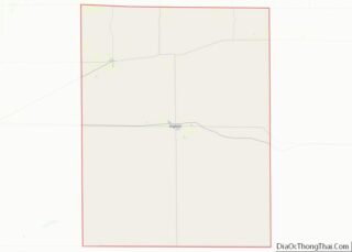
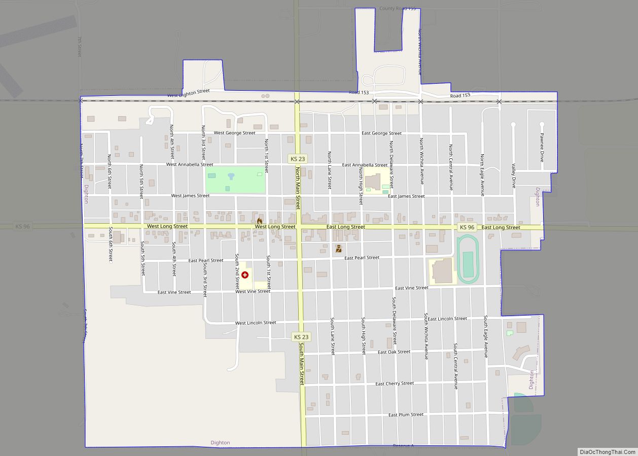
Online Interactive Map
Click on ![]() to view map in "full screen" mode.
to view map in "full screen" mode.
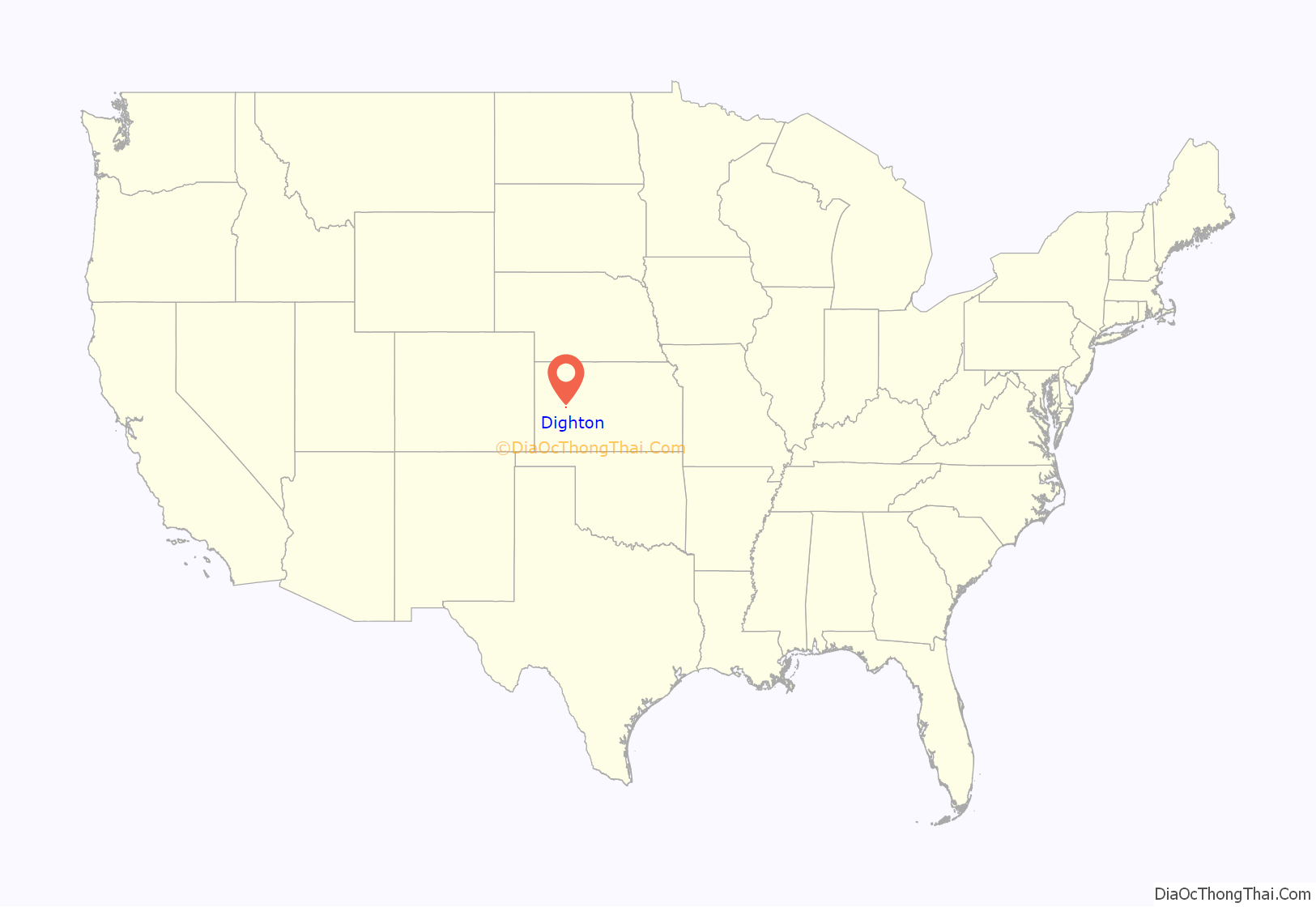
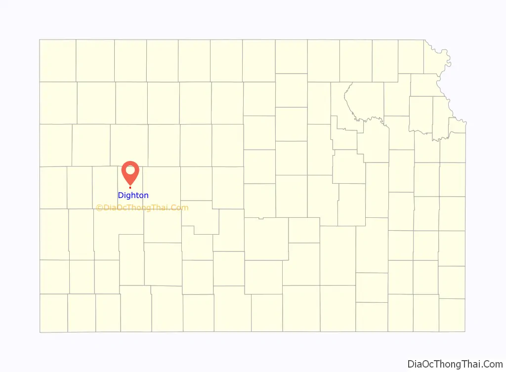
Dighton location map. Where is Dighton city?
History
19th century
The Homestead Act of 1862 offered 160 acres (0.65 km) of land in the American West, previously owned by railroads, to homesteaders who could live on the land for five years. Drawn west by the promise of free, fertile land, pioneer settlers arrived in Kansas starting in 1869. In 1879, W.A. Watson arrived at the town site, and a post office was established. In 1885, there were three houses and seven voters in town. Lane County became a county in 1886, with Dighton as its county seat. By 1900, the population was 194, and by 1910 it had grown to 370, and the town had banks; a flour mill; a grain elevator; two newspapers; public schools; a hotel; merchants; Baptist, Catholic, and Methodist churches; telegraph service; a band and telephones.
Life was difficult for the early pioneers, who built houses made of sod and found that the land was quite dry, and not as fertile as they had been led to believe. A song written by Frank Baker, the Lane County Bachelor, became a popular folk song throughout the western United States.
20th century
On May 23, 1928, the Fleagle Gang arrived in Dighton after robbing the First National Bank of Lamar, Colorado. Needing medical attention, they kidnapped local doctor W.W. Wineinger, and later shot him and dumped his body into a ravine.
The courtroom mural, “The First House of Lane County,” by Mary Alice Bosley, was featured in Kansas Murals: A Traveler’s Guide, by Jost and Loewenstein.
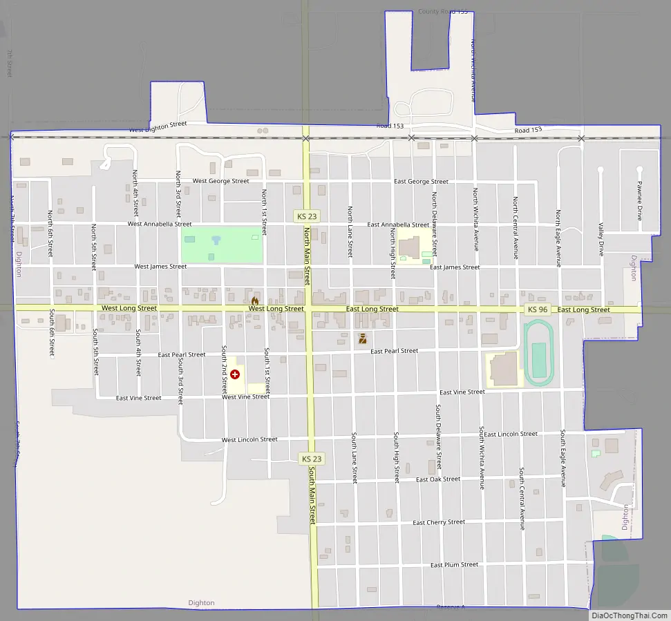
Dighton Road Map
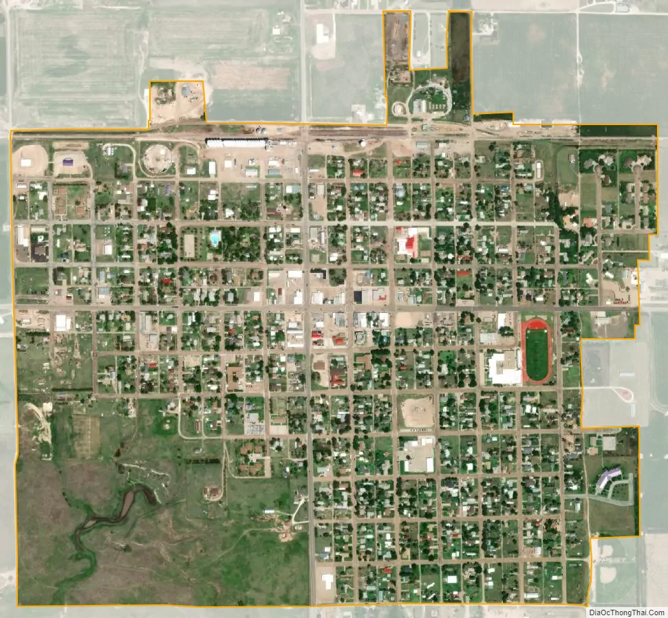
Dighton city Satellite Map
Geography
Dighton is located at 38°28′53″N 100°27′54″W / 38.48139°N 100.46500°W / 38.48139; -100.46500 (38.481506, -100.464893), at the intersection of K-96 and K-23. According to the United States Census Bureau, the city has a total area of 0.88 square miles (2.28 km), all land.
See also
Map of Kansas State and its subdivision:- Allen
- Anderson
- Atchison
- Barber
- Barton
- Bourbon
- Brown
- Butler
- Chase
- Chautauqua
- Cherokee
- Cheyenne
- Clark
- Clay
- Cloud
- Coffey
- Comanche
- Cowley
- Crawford
- Decatur
- Dickinson
- Doniphan
- Douglas
- Edwards
- Elk
- Ellis
- Ellsworth
- Finney
- Ford
- Franklin
- Geary
- Gove
- Graham
- Grant
- Gray
- Greeley
- Greenwood
- Hamilton
- Harper
- Harvey
- Haskell
- Hodgeman
- Jackson
- Jefferson
- Jewell
- Johnson
- Kearny
- Kingman
- Kiowa
- Labette
- Lane
- Leavenworth
- Lincoln
- Linn
- Logan
- Lyon
- Marion
- Marshall
- McPherson
- Meade
- Miami
- Mitchell
- Montgomery
- Morris
- Morton
- Nemaha
- Neosho
- Ness
- Norton
- Osage
- Osborne
- Ottawa
- Pawnee
- Phillips
- Pottawatomie
- Pratt
- Rawlins
- Reno
- Republic
- Rice
- Riley
- Rooks
- Rush
- Russell
- Saline
- Scott
- Sedgwick
- Seward
- Shawnee
- Sheridan
- Sherman
- Smith
- Stafford
- Stanton
- Stevens
- Sumner
- Thomas
- Trego
- Wabaunsee
- Wallace
- Washington
- Wichita
- Wilson
- Woodson
- Wyandotte
- Alabama
- Alaska
- Arizona
- Arkansas
- California
- Colorado
- Connecticut
- Delaware
- District of Columbia
- Florida
- Georgia
- Hawaii
- Idaho
- Illinois
- Indiana
- Iowa
- Kansas
- Kentucky
- Louisiana
- Maine
- Maryland
- Massachusetts
- Michigan
- Minnesota
- Mississippi
- Missouri
- Montana
- Nebraska
- Nevada
- New Hampshire
- New Jersey
- New Mexico
- New York
- North Carolina
- North Dakota
- Ohio
- Oklahoma
- Oregon
- Pennsylvania
- Rhode Island
- South Carolina
- South Dakota
- Tennessee
- Texas
- Utah
- Vermont
- Virginia
- Washington
- West Virginia
- Wisconsin
- Wyoming