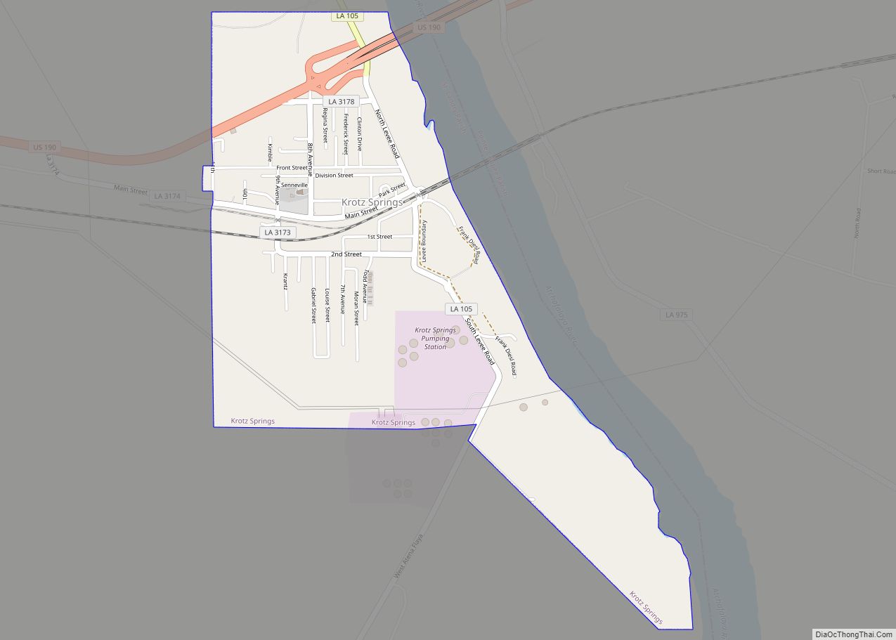
Krotz Springs is a town in St. Landry Parish, Louisiana, United States, on the Atchafalaya River. The population was 1,198 at the 2010 census, down from 1,219 in 2000. It is part of the Opelousas–Eunice Micropolitan Statistical Area.
| Name: | Krotz Springs town |
|---|---|
| LSAD Code: | 43 |
| LSAD Description: | town (suffix) |
| State: | Louisiana |
| County: | St. Landry Parish |
| Elevation: | 30 ft (9 m) |
| Total Area: | 1.73 sq mi (4.49 km²) |
| Land Area: | 1.73 sq mi (4.47 km²) |
| Water Area: | 0.01 sq mi (0.01 km²) |
| Total Population: | 904 |
| Population Density: | 523.15/sq mi (202.02/km²) |
| Area code: | 337 |
| FIPS code: | 2240280 |
| Website: | krotzsprings.net |
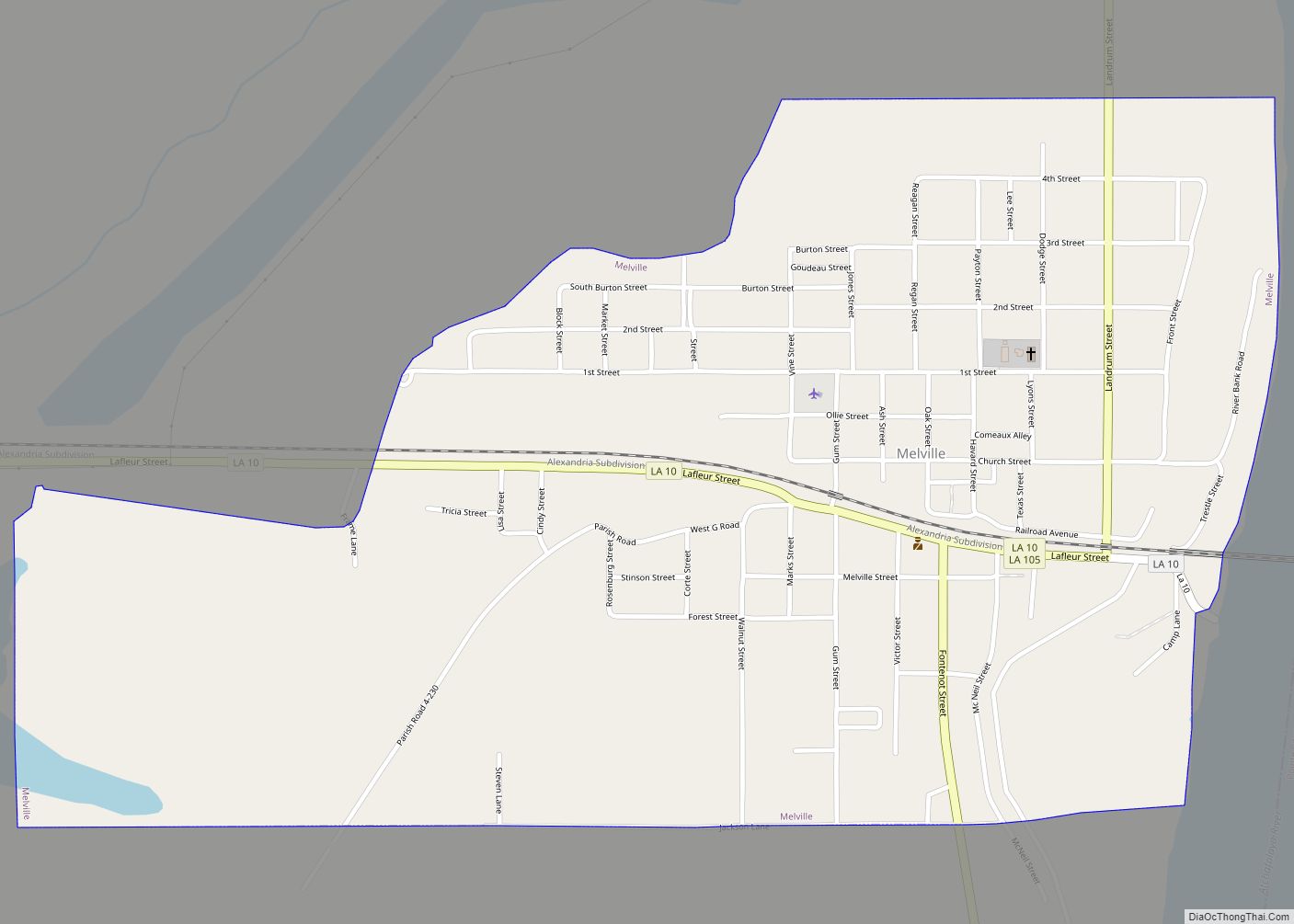
Online Interactive Map
Click on ![]() to view map in "full screen" mode.
to view map in "full screen" mode.
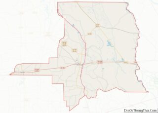
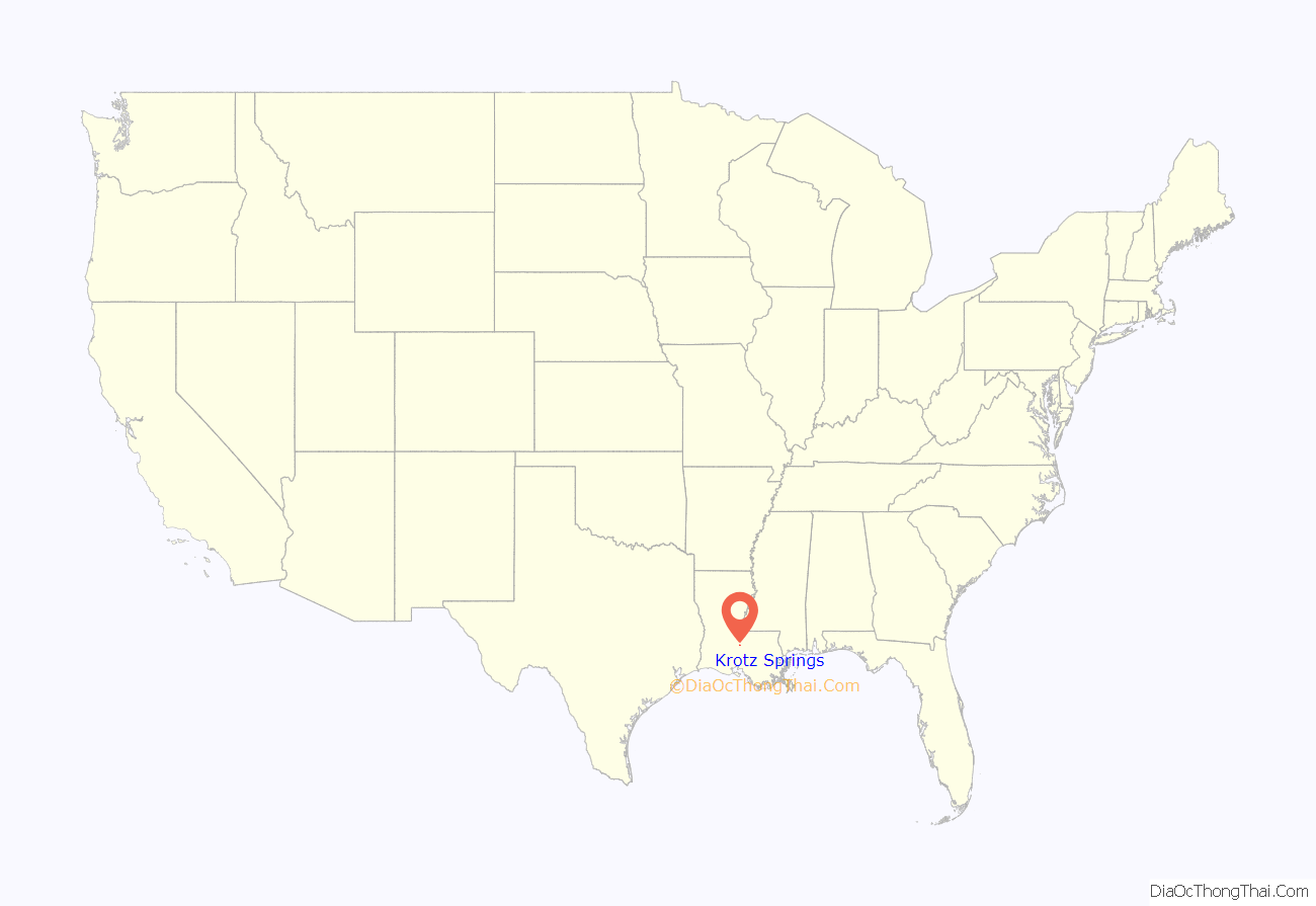
Krotz Springs location map. Where is Krotz Springs town?
History
Around the turn of the 20th century, an Ohio native, Charles William Krotz, bought 20,000 acres (81 km) of woodland around the Atchafalaya Basin and set up a sawmill to trim the trees hauled out of the basin. The tiny settlement that grew up around the mill was called Latania (fan palm), after the bayou of the same name and the types of palm plants found in the area.
Thinking he was sitting on an untapped pool of oil, Krotz attempted to drill the first oil well in St. Landry Parish in 1900, but he struck water instead of oil, the result becoming known as Krotz’s spring. The spring was used to supply water for the developing sawmill town, and Krotz even bottled the water, selling it throughout the country.
In 1909, a post office was established in the town, and the obvious choice of a name was Krotz Springs.
The Krotz Springs Bridge spanning the Atchafalaya River opened in 1928 and carried railroad and automobile traffic. It was superseded by other bridges at the same location in 1934, 1973, and 1988.
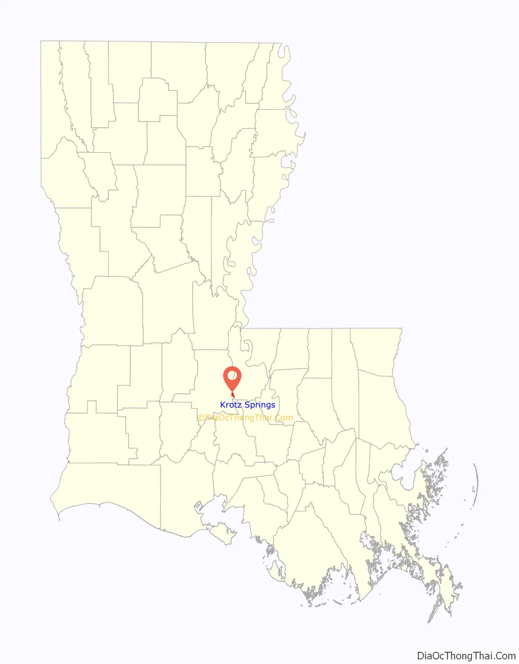
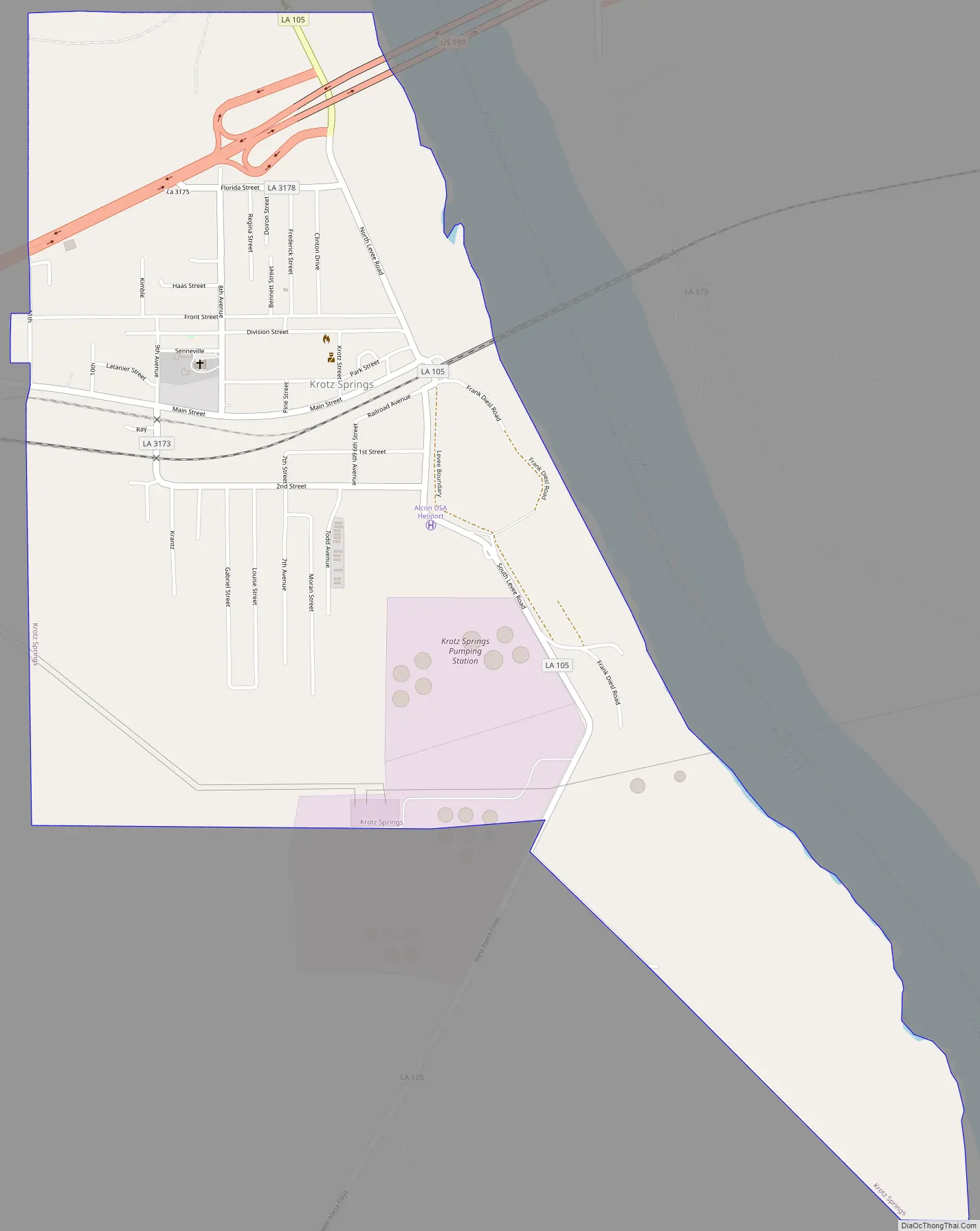
Krotz Springs Road Map
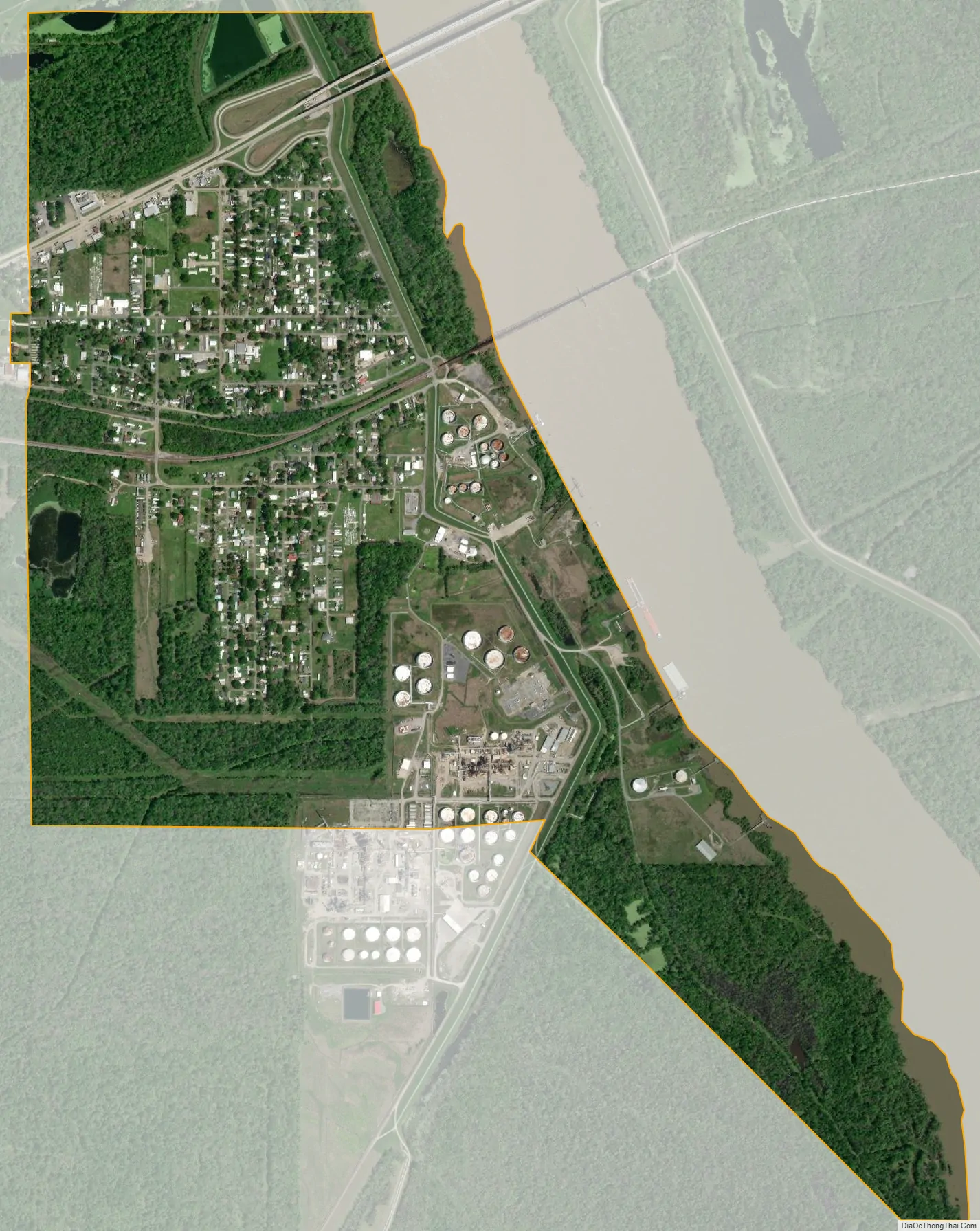
Krotz Springs city Satellite Map
Geography
Krotz Springs is located at 30°32′15″N 91°45′18″W / 30.53750°N 91.75500°W / 30.53750; -91.75500 (30.537565, -91.754926). On the eastern border of the town is Pointe Coupee Parish over the Atchafalaya River via U.S. Highway 190 while Opelousas, the St. Landry Parish seat, is located 20 miles (32 km) west of Krotz Springs. The city of Baton Rouge is located 40 miles (64 km) to the east.
According to the United States Census Bureau, the town has a total area of 1.7 square miles (4.4 km), all land.
See also
Map of Louisiana State and its subdivision:- Acadia
- Allen
- Ascension
- Assumption
- Avoyelles
- Beauregard
- Bienville
- Bossier
- Caddo
- Calcasieu
- Caldwell
- Cameron
- Catahoula
- Claiborne
- Concordia
- De Soto
- East Baton Rouge
- East Carroll
- East Feliciana
- Evangeline
- Franklin
- Grant
- Iberia
- Iberville
- Jackson
- Jefferson
- Jefferson Davis
- La Salle
- Lafayette
- Lafourche
- Lincoln
- Livingston
- Madison
- Morehouse
- Natchitoches
- Orleans
- Ouachita
- Plaquemines
- Pointe Coupee
- Rapides
- Red River
- Richland
- Sabine
- Saint Bernard
- Saint Charles
- Saint Helena
- Saint James
- Saint John the Baptist
- Saint Landry
- Saint Martin
- Saint Mary
- Saint Tammany
- Tangipahoa
- Tensas
- Terrebonne
- Union
- Vermilion
- Vernon
- Washington
- Webster
- West Baton Rouge
- West Carroll
- West Feliciana
- Winn
- Alabama
- Alaska
- Arizona
- Arkansas
- California
- Colorado
- Connecticut
- Delaware
- District of Columbia
- Florida
- Georgia
- Hawaii
- Idaho
- Illinois
- Indiana
- Iowa
- Kansas
- Kentucky
- Louisiana
- Maine
- Maryland
- Massachusetts
- Michigan
- Minnesota
- Mississippi
- Missouri
- Montana
- Nebraska
- Nevada
- New Hampshire
- New Jersey
- New Mexico
- New York
- North Carolina
- North Dakota
- Ohio
- Oklahoma
- Oregon
- Pennsylvania
- Rhode Island
- South Carolina
- South Dakota
- Tennessee
- Texas
- Utah
- Vermont
- Virginia
- Washington
- West Virginia
- Wisconsin
- Wyoming