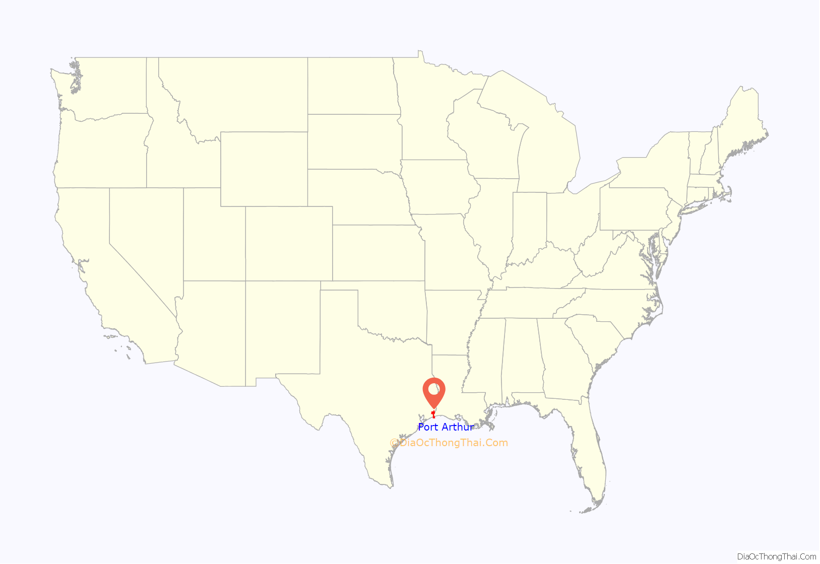
Port Arthur is a city in Jefferson County within the Beaumont–Port Arthur metropolitan area of the U.S. state of Texas. A small, uninhabited portion extends into Orange County; it is 90 mi (140 km) east of Houston. The largest oil refinery in the United States, the Motiva Refinery, is located in Port Arthur.
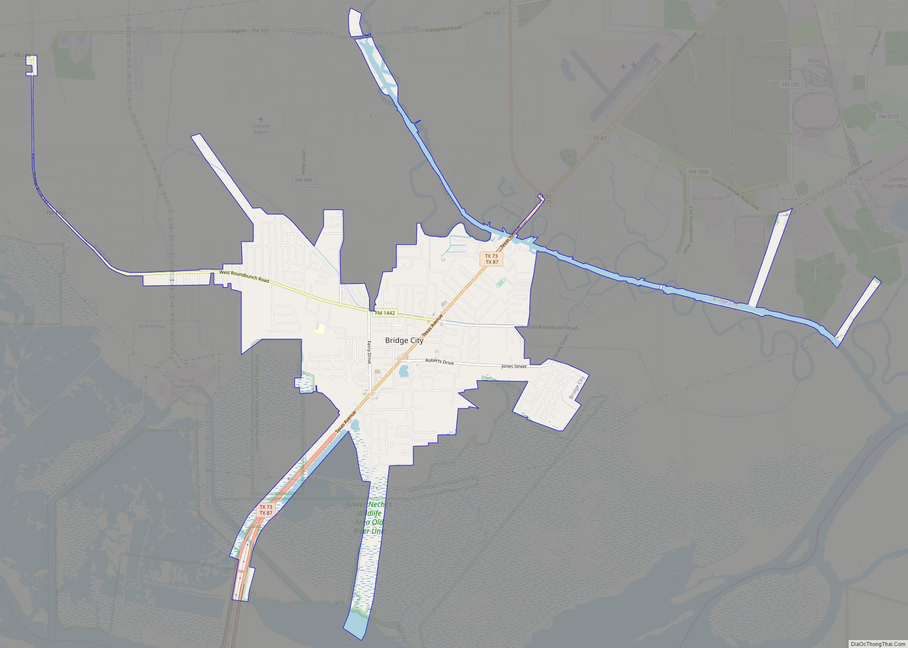
The population of Port Arthur was 53,818 at the 2010 census, down from 57,755 at the 2000 census. By 2020, its population rebounded to 56,039. Early attempts at settlements in the area had all failed. However, in 1895, Arthur Stilwell founded Port Arthur, and the town quickly grew. Port Arthur was incorporated as a city in 1898 and soon developed into a seaport. It eventually became the center of a large oil refinery network. The Rainbow Bridge across the Neches River connects Port Arthur to Bridge City.
Port Arthur is vulnerable to hurricanes and extensive damage to the city has been caused several times.
| Name: | Port Arthur city |
|---|---|
| LSAD Code: | 25 |
| LSAD Description: | city (suffix) |
| State: | Texas |
| County: | Jefferson County, Orange County |
| Elevation: | 7 ft (2 m) |
| Total Area: | 144.17 sq mi (373.41 km²) |
| Land Area: | 77.15 sq mi (199.82 km²) |
| Water Area: | 67.02 sq mi (173.58 km²) |
| Total Population: | 56,039 |
| Population Density: | 703.55/sq mi (271.64/km²) |
| ZIP code: | 77640-77642 |
| Area code: | 409 |
| FIPS code: | 4858820 |
| GNISfeature ID: | 1384151 |
| Website: | portarthur.net |
Online Interactive Map
Click on ![]() to view map in "full screen" mode.
to view map in "full screen" mode.
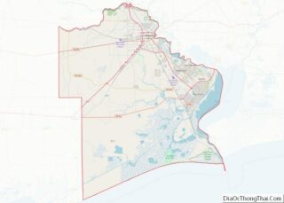
Port Arthur location map. Where is Port Arthur city?

History
Aurora was an early settlement attempt near the mouth of Taylor Bayou on Sabine Lake, about 14 miles (23 km) long and 7 miles (11 km) wide. It is a saltwater estuary formed by the confluence of the Neches and Sabine Rivers. Through its tidal outlet, 5-mile-long (8 km) Sabine Pass, Sabine Lake drains some 50,000 sq mi (100,000 km) of Texas and Louisiana into the Gulf of Mexico.
The town was conceived in 1837, and in 1840 promoters led by Almanzon Huston were offering town lots for sale. Some were sold, but Huston’s project failed to attract many settlers. The area next was known as “Sparks”, after John Sparks, who moved his family to the shores of Sabine Lake near the site of Aurora. The Eastern Texas Railroad, completed between Sabine Pass and Beaumont, Texas, passed 4 miles (6 km) west of Sparks. However, the American Civil War soon began, and rail lines were removed. In 1886, a destructive hurricane hit the coast, causing the remaining residents to dismantle their homes and move to Beaumont. By 1895, Aurora had become a ghost town.
Arthur Stilwell led the resettling of the area as part of his planned city as the southern terminus of his Kansas City, Pittsburg and Gulf Railroad, predecessor to the Kansas City Southern Railway. Stilwell named the city Port Arthur after himself, not the British Royal Navy Lieutenant who gave his name to Port Arthur, China.
Pleasure Island now separates the city from the Gulf Intracoastal Waterway. The 18.5-mile (29.8 km) man-made island was created between 1899 and 1908 by the Corps of Engineers to support development of the port.
Arthur Stilwell founded the Port Arthur Channel and Dock Company to manage the port facilities. The port officially opened with the arrival of the British steamer Saint Oswald in 1899.
When oil was discovered at Spindletop, the J.M. Guffey Petroleum Company, later Gulf Oil, had run pipelines to Port Arthur as a shipping point and a location for an oil refinery. In November 1901, the first tanker, the Cardium, departed with Spindletop oil. The refinery was enlarged in 1902, and a pipeline connected to the Glenn Pool Oil Reserve in Oklahoma. The Texas Company, later Texaco, also started building a refinery in 1902. By 1916, the Port Arthur refinery was one of the three largest in the United States.
In 2015, the city council proposed an ordinance to declare Port Arthur a “film friendly city.”
In October 2021, Governor Abbott announced that Port Arthur has been declared a “film friendly city” by the Texas Film Commission.
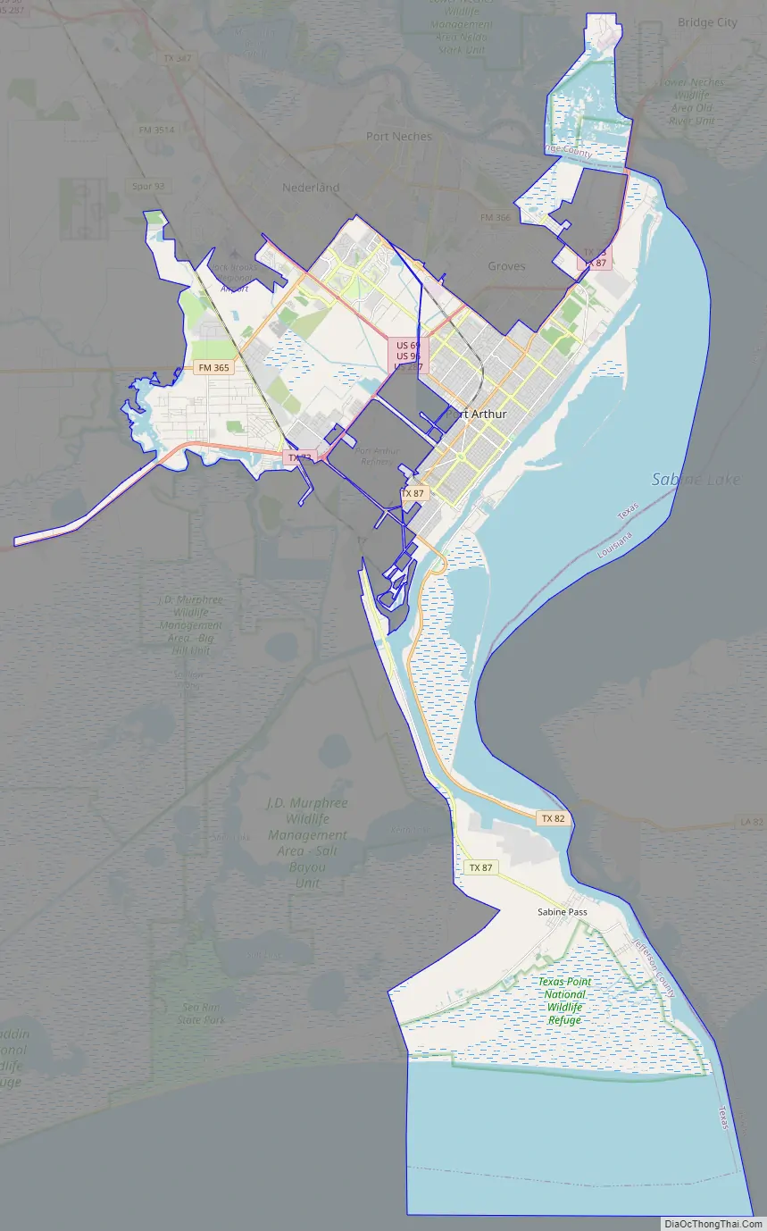
Port Arthur Road Map
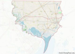
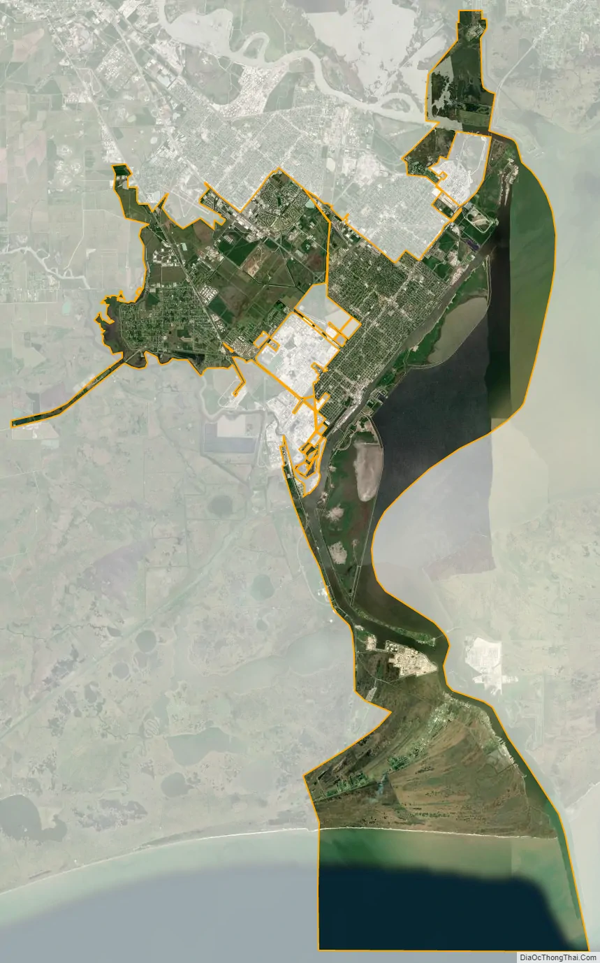
Port Arthur city Satellite Map
Geography
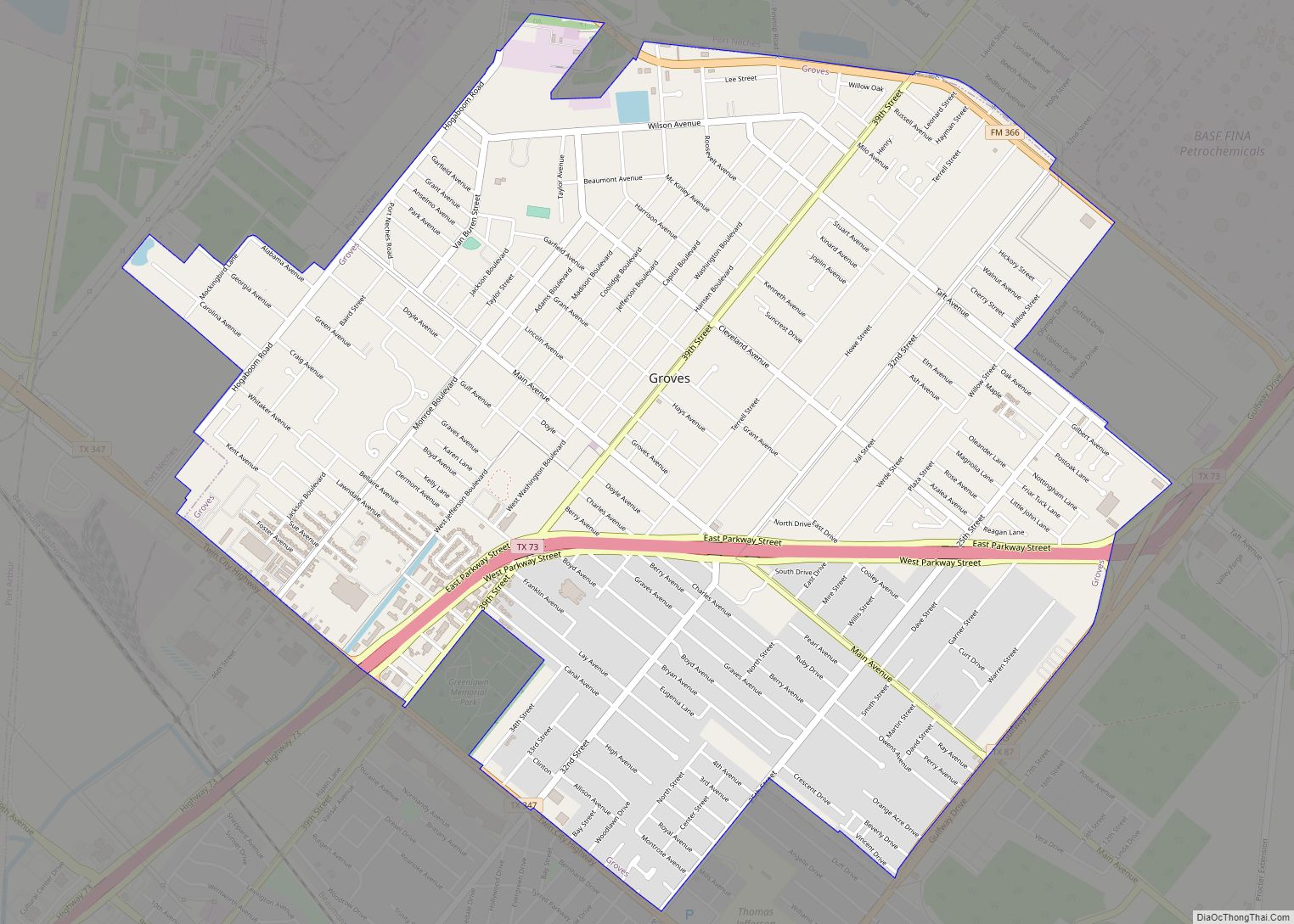
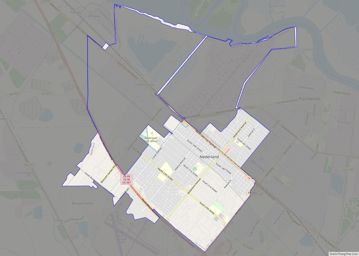
Port Arthur is located on the eastern edge of Jefferson County at 29°53′6″N 93°56′24″W / 29.88500°N 93.94000°W / 29.88500; -93.94000 (29.884864, −93.939902), on the west side of Sabine Lake. It is bordered to the northeast by Orange County, Texas, and to the southeast, across Sabine Lake, by Cameron Parish, Louisiana. The Port Arthur city limits extend south along the west side of Sabine Pass, the outlet of Sabine Lake, as far as the Gulf of Mexico on the city’s southern border. To the north, the city limits extend across the Neches River into Orange County. Port Arthur is bordered to the northwest by the cities of Nederland, Groves, and Port Neches, and to the northeast by Bridge City in Orange County.
According to the United States Census Bureau, the city has a total area of 144.1 square miles (373.1 km), of which 76.9 square miles (199.2 km) are land and 67.1 square miles (173.9 km), or 46.61%, are covered by water.
Communities
Communities in Port Arthur include:
- El Vista
- Griffing Park
- Lakeview
- Pear Ridge
- Port Acres
- Sabine Pass
- West Side
Tropical cyclones
Celebrations in Port Arthur on completion of the Kansas City, Pittsburg and Gulf Railroad between Kansas City and Port Arthur occurred Saturday, September 11, 1897. The celebrations brought additional people into town. The next day, a major hurricane hit Port Arthur. Water flowed five feet deep in the streets. People loaded into the unfinished railroad roundhouse seeking shelter; the building promptly collapsed, killing four. In the end, 13 people died, homes were destroyed, and a pleasure pier was severely damaged.
In June 1957, Hurricane Audrey made landfall just east of Port Arthur in Cameron Parish, Louisiana, as a category 3 hurricane. The storm caused extensive wind damage around the city and significant storm surge flooding just east in Southwest Louisiana.
On September 24, 2005, Hurricane Rita made landfall between Sabine Pass, Texas, and Johnson Bayou, Louisiana, as a category 3 hurricane. A wind gust of 116 mph (187 km/h) was recorded in Port Arthur. The storm caused widespread significant wind damage throughout the city, with power outages lasting several weeks in some locations. Some areas of the city also received flooding due to Rita.
On September 13, 2007, Hurricane Humberto made landfall west of Port Arthur as a category 1 hurricane. The storm moved northeast across the Golden Triangle, causing widespread wind damage; however, most of the damage was relatively minor. An 84 mph (135 km/h) wind gust was recorded at the Southeast Texas Regional Airport just northwest of the city.
On August 5, 2008, Tropical Storm Edouard made landfall just west of Port Arthur. The effects felt in the city were light; however, wind gusts up to 55 mph (89 km/h) were recorded.
On September 13, 2008, Hurricane Ike made landfall on Galveston Island as a category 2 hurricane. Due to the storm’s unusually large size, effects were widespread and were felt across much of Southeast Texas. Port Arthur sustained significant wind damage and many of the city’s residents lost power. The Port Arthur seawall protected the city from the major flooding that surrounding cities experienced.
On August 29, 2017, after Harvey made a second landfall at tropical storm status, 26 inches of rain fell in a single day at the airport near Port Arthur, triggering widespread flash flooding in the city. According to the Port Arthur mayor Derrick Freeman, 20,000 homes were flooded with up to 6 ft of water. On August 30, Freeman posted on Facebook, “Our whole city is underwater right now.”
Hurricane Laura was expected to make landfall as a major hurricane with Port Arthur in its direct path. Port Arthur was evacuated. However, turning almost due north, Laura ended up making its final landfall near Cameron, Louisiana.
Climate
Port Arthur is tied with Lake Charles, Louisiana, and Astoria, Oregon, as the most humid city in the contiguous United States. The average relative humidity is 90% in the morning, and 72% in the afternoon.
See also
Map of Texas State and its subdivision:- Anderson
- Andrews
- Angelina
- Aransas
- Archer
- Armstrong
- Atascosa
- Austin
- Bailey
- Bandera
- Bastrop
- Baylor
- Bee
- Bell
- Bexar
- Blanco
- Borden
- Bosque
- Bowie
- Brazoria
- Brazos
- Brewster
- Briscoe
- Brooks
- Brown
- Burleson
- Burnet
- Caldwell
- Calhoun
- Callahan
- Cameron
- Camp
- Carson
- Cass
- Castro
- Chambers
- Cherokee
- Childress
- Clay
- Cochran
- Coke
- Coleman
- Collin
- Collingsworth
- Colorado
- Comal
- Comanche
- Concho
- Cooke
- Coryell
- Cottle
- Crane
- Crockett
- Crosby
- Culberson
- Dallam
- Dallas
- Dawson
- Deaf Smith
- Delta
- Denton
- Dewitt
- Dickens
- Dimmit
- Donley
- Duval
- Eastland
- Ector
- Edwards
- El Paso
- Ellis
- Erath
- Falls
- Fannin
- Fayette
- Fisher
- Floyd
- Foard
- Fort Bend
- Franklin
- Freestone
- Frio
- Gaines
- Galveston
- Garza
- Gillespie
- Glasscock
- Goliad
- Gonzales
- Gray
- Grayson
- Gregg
- Grimes
- Guadalupe
- Hale
- Hall
- Hamilton
- Hansford
- Hardeman
- Hardin
- Harris
- Harrison
- Hartley
- Haskell
- Hays
- Hemphill
- Henderson
- Hidalgo
- Hill
- Hockley
- Hood
- Hopkins
- Houston
- Howard
- Hudspeth
- Hunt
- Hutchinson
- Irion
- Jack
- Jackson
- Jasper
- Jeff Davis
- Jefferson
- Jim Hogg
- Jim Wells
- Johnson
- Jones
- Karnes
- Kaufman
- Kendall
- Kenedy
- Kent
- Kerr
- Kimble
- King
- Kinney
- Kleberg
- Knox
- La Salle
- Lamar
- Lamb
- Lampasas
- Lavaca
- Lee
- Leon
- Liberty
- Limestone
- Lipscomb
- Live Oak
- Llano
- Loving
- Lubbock
- Lynn
- Madison
- Marion
- Martin
- Mason
- Matagorda
- Maverick
- McCulloch
- McLennan
- McMullen
- Medina
- Menard
- Midland
- Milam
- Mills
- Mitchell
- Montague
- Montgomery
- Moore
- Morris
- Motley
- Nacogdoches
- Navarro
- Newton
- Nolan
- Nueces
- Ochiltree
- Oldham
- Orange
- Palo Pinto
- Panola
- Parker
- Parmer
- Pecos
- Polk
- Potter
- Presidio
- Rains
- Randall
- Reagan
- Real
- Red River
- Reeves
- Refugio
- Roberts
- Robertson
- Rockwall
- Runnels
- Rusk
- Sabine
- San Augustine
- San Jacinto
- San Patricio
- San Saba
- Schleicher
- Scurry
- Shackelford
- Shelby
- Sherman
- Smith
- Somervell
- Starr
- Stephens
- Sterling
- Stonewall
- Sutton
- Swisher
- Tarrant
- Taylor
- Terrell
- Terry
- Throckmorton
- Titus
- Tom Green
- Travis
- Trinity
- Tyler
- Upshur
- Upton
- Uvalde
- Val Verde
- Van Zandt
- Victoria
- Walker
- Waller
- Ward
- Washington
- Webb
- Wharton
- Wheeler
- Wichita
- Wilbarger
- Willacy
- Williamson
- Wilson
- Winkler
- Wise
- Wood
- Yoakum
- Young
- Zapata
- Zavala
- Alabama
- Alaska
- Arizona
- Arkansas
- California
- Colorado
- Connecticut
- Delaware
- District of Columbia
- Florida
- Georgia
- Hawaii
- Idaho
- Illinois
- Indiana
- Iowa
- Kansas
- Kentucky
- Louisiana
- Maine
- Maryland
- Massachusetts
- Michigan
- Minnesota
- Mississippi
- Missouri
- Montana
- Nebraska
- Nevada
- New Hampshire
- New Jersey
- New Mexico
- New York
- North Carolina
- North Dakota
- Ohio
- Oklahoma
- Oregon
- Pennsylvania
- Rhode Island
- South Carolina
- South Dakota
- Tennessee
- Texas
- Utah
- Vermont
- Virginia
- Washington
- West Virginia
- Wisconsin
- Wyoming