Watson is an unincorporated community and census-designated place (CDP) in Livingston Parish, Louisiana, United States. The community is in the Baton Rouge Metropolitan Statistical Area.
| Name: | Watson CDP |
|---|---|
| LSAD Code: | 57 |
| LSAD Description: | CDP (suffix) |
| State: | Louisiana |
| County: | Livingston Parish |
| Elevation: | 69 ft (21 m) |
| Total Area: | 0.96 sq mi (2.48 km²) |
| Land Area: | 0.96 sq mi (2.48 km²) |
| Water Area: | 0.00 sq mi (0.00 km²) |
| Total Population: | 956 |
| Population Density: | 996.87/sq mi (384.85/km²) |
| ZIP code: | 70786 (PO Box) 70706 (residences) |
| Area code: | 225 |
| FIPS code: | 2280010 |
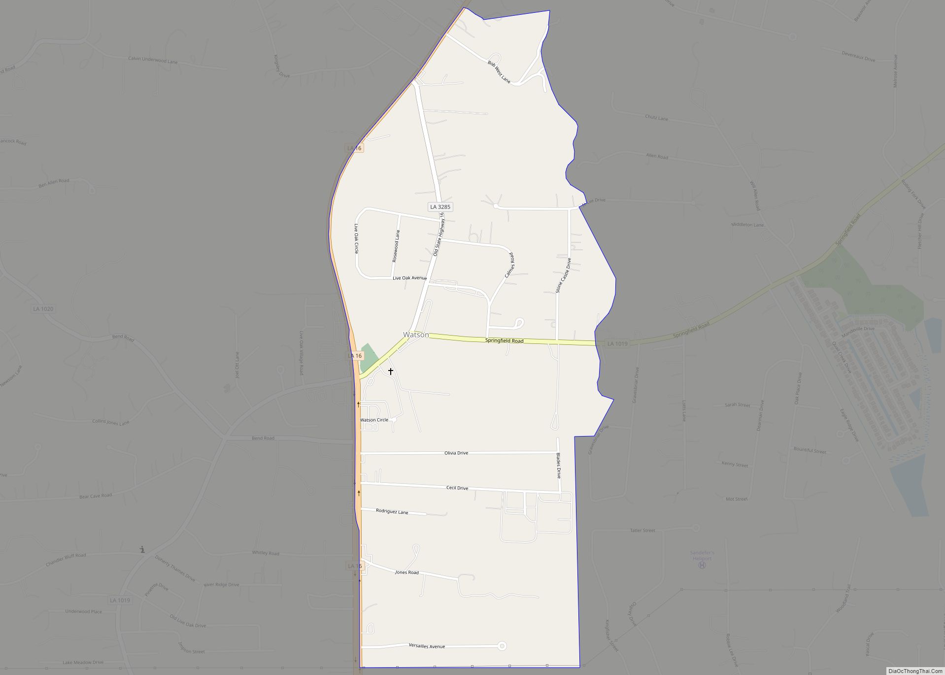
Online Interactive Map
Click on ![]() to view map in "full screen" mode.
to view map in "full screen" mode.
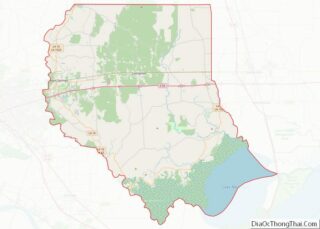
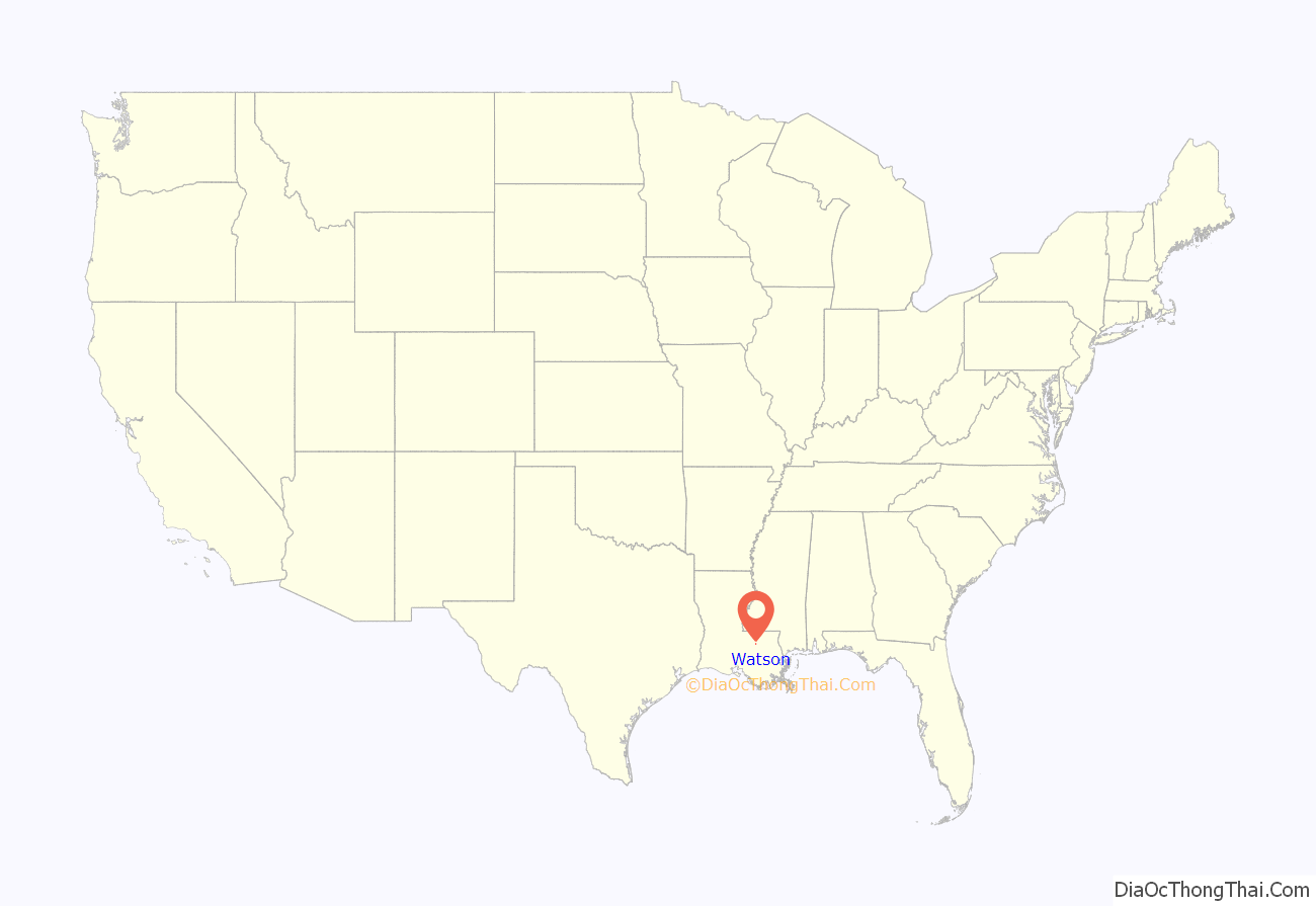
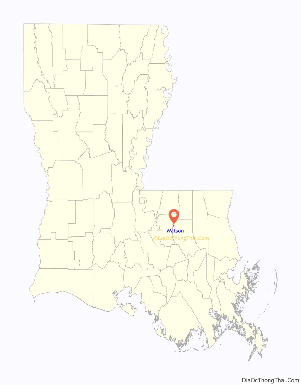
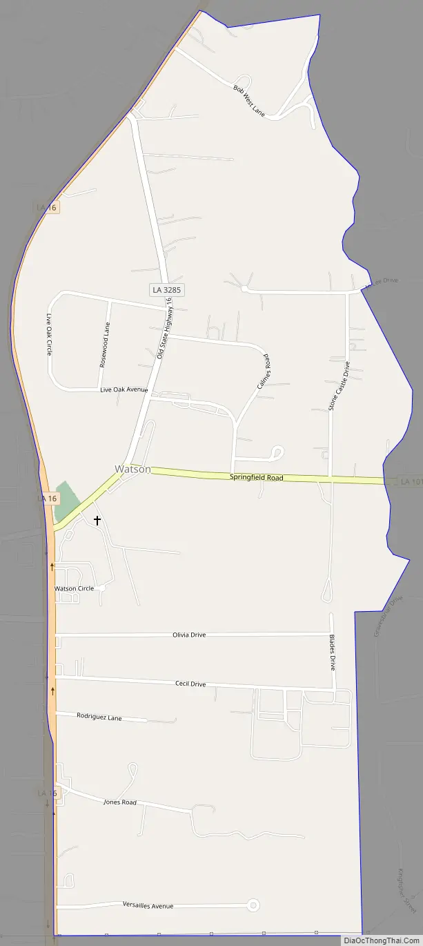
Watson location map. Where is Watson CDP?
History
Watson Post Office was established on February 20, 1894, by George A. Watson. The first Live Oak School was built in 1895 on land donated by Rev. Joel Ott. Several buildings were used for classes there, until the present site was purchased and a two-story school built. Published histories of Live Oak Methodist Church state that the first church was built not more than a quarter-mile from the present site prior to the Civil War. It was destroyed by Union soldiers. The church history states that W.C. Newsom, Huff Jones, George Nesom, J.B. Easterly and James Chandler erected a new building shortly after the Civil War fire. In 1893, under the pastorate of J.P. Haney of the Mississippi Conference, the frame church that was used until 1950 was constructed. As of April 2011, there are three churches in Watson, the oldest turned into a thrift store. The newest, finished in late 2010, is by far the tallest.
Since Watson is unincorporated, Watson’s ZIP code of 70786 is available only to post office box recipients. All other residences and businesses use a mailing address for Denham Springs.
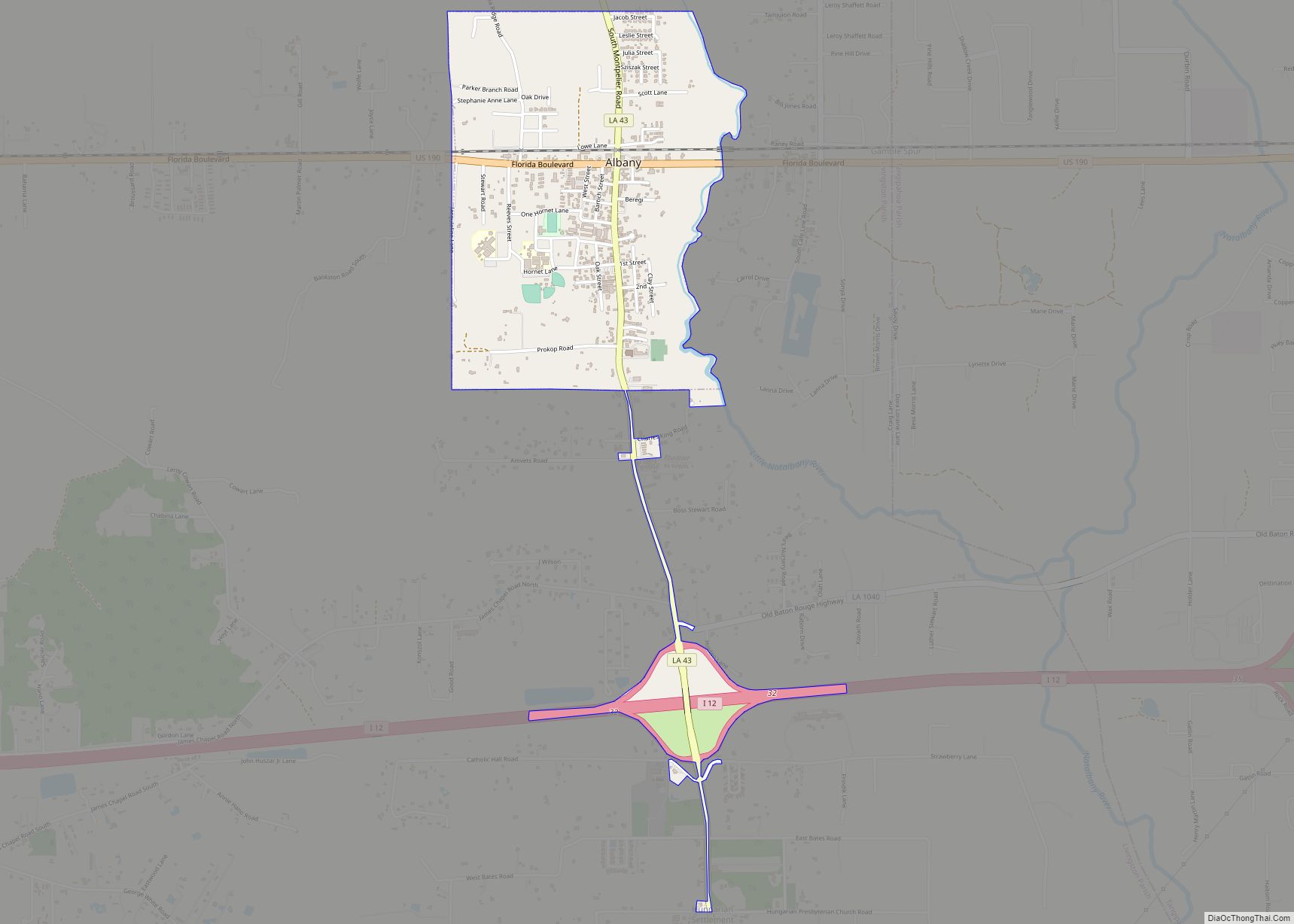
Watson Road Map
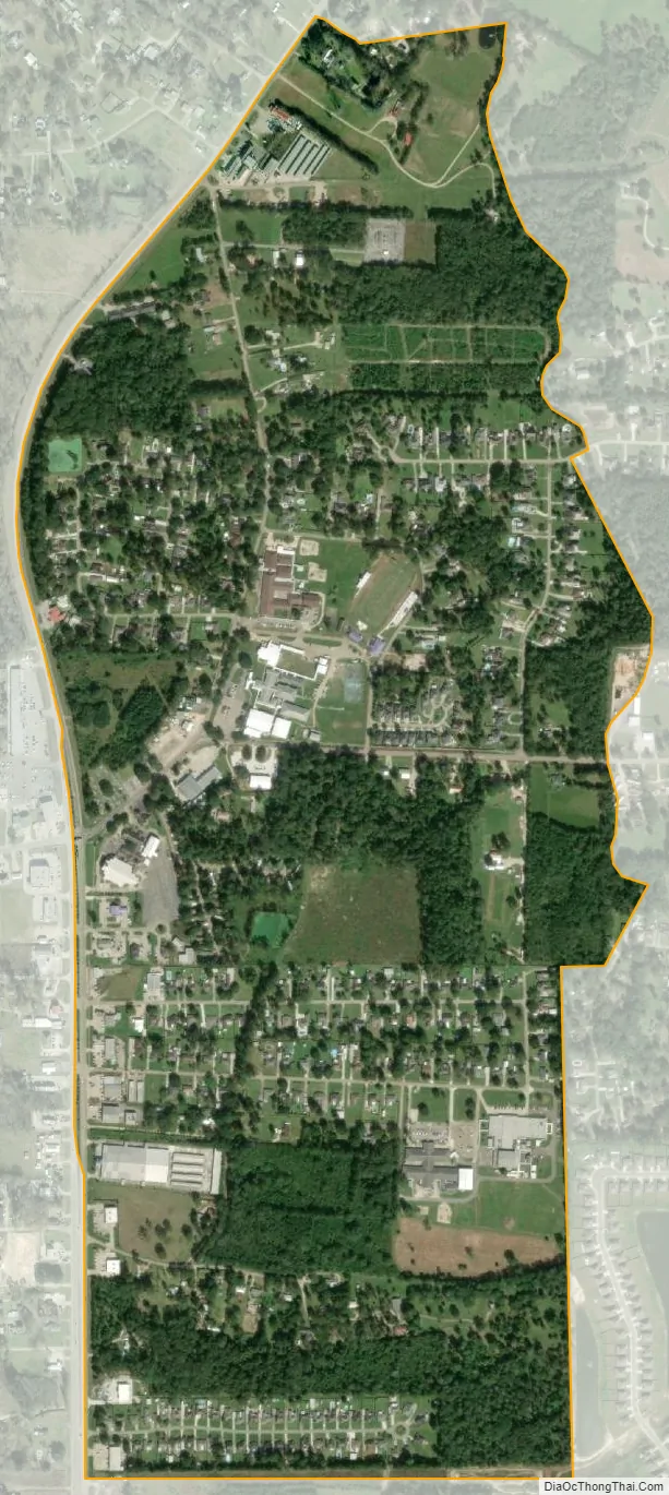
Watson city Satellite Map
Geography
Watson is located in northwest Livingston Parish at 30°34′30″N 90°57′10″W / 30.57500°N 90.95278°W / 30.57500; -90.95278 (30.575, -90.953). The village is north of Denham Springs and is situated around the intersection of Range Road (LA 16) and Springfield Road (LA 1019). LA 16 forms the western border of the CDP; the highway leads south 6 miles (10 km) to Denham Springs and northeast 32 miles (51 km) to Amite City. Watson sits at an elevation of 65 feet (20 m).
According to the U.S. Census Bureau, the Watson CDP has an area of 0.97 square miles (2.5 km), all of it recorded as land.
Climate
Watson is located in a humid, subtropical region. The mild, short, wet, and somewhat warm winters are followed by long, hot, humid, and fairly wet summers.
See also
Map of Louisiana State and its subdivision:- Acadia
- Allen
- Ascension
- Assumption
- Avoyelles
- Beauregard
- Bienville
- Bossier
- Caddo
- Calcasieu
- Caldwell
- Cameron
- Catahoula
- Claiborne
- Concordia
- De Soto
- East Baton Rouge
- East Carroll
- East Feliciana
- Evangeline
- Franklin
- Grant
- Iberia
- Iberville
- Jackson
- Jefferson
- Jefferson Davis
- La Salle
- Lafayette
- Lafourche
- Lincoln
- Livingston
- Madison
- Morehouse
- Natchitoches
- Orleans
- Ouachita
- Plaquemines
- Pointe Coupee
- Rapides
- Red River
- Richland
- Sabine
- Saint Bernard
- Saint Charles
- Saint Helena
- Saint James
- Saint John the Baptist
- Saint Landry
- Saint Martin
- Saint Mary
- Saint Tammany
- Tangipahoa
- Tensas
- Terrebonne
- Union
- Vermilion
- Vernon
- Washington
- Webster
- West Baton Rouge
- West Carroll
- West Feliciana
- Winn
- Alabama
- Alaska
- Arizona
- Arkansas
- California
- Colorado
- Connecticut
- Delaware
- District of Columbia
- Florida
- Georgia
- Hawaii
- Idaho
- Illinois
- Indiana
- Iowa
- Kansas
- Kentucky
- Louisiana
- Maine
- Maryland
- Massachusetts
- Michigan
- Minnesota
- Mississippi
- Missouri
- Montana
- Nebraska
- Nevada
- New Hampshire
- New Jersey
- New Mexico
- New York
- North Carolina
- North Dakota
- Ohio
- Oklahoma
- Oregon
- Pennsylvania
- Rhode Island
- South Carolina
- South Dakota
- Tennessee
- Texas
- Utah
- Vermont
- Virginia
- Washington
- West Virginia
- Wisconsin
- Wyoming