Geraldine is a town in Chouteau County, Montana, United States. The population was 207 at the 2020 census. The area around the town is an agricultural, largely wheat-producing, region.
| Name: | Geraldine town |
|---|---|
| LSAD Code: | 43 |
| LSAD Description: | town (suffix) |
| State: | Montana |
| County: | Chouteau County |
| Elevation: | 3,136 ft (956 m) |
| Total Area: | 0.58 sq mi (1.50 km²) |
| Land Area: | 0.57 sq mi (1.48 km²) |
| Water Area: | 0.00 sq mi (0.01 km²) |
| Total Population: | 207 |
| Population Density: | 361.26/sq mi (139.39/km²) |
| ZIP code: | 59446 |
| Area code: | 406 |
| FIPS code: | 3030400 |
| GNISfeature ID: | 0771740 |
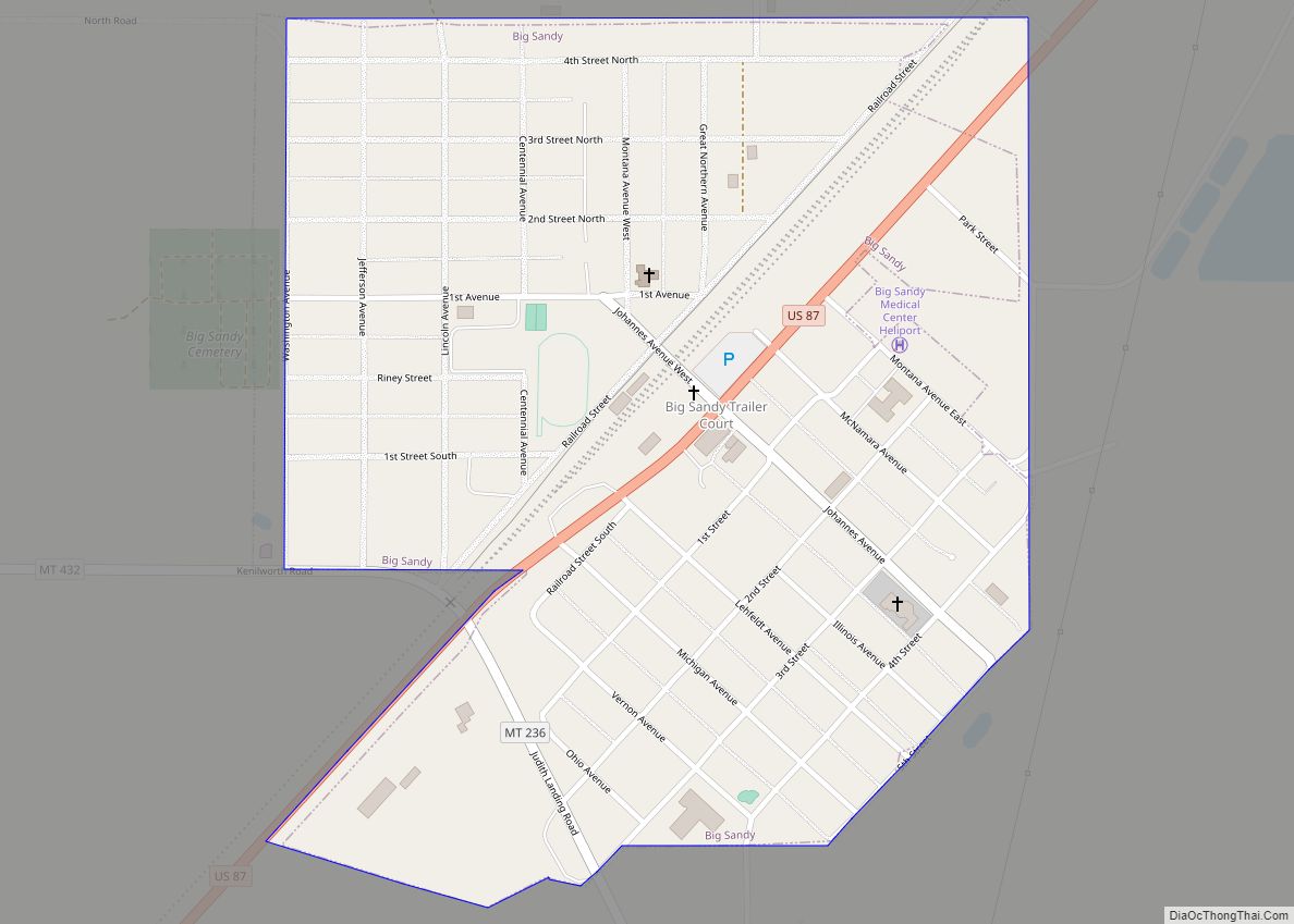
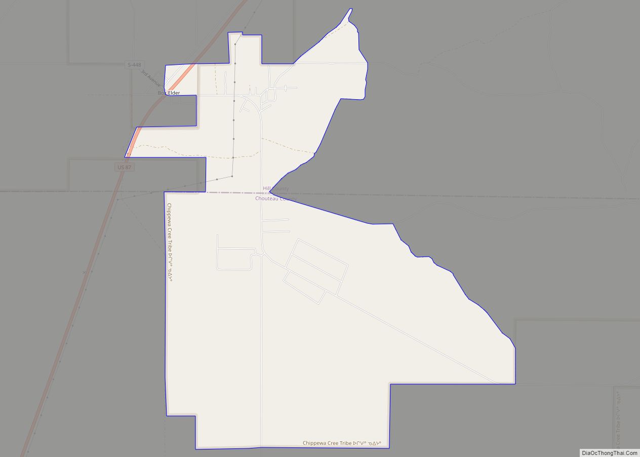
Online Interactive Map
Click on ![]() to view map in "full screen" mode.
to view map in "full screen" mode.
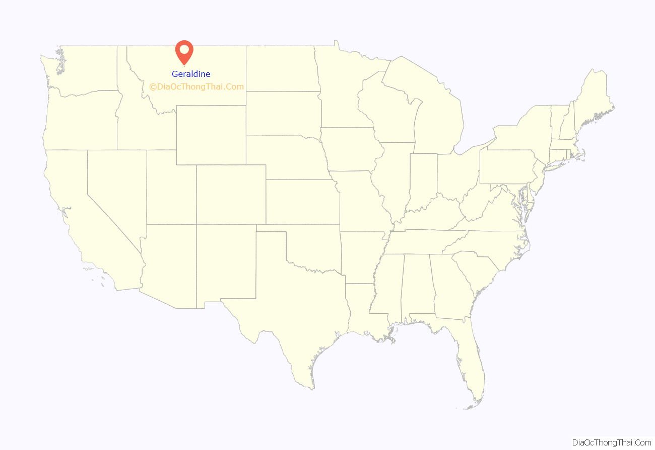
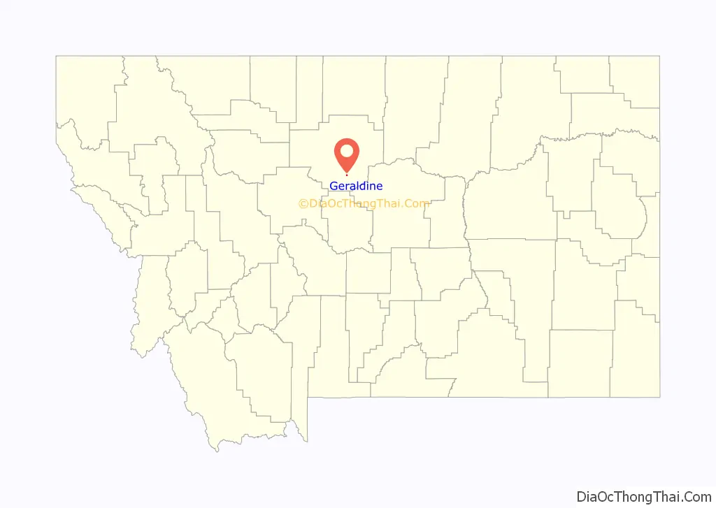
Geraldine location map. Where is Geraldine town?
History
Geraldine was originally created as a stop on the Milwaukee Railroad. It was named for Almira Geraldine Rockefeller (or perhaps her daughter, Ethel Geraldine Rockefeller Dodge), the wife of William Rockefeller, the director of the railroad at the time.
The Milwaukee Road built a branch line from Harlowton to Great Falls in 1916. The town’s wood-constructed railroad depot, also built in 1916, has been restored in recent years, now contains displays on the history of the area, and is a Montana Historic Site which is on the National Register of Historic Places. The Central Montana Rail runs a tourist train from Lewistown to Geraldine in the summer and passengers get to tour the restored depot.
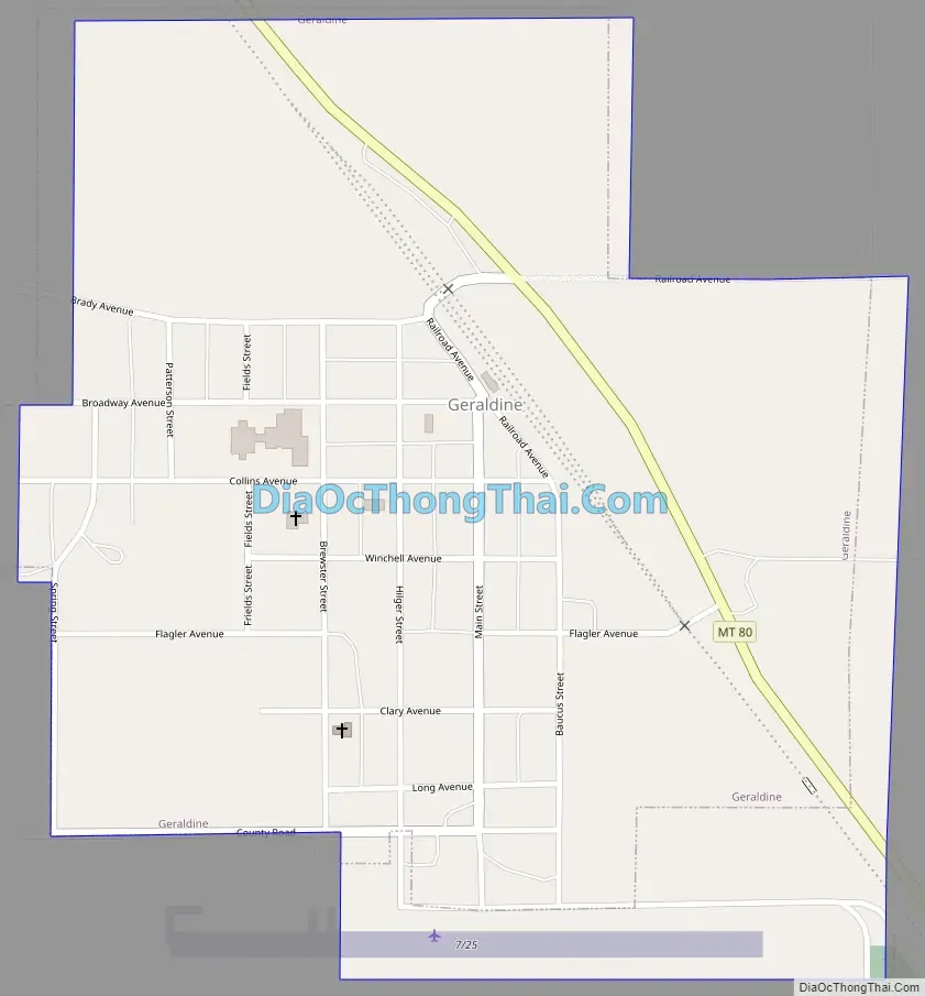
Geraldine Road Map
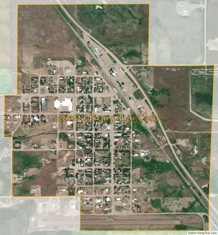
Geraldine city Satellite Map
Geography
Geraldine is located at 47°36′9″N 110°16′4″W / 47.60250°N 110.26778°W / 47.60250; -110.26778 (47.602384, -110.267779). Montana Highway 80 cuts through town. It is near both Kingsbury Lake and Big Lake.
According to the United States Census Bureau, the town has a total area of 0.52 square miles (1.35 km), all land.
See also
Map of Montana State and its subdivision:- Beaverhead
- Big Horn
- Blaine
- Broadwater
- Carbon
- Carter
- Cascade
- Chouteau
- Custer
- Daniels
- Dawson
- Deer Lodge
- Fallon
- Fergus
- Flathead
- Gallatin
- Garfield
- Glacier
- Golden Valley
- Granite
- Hill
- Jefferson
- Judith Basin
- Lake
- Lewis and Clark
- Liberty
- Lincoln
- Madison
- McCone
- Meagher
- Mineral
- Missoula
- Musselshell
- Park
- Petroleum
- Phillips
- Pondera
- Powder River
- Powell
- Prairie
- Ravalli
- Richland
- Roosevelt
- Rosebud
- Sanders
- Sheridan
- Silver Bow
- Stillwater
- Sweet Grass
- Teton
- Toole
- Treasure
- Valley
- Wheatland
- Wibaux
- Yellowstone
- Alabama
- Alaska
- Arizona
- Arkansas
- California
- Colorado
- Connecticut
- Delaware
- District of Columbia
- Florida
- Georgia
- Hawaii
- Idaho
- Illinois
- Indiana
- Iowa
- Kansas
- Kentucky
- Louisiana
- Maine
- Maryland
- Massachusetts
- Michigan
- Minnesota
- Mississippi
- Missouri
- Montana
- Nebraska
- Nevada
- New Hampshire
- New Jersey
- New Mexico
- New York
- North Carolina
- North Dakota
- Ohio
- Oklahoma
- Oregon
- Pennsylvania
- Rhode Island
- South Carolina
- South Dakota
- Tennessee
- Texas
- Utah
- Vermont
- Virginia
- Washington
- West Virginia
- Wisconsin
- Wyoming