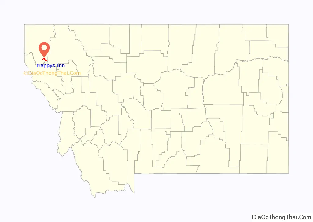
Happys Inn is a census-designated place (CDP) in Lincoln County, Montana, United States. The population was 164 at the 2010 census.
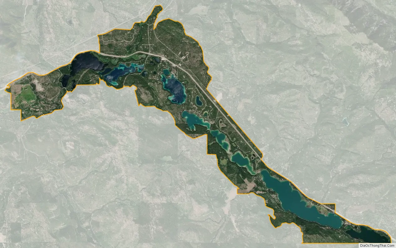
Happys Inn has a bar that carries its namesake. The census area extends for 12 miles (19 km) down the length of the chain of lakes area of Lincoln County. The community is along U.S. Route 2, 40 miles (64 km) southeast of Libby, the Lincoln county seat, and 49 miles (79 km) west of Kalispell.
According to the U.S. Census Bureau, the CDP has a total area of 12.4 square miles (32.2 km), of which 9.8 square miles (25.4 km) are land and 2.6 square miles (6.8 km), or 21.22%, are water.
| Name: | Happys Inn CDP |
|---|---|
| LSAD Code: | 57 |
| LSAD Description: | CDP (suffix) |
| State: | Montana |
| County: | Lincoln County |
| Elevation: | 3,333 ft (1,016 m) |
| Total Area: | 12.45 sq mi (32.24 km²) |
| Land Area: | 9.81 sq mi (25.40 km²) |
| Water Area: | 2.64 sq mi (6.84 km²) |
| Total Population: | 179 |
| Population Density: | 18.25/sq mi (7.05/km²) |
| Area code: | 406 |
| FIPS code: | 3034110 |
| GNISfeature ID: | 2583813 |
Online Interactive Map
Click on ![]() to view map in "full screen" mode.
to view map in "full screen" mode.
Happys Inn location map. Where is Happys Inn CDP?

Happys Inn Road Map

Happys Inn city Satellite Map
See also
Map of Montana State and its subdivision:- Beaverhead
- Big Horn
- Blaine
- Broadwater
- Carbon
- Carter
- Cascade
- Chouteau
- Custer
- Daniels
- Dawson
- Deer Lodge
- Fallon
- Fergus
- Flathead
- Gallatin
- Garfield
- Glacier
- Golden Valley
- Granite
- Hill
- Jefferson
- Judith Basin
- Lake
- Lewis and Clark
- Liberty
- Lincoln
- Madison
- McCone
- Meagher
- Mineral
- Missoula
- Musselshell
- Park
- Petroleum
- Phillips
- Pondera
- Powder River
- Powell
- Prairie
- Ravalli
- Richland
- Roosevelt
- Rosebud
- Sanders
- Sheridan
- Silver Bow
- Stillwater
- Sweet Grass
- Teton
- Toole
- Treasure
- Valley
- Wheatland
- Wibaux
- Yellowstone
- Alabama
- Alaska
- Arizona
- Arkansas
- California
- Colorado
- Connecticut
- Delaware
- District of Columbia
- Florida
- Georgia
- Hawaii
- Idaho
- Illinois
- Indiana
- Iowa
- Kansas
- Kentucky
- Louisiana
- Maine
- Maryland
- Massachusetts
- Michigan
- Minnesota
- Mississippi
- Missouri
- Montana
- Nebraska
- Nevada
- New Hampshire
- New Jersey
- New Mexico
- New York
- North Carolina
- North Dakota
- Ohio
- Oklahoma
- Oregon
- Pennsylvania
- Rhode Island
- South Carolina
- South Dakota
- Tennessee
- Texas
- Utah
- Vermont
- Virginia
- Washington
- West Virginia
- Wisconsin
- Wyoming


