Pioneer Junction is a census-designated place (CDP) in Lincoln County, Montana, United States. The population was 959 at the 2010 census.
| Name: | Pioneer Junction CDP |
|---|---|
| LSAD Code: | 57 |
| LSAD Description: | CDP (suffix) |
| State: | Montana |
| County: | Lincoln County |
| Elevation: | 2,438 ft (743 m) |
| Total Area: | 3.52 sq mi (9.13 km²) |
| Land Area: | 3.52 sq mi (9.13 km²) |
| Water Area: | 0.00 sq mi (0.00 km²) |
| Total Population: | 902 |
| Population Density: | 255.96/sq mi (98.82/km²) |
| Area code: | 406 |
| FIPS code: | 3057950 |
| GNISfeature ID: | 2583833 |
Online Interactive Map
Click on ![]() to view map in "full screen" mode.
to view map in "full screen" mode.
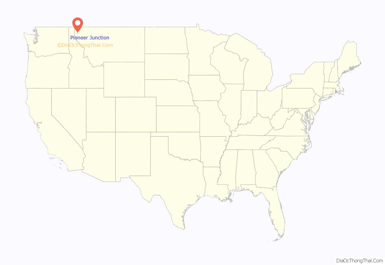
Pioneer Junction location map. Where is Pioneer Junction CDP?
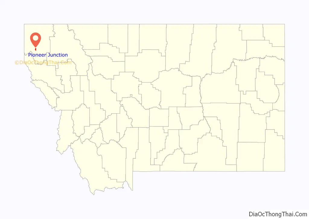
Pioneer Junction Road Map
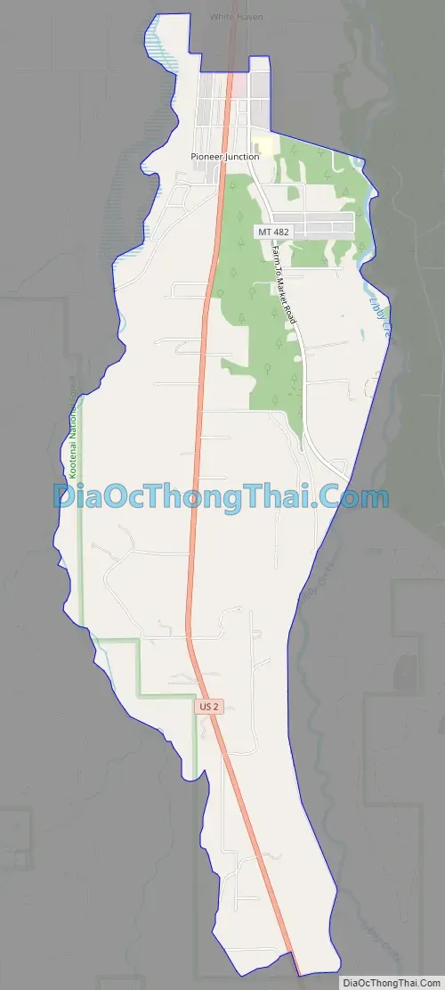
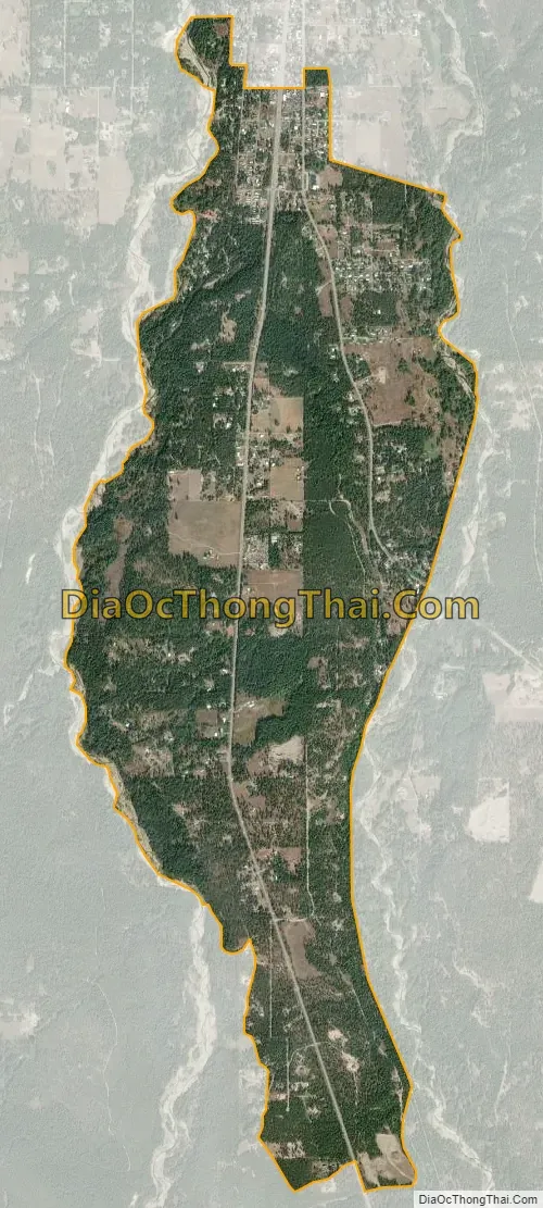
Pioneer Junction city Satellite Map
Geography
The community is south of the center of Lincoln County, along U.S. Route 2. It is bordered to the north by the White Haven CDP. Libby, the county seat, is 4 miles (6 km) to the north via US 2 westbound, and Kalispell is 84 miles (135 km) eastbound on US 2.
According to the U.S. Census Bureau, the Pioneer Junction CDP has an area of 3.5 square miles (9.1 km), all land. It sits between two creeks, Libby Creek to the east and its tributary, Big Cherry Creek, to the west. Libby Creek flows north to the Kootenai River at Libby and is part of the Columbia River watershed.
See also
Map of Montana State and its subdivision:- Beaverhead
- Big Horn
- Blaine
- Broadwater
- Carbon
- Carter
- Cascade
- Chouteau
- Custer
- Daniels
- Dawson
- Deer Lodge
- Fallon
- Fergus
- Flathead
- Gallatin
- Garfield
- Glacier
- Golden Valley
- Granite
- Hill
- Jefferson
- Judith Basin
- Lake
- Lewis and Clark
- Liberty
- Lincoln
- Madison
- McCone
- Meagher
- Mineral
- Missoula
- Musselshell
- Park
- Petroleum
- Phillips
- Pondera
- Powder River
- Powell
- Prairie
- Ravalli
- Richland
- Roosevelt
- Rosebud
- Sanders
- Sheridan
- Silver Bow
- Stillwater
- Sweet Grass
- Teton
- Toole
- Treasure
- Valley
- Wheatland
- Wibaux
- Yellowstone
- Alabama
- Alaska
- Arizona
- Arkansas
- California
- Colorado
- Connecticut
- Delaware
- District of Columbia
- Florida
- Georgia
- Hawaii
- Idaho
- Illinois
- Indiana
- Iowa
- Kansas
- Kentucky
- Louisiana
- Maine
- Maryland
- Massachusetts
- Michigan
- Minnesota
- Mississippi
- Missouri
- Montana
- Nebraska
- Nevada
- New Hampshire
- New Jersey
- New Mexico
- New York
- North Carolina
- North Dakota
- Ohio
- Oklahoma
- Oregon
- Pennsylvania
- Rhode Island
- South Carolina
- South Dakota
- Tennessee
- Texas
- Utah
- Vermont
- Virginia
- Washington
- West Virginia
- Wisconsin
- Wyoming


