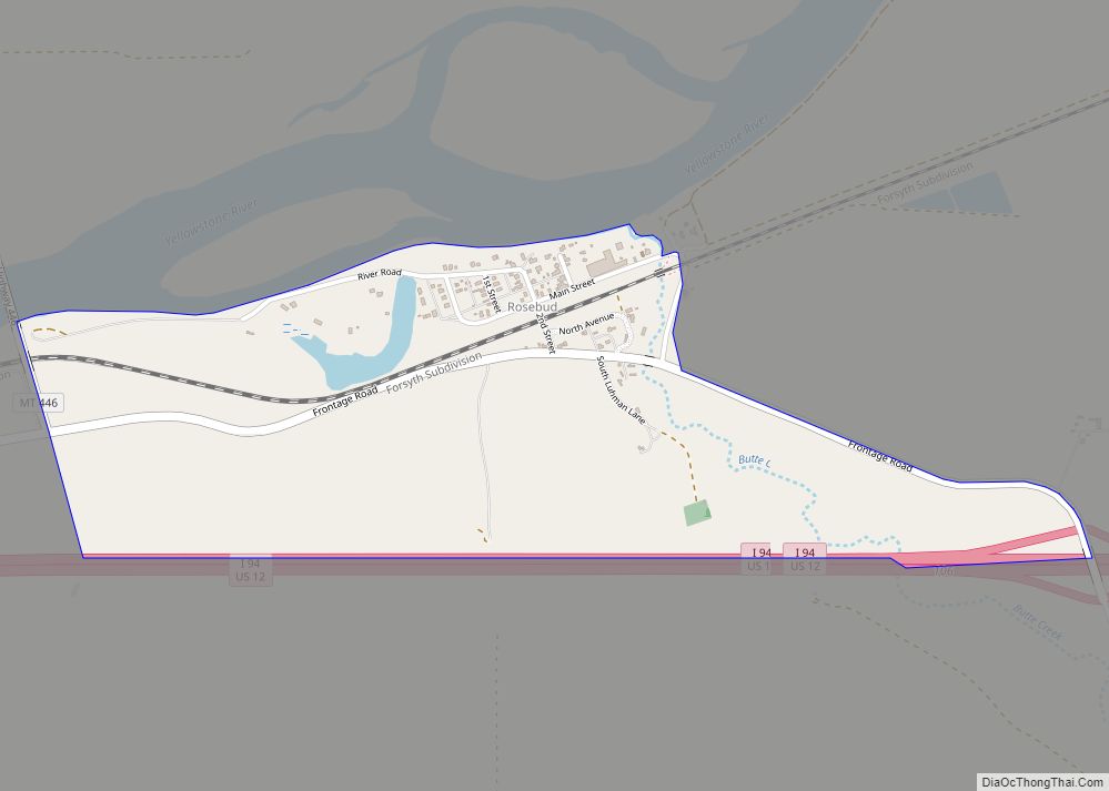
Rosebud is an unincorporated community, census-designated place and river town in Rosebud County, Montana, United States. It is located approximately 1.5 miles east of the intersection of the Yellowstone River and Rosebud Creek. Interstate 94 passes south of the town.
In 1878, Rosebud began as a small post office referred to as Beeman, on the Fort Keogh–Bozeman Stage Line. In 1882 the Northern Pacific Railroad and named the town Rosebud.
The Rosebud High School is the highest level of education offered for the town. Enrollment is 31 with a student teacher ratio of 4:1. The team name is the Wranglers.
| Name: | Rosebud CDP |
|---|---|
| LSAD Code: | 57 |
| LSAD Description: | CDP (suffix) |
| State: | Montana |
| County: | Rosebud County |
| Elevation: | 2,480 ft (760 m) |
| Total Area: | 0.77 sq mi (2.00 km²) |
| Land Area: | 0.76 sq mi (1.98 km²) |
| Water Area: | 0.01 sq mi (0.02 km²) |
| Total Population: | 67 |
| Population Density: | 87.70/sq mi (33.85/km²) |
| Area code: | 406 |
| FIPS code: | 3064375 |
| GNISfeature ID: | 775943 |
| Website: | http://www.rosebudmontana.com |
Online Interactive Map
Click on ![]() to view map in "full screen" mode.
to view map in "full screen" mode.
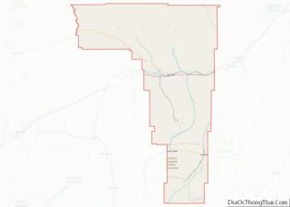
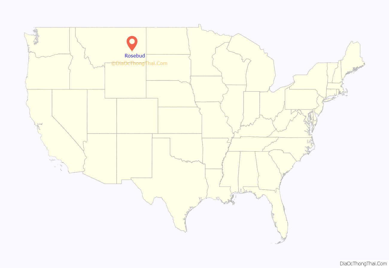
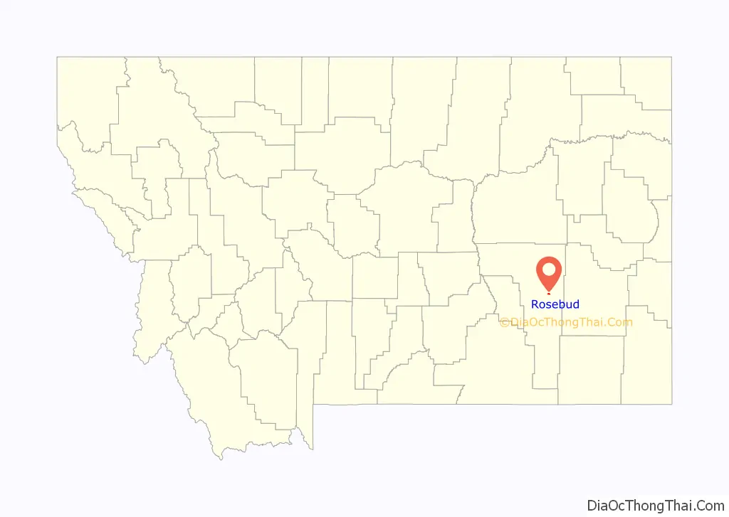
Rosebud location map. Where is Rosebud CDP?
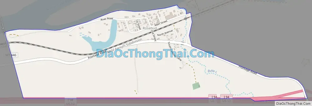
Rosebud Road Map
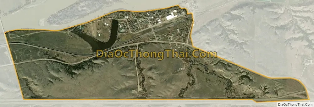
Rosebud city Satellite Map
See also
Map of Montana State and its subdivision:- Beaverhead
- Big Horn
- Blaine
- Broadwater
- Carbon
- Carter
- Cascade
- Chouteau
- Custer
- Daniels
- Dawson
- Deer Lodge
- Fallon
- Fergus
- Flathead
- Gallatin
- Garfield
- Glacier
- Golden Valley
- Granite
- Hill
- Jefferson
- Judith Basin
- Lake
- Lewis and Clark
- Liberty
- Lincoln
- Madison
- McCone
- Meagher
- Mineral
- Missoula
- Musselshell
- Park
- Petroleum
- Phillips
- Pondera
- Powder River
- Powell
- Prairie
- Ravalli
- Richland
- Roosevelt
- Rosebud
- Sanders
- Sheridan
- Silver Bow
- Stillwater
- Sweet Grass
- Teton
- Toole
- Treasure
- Valley
- Wheatland
- Wibaux
- Yellowstone
- Alabama
- Alaska
- Arizona
- Arkansas
- California
- Colorado
- Connecticut
- Delaware
- District of Columbia
- Florida
- Georgia
- Hawaii
- Idaho
- Illinois
- Indiana
- Iowa
- Kansas
- Kentucky
- Louisiana
- Maine
- Maryland
- Massachusetts
- Michigan
- Minnesota
- Mississippi
- Missouri
- Montana
- Nebraska
- Nevada
- New Hampshire
- New Jersey
- New Mexico
- New York
- North Carolina
- North Dakota
- Ohio
- Oklahoma
- Oregon
- Pennsylvania
- Rhode Island
- South Carolina
- South Dakota
- Tennessee
- Texas
- Utah
- Vermont
- Virginia
- Washington
- West Virginia
- Wisconsin
- Wyoming