Williston is a city in and the county seat of Williams County, North Dakota, United States. The 2020 census gave its population as 29,160, making Williston the sixth-largest city in North Dakota. The city’s population nearly doubled between 2010 and 2020, due largely to the North Dakota oil boom.
Williston’s newspaper is the daily Williston Herald. Williston is the home of Williston State College and the Miss North Dakota Scholarship Pageant.
| Name: | Williston city |
|---|---|
| LSAD Code: | 25 |
| LSAD Description: | city (suffix) |
| State: | North Dakota |
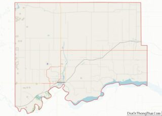
| County: | Williams County |
| Elevation: | 1,877 ft (572 m) |
| Total Area: | 23.33 sq mi (60.44 km²) |
| Land Area: | 23.19 sq mi (60.07 km²) |
| Water Area: | 0.14 sq mi (0.36 km²) |
| Total Population: | 29,160 |
| Population Density: | 1,257.22/sq mi (485.41/km²) |
| ZIP code: | 58801–58802 |
| Area code: | 701 |
| FIPS code: | 3886220 |
| GNISfeature ID: | 1032815 |
| Website: | cityofwilliston.com |
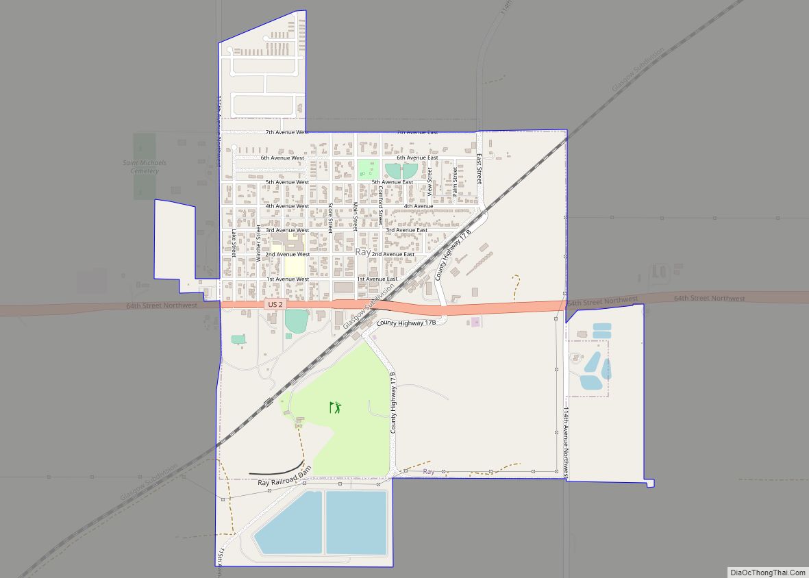
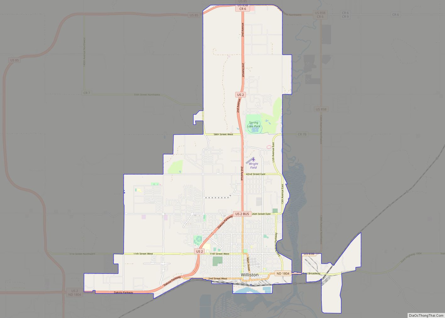
Online Interactive Map
Click on ![]() to view map in "full screen" mode.
to view map in "full screen" mode.
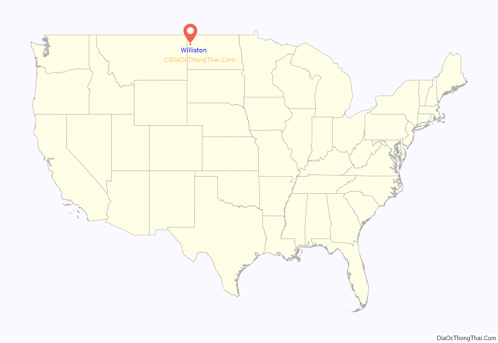
Williston location map. Where is Williston city?

History
Founded in 1887, Williston was named for Daniel Willis James, a merchant and capitalist, by his friend, railroad magnate James J. Hill.
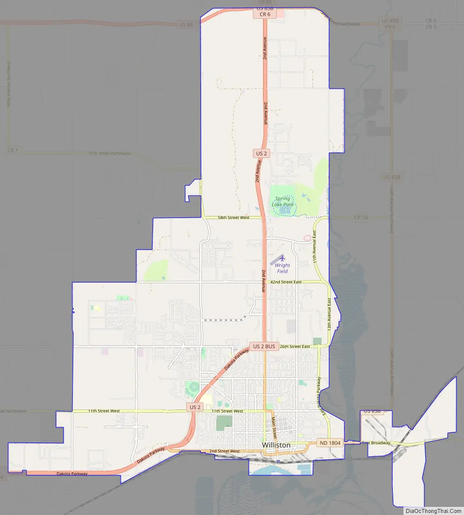
Williston Road Map
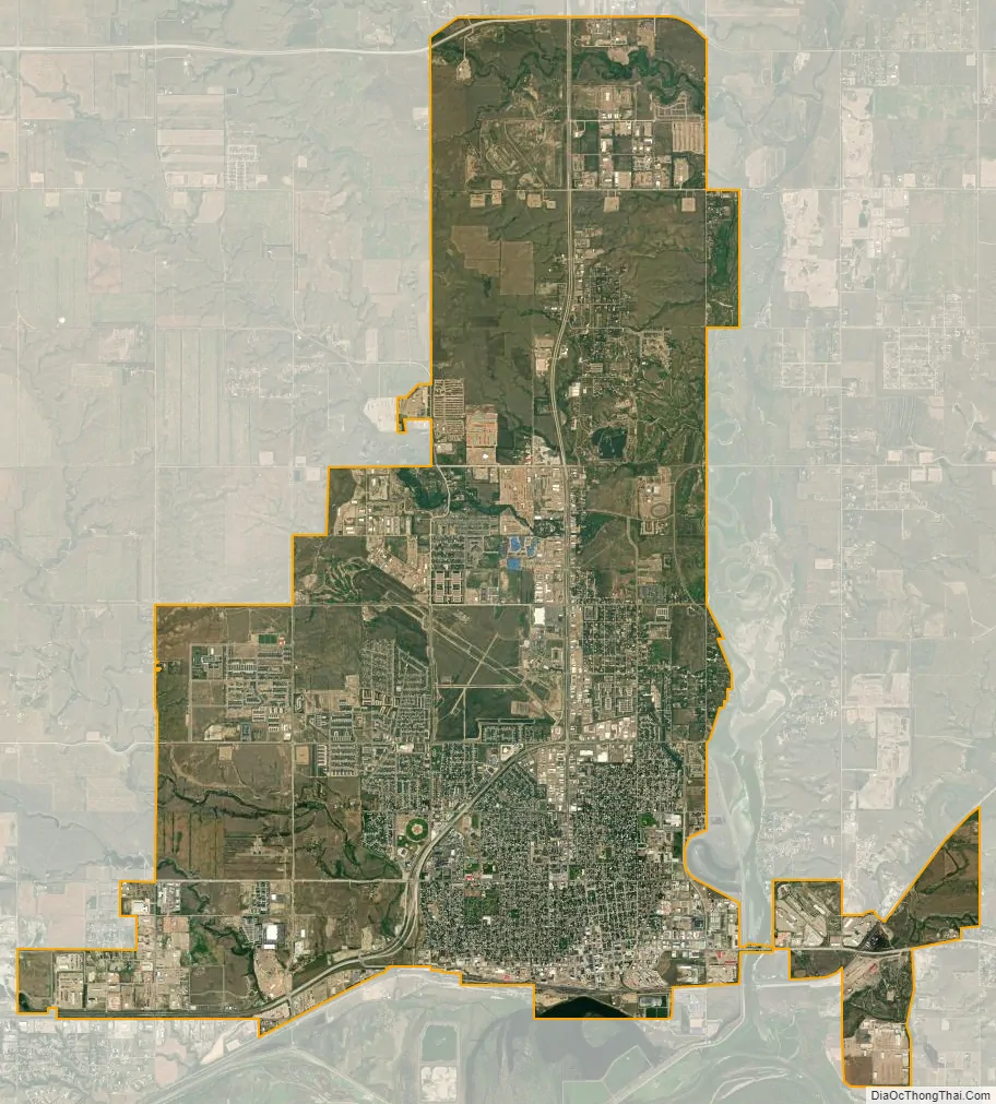
Williston city Satellite Map
Geography
Williston is located at the crossroads of U.S. Highways 2 and 85, near the confluence of the Yellowstone and Missouri rivers, at the upper end of the Lake Sakakawea reservoir.
According to the United States Census Bureau, the city has a total area of 7.56 square miles (19.58 km), of which 7.50 square miles (19.42 km) is land and 0.06 square miles (0.16 km) is water.
The municipality is 18 miles (29 km) from the Montana–North Dakota border and 60 miles (97 km) from the Canadian border.
Climate
Williston has a cold semi-arid climate; closely bordering upon a warm-summer humid continental climate. It is part of USDA Hardiness zone 4a. The normal monthly mean temperature ranges from 11.5 °F (−11.4 °C) in January to 70.4 °F (21.3 °C) in July. On average, there are 2 days that reach 100 °F (38 °C) or higher, 22 days of 90 °F (32 °C)+ highs, 39 days with a low of 0 °F (−18 °C) or below, 7 days with lows plummeting to at least −20 °F (−29 °C), and 6 days that do not rise above 0 °F annually. The average window for freezing temperatures is September 20 through May 21, allowing a growing season of 121 days; . Extreme temperatures officially range from −50 °F (−46 °C) on December 23, 1983 and February 16, 1936 up to 110 °F (43 °C) on July 5, 1936; the record cold daily maximum is −29 °F (−34 °C) on January 16, 1930, while, conversely, the record warm daily minimum is 78 °F (26 °C) last set July 19, 1974.
Precipitation is greatest in June and July and averages 14.88 in (378 mm) annually, but has ranged from 6.13 in (156 mm) in 1934 to 22.04 in (560 mm) in 1896. Snowfall averages 48.2 in (122 cm) per season, and has historically ranged from 8.0 in (20 cm) in 1908–1909 to 107.2 in (272 cm) in 2010–2011; the average window for measurable (≥0.1 in or 0.25 cm) snowfall is October 21 through April 26, although snow in May occurs at most several times per decade and September snow is a much rarer event. Due to the relative aridity, there are only 3.9 days per season where 24-hour snowfall exceeds 3 in (7.6 cm).
- ^ Mean monthly maxima and minima (i.e. the expected highest and lowest temperature readings at any point during the year or given month) calculated based on data at said location from 1991 to 2020.
- ^ Official records for Williston kept at the Weather Bureau Office from January 1894 to June 1948, Sloulin Field International Airport from July 1948 until October 22, 2019, and the new Williston Basin Int’l since October 23, 2019.
- ^ Only 22 to 24 years out of the 29 in the normals period were used to calculate the humidity normals.
See also
Map of North Dakota State and its subdivision:- Adams
- Barnes
- Benson
- Billings
- Bottineau
- Bowman
- Burke
- Burleigh
- Cass
- Cavalier
- Dickey
- Divide
- Dunn
- Eddy
- Emmons
- Foster
- Golden Valley
- Grand Forks
- Grant
- Griggs
- Hettinger
- Kidder
- Lamoure
- Logan
- McHenry
- McIntosh
- McKenzie
- McLean
- Mercer
- Morton
- Mountrail
- Nelson
- Oliver
- Pembina
- Pierce
- Ramsey
- Ransom
- Renville
- Richland
- Rolette
- Sargent
- Sheridan
- Sioux
- Slope
- Stark
- Steele
- Stutsman
- Towner
- Traill
- Walsh
- Ward
- Wells
- Williams
- Alabama
- Alaska
- Arizona
- Arkansas
- California
- Colorado
- Connecticut
- Delaware
- District of Columbia
- Florida
- Georgia
- Hawaii
- Idaho
- Illinois
- Indiana
- Iowa
- Kansas
- Kentucky
- Louisiana
- Maine
- Maryland
- Massachusetts
- Michigan
- Minnesota
- Mississippi
- Missouri
- Montana
- Nebraska
- Nevada
- New Hampshire
- New Jersey
- New Mexico
- New York
- North Carolina
- North Dakota
- Ohio
- Oklahoma
- Oregon
- Pennsylvania
- Rhode Island
- South Carolina
- South Dakota
- Tennessee
- Texas
- Utah
- Vermont
- Virginia
- Washington
- West Virginia
- Wisconsin
- Wyoming