St. Regis or Saint Regis is an unincorporated community and census-designated place (CDP) in Mineral County, Montana. The population was 319 at the time of the 2010 census.
The post office opened in 1896.
| Name: | St. Regis CDP |
|---|---|
| LSAD Code: | 57 |
| LSAD Description: | CDP (suffix) |
| State: | Montana |
| County: | Mineral County |
| Elevation: | 2,635 ft (803 m) |
| Total Area: | 0.88 sq mi (2.28 km²) |
| Land Area: | 0.86 sq mi (2.22 km²) |
| Water Area: | 0.02 sq mi (0.06 km²) |
| Total Population: | 313 |
| Population Density: | 365.65/sq mi (141.12/km²) |
| ZIP code: | 59866 |
| Area code: | 406 |
| FIPS code: | 3065575 |
| GNISfeature ID: | 2409233 |
Online Interactive Map
Click on ![]() to view map in "full screen" mode.
to view map in "full screen" mode.
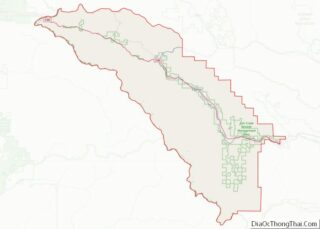
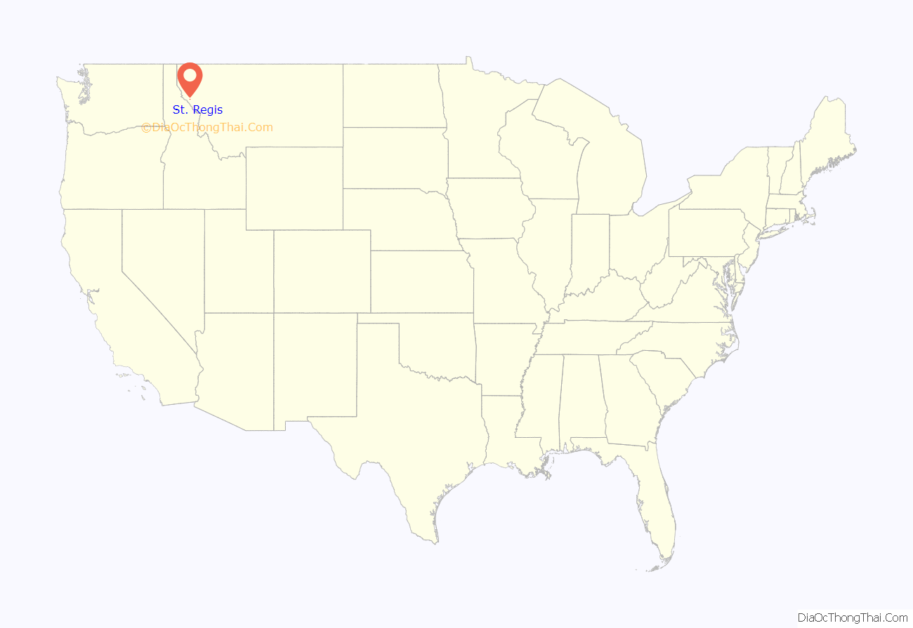
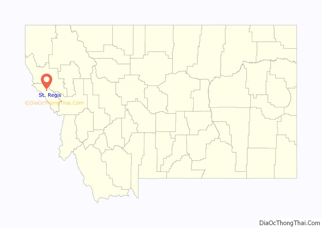
St. Regis location map. Where is St. Regis CDP?
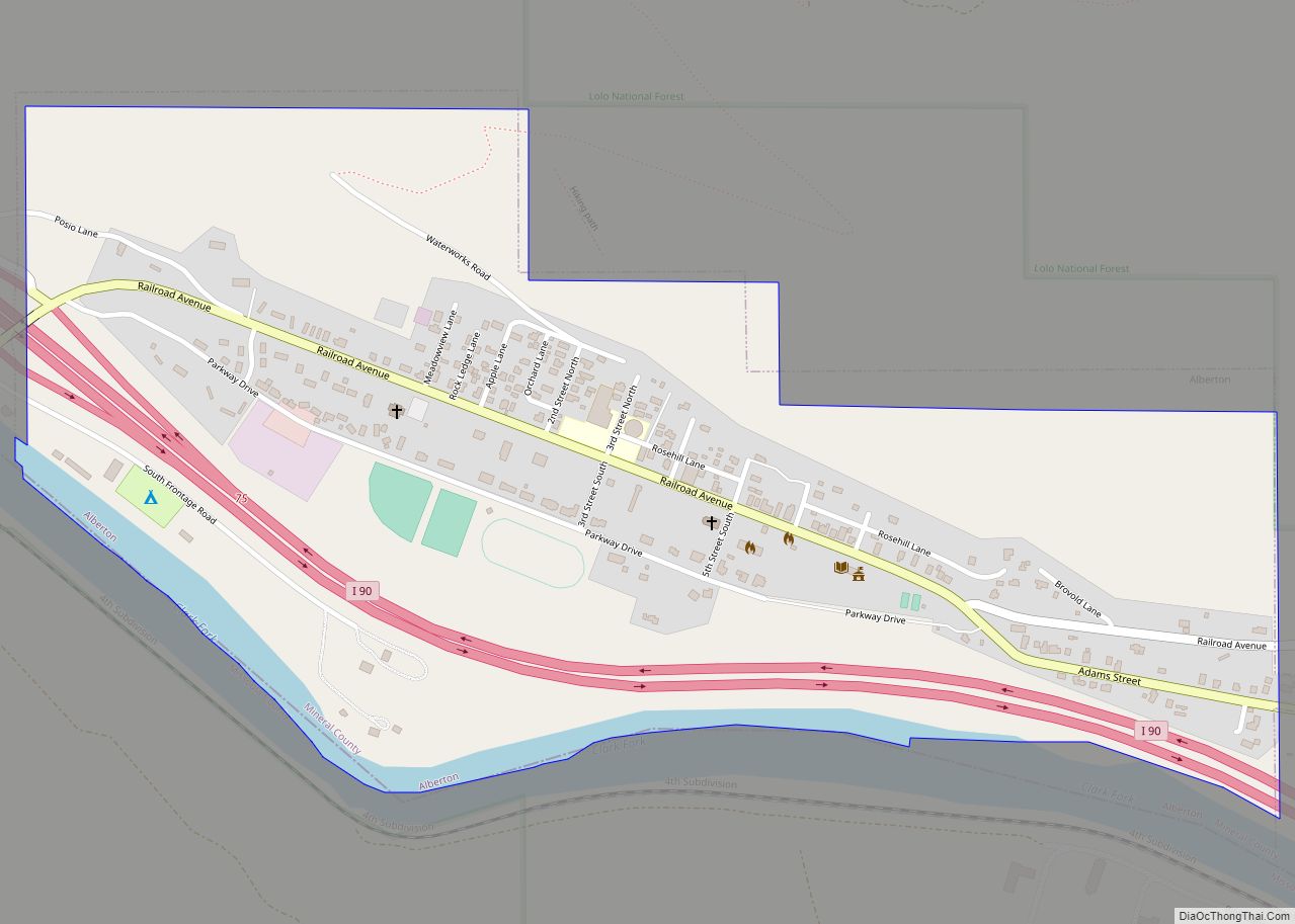
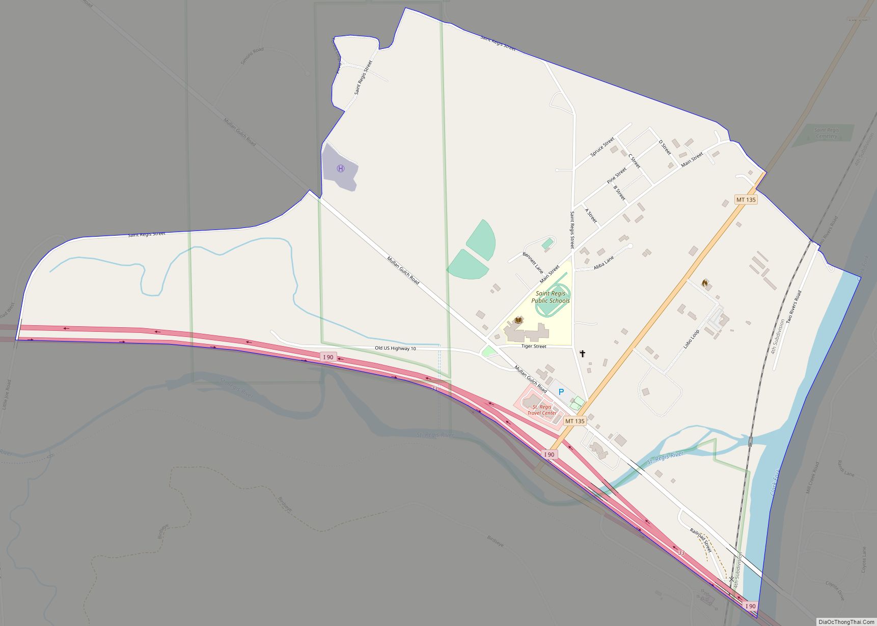
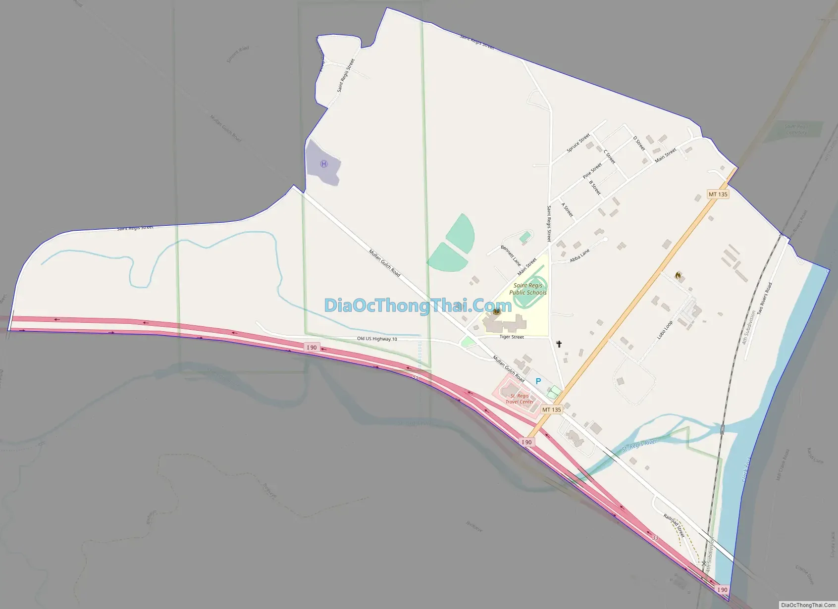
St. Regis Road Map
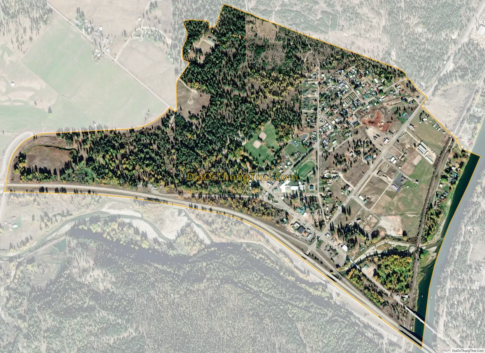
St. Regis city Satellite Map
Geography
St. Regis is located at 47°17′58″N 115°6′1″W / 47.29944°N 115.10028°W / 47.29944; -115.10028 (47.299477, −115.100277), at the confluence of the St. Regis River and the Clark Fork. It is on Montana Highway 135, a shortcut to Glacier National Park. Interstate 90 runs along the southern edge of the community, with access from Exit 33. I-90 leads southeast 71 miles (114 km) to Missoula and west 93 miles (150 km) to Coeur d’Alene, Idaho.
According to the United States Census Bureau, the St. Regis CDP has a total area of 0.9 square miles (2.3 km), of which 0.02 square miles (0.06 km), or 2.65%, are water.
Climate
This climatic region is typified by large seasonal temperature differences, with warm to hot (and often humid) summers and cold (sometimes severely cold) winters. According to the Köppen Climate Classification system, St. Regis has a humid continental climate, abbreviated “Dfb” on climate maps.
See also
Map of Montana State and its subdivision:- Beaverhead
- Big Horn
- Blaine
- Broadwater
- Carbon
- Carter
- Cascade
- Chouteau
- Custer
- Daniels
- Dawson
- Deer Lodge
- Fallon
- Fergus
- Flathead
- Gallatin
- Garfield
- Glacier
- Golden Valley
- Granite
- Hill
- Jefferson
- Judith Basin
- Lake
- Lewis and Clark
- Liberty
- Lincoln
- Madison
- McCone
- Meagher
- Mineral
- Missoula
- Musselshell
- Park
- Petroleum
- Phillips
- Pondera
- Powder River
- Powell
- Prairie
- Ravalli
- Richland
- Roosevelt
- Rosebud
- Sanders
- Sheridan
- Silver Bow
- Stillwater
- Sweet Grass
- Teton
- Toole
- Treasure
- Valley
- Wheatland
- Wibaux
- Yellowstone
- Alabama
- Alaska
- Arizona
- Arkansas
- California
- Colorado
- Connecticut
- Delaware
- District of Columbia
- Florida
- Georgia
- Hawaii
- Idaho
- Illinois
- Indiana
- Iowa
- Kansas
- Kentucky
- Louisiana
- Maine
- Maryland
- Massachusetts
- Michigan
- Minnesota
- Mississippi
- Missouri
- Montana
- Nebraska
- Nevada
- New Hampshire
- New Jersey
- New Mexico
- New York
- North Carolina
- North Dakota
- Ohio
- Oklahoma
- Oregon
- Pennsylvania
- Rhode Island
- South Carolina
- South Dakota
- Tennessee
- Texas
- Utah
- Vermont
- Virginia
- Washington
- West Virginia
- Wisconsin
- Wyoming