West Glendive is a census-designated place (CDP) in Dawson County, Montana, United States. The population was 1,998 at the 2020 census.
| Name: | West Glendive CDP |
|---|---|
| LSAD Code: | 57 |
| LSAD Description: | CDP (suffix) |
| State: | Montana |
| County: | Dawson County |
| Elevation: | 2,119 ft (646 m) |
| Total Area: | 3.85 sq mi (9.98 km²) |
| Land Area: | 3.84 sq mi (9.95 km²) |
| Water Area: | 0.01 sq mi (0.03 km²) |
| Total Population: | 1,998 |
| Population Density: | 519.91/sq mi (200.73/km²) |
| Area code: | 406 |
| FIPS code: | 3079086 |
| GNISfeature ID: | 1853191 |
Online Interactive Map
Click on ![]() to view map in "full screen" mode.
to view map in "full screen" mode.
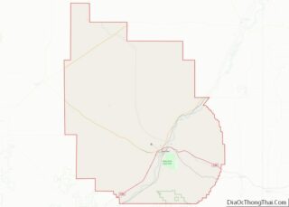
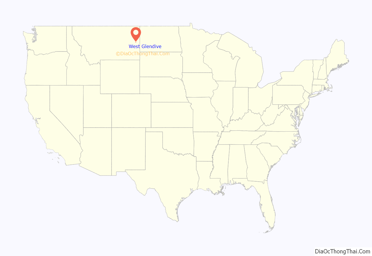
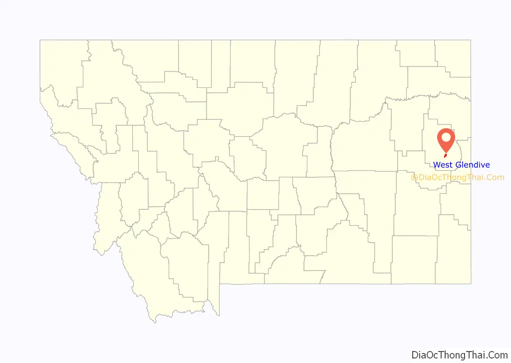
West Glendive location map. Where is West Glendive CDP?
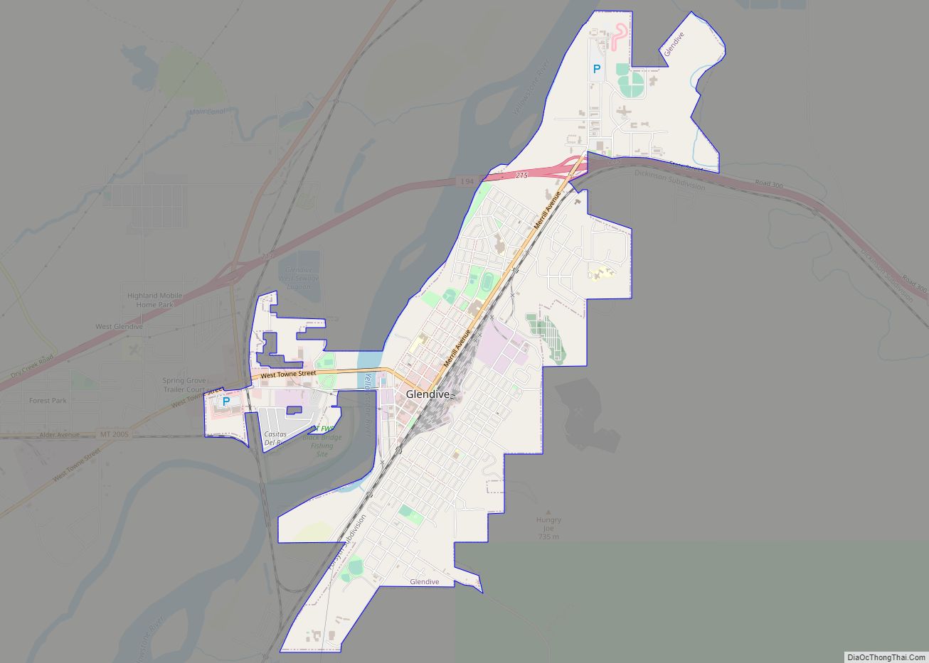
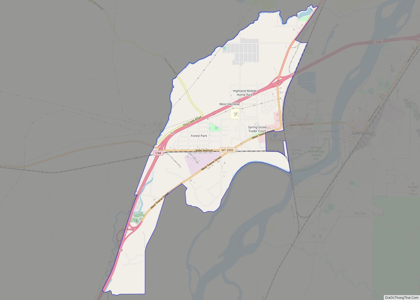
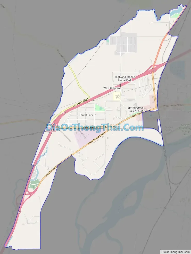
West Glendive Road Map
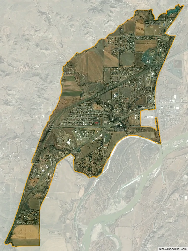
West Glendive city Satellite Map
Geography
West Glendive is located in south-central Dawson County at 47°06′39″N 104°44′53″W / 47.110710°N 104.748022°W / 47.110710; -104.748022 (47.110710, -104.748022), on the west side of the Yellowstone River, across from the city of Glendive. (A portion of Glendive extends west across the river to touch the West Glendive CDP.) Interstate 94 passes through the CDP, with access from Exits 210, 211, and 213. I-94 leads southwest 75 miles (121 km) to Miles City and east past Glendive 99 miles (159 km) to Dickinson, North Dakota. Montana Highway 16 leads northeast from West Glendive 52 miles (84 km) along the Yellowstone River to Sidney.
According to the U.S. Census Bureau, the West Glendive CDP has a total area of 3.9 square miles (10.1 km), of which 0.01 square miles (0.03 km), or 0.30%, is water.
See also
Map of Montana State and its subdivision:- Beaverhead
- Big Horn
- Blaine
- Broadwater
- Carbon
- Carter
- Cascade
- Chouteau
- Custer
- Daniels
- Dawson
- Deer Lodge
- Fallon
- Fergus
- Flathead
- Gallatin
- Garfield
- Glacier
- Golden Valley
- Granite
- Hill
- Jefferson
- Judith Basin
- Lake
- Lewis and Clark
- Liberty
- Lincoln
- Madison
- McCone
- Meagher
- Mineral
- Missoula
- Musselshell
- Park
- Petroleum
- Phillips
- Pondera
- Powder River
- Powell
- Prairie
- Ravalli
- Richland
- Roosevelt
- Rosebud
- Sanders
- Sheridan
- Silver Bow
- Stillwater
- Sweet Grass
- Teton
- Toole
- Treasure
- Valley
- Wheatland
- Wibaux
- Yellowstone
- Alabama
- Alaska
- Arizona
- Arkansas
- California
- Colorado
- Connecticut
- Delaware
- District of Columbia
- Florida
- Georgia
- Hawaii
- Idaho
- Illinois
- Indiana
- Iowa
- Kansas
- Kentucky
- Louisiana
- Maine
- Maryland
- Massachusetts
- Michigan
- Minnesota
- Mississippi
- Missouri
- Montana
- Nebraska
- Nevada
- New Hampshire
- New Jersey
- New Mexico
- New York
- North Carolina
- North Dakota
- Ohio
- Oklahoma
- Oregon
- Pennsylvania
- Rhode Island
- South Carolina
- South Dakota
- Tennessee
- Texas
- Utah
- Vermont
- Virginia
- Washington
- West Virginia
- Wisconsin
- Wyoming