Wilsonville is a city primarily in Clackamas County, Oregon, United States. A portion of the northern section of the city is in Washington County. It was founded as Boones Landing because of the Boones Ferry which crossed the Willamette River at the location; the community became Wilsonville in 1880. The city was incorporated in 1969 with a population of approximately 1,000. The population was 13,991 at the 2000 census, and grew to 19,509 as of 2010. Slightly more than 90% of residents at the 2000 census were white, with Hispanics comprising the largest minority group.
Located within the Portland metropolitan area, the city also includes the planned communities of Charbonneau on the south side of the river, and Villebois on the western edge. The city is bisected by Interstate 5 and includes I-5’s Boone Bridge over the Willamette. Public transportation is provided by the city-owned South Metro Area Regional Transit, which connects to the Portland-based TriMet by train through TriMet’s WES and by bus at the Tualatin Park & Ride. Students in public schools attend schools in the West Linn-Wilsonville and Canby school districts, including the only traditional high school, Wilsonville High School. Clackamas Community College and Oregon Tech have satellite campuses in the city.
Wilsonville has a council-manager form of government and operates its own library, public works, and parks & recreation department. Fire and police protection are contracted out to other regional government agencies. Wilsonville Public Works contracts Jacobs for operation of the wastewater treatment plant, and Veolia North America for operation of the Willamette River Water Treatment Plant. The city is home to several technology companies including Mentor Graphics, along with Stream Global Services, the largest employer in the city. Wilsonville contains many distribution and manufacturing buildings adjacent to Interstate 5 such as regional distribution facilities for Coca-Cola and Rite Aid. Retail centers include Argyle Square on the north and the Town Center Shopping Center to the south. Media in Wilsonville consists of the Portland area broadcast stations, regional newspapers, and the local Wilsonville Spokesman newspaper.
| Name: | Wilsonville city |
|---|---|
| LSAD Code: | 25 |
| LSAD Description: | city (suffix) |
| State: | Oregon |
| County: | Clackamas County, Washington County |
| Incorporated: | October 10, 1968 |
| Elevation: | 154 ft (47 m) |
| Total Area: | 7.76 sq mi (20.09 km²) |
| Land Area: | 7.55 sq mi (19.56 km²) |
| Water Area: | 0.21 sq mi (0.53 km²) |
| Total Population: | 26,664 |
| Population Density: | 3,531.19/sq mi (1,363.33/km²) |
| ZIP code: | 97070 |
| Area code: | 503 and 971 |
| FIPS code: | 4182800 |
| GNISfeature ID: | 1136917 |
| Website: | www.ci.wilsonville.or.us |
Online Interactive Map
Click on ![]() to view map in "full screen" mode.
to view map in "full screen" mode.
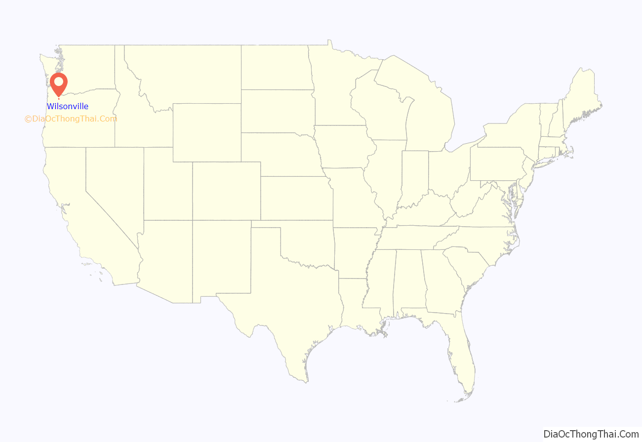
Wilsonville location map. Where is Wilsonville city?

History
Alphonso Boone, the grandson of Daniel Boone, settled in what would later become Wilsonville in 1846 and established the Boones Ferry across the Willamette River in 1847. The ferry gave rise to the community of Boones Landing, which eventually grew into Wilsonville. Originally, the area was part of what became Yamhill County, but was transferred to the current Clackamas County in 1855. The first post office was established in 1876 with the name Boones Ferry.
Wilsonville became the name of the community on June 3, 1880, named after the first postmaster, Charles Wilson. That same year the first school, Wilsonville Grade School, was opened as a single-room building. By 1890, the railroad had reached town and the community contained depot, several hotels, a saloon, a tavern, a bank, and several other commercial establishments. In 1897, the twelve school districts in the vicinity of Wilsonville up to Lake Oswego merged to create a single district. A railroad bridge was built across the river for the Oregon Electric Railway beginning in 1906. The bridge was completed the next year and service from Wilsonville south to Salem began in 1908.
A new Methodist church was built in the community in 1910, which was used until 1988 and is still standing. Two years later, a new two-room school replaced the old one-room school, which in turn was replaced by a modern school in the mid 1900s, all on the same property. In 1939, the wooden trestle part of the railroad bridge across the Willamette caught fire and burned. Boones Ferry was decommissioned after the Boone Bridge opened in 1954 carrying what was then the Baldock Freeway, and is today Interstate 5.
In 1961, the Dammasch State Hospital mental hospital opened on the west side of the community. Gordon House, the only house in Oregon to be designed by architect Frank Lloyd Wright, was built in 1963 near what became Charbonneau and moved to the Oregon Garden in 2001. Wilsonville was flooded in 1964 and the first fire station was built in 1966. Wilsonville was incorporated as a city on October 10, 1968, with a population of about 1,000. In 1971, the planned community of Charbonneau on the south side of the river was annexed into the city the year after development began.
Tektronix built a campus in the city beginning in 1973, which was later sold to Xerox. The following year Wilsonville’s city hall relocated from Tauchman House at what is now Boones Ferry Park to a trailer and the next year the first city manager was hired. A standalone post office was built in 1976 at Boones Ferry and Wilsonville roads, with city police protection added in 1979. In 1980, the city reached a population of 2,920, and in 1982 the library was opened. The next year, a new city hall was opened, replacing a trailer that had served as city hall since 1975.
In 1988, the city opened their first library building, which replaced the one-room library located in space leased from the school district. The population grew to 7,106 at the 1990 census, and in 1991 the Town Center Shopping Center along Wilsonville Road opened. Due to growth in the West Linn-Wilsonville School District, the school board approved building a new high school to be located in Wilsonville in 1992.
Author Walt Morey owned an estate in Wilsonville and after his death in 1992, his widow sold the property to a developer. The housing development built on that property, Morey’s Landing, bears his name as does the children’s section of the Wilsonville Public Library. Walt Morey Park, a bear-themed park located in Morey’s Landing, contains a life-size 8-foot-tall wooden statue of Morey’s most famous literary creation, Gentle Ben.
Living Enrichment Center, a New Thought Church with as many as 3,000 members, was headquartered in Wilsonville from 1992 until 2004. The church closed that year after problems that including money laundering by the church leaders led to the bankrupting of the church.
In 1995, Dammasch State Hospital was closed by the state of Oregon, and the site was then proposed as a location for what became the Coffee Creek Correctional Facility, which opened in 2001 at a different site to the north of the old hospital grounds. In protest of the construction of the prison, specifically the effect on property values, Larry Eaton began erecting school buses on his property. The former grounds of the state hospital have been redeveloped as Villebois, a primarily residential planned community. Also in 1995, Wilsonville High School opened as part of the West Linn-Wilsonville School District, the first high school in the city’s history. In 1998, lack of an adequate long-term water supply forced the city to suspend adding any new developments to the city. A new water treatment plant on the Willamette River opened in 2002 to address this need.
The Wilsonville Public Library was expanded to nearly four times the size of the 7,500-square-foot (700 m) 1988 building with an expansion finished in 2002. Wilsonville Primary School was closed in June 2001, and later sold with the property and turned into a shopping center, anchored by an Albertsons supermarket. In September 2006, Wilsonville opened a new $9.9 million, two-story brick and steel city hall after a controversy concerning its location led to unsuccessful attempts to recall several elected officials in the city, including the mayor. In 2007, the old city hall building was turned into a new public works and police department.
Wilsonville Road Map
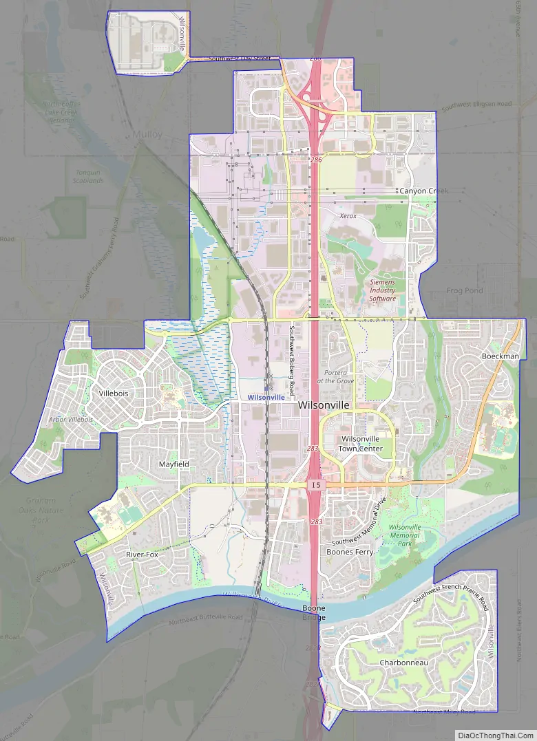
Wilsonville city Satellite Map

Geography
Wilsonville is located on the southern edge of the Portland metropolitan area sitting at an elevation of 154 feet (47 m) above sea level. Primarily in the southwestern part of Clackamas County, the northern section is in Washington County. It is located on the north side of the Willamette River around where Alphonse Boone established the Boones Ferry. Neighboring cities are Tualatin on the north, Sherwood to the northwest, and Canby and Aurora to the southeast. Newberg in Yamhill County is approximately 14 miles west along Wilsonville Road. The Willamette separates the majority of the city from Charbonneau, a planned community and neighborhood within the city limits, on the south.
According to the United States Census Bureau, the city has a total area of 7.42 square miles (19.22 km), of which 7.21 square miles (18.67 km) is land and 0.21 square miles (0.54 km) is water. Waterways in addition to the Willamette River include Arrowhead Creek, Meridian Creek, Basalt Creek, Seely Ditch, Boeckman Creek, and Coffee Lake Creek. The Boeckman and Coffee Lake creeks account for 85% of the runoff in Wilsonville. Coffee Lake Creek is on the west side of the city and includes Coffee Lake and the Coffee Lake Wetlands. The foothills of the Chehalem Mountains lie to the west of Wilsonville, with most land within the city on level ground.
Wilsonville divides the city into 16 neighborhood groups, designated A through P. Within each of these planning areas are individual neighborhoods, and occasionally a neighborhood spans several of these groups. For instance the Villebois development covers areas D through G. Individual neighborhoods include Charbonneau, Wilsonville Meadows, Canyon Creek North, Town Center, RiverGreen, Frog Pond, and Old Town to name a few. Wilsonville’s Old Town neighborhood, the oldest of the neighborhoods, is located south of Wilsonville Road along Boones Ferry Road adjacent to the landing of the old Boones Ferry and contains the original portions of the town.
Climate
Wilsonville, as part of the Willamette Valley is within the Marine west coast climate zone. Summers in Wilsonville are generally warm, but temperatures year-round are moderated by a marine influence from the Pacific Ocean. Wilsonville receives most of its precipitation during the mild to cool winter months, with the wettest period from November through March. July and August are the warmest months with an average high temperature of 87 °F (31 °C), while December is the coolest month with an average low of 34 °F (1 °C). December is also on average the wettest month with 6.67 inches (169 mm). The highest recorded temperature, 116 °F (47 °C), occurred June 28th, 2021, during a record breaking heatwave throughout the Pacific Northwest. Wilsonville’s lowest recorded temperature was −15 °F (−26 °C) on December 23, 1998.
See also
Map of Oregon State and its subdivision: Map of other states:- Alabama
- Alaska
- Arizona
- Arkansas
- California
- Colorado
- Connecticut
- Delaware
- District of Columbia
- Florida
- Georgia
- Hawaii
- Idaho
- Illinois
- Indiana
- Iowa
- Kansas
- Kentucky
- Louisiana
- Maine
- Maryland
- Massachusetts
- Michigan
- Minnesota
- Mississippi
- Missouri
- Montana
- Nebraska
- Nevada
- New Hampshire
- New Jersey
- New Mexico
- New York
- North Carolina
- North Dakota
- Ohio
- Oklahoma
- Oregon
- Pennsylvania
- Rhode Island
- South Carolina
- South Dakota
- Tennessee
- Texas
- Utah
- Vermont
- Virginia
- Washington
- West Virginia
- Wisconsin
- Wyoming


