Chapin, popularly known as the “Capital of Lake Murray”, is a small lake town located at the northern tip of Lexington County, South Carolina, United States. Lake Murray separates Chapin from the rest of Lexington County. The population of Chapin was 1,445 according to the 2010 census, and an estimated 1,633 in 2019.
Chapin is located approximately 24 miles (39 km) northwest of Columbia, and many people commute there for work; however, the town is considered fringe rural by the US postal service.
The town government is set up in the mayor-council form, and the current mayor is Albert Koon. Chapin has four public schools in the area; the first Chapin school was built in 1924. Lake Murray is the main attraction to Chapin and provides boaters with water-related recreation.
| Name: | Chapin town |
|---|---|
| LSAD Code: | 43 |
| LSAD Description: | town (suffix) |
| State: | South Carolina |
| County: | Lexington County |
| Elevation: | 463 ft (141 m) |
| Total Area: | 1.99 sq mi (5.16 km²) |
| Land Area: | 1.98 sq mi (5.13 km²) |
| Water Area: | 0.01 sq mi (0.03 km²) |
| Total Population: | 1,809 |
| Population Density: | 913.64/sq mi (352.81/km²) |
| ZIP code: | 29036 |
| Area code: | 803, 839 |
| FIPS code: | 4513150 |
| GNISfeature ID: | 1231155 |
| Website: | www.chapinsc.com |
Online Interactive Map
Click on ![]() to view map in "full screen" mode.
to view map in "full screen" mode.
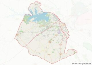
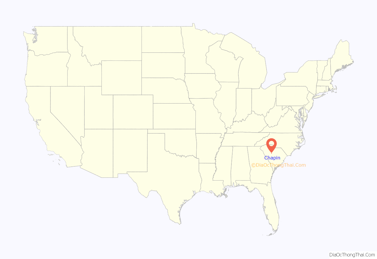
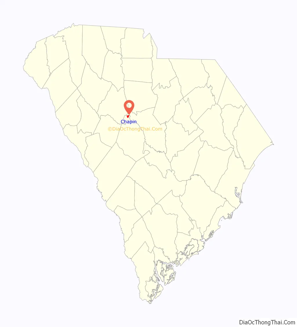
Chapin location map. Where is Chapin town?
History
Chapin is named after Martin Chapin in 1889. After Chapin and Laura Anne Benjamin were married on June 16, 1850, the couple moved down South because of Martin’s health (a lung condition). The Chapins were living in Columbia when Martin’s doctor suggested he to move to the Piney Woods area. He bought property in this area, and over the years Chapin bought 4,218 acres (1,707 ha). He built a home in Piney Woods and later a hotel in the 1880s along the new rail line that ran from Columbia to Laurens, the Columbia, Newberry and Laurens Railroad. The railroad provided a way to trade and transport goods to the capital city. Cotton and the lumber industry were flourishing with the railroad providing transportation. After Martin’s death on August 31, 1894, Laura Chapin sold their home and moved into the Chapin hotel.
On March 28, 1907, Job S. Wessinger, P.M. Frick, and J. S. Honeycut founded the Bank of Chapin. One year later the building for the bank was built. The bank prospered with help from the railroad.
During World War I, Chapin was doing well economically. The price of cotton had risen and the farmers were making plenty of money. As a result, the Bank of Chapin was also thriving during this time. The first high school was built in 1924.
Slowly the businesses in Chapin were starting to experience hard times nearing the 1930s. On Thursday, October 15, 1931, the Bank of Chapin did not open, and like other banks around the world, the bank would not allow customers to withdraw their money. Anybody who had money saved in the bank lost that money due to the crash of the stock market, later known as the start of the Great Depression. Another disaster to hit Chapin was the building of the dam on the Saluda River that would result in the building of a lake. This lake would take over most of the Chapin families’ farms and homesteads. The building of the dam was started in 1927.
In the midst of the Great Depression Chapin started a recreational team sport of baseball. In 1935, the Dutch Fork League was formed where Chapin had its own team. This team helped the unemployed men occupy their time during these difficult times. These baseball games attracted thousands of people.
During the 1940s Chapin grew through improvements to the school and opening new businesses. One new business that came to Chapin were filling stations. The next business was a cabinet shop called E. A. Frick and Son. Chapin also built paved roads, a baseball field and established the public library. In 1950 the first post office building was constructed, along with new telephone services.
The 1960s were about new and better services. Garbage collection was an issue in the ’60s, so the town government bought land and built a landfill. Transportation was the next service provided by access to an interstate highway. On September 7, 1960 a section of Interstate 26 was opened between Columbia and Pomaria. The interstate made Chapin more accessible. Streets in town were also improved. Another improvement of the ’60s was the new water system. In 1965 a volunteer fire department was organized, and in 1966 the town had its first ambulance. Chapin also started growing in population as more people moved to the town in the 1960s.
During the 1970s new schools were built. Chapin football became a community event, and the school football team won state championships in 1973 and 1974. Also in the ’70s churches in the town of Chapin were growing by establishment of Chapin Baptist Church, St. Francis of Assisi Episcopal Church, Our Lady of the Lake Catholic Church, and Lake Murray Presbyterian Church.
The Robinson-Hiller House was listed on the U.S. National Register of Historic Places in 1998, and the Chapin Commercial Historic District was added in 2019.
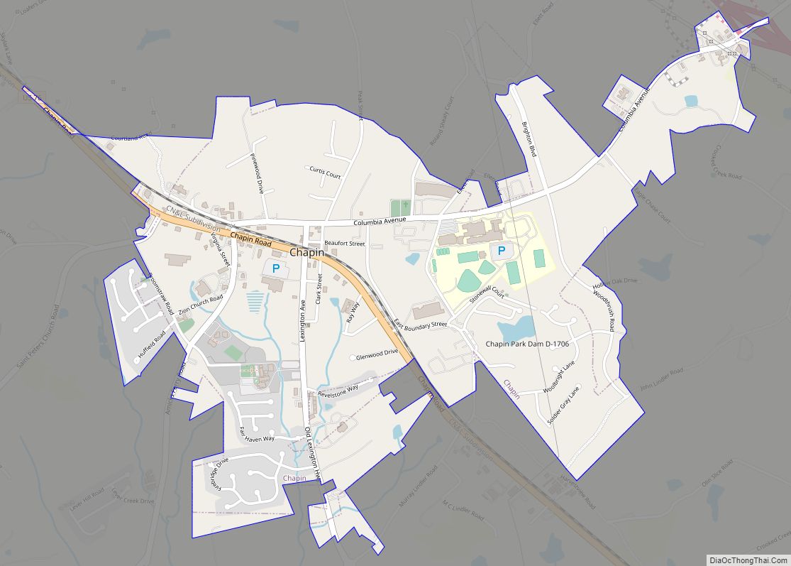
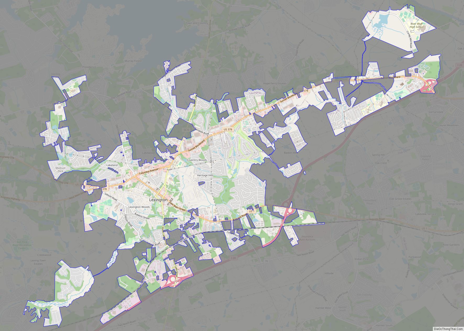
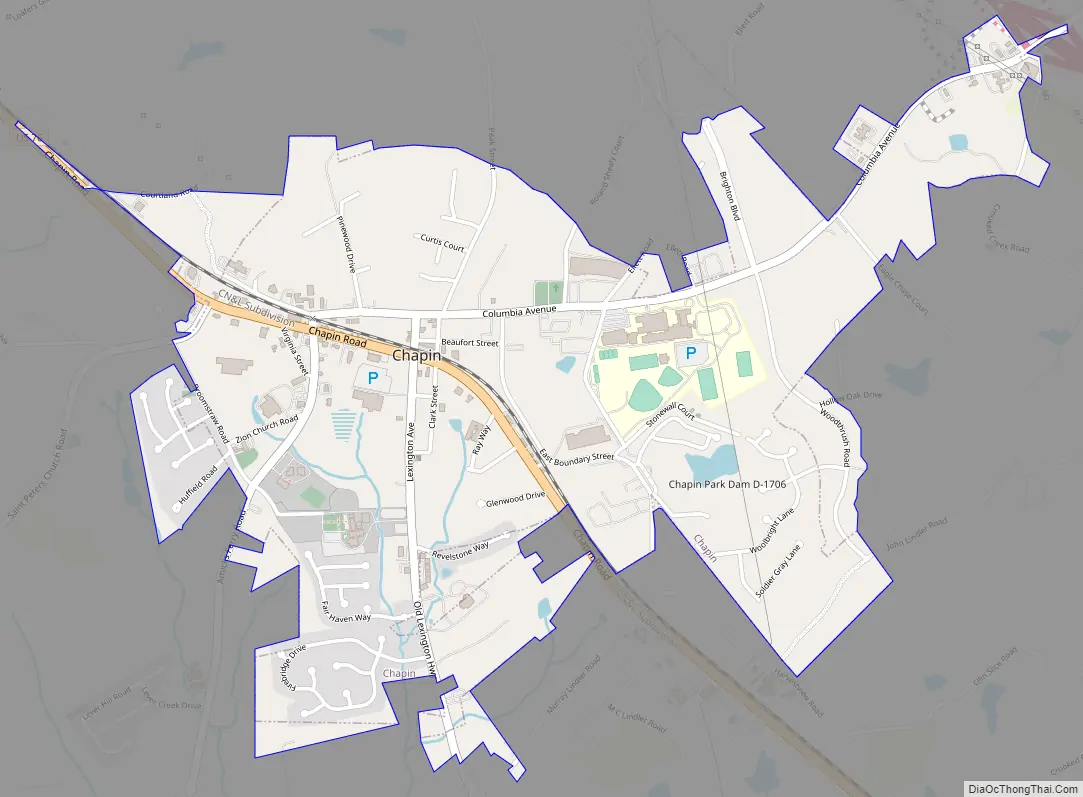
Chapin Road Map
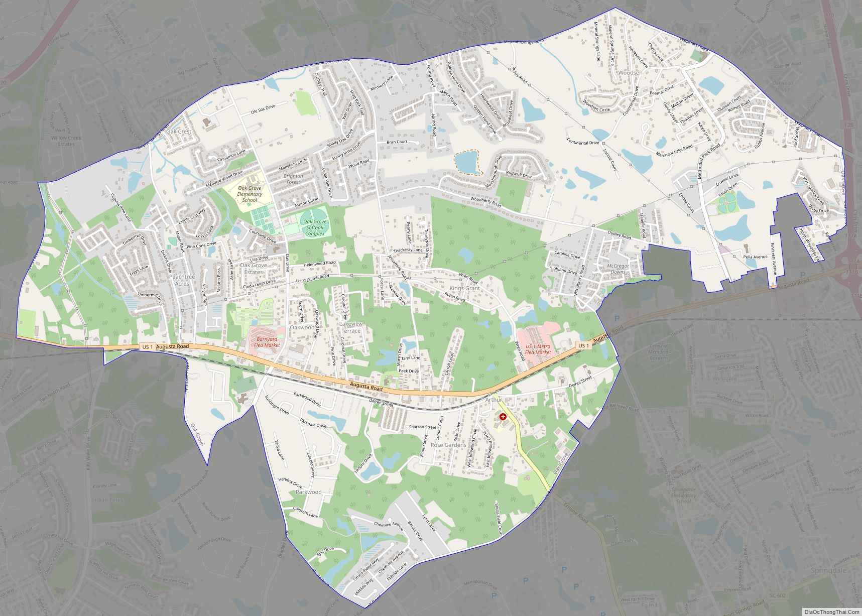
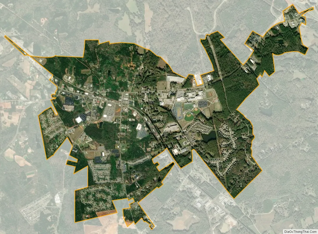
Chapin city Satellite Map
Geography
Chapin is located in the northern corner of Lexington County at 34°9′57″N 81°20′50″W / 34.16583°N 81.34722°W / 34.16583; -81.34722 (34.165783, -81.347260).
According to the United States Census Bureau, the town has a total area of 2.0 square miles (5.2 km), of which 0.01 square miles (0.03 km), or 0.53%, are water.
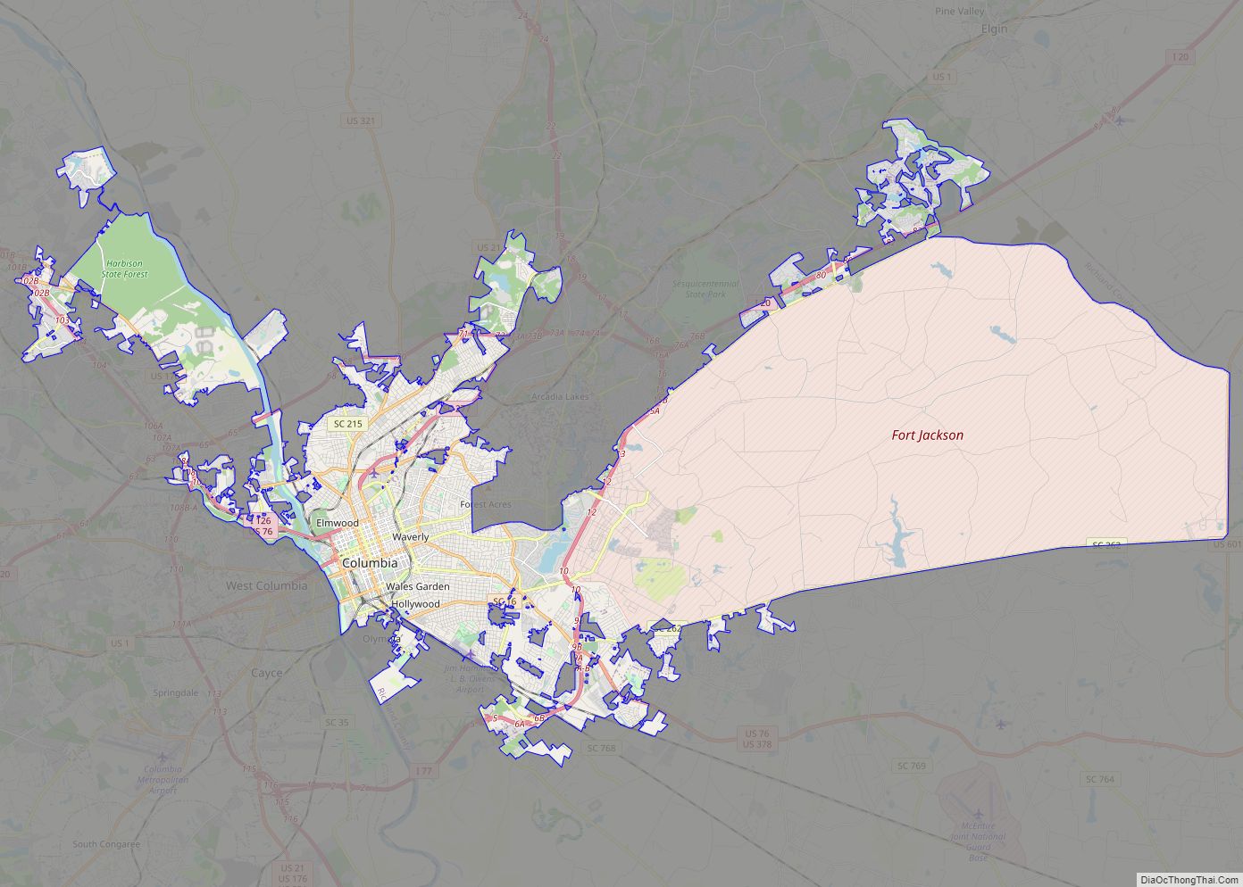
While Chapin is a part of Lexington County, the creation of Lake Murray by the Dreher Shoals Dam cut Chapin off from the rest of the county by road, creating something of an exclave.
See also
Map of South Carolina State and its subdivision:- Abbeville
- Aiken
- Allendale
- Anderson
- Bamberg
- Barnwell
- Beaufort
- Berkeley
- Calhoun
- Charleston
- Cherokee
- Chester
- Chesterfield
- Clarendon
- Colleton
- Darlington
- Dillon
- Dorchester
- Edgefield
- Fairfield
- Florence
- Georgetown
- Greenville
- Greenwood
- Hampton
- Horry
- Jasper
- Kershaw
- Lancaster
- Laurens
- Lee
- Lexington
- Marion
- Marlboro
- McCormick
- Newberry
- Oconee
- Orangeburg
- Pickens
- Richland
- Saluda
- Spartanburg
- Sumter
- Union
- Williamsburg
- York
- Alabama
- Alaska
- Arizona
- Arkansas
- California
- Colorado
- Connecticut
- Delaware
- District of Columbia
- Florida
- Georgia
- Hawaii
- Idaho
- Illinois
- Indiana
- Iowa
- Kansas
- Kentucky
- Louisiana
- Maine
- Maryland
- Massachusetts
- Michigan
- Minnesota
- Mississippi
- Missouri
- Montana
- Nebraska
- Nevada
- New Hampshire
- New Jersey
- New Mexico
- New York
- North Carolina
- North Dakota
- Ohio
- Oklahoma
- Oregon
- Pennsylvania
- Rhode Island
- South Carolina
- South Dakota
- Tennessee
- Texas
- Utah
- Vermont
- Virginia
- Washington
- West Virginia
- Wisconsin
- Wyoming