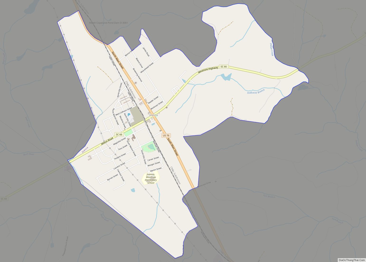
Joanna is an unincorporated community and census-designated place (CDP) in Laurens County, South Carolina, United States. The population was 1,539 at the 2010 census, down from 1,609 at the 2000 census. It is part of the Greenville–Mauldin–Easley Metropolitan Statistical Area.
| Name: | Joanna CDP |
|---|---|
| LSAD Code: | 57 |
| LSAD Description: | CDP (suffix) |
| State: | South Carolina |
| County: | Laurens County |
| Elevation: | 607 ft (185 m) |
| Total Area: | 3.14 sq mi (8.14 km²) |
| Land Area: | 3.14 sq mi (8.13 km²) |
| Water Area: | 0.01 sq mi (0.01 km²) |
| Total Population: | 1,517 |
| Population Density: | 483.58/sq mi (186.69/km²) |
| ZIP code: | 29351 |
| Area code: | 864 |
| FIPS code: | 4536790 |
| GNISfeature ID: | 1246175 |
Online Interactive Map
Click on ![]() to view map in "full screen" mode.
to view map in "full screen" mode.
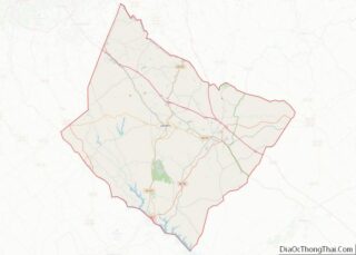
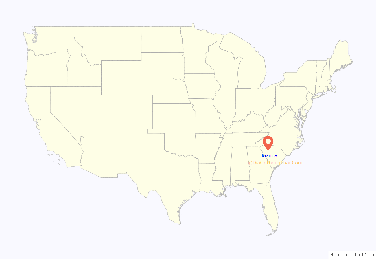
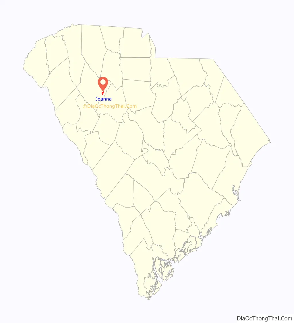
Joanna location map. Where is Joanna CDP?
History
The community was first settled in the 1760s. By the 1850s, the town was known as “Martin’s Depot”, in honor of a local planter, Martin Kinard, who had helped bring the Laurens Railroad through. On April 30, 1865, Confederate President Jefferson Davis and his cabinet passed through the town on their flight from Richmond and spent the night at the Lafayette Young house, 5 miles (8 km) to the southwest. Martin’s Depot was renamed “Goldville” in 1872. In 1948 the name of the town was again changed, to “Joanna”, the name of the wife of a local industrialist.
Joanna Road Map
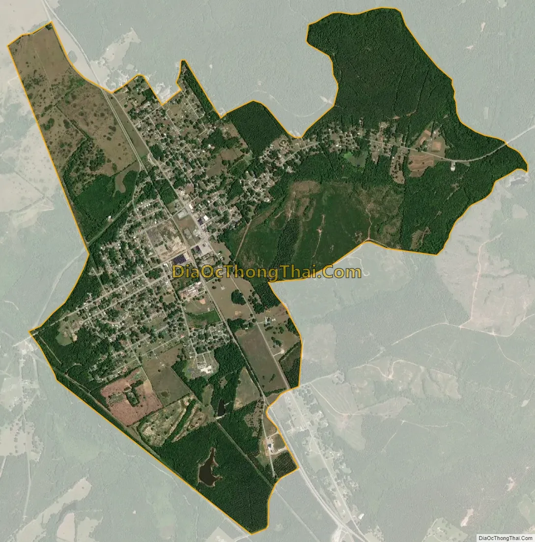
Joanna city Satellite Map
Geography
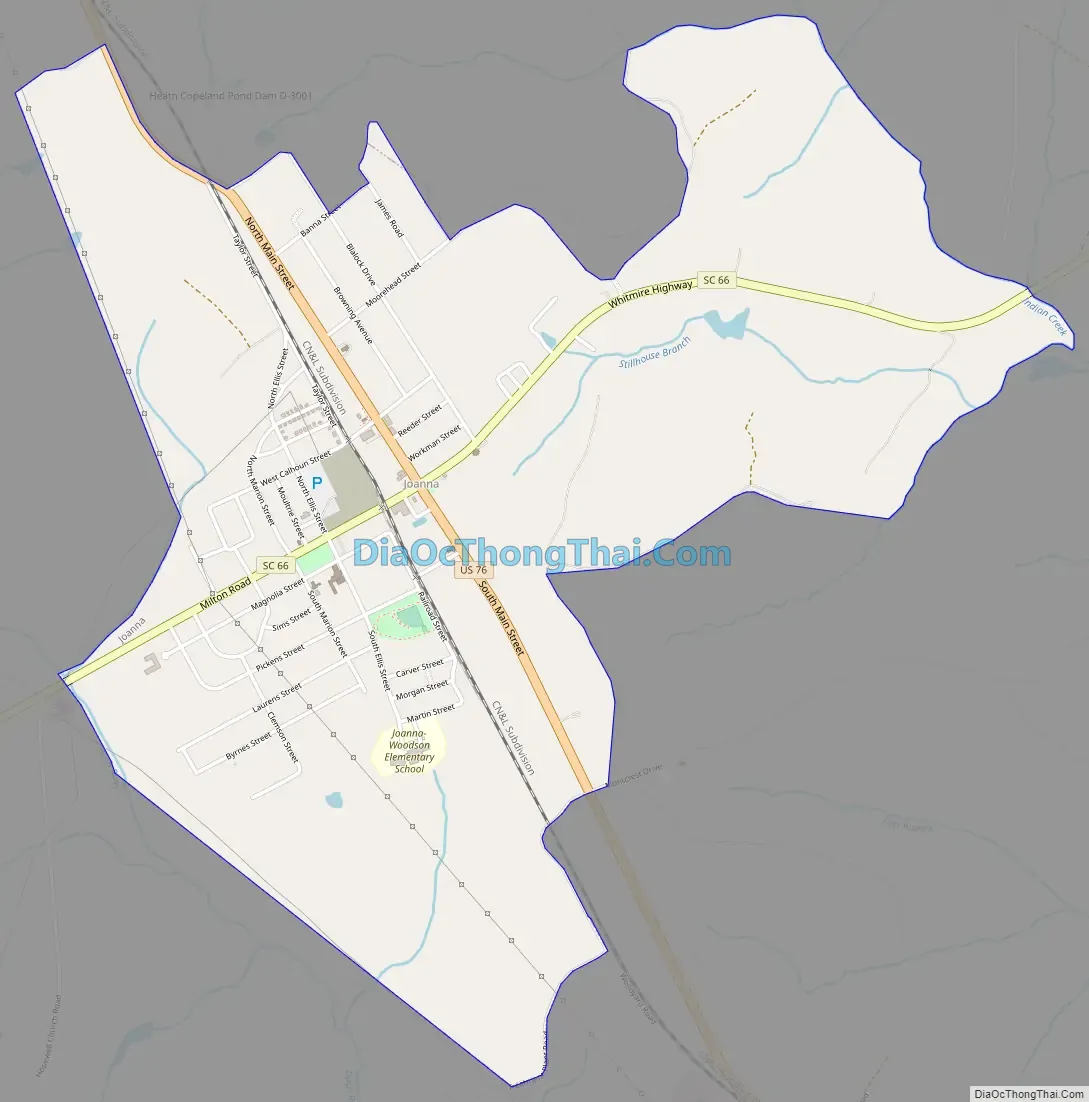
Joanna is located in eastern Laurens County at 34°24′53″N 81°48′51″W / 34.414668°N 81.814229°W / 34.414668; -81.814229. U.S. Route 76 passes through the east side of the community, leading northwest 6 miles (10 km) to Clinton and 14 miles (23 km) to Laurens, the county seat, and southeast 16 miles (26 km) to Newberry. Interstate 26 passes 3 miles (5 km) northeast of Joanna, accessible from South Carolina Highway 66.
According to the United States Census Bureau, the CDP has a total area of 3.1 square miles (8.1 km), of which 0.004 square miles (0.01 km), or 0.18%, are water. The CDP extends west to the upper reaches of the Bush River, a southeast-flowing tributary of the Saluda River, and east to Indian Creek, an east-flowing tributary of the Enoree River and then the Broad River.
See also
Map of South Carolina State and its subdivision:- Abbeville
- Aiken
- Allendale
- Anderson
- Bamberg
- Barnwell
- Beaufort
- Berkeley
- Calhoun
- Charleston
- Cherokee
- Chester
- Chesterfield
- Clarendon
- Colleton
- Darlington
- Dillon
- Dorchester
- Edgefield
- Fairfield
- Florence
- Georgetown
- Greenville
- Greenwood
- Hampton
- Horry
- Jasper
- Kershaw
- Lancaster
- Laurens
- Lee
- Lexington
- Marion
- Marlboro
- McCormick
- Newberry
- Oconee
- Orangeburg
- Pickens
- Richland
- Saluda
- Spartanburg
- Sumter
- Union
- Williamsburg
- York
- Alabama
- Alaska
- Arizona
- Arkansas
- California
- Colorado
- Connecticut
- Delaware
- District of Columbia
- Florida
- Georgia
- Hawaii
- Idaho
- Illinois
- Indiana
- Iowa
- Kansas
- Kentucky
- Louisiana
- Maine
- Maryland
- Massachusetts
- Michigan
- Minnesota
- Mississippi
- Missouri
- Montana
- Nebraska
- Nevada
- New Hampshire
- New Jersey
- New Mexico
- New York
- North Carolina
- North Dakota
- Ohio
- Oklahoma
- Oregon
- Pennsylvania
- Rhode Island
- South Carolina
- South Dakota
- Tennessee
- Texas
- Utah
- Vermont
- Virginia
- Washington
- West Virginia
- Wisconsin
- Wyoming