Glenville is a town in and the county seat of Gilmer County, West Virginia, United States, along the Little Kanawha River. The population was 1,128 at the 2020 census. It is the home of Glenville State University.
| Name: | Glenville town |
|---|---|
| LSAD Code: | 43 |
| LSAD Description: | town (suffix) |
| State: | West Virginia |
| County: | Gilmer County |
| Elevation: | 725 ft (221 m) |
| Total Area: | 1.03 sq mi (2.68 km²) |
| Land Area: | 1.00 sq mi (2.58 km²) |
| Water Area: | 0.04 sq mi (0.10 km²) |
| Total Population: | 1,128 |
| Population Density: | 1,438.31/sq mi (555.44/km²) |
| ZIP code: | 26351 |
| Area code: | 304 |
| FIPS code: | 5432044 |
| GNISfeature ID: | 1539468 |
| Website: | cityofglenvillewv.com |
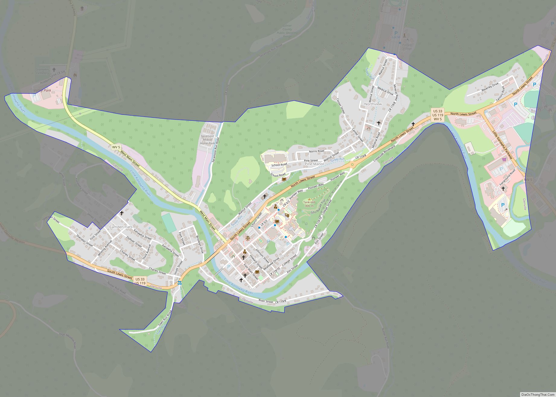
Online Interactive Map
Click on ![]() to view map in "full screen" mode.
to view map in "full screen" mode.
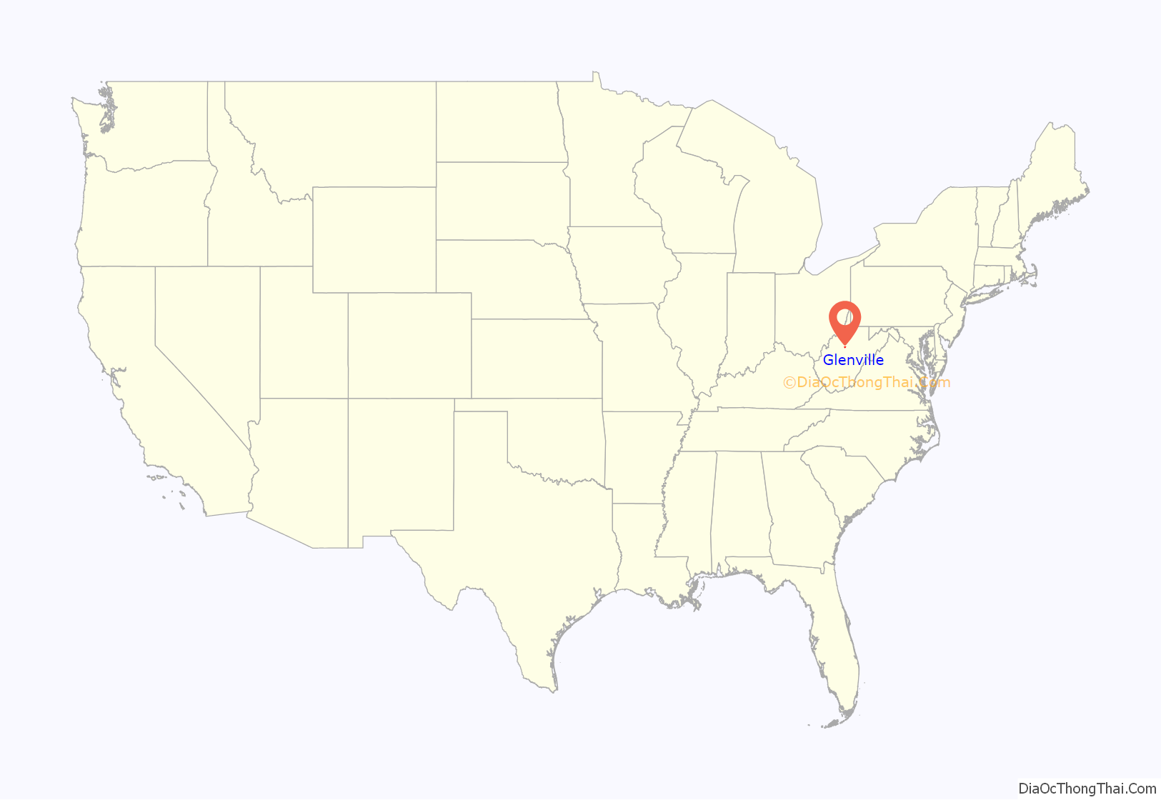
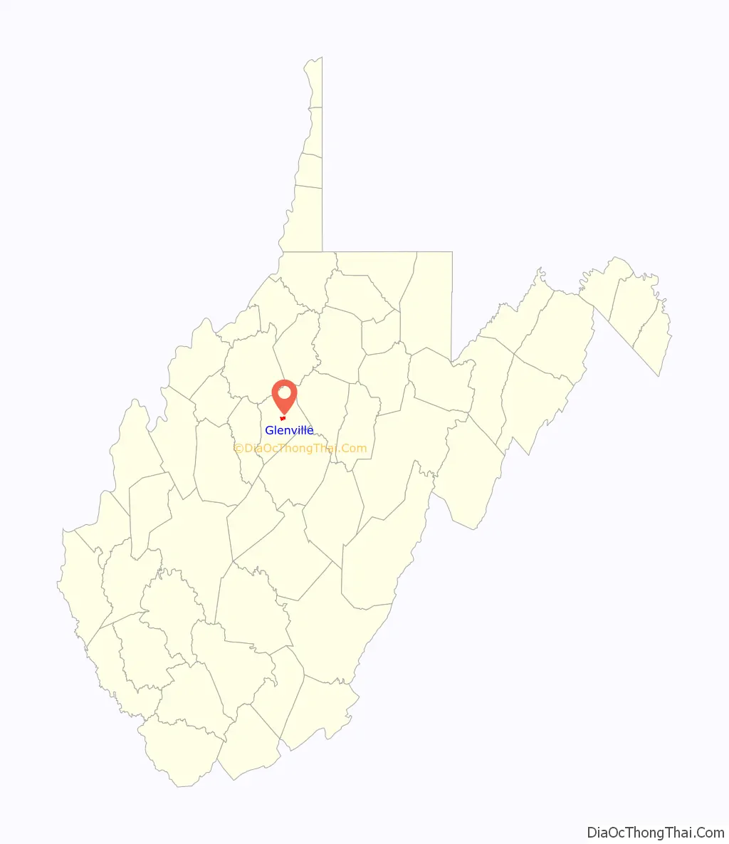
Glenville location map. Where is Glenville town?
History
In the late 1700s and early 1800s, pioneers began settling in the area they called ‘‘the Ford’’ because it was a place where travelers could cross the river. Later, the community was named Glenville because of its location in a glen. The first grist mill in present-day Gilmer County was constructed there in 1812. The first courthouse was completed in 1850, the second in 1872, and the current courthouse in 1923. Glenville was incorporated in 1856.
Before the 1930s, the Little Kanawha River’s commercial traffic dominated the town’s economy. Road construction contributed to the demise of riverboating by the late 1930s. The natural gas and oil industry rose to prominence after oil was struck in 1875 at nearby Letter Gap. Glenville is now the headquarters of several oil and gas firms. The 1985 flood devastated the downtown, leading many businesses to move to the higher Hays City neighborhood at the main highway intersection.
The Little Kanawha Valley Bank was incorporated in 1901. Its small frame building, covered in pressed metal, is now on the National Register of Historic Places. By 1906, the First National Bank of Glenville and the Glenville Banking and Trust Company had also been created. Glenville is now served by United Bank and a branch of Calhoun Banks of Grantsville.
Early Methodist circuit riders and Baptist missionaries brought their respective forms of worship to Glenville early in the 19th century. The Presbyterian Church was organized in 1847; the First Baptist Church, 1850; and Trinity United Methodist Church, 1896. Several other churches also serve the area today. Glenville has a golf club and recreation center, among several other facilities built at the old county poor farm.
In 1885, the Glenville Crescent first published Ellen King’s poem, ‘‘The West Virginia Hills,’’ which later became the official state song. While this newspaper didn’t survive, the Glenville Pathfinder (1892) and the Glenville Democrat (1904) have.
The flood of 1985 devastated all of Glenville. A late season tropical storm named Juan moved North leaving abundant moisture over the Southeast. On Sunday, November 3, another storm formed in Southeastern Georgia. This new storm tapped into the moisture left by Juan. By November 4, a large area of rain began to form from the Western North Carolina to Southern West Virginia. The storm’s center slowly moved north, over central West Virginia. Rainfall rates of 3 to 6 inches in 12 hours were observed over the headwaters of the Potomac, Greenbrier, and Little Kanawha rivers.
On Monday night, November 5, severe flooding took place and by midnight the rain became lighter, but by then flooding had begun. All of downtown Glenville was affected. Stores were closed, and buildings were flooded. Shopkeepers attempted to save their stock by piling sandbags up to stop the water, but to little avail. 47 people died to the 1985 flooding. Most of the deaths were in rural Pendleton County and Grant County, according to the National Weather Service.
On January 22–23, 2016 Glenville was impacted by the January 2016 United States blizzard. The storm dropped a total of 19 inches in the area.
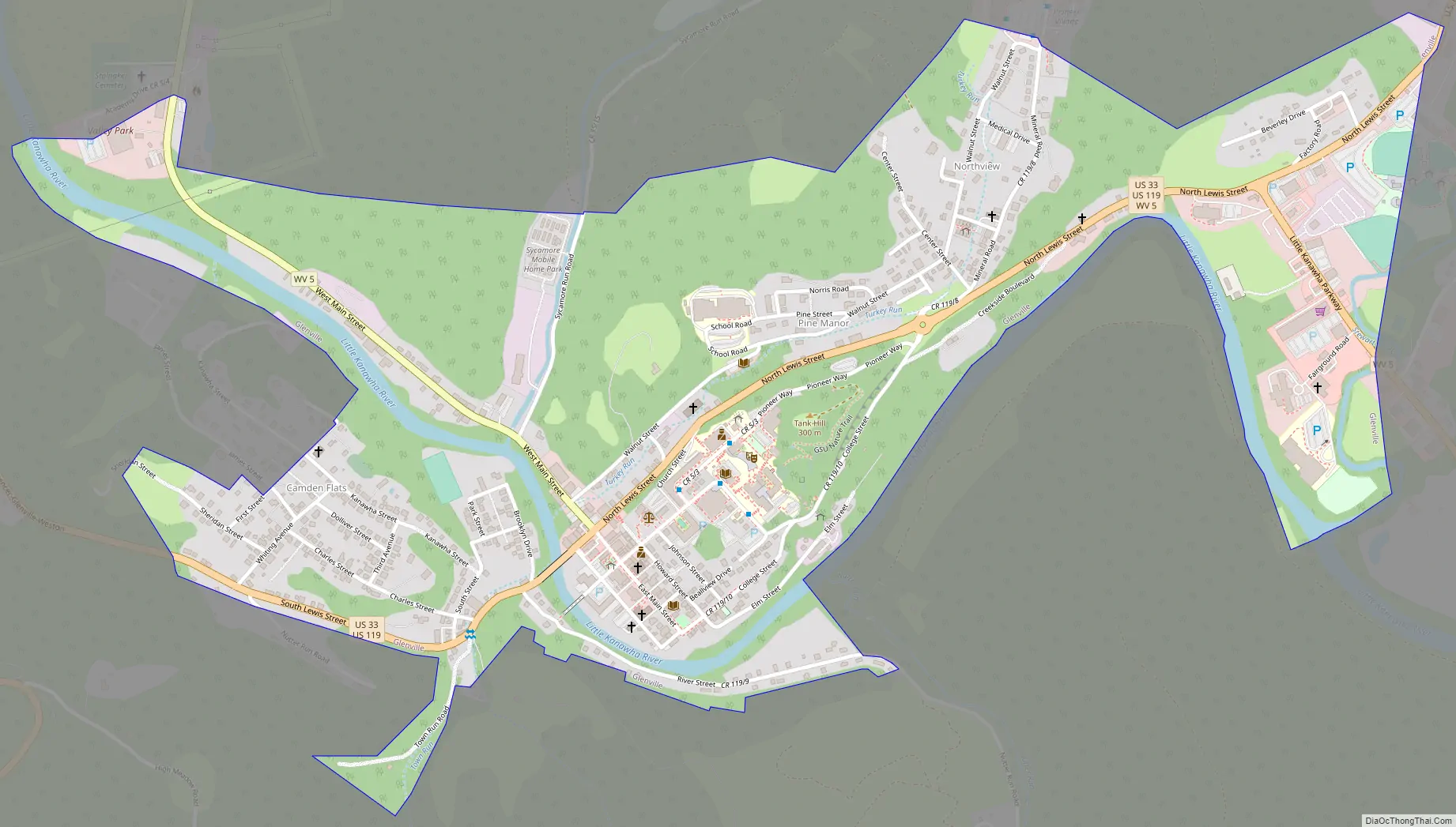
Glenville Road Map
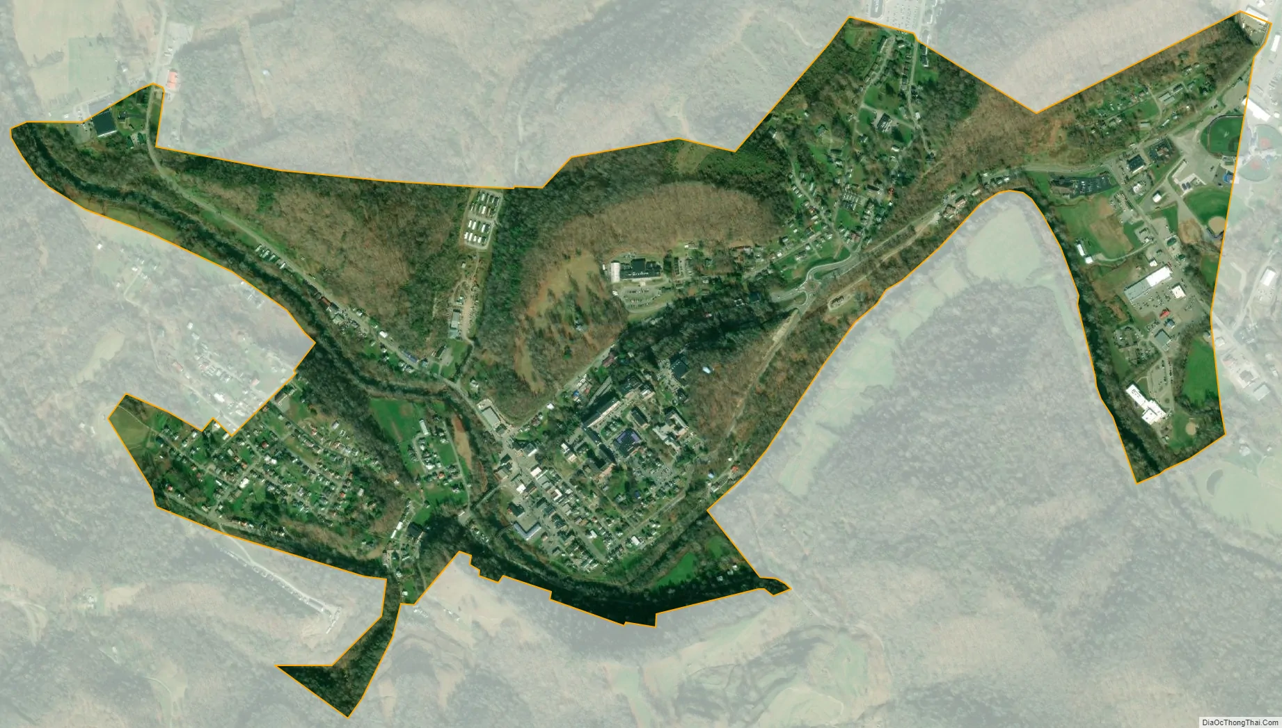
Glenville city Satellite Map
Geography
Glenville is located at 38°56′7″N 80°50′14″W / 38.93528°N 80.83722°W / 38.93528; -80.83722 (38.935405, -80.837114).
According to the United States Census Bureau, the town has a total area of 1.04 square miles (2.69 km), of which 1.00 square mile (2.59 km) is land and 0.04 square miles (0.10 km) is water.
Climate
See also
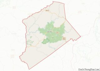
Map of West Virginia State and its subdivision:- Barbour
- Berkeley
- Boone
- Braxton
- Brooke
- Cabell
- Calhoun
- Clay
- Doddridge
- Fayette
- Gilmer
- Grant
- Greenbrier
- Hampshire
- Hancock
- Hardy
- Harrison
- Jackson
- Jefferson
- Kanawha
- Lewis
- Lincoln
- Logan
- Marion
- Marshall
- Mason
- McDowell
- Mercer
- Mineral
- Mingo
- Monongalia
- Monroe
- Morgan
- Nicholas
- Ohio
- Pendleton
- Pleasants
- Pocahontas
- Preston
- Putnam
- Raleigh
- Randolph
- Ritchie
- Roane
- Summers
- Taylor
- Tucker
- Tyler
- Upshur
- Wayne
- Webster
- Wetzel
- Wirt
- Wood
- Wyoming
- Alabama
- Alaska
- Arizona
- Arkansas
- California
- Colorado
- Connecticut
- Delaware
- District of Columbia
- Florida
- Georgia
- Hawaii
- Idaho
- Illinois
- Indiana
- Iowa
- Kansas
- Kentucky
- Louisiana
- Maine
- Maryland
- Massachusetts
- Michigan
- Minnesota
- Mississippi
- Missouri
- Montana
- Nebraska
- Nevada
- New Hampshire
- New Jersey
- New Mexico
- New York
- North Carolina
- North Dakota
- Ohio
- Oklahoma
- Oregon
- Pennsylvania
- Rhode Island
- South Carolina
- South Dakota
- Tennessee
- Texas
- Utah
- Vermont
- Virginia
- Washington
- West Virginia
- Wisconsin
- Wyoming