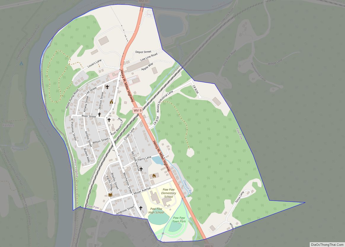
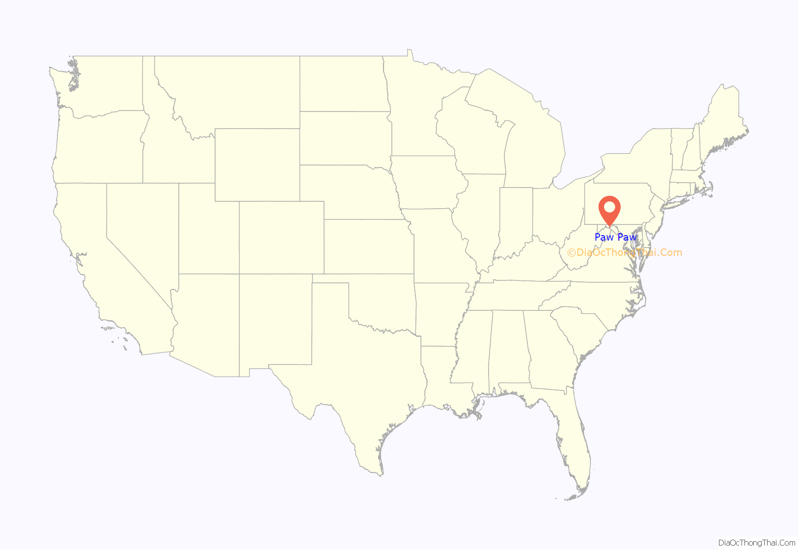
Paw Paw is a town in Morgan County, West Virginia, United States. The population was 410 at the 2020 census. The town is known for the nearby Paw Paw Tunnel. Paw Paw was incorporated by the Circuit Court of Morgan County on April 8, 1891, and named for the pawpaw, a wild fruit that grows in abundance throughout this region. Paw Paw is the westernmost incorporated community in Morgan County, and the Hagerstown-Martinsburg, MD-WV Metropolitan Statistical Area.
Paw Paw is located along the section of the Potomac River known as the Paw Paw Bends. The Paw Paw Valley is surrounded by the ridges of Sideling Hill, Green Ridge, Purslane Mountain and Town Hill.
The town is the namesake of the Paw Paw Tunnel which was part of the Chesapeake and Ohio Canal. Construction of the tunnel began in 1836 and was completed in 1850, 12 years behind schedule. Today, the tunnel and nearby canal are part of the Chesapeake and Ohio Canal National Historical Park.
| Name: | Paw Paw town |
|---|---|
| LSAD Code: | 43 |
| LSAD Description: | town (suffix) |
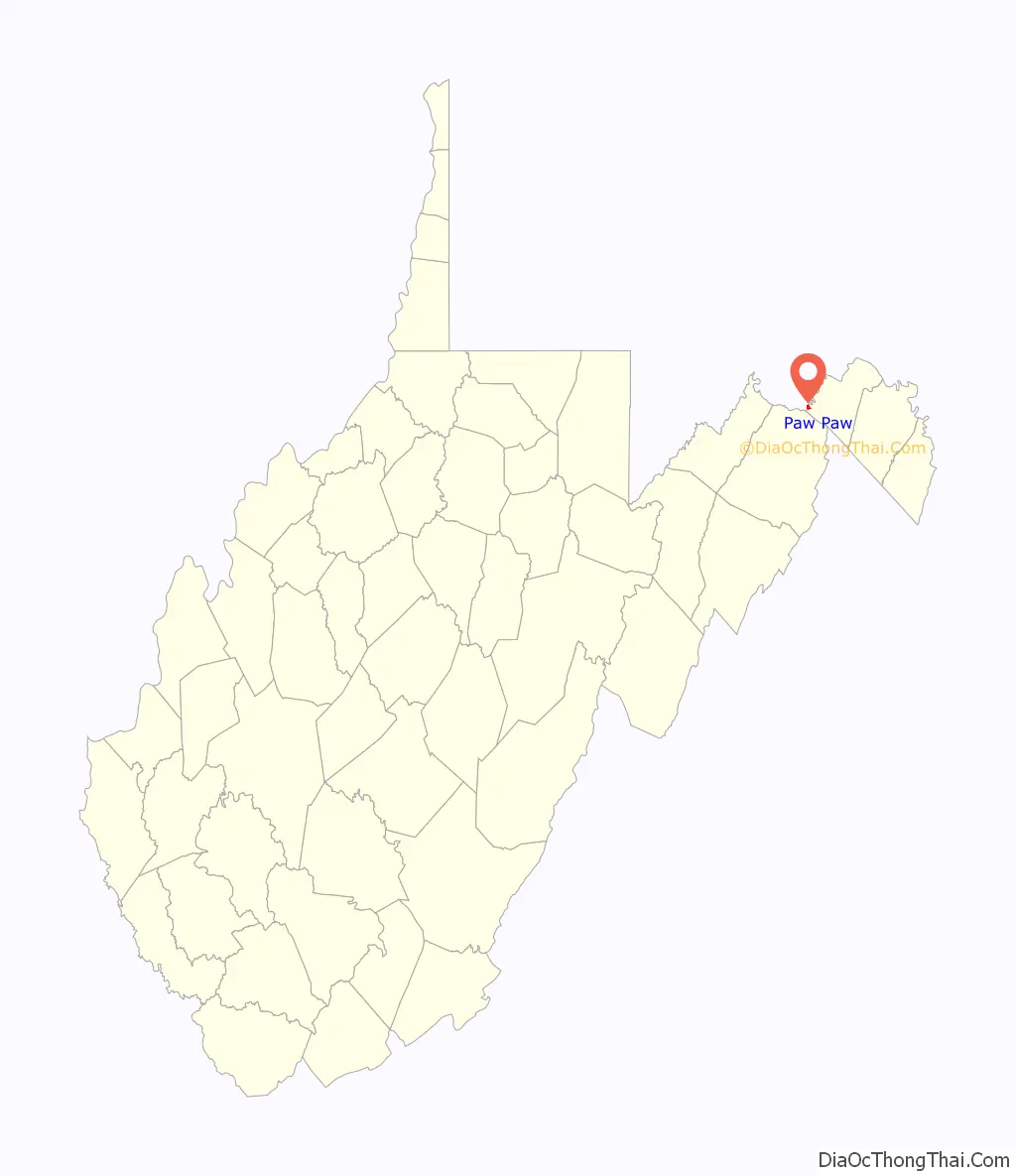
| State: | West Virginia |
| County: | Morgan County |
| Elevation: | 571 ft (174 m) |
| Total Area: | 0.53 sq mi (1.37 km²) |
| Land Area: | 0.53 sq mi (1.37 km²) |
| Water Area: | 0.00 sq mi (0.00 km²) |
| Total Population: | 410 |
| Population Density: | 928.30/sq mi (358.32/km²) |
| ZIP code: | 25434 |
| Area code: | 304 |
| FIPS code: | 5462332 |
| GNISfeature ID: | 1544641 |
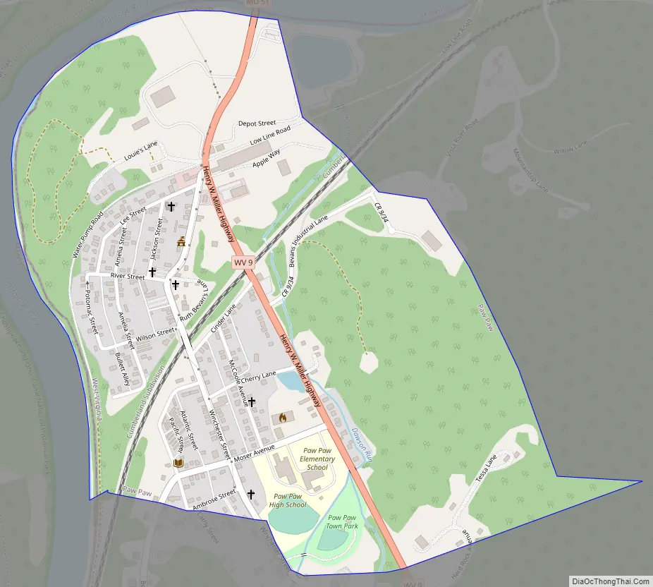
Online Interactive Map
Click on ![]() to view map in "full screen" mode.
to view map in "full screen" mode.
Paw Paw location map. Where is Paw Paw town?
History
The earliest human habitation in the upper Potomac River Valley probably dates from 10,000 BC when humans migrated across the Bering Straits into North America. In the 17th century, Europeans began arriving in increasing numbers. As European settlements gradually spread across western Virginia, the tribes were pushed from their villages and fields, which were then claimed and cultivated by the new settlers.
In 1681, England’s King Charles II made the first land grants in what is now the Eastern Panhandle of West Virginia. The territory, which includes Morgan County, was eventually inherited by Thomas, sixth Lord Fairfax and became known as the Fairfax Land Grant. In 1746, Thomas Jefferson’s father Peter was part of the survey party that reached the source of the Potomac River and set down the landmark known as the Fairfax Stone, now part of the Fairfax Stone Historical Monument State Park.
The following year, George Washington surveyed the region and later purchased land on the Paw Paw Bends, so named because of the way the Potomac River twists and turns for 31 miles between the towns of Paw Paw and Little Orleans. Washington described the land as being “In the shape of a horseshoe, the river running almost around it—two hundred acres of rich low grounds with a great abundance of walnut trees.”
By 1749, the Potomac River near present-day Paw Paw was being navigated by fur traders of the Ohio Company, while settlers were establishing farms on the surrounding land.
In 1836, the C&O Canal Company began work on a tunnel that was designed to eliminate seven miles of navigation on the river near Paw Paw. Two years later, construction of the Baltimore and Ohio Railroad began. Because of its proximity to both the railroad and the river, Paw Paw was considered a place of strategic importance during the American Civil War and was occupied by some 16,000 Union troops, most whom were quartered at Camp Chase (now Camp Hill), located east of Paw Paw, under the command of Brigadier General Frederick W. Lander.
In 1868, J.B. Hoyt and Company of New York established a leather factory in Paw Paw, which provided hundreds of jobs until its closure in 1951. Paw Paw also became well-known for its local orchards and fruit packing houses. The Morgan News reported in 1894 “Paw Paw at the present time is more beautiful than in any former time of her history. The streets are superb, plank pavements elegant and her street lights refulgent.” The streets were lit by oil lamps until 1926 when the Paw Paw Electric Company was awarded the franchise to bring electricity to the town. The first public school in Paw Paw started in the early 1870s in a building erected on the grounds of the tannery, but was washed away in the flood of 1877.
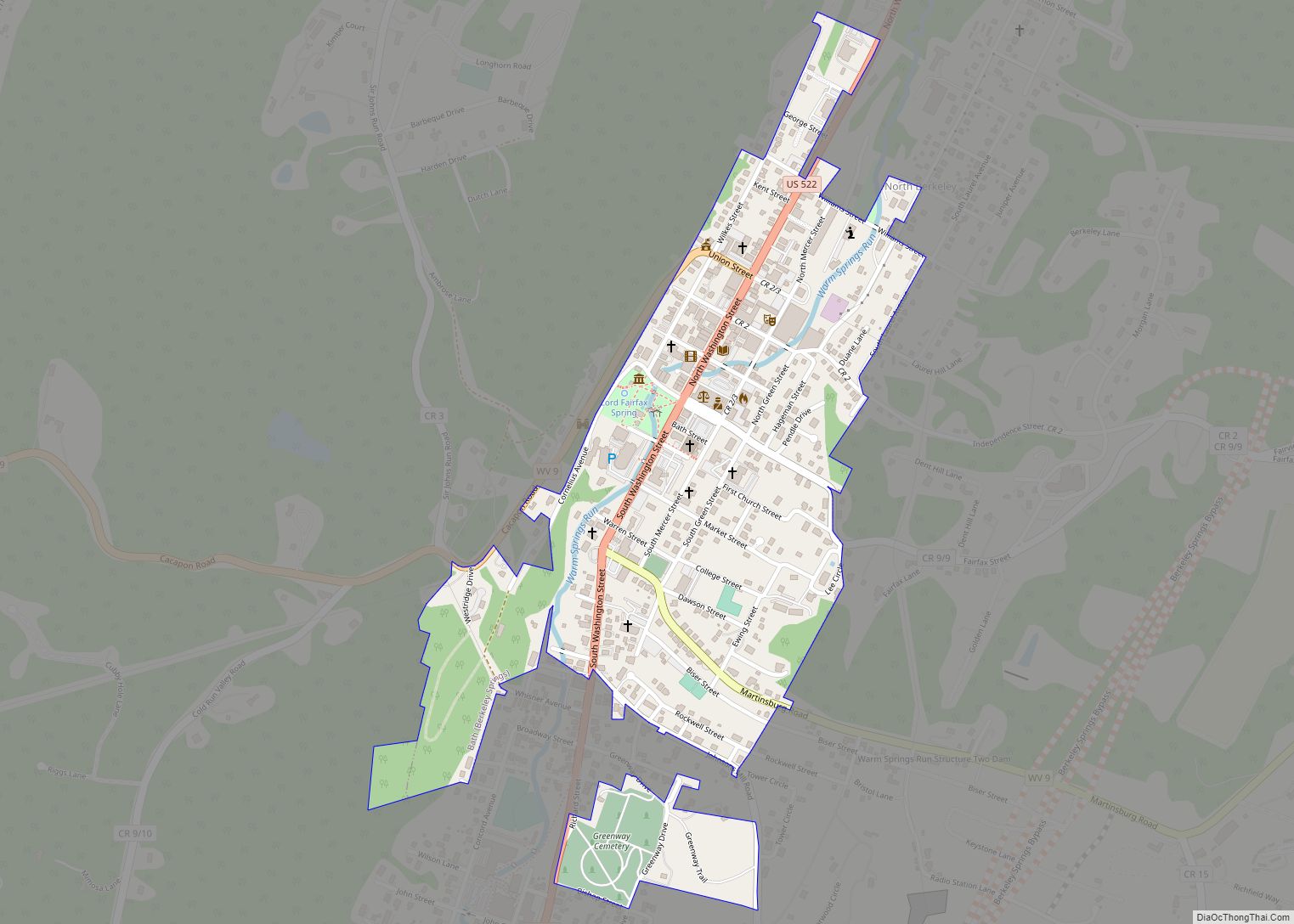
Paw Paw Road Map
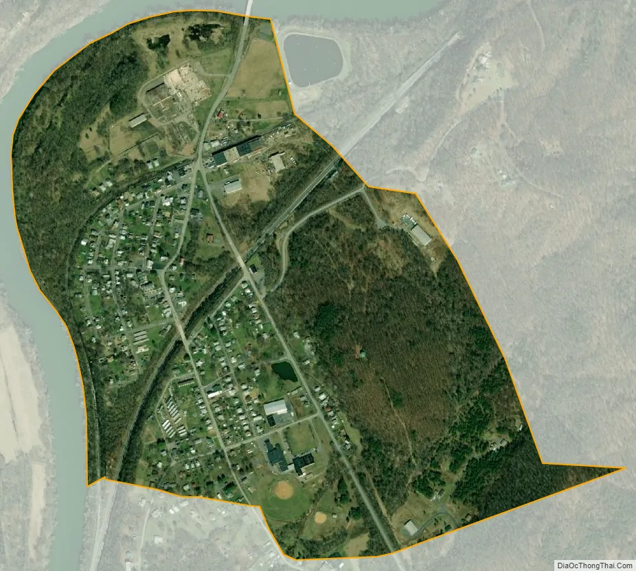
Paw Paw city Satellite Map
Geography
Paw Paw is located at 39°31′52″N 78°27′25″W / 39.53111°N 78.45694°W / 39.53111; -78.45694 (39.531140, -78.456920).
According to the United States Census Bureau, the town has a total area of 0.53 square miles (1.37 km), all of it land.
See also
Map of West Virginia State and its subdivision:- Barbour
- Berkeley
- Boone
- Braxton
- Brooke
- Cabell
- Calhoun
- Clay
- Doddridge
- Fayette
- Gilmer
- Grant
- Greenbrier
- Hampshire
- Hancock
- Hardy
- Harrison
- Jackson
- Jefferson
- Kanawha
- Lewis
- Lincoln
- Logan
- Marion
- Marshall
- Mason
- McDowell
- Mercer
- Mineral
- Mingo
- Monongalia
- Monroe
- Morgan
- Nicholas
- Ohio
- Pendleton
- Pleasants
- Pocahontas
- Preston
- Putnam
- Raleigh
- Randolph
- Ritchie
- Roane
- Summers
- Taylor
- Tucker
- Tyler
- Upshur
- Wayne
- Webster
- Wetzel
- Wirt
- Wood
- Wyoming
- Alabama
- Alaska
- Arizona
- Arkansas
- California
- Colorado
- Connecticut
- Delaware
- District of Columbia
- Florida
- Georgia
- Hawaii
- Idaho
- Illinois
- Indiana
- Iowa
- Kansas
- Kentucky
- Louisiana
- Maine
- Maryland
- Massachusetts
- Michigan
- Minnesota
- Mississippi
- Missouri
- Montana
- Nebraska
- Nevada
- New Hampshire
- New Jersey
- New Mexico
- New York
- North Carolina
- North Dakota
- Ohio
- Oklahoma
- Oregon
- Pennsylvania
- Rhode Island
- South Carolina
- South Dakota
- Tennessee
- Texas
- Utah
- Vermont
- Virginia
- Washington
- West Virginia
- Wisconsin
- Wyoming