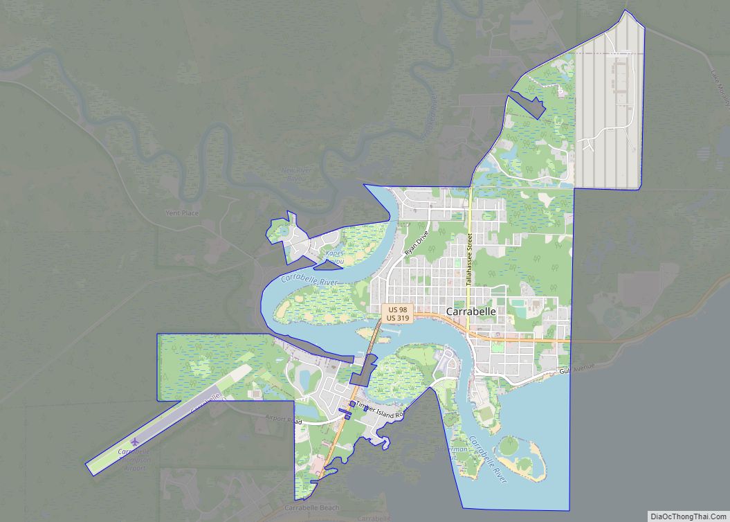
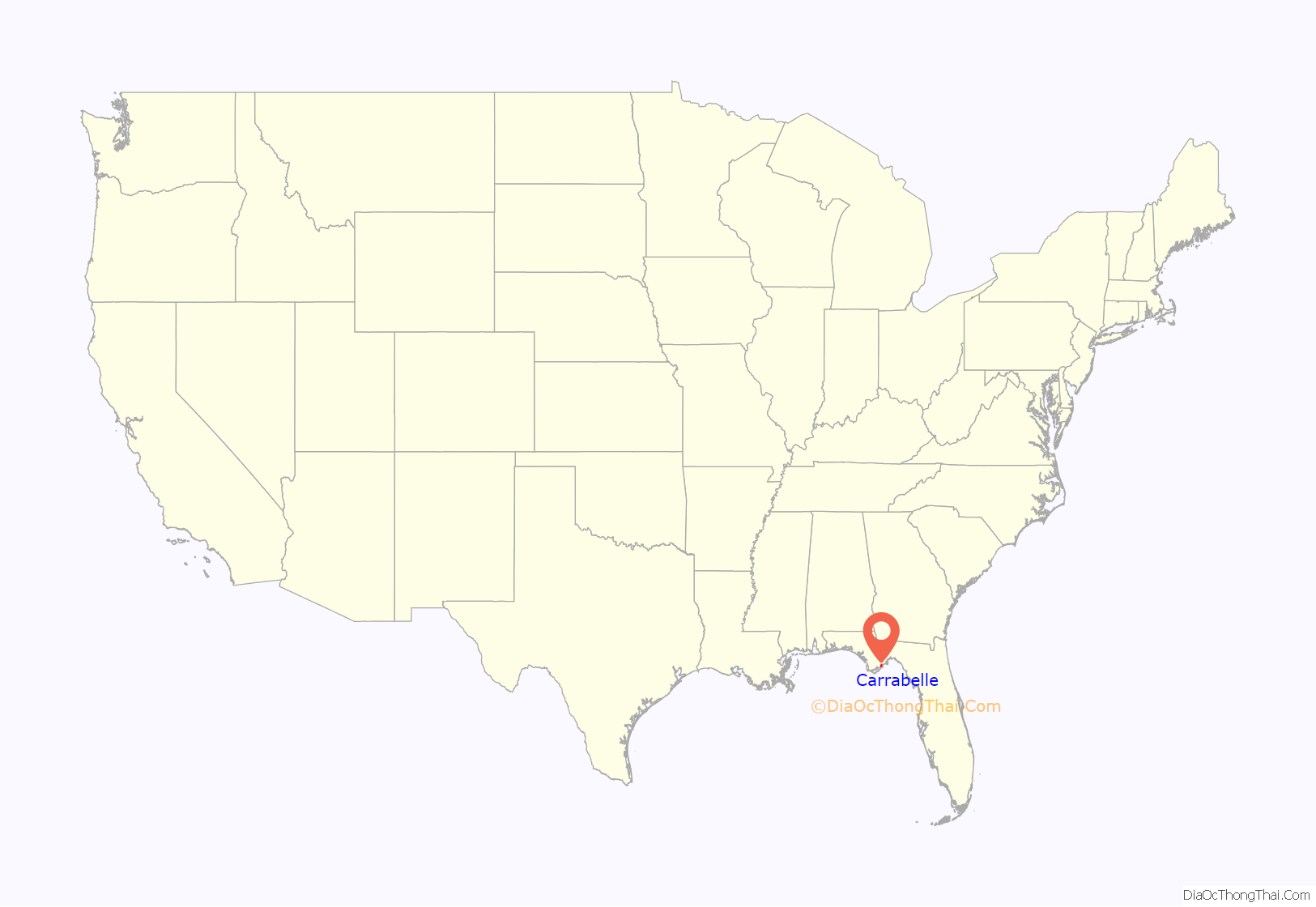
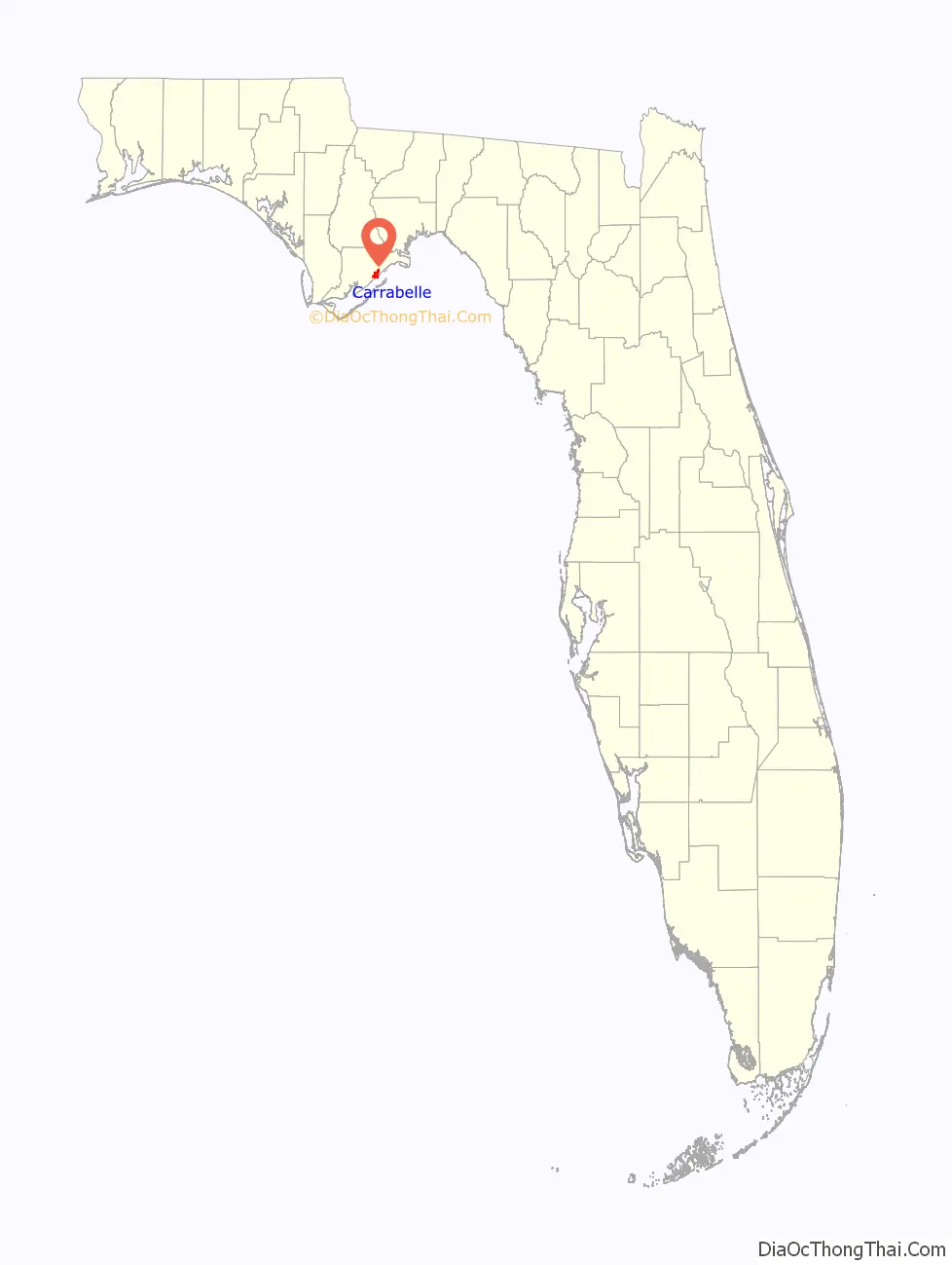
Carrabelle is a city in Franklin County along Florida‘s Panhandle, United States. The population was 2,778 as of the 2010 census. Carrabelle is located east of Apalachicola at the mouth of the Carrabelle River on the Gulf of Mexico.
| Name: | Carrabelle city |
|---|---|
| LSAD Code: | 25 |
| LSAD Description: | city (suffix) |
| State: | Florida |
| County: | Franklin County |
| Elevation: | 26 ft (8 m) |
| Total Area: | 5.93 sq mi (15.35 km²) |
| Land Area: | 4.79 sq mi (12.40 km²) |
| Water Area: | 1.14 sq mi (2.95 km²) |
| Total Population: | 2,606 |
| Population Density: | 544.39/sq mi (210.18/km²) |
| ZIP code: | 32322 |
| Area code: | 850 |
| FIPS code: | 1210725 |
| GNISfeature ID: | 0280069 |
| Website: | www.mycarrabelle.com |
Online Interactive Map
Click on ![]() to view map in "full screen" mode.
to view map in "full screen" mode.
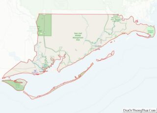
Carrabelle location map. Where is Carrabelle city?
History
In 1528, the first Spanish expedition of Pánfilo de Narváez passed through the area on its way from Tampa Bay to the Rio Grande. From the late 17th century through early 18th century, a few passages referring to the area are mentioned. Carrabelle, Dog Island, and St. George Island served as points to stage raids on local ports, as well as San Marcos de Apalache in 1677 and 1682.
In 1876, explorer Nathaniel Holmes Bishop of Medford, Massachusetts, navigated the Crooked River through the lowlands east to the Ochlockonee River. In 1877, Oliver Hudson Kelley from Massachusetts founded the town and named it “Rio Carrabella,” after his niece, Caroline Hall. The following year, the first U.S. post office was established with its address as Rio Carrabella. Hall served as the town’s first postmaster. The Town of Carrabelle was incorporated on December 24, 1881.
In 1891, the Carrabelle, Tallahassee and Georgia Railroad was established to connect Carrabelle northward through Tallahassee to the Florida-Georgia line, eventually terminating in Augusta, Georgia.
The city was chartered by the Florida Legislature in May 1893.
On August 1, 1899, the 2nd hurricane of the season struck the area, almost destroying the town and leaving just nine homes.
In 1942, Camp Gordon Johnston was opened for the purpose of training amphibious soldiers on nearby beaches. The camp trained a quarter of a million men and closed in 1946.
On August 23, 2008, Tropical Storm Fay made its record fourth landfall in the state of Florida at Carrabelle.
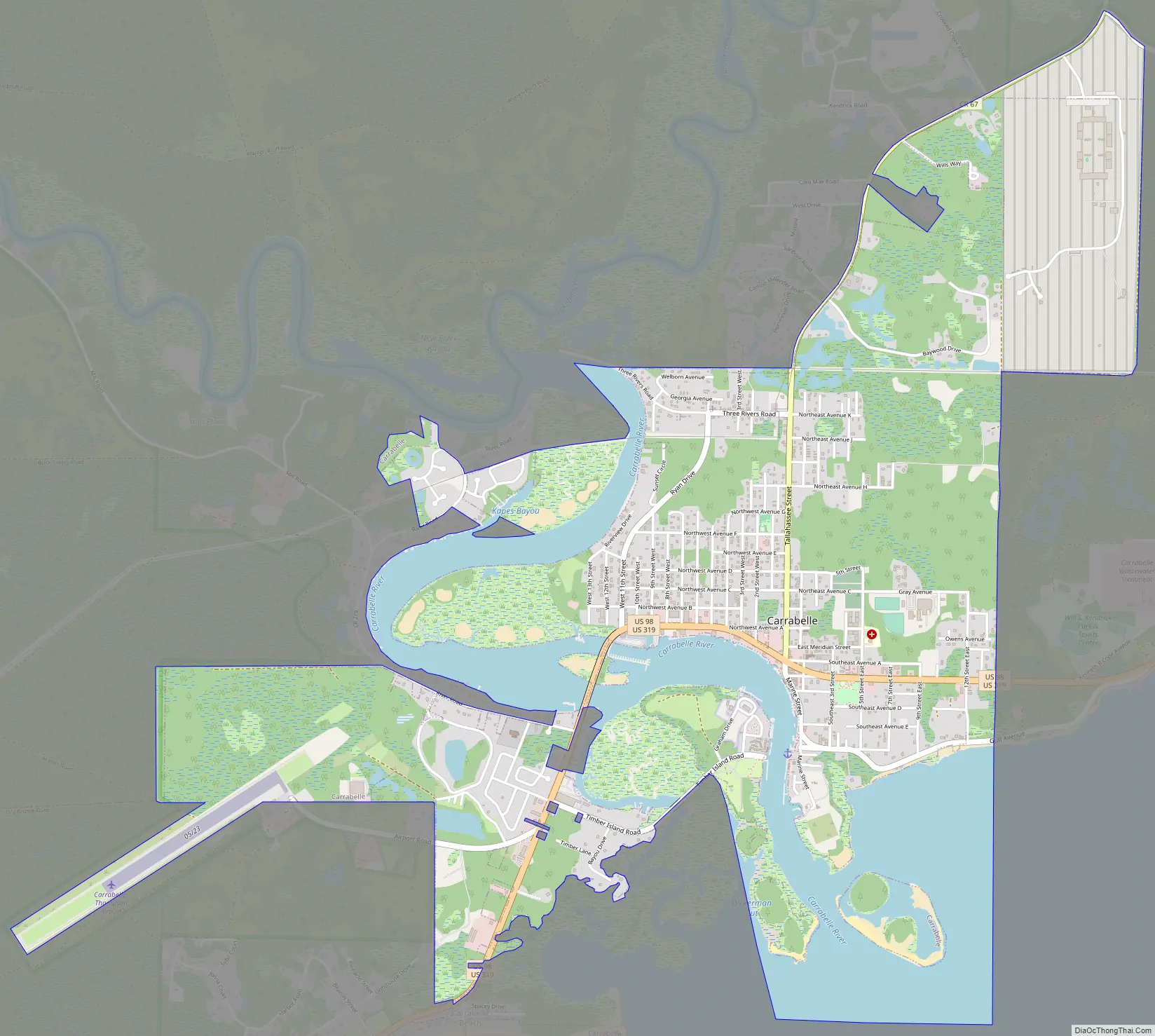
Carrabelle Road Map
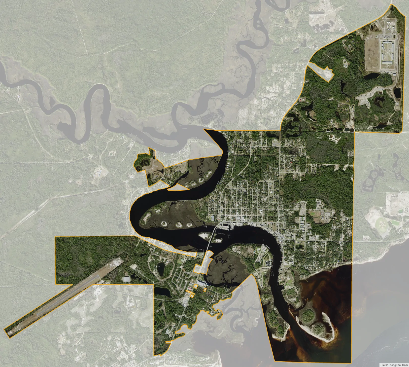
Carrabelle city Satellite Map
Geography
Carrabelle is located east of the center of Franklin County along the Carrabelle River and on St. James Island, between St. George Sound to the south and the Crooked and New rivers to the north. To the south is Dog Island, separating St. George Sound from the Gulf of Mexico.
U.S. Route 98 passes through Carrabelle, leading west 22 miles (35 km) to Apalachicola and northeast 30 miles (48 km) to Medart. Tallahassee, the state capital, is 54 miles (87 km) to the northeast.
According to the United States Census Bureau, Carrabelle has a total area of 5.6 square miles (14.6 km), of which 4.5 square miles (11.7 km) is land and 1.1 square miles (2.9 km), or 20.12%, is water.
Carrabelle is the eastern terminus of the Gulf Intracoastal Waterway.
See also
Map of Florida State and its subdivision:- Alachua
- Baker
- Bay
- Bradford
- Brevard
- Broward
- Calhoun
- Charlotte
- Citrus
- Clay
- Collier
- Columbia
- Desoto
- Dixie
- Duval
- Escambia
- Flagler
- Franklin
- Gadsden
- Gilchrist
- Glades
- Gulf
- Hamilton
- Hardee
- Hendry
- Hernando
- Highlands
- Hillsborough
- Holmes
- Indian River
- Jackson
- Jefferson
- Lafayette
- Lake
- Lee
- Leon
- Levy
- Liberty
- Madison
- Manatee
- Marion
- Martin
- Miami-Dade
- Monroe
- Nassau
- Okaloosa
- Okeechobee
- Orange
- Osceola
- Palm Beach
- Pasco
- Pinellas
- Polk
- Putnam
- Saint Johns
- Saint Lucie
- Santa Rosa
- Sarasota
- Seminole
- Sumter
- Suwannee
- Taylor
- Union
- Volusia
- Wakulla
- Walton
- Washington
- Alabama
- Alaska
- Arizona
- Arkansas
- California
- Colorado
- Connecticut
- Delaware
- District of Columbia
- Florida
- Georgia
- Hawaii
- Idaho
- Illinois
- Indiana
- Iowa
- Kansas
- Kentucky
- Louisiana
- Maine
- Maryland
- Massachusetts
- Michigan
- Minnesota
- Mississippi
- Missouri
- Montana
- Nebraska
- Nevada
- New Hampshire
- New Jersey
- New Mexico
- New York
- North Carolina
- North Dakota
- Ohio
- Oklahoma
- Oregon
- Pennsylvania
- Rhode Island
- South Carolina
- South Dakota
- Tennessee
- Texas
- Utah
- Vermont
- Virginia
- Washington
- West Virginia
- Wisconsin
- Wyoming