Indiantown is a village in Martin County, Florida, United States. The population was 6,560 at the 2020 census. It is a rural community in the interior of Florida’s Treasure Coast region, first established in the early 1900s, then incorporated on December 31, 2017. The village is governed by a mayor and council elected at-large, while day-to-day operations are directed by the village manager.
| Name: | Indiantown village |
|---|---|
| LSAD Code: | 47 |
| LSAD Description: | village (suffix) |
| State: | Florida |
| County: | Martin County |
| Elevation: | 33 ft (10 m) |
| Total Area: | 14.44 sq mi (37.40 km²) |
| Land Area: | 14.18 sq mi (36.73 km²) |
| Water Area: | 0.26 sq mi (0.67 km²) |
| Total Population: | 6,560 |
| Population Density: | 462.62/sq mi (178.62/km²) |
| ZIP code: | 34956 |
| Area code: | 772 |
| FIPS code: | 1233700 |
| GNISfeature ID: | 0294216 |
| Website: | www.indiantownfl.gov |
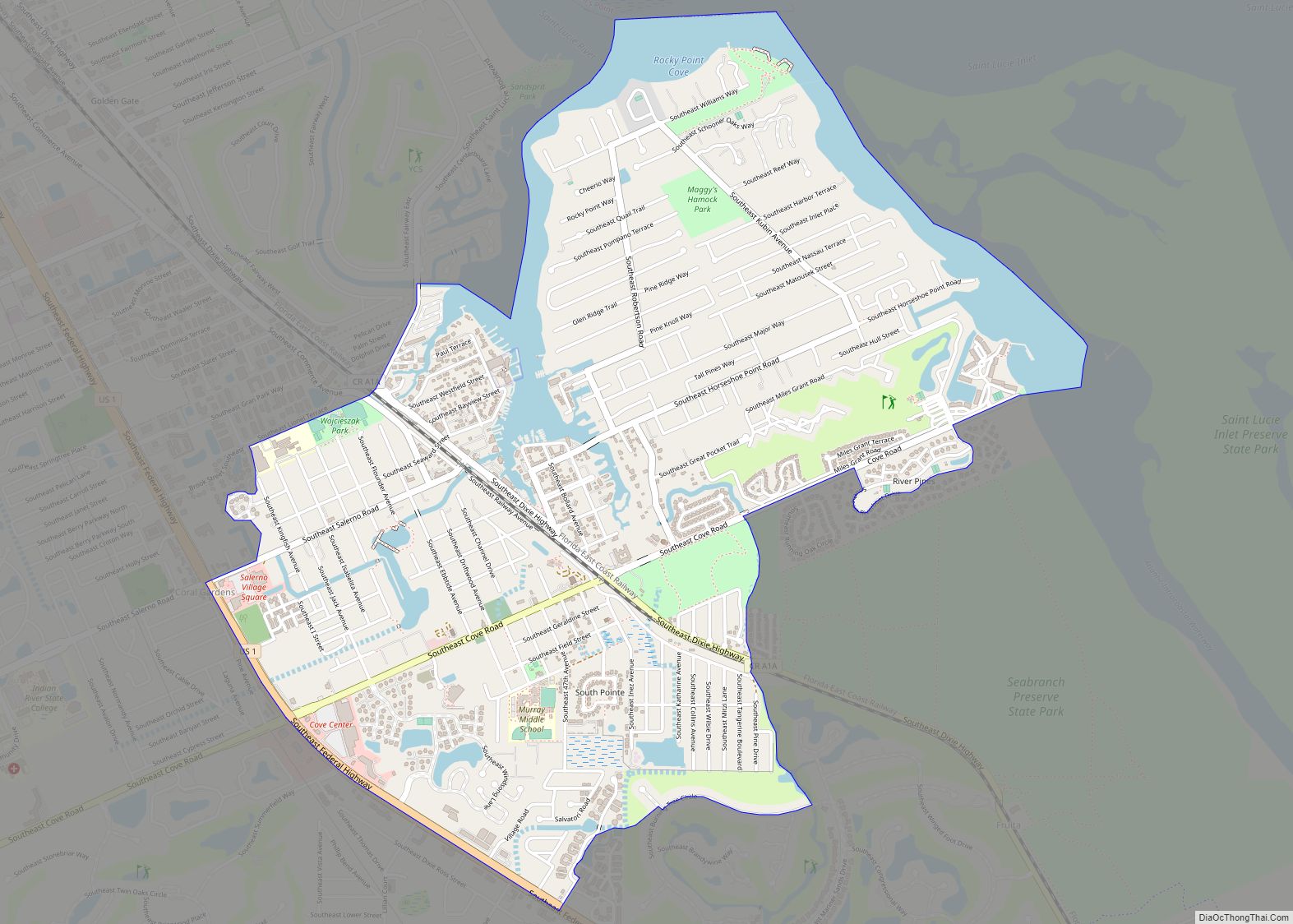
Online Interactive Map
Click on ![]() to view map in "full screen" mode.
to view map in "full screen" mode.
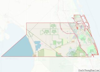
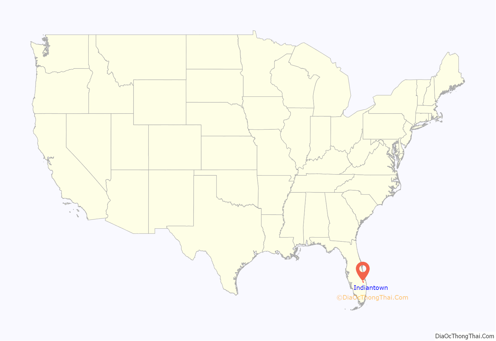
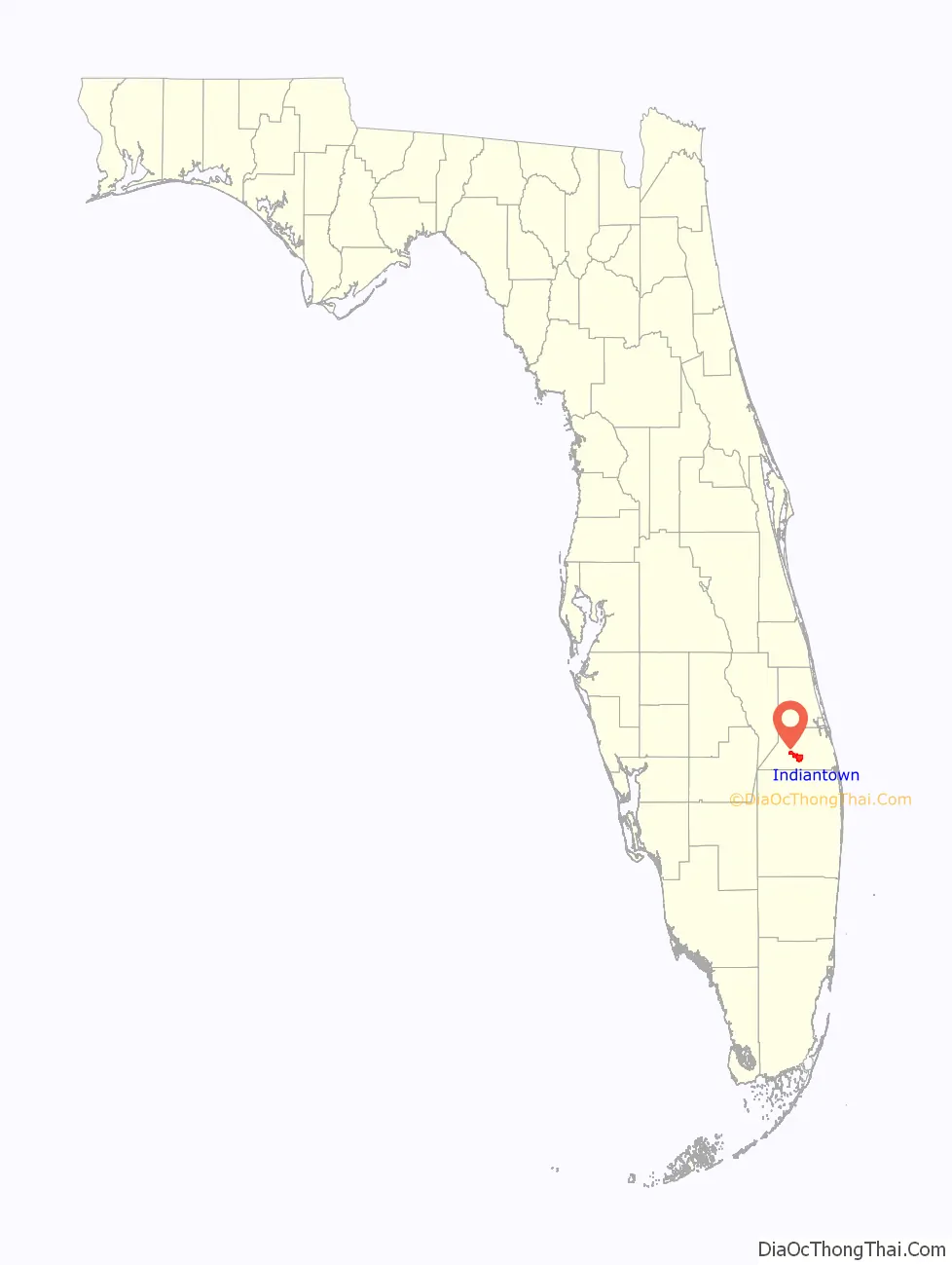
Indiantown location map. Where is Indiantown village?
History
Indiantown was originally established by the Seminole people as a trading post. Tribes fleeing southwards from the U.S. Army after the First Seminole War found the area an attractive place to settle due to a relatively higher elevation and ample hunting and fishing spots. It was then settled by white American migrants in the 1890s.
In 1924, Indiantown was transformed when S. Davies Warfield built an extension of the Seaboard Air Line Railroad from Coleman, Florida, to West Palm Beach, passing directly through—and stopping in—Indiantown.
Warfield planned to make Indiantown the southern hub of the Seaboard rail line. Toward that end, he planned a model city, laying out streets and building a school, housing, and a railroad station. Warfield also built the Seminole Inn, which is now on the National Register of Historic Places.
The Florida land boom of the 1920s fizzled out after 1926. Warfield died a year later, putting an end to plans to make Indiantown the Seaboard’s southern headquarters. The 1928 Okeechobee hurricane wreaked significant destruction and halted further development.
A serious effort to revitalize the local economy began in 1952 when the Indiantown Development Corporation was sold and restructured as the Indiantown Company. The company was involved in the construction of new water and sewage systems, housing developments, docks making use of the St. Lucie River, and a 6,000-foot (1,830 m) airstrip for bringing in small cargo and civilian air traffic.
In the 1950s and 1960s, Indiantown was home to the Circle T Ranch and its Circle T Rodeo Bowl. The 1963 rodeo event drew approximately 15,000 visitors, making it the largest tourist attraction in Florida at the time. The ranch was later bought out and turned into a filming studio.
Seaboard trains continued to stop at the Indiantown depot through the 1960s, but passenger service to the station was eliminated when Amtrak took over in 1971. The depot was demolished several years later. The Seminole Inn is virtually all that remains of the 1920s boom.
Warfield’s contributions to Indiantown are memorialized in, among others, Warfield Boulevard (the main route through Indiantown) and Warfield Elementary School.
Currently, the economy of Indiantown relies heavily on seasonal agriculture. The town also continues to make use of its position near the intersections of many major roads to act as a transportation and infrastructure hub. There are also attempts to take advantage of nearby natural wetlands and to revitalize the rodeo in order to draw in tourists.
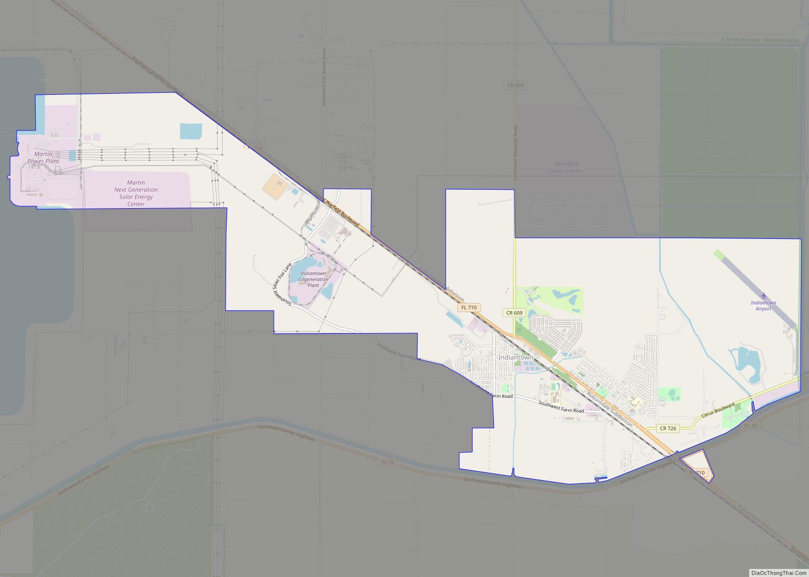
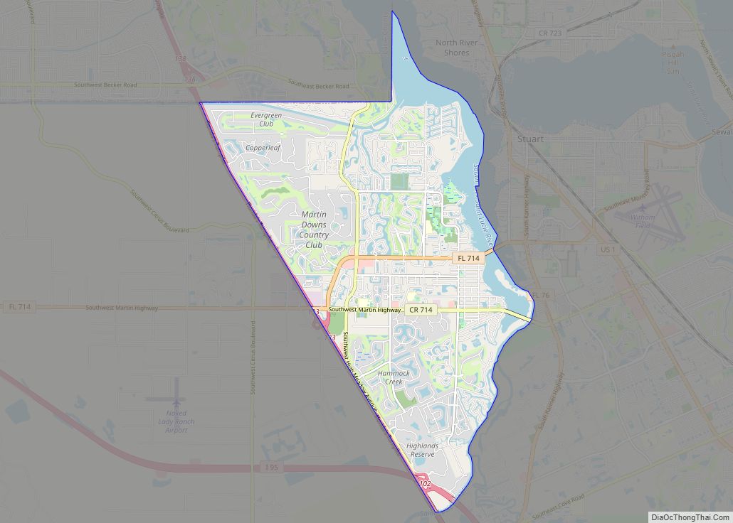
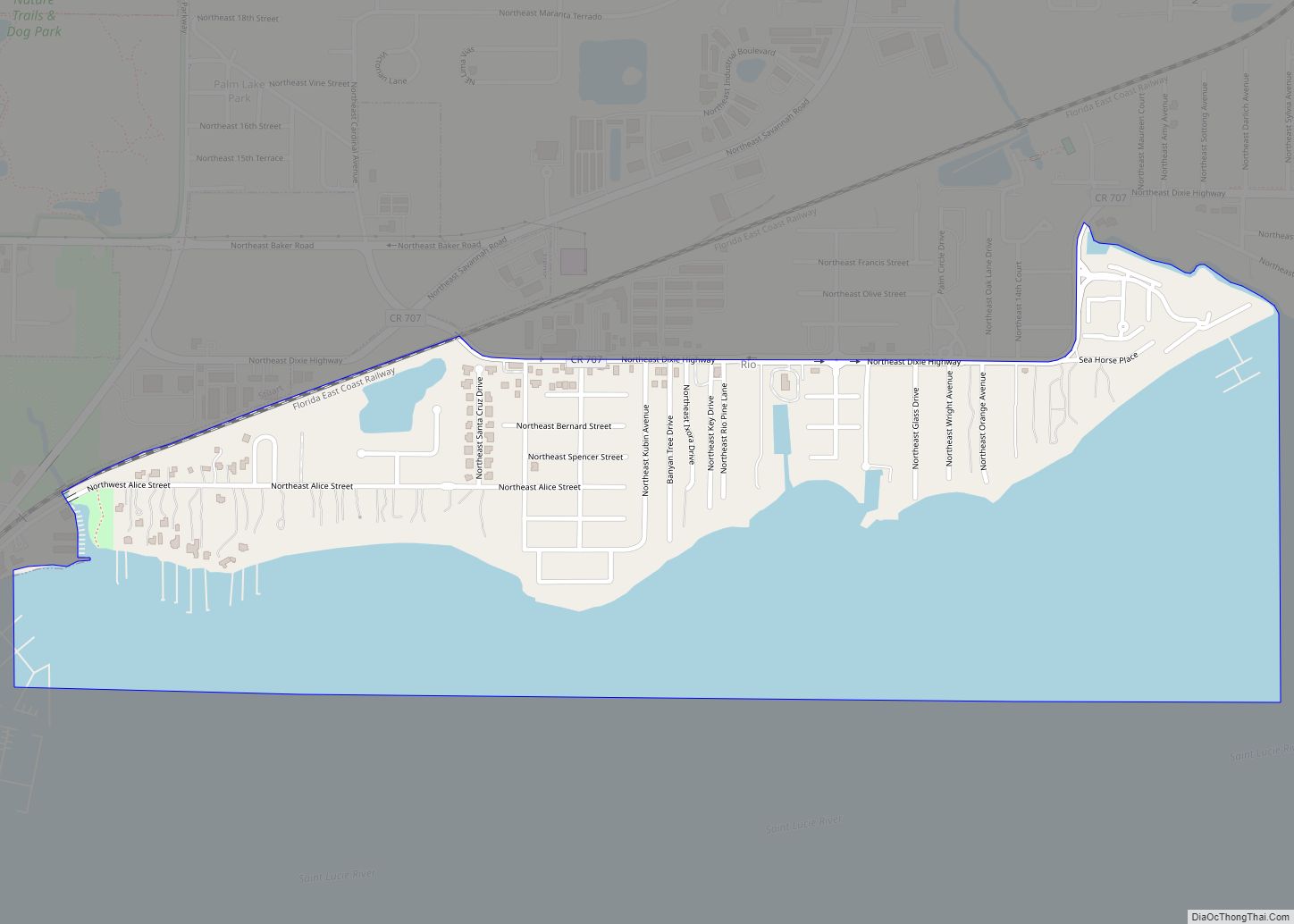
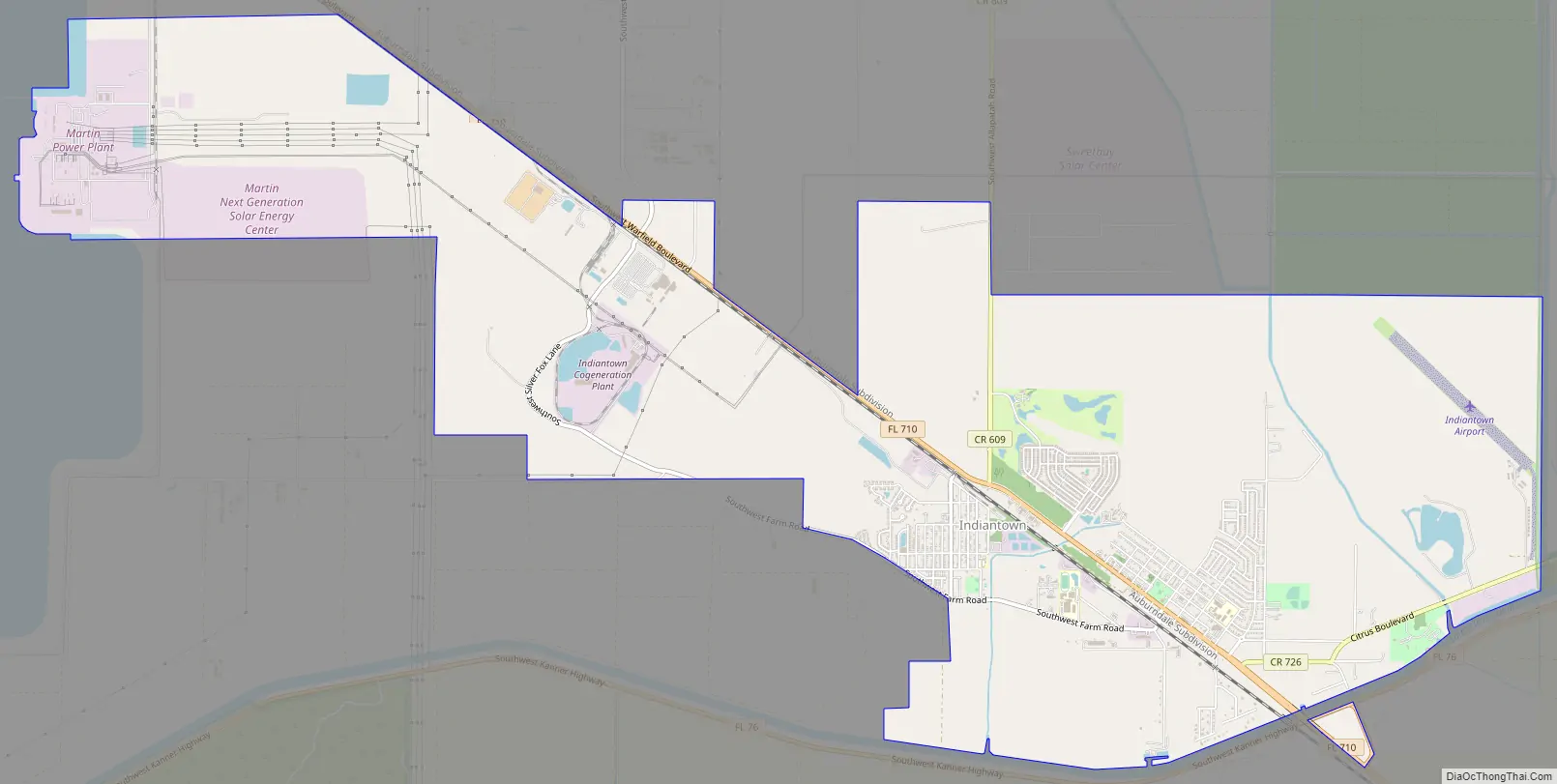
Indiantown Road Map
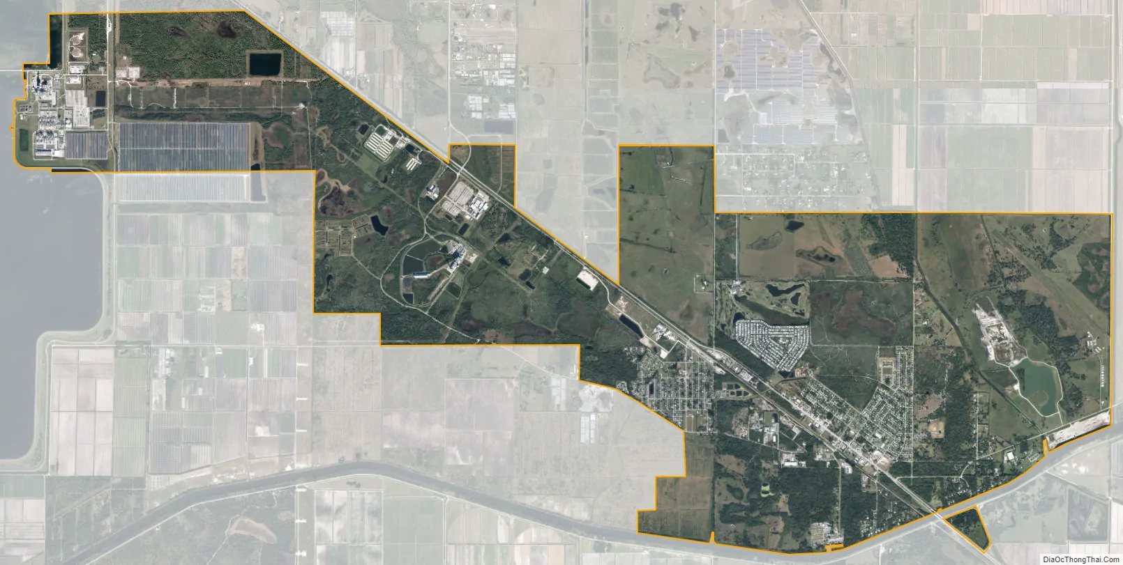
Indiantown city Satellite Map
Geography
Indiantown is located in western Martin County at 27°2′N 80°28′W / 27.033°N 80.467°W / 27.033; -80.467 (27.0263, –80.4728). It is 12 miles (19 km) east of Port Mayaca on Lake Okeechobee, 22 miles (35 km) southwest of Stuart, the Martin county seat, and 36 miles (58 km) northwest of West Palm Beach.
According to the United States Census Bureau, Indiantown has a total area of 14.4 square miles (37 km), of which 0.3 square miles (0.8 km), or 1.80%, are water. The town’s southern border is the St. Lucie Canal, connecting Lake Okeechobee with the St. Lucie River near Stuart.
See also
Map of Florida State and its subdivision:- Alachua
- Baker
- Bay
- Bradford
- Brevard
- Broward
- Calhoun
- Charlotte
- Citrus
- Clay
- Collier
- Columbia
- Desoto
- Dixie
- Duval
- Escambia
- Flagler
- Franklin
- Gadsden
- Gilchrist
- Glades
- Gulf
- Hamilton
- Hardee
- Hendry
- Hernando
- Highlands
- Hillsborough
- Holmes
- Indian River
- Jackson
- Jefferson
- Lafayette
- Lake
- Lee
- Leon
- Levy
- Liberty
- Madison
- Manatee
- Marion
- Martin
- Miami-Dade
- Monroe
- Nassau
- Okaloosa
- Okeechobee
- Orange
- Osceola
- Palm Beach
- Pasco
- Pinellas
- Polk
- Putnam
- Saint Johns
- Saint Lucie
- Santa Rosa
- Sarasota
- Seminole
- Sumter
- Suwannee
- Taylor
- Union
- Volusia
- Wakulla
- Walton
- Washington
- Alabama
- Alaska
- Arizona
- Arkansas
- California
- Colorado
- Connecticut
- Delaware
- District of Columbia
- Florida
- Georgia
- Hawaii
- Idaho
- Illinois
- Indiana
- Iowa
- Kansas
- Kentucky
- Louisiana
- Maine
- Maryland
- Massachusetts
- Michigan
- Minnesota
- Mississippi
- Missouri
- Montana
- Nebraska
- Nevada
- New Hampshire
- New Jersey
- New Mexico
- New York
- North Carolina
- North Dakota
- Ohio
- Oklahoma
- Oregon
- Pennsylvania
- Rhode Island
- South Carolina
- South Dakota
- Tennessee
- Texas
- Utah
- Vermont
- Virginia
- Washington
- West Virginia
- Wisconsin
- Wyoming