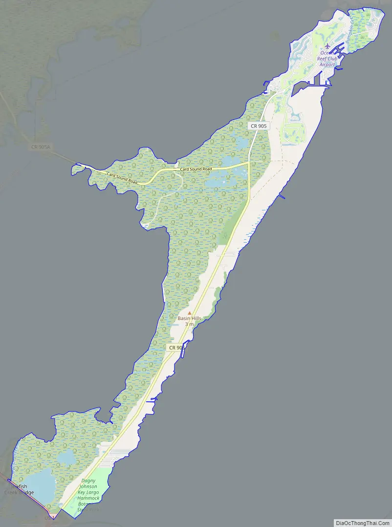
North Key Largo is an unincorporated area and census-designated place (CDP) in Monroe County, Florida, United States. The population was 1,431 at the 2020 census, up from 1,244 in 2010. It includes two private clubs, the Ocean Reef Club and the Key Largo Anglers Club, and is reached from the mainland via the Card Sound Bridge.
| Name: | North Key Largo CDP |
|---|---|
| LSAD Code: | 57 |
| LSAD Description: | CDP (suffix) |
| State: | Florida |
| County: | Monroe County |
| Elevation: | 8 ft (2 m) |
| Total Area: | 19.58 sq mi (50.71 km²) |
| Land Area: | 18.59 sq mi (48.14 km²) |
| Water Area: | 0.99 sq mi (2.57 km²) |
| Total Population: | 1,431 |
| Population Density: | 76.99/sq mi (29.73/km²) |
| ZIP code: | 33037 (Key Largo) |
| FIPS code: | 1249406 |
| GNISfeature ID: | 1867181 |
Online Interactive Map
Click on ![]() to view map in "full screen" mode.
to view map in "full screen" mode.
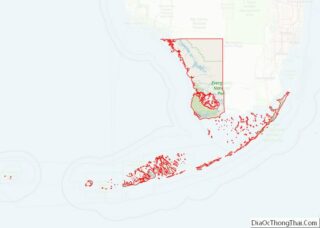
North Key Largo location map. Where is North Key Largo CDP?
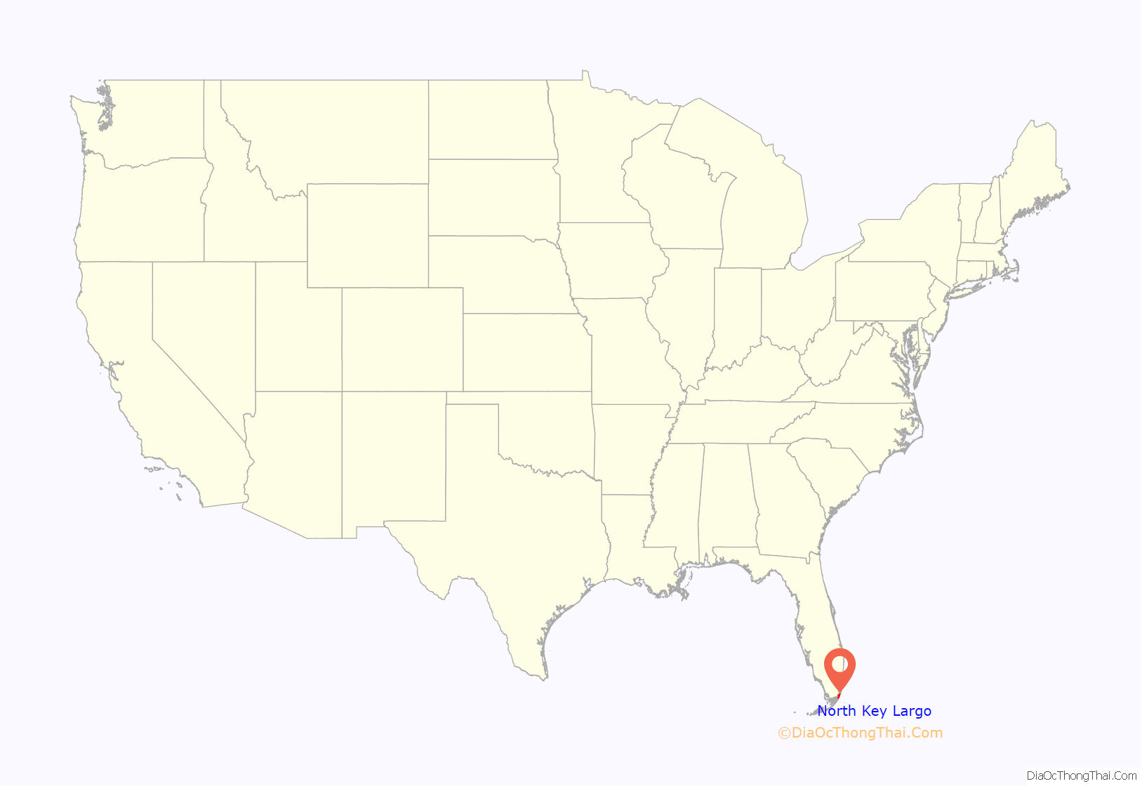
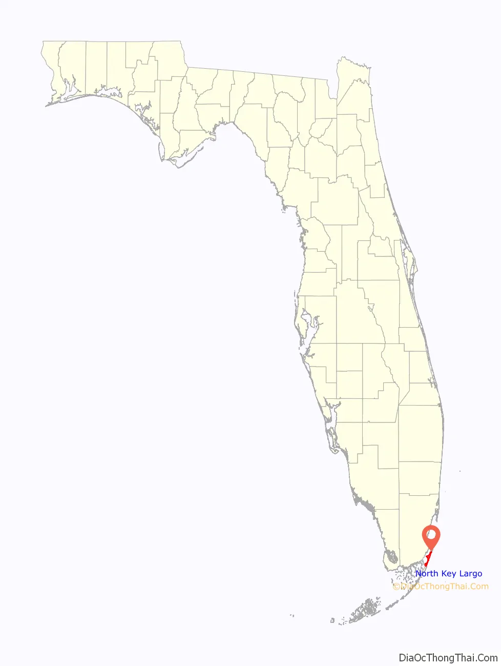
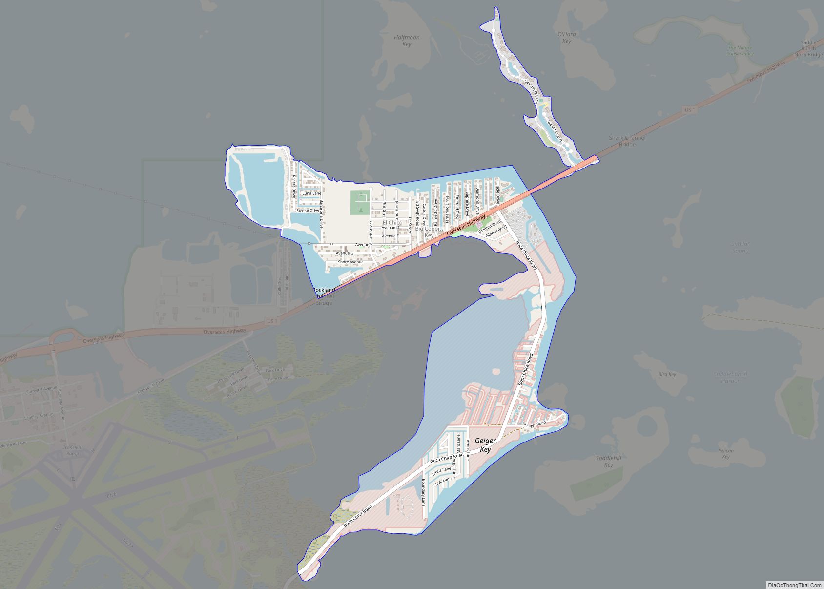
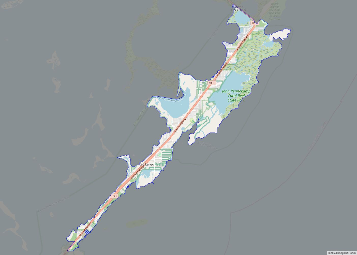
North Key Largo Road Map
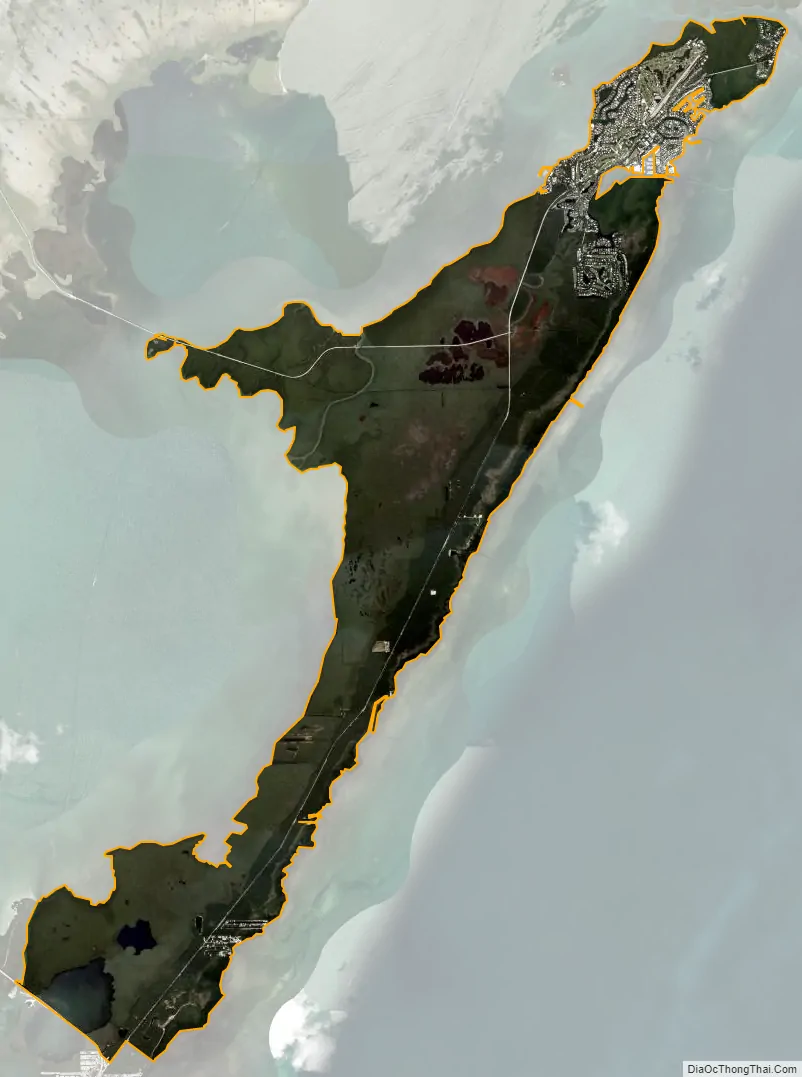
North Key Largo city Satellite Map
Geography
North Key Largo is located in the northern part of the Florida Keys at 25°17′23″N 80°18′25″W / 25.28972°N 80.30694°W / 25.28972; -80.30694 (25.289586, -80.306813). It occupies the northern 13 miles (21 km) of the island of Key Largo and is bordered to the south by the community of Key Largo. To the west, separating the island from the mainland, are Barnes Sound and Card Sound. Palo Alto Key is to the north, and the Atlantic Ocean is to the east.
According to the United States Census Bureau, the North Key Largo CDP has a total area of 19.6 square miles (51 km), of which 18.6 square miles (48 km) are land and 1.0 square mile (2.6 km), or 5.07%, is water.
See also
Map of Florida State and its subdivision:- Alachua
- Baker
- Bay
- Bradford
- Brevard
- Broward
- Calhoun
- Charlotte
- Citrus
- Clay
- Collier
- Columbia
- Desoto
- Dixie
- Duval
- Escambia
- Flagler
- Franklin
- Gadsden
- Gilchrist
- Glades
- Gulf
- Hamilton
- Hardee
- Hendry
- Hernando
- Highlands
- Hillsborough
- Holmes
- Indian River
- Jackson
- Jefferson
- Lafayette
- Lake
- Lee
- Leon
- Levy
- Liberty
- Madison
- Manatee
- Marion
- Martin
- Miami-Dade
- Monroe
- Nassau
- Okaloosa
- Okeechobee
- Orange
- Osceola
- Palm Beach
- Pasco
- Pinellas
- Polk
- Putnam
- Saint Johns
- Saint Lucie
- Santa Rosa
- Sarasota
- Seminole
- Sumter
- Suwannee
- Taylor
- Union
- Volusia
- Wakulla
- Walton
- Washington
- Alabama
- Alaska
- Arizona
- Arkansas
- California
- Colorado
- Connecticut
- Delaware
- District of Columbia
- Florida
- Georgia
- Hawaii
- Idaho
- Illinois
- Indiana
- Iowa
- Kansas
- Kentucky
- Louisiana
- Maine
- Maryland
- Massachusetts
- Michigan
- Minnesota
- Mississippi
- Missouri
- Montana
- Nebraska
- Nevada
- New Hampshire
- New Jersey
- New Mexico
- New York
- North Carolina
- North Dakota
- Ohio
- Oklahoma
- Oregon
- Pennsylvania
- Rhode Island
- South Carolina
- South Dakota
- Tennessee
- Texas
- Utah
- Vermont
- Virginia
- Washington
- West Virginia
- Wisconsin
- Wyoming