Palm River-Clair Mel is a census-designated place (CDP) in Hillsborough County, Florida, United States. The population was 21,024 at the 2010 census, up from 17,589 at the 2000 census. The census area includes the unincorporated communities of Clair-Mel City and Palm River. The ZIP code for Palm River-Clair Mel is 33619.
| Name: | Palm River-Clair Mel CDP |
|---|---|
| LSAD Code: | 57 |
| LSAD Description: | CDP (suffix) |
| State: | Florida |
| County: | Hillsborough County |
| Elevation: | 18 ft (5 m) |
| Total Area: | 11.69 sq mi (30.27 km²) |
| Land Area: | 11.43 sq mi (29.61 km²) |
| Water Area: | 0.25 sq mi (0.65 km²) |
| Total Population: | 26,142 |
| Population Density: | 2,286.34/sq mi (882.75/km²) |
| FIPS code: | 1254387 |
| GNISfeature ID: | 2403391 |
Online Interactive Map
Click on ![]() to view map in "full screen" mode.
to view map in "full screen" mode.
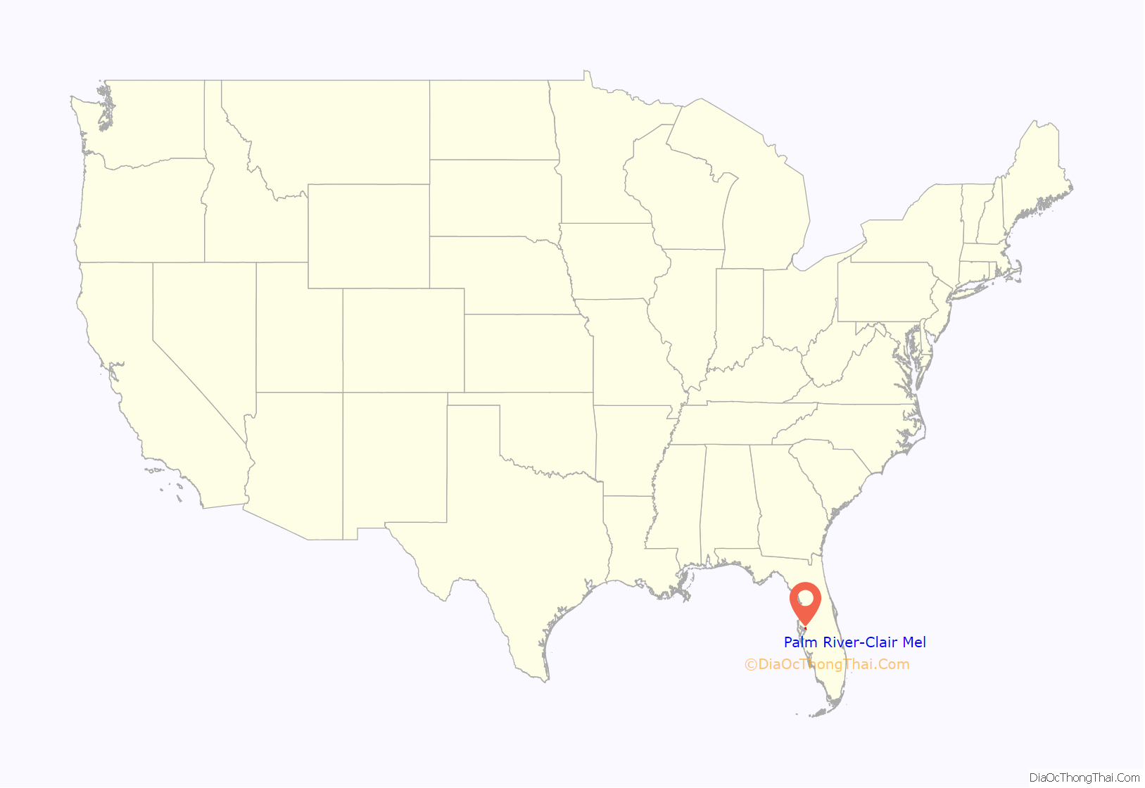
Palm River-Clair Mel location map. Where is Palm River-Clair Mel CDP?
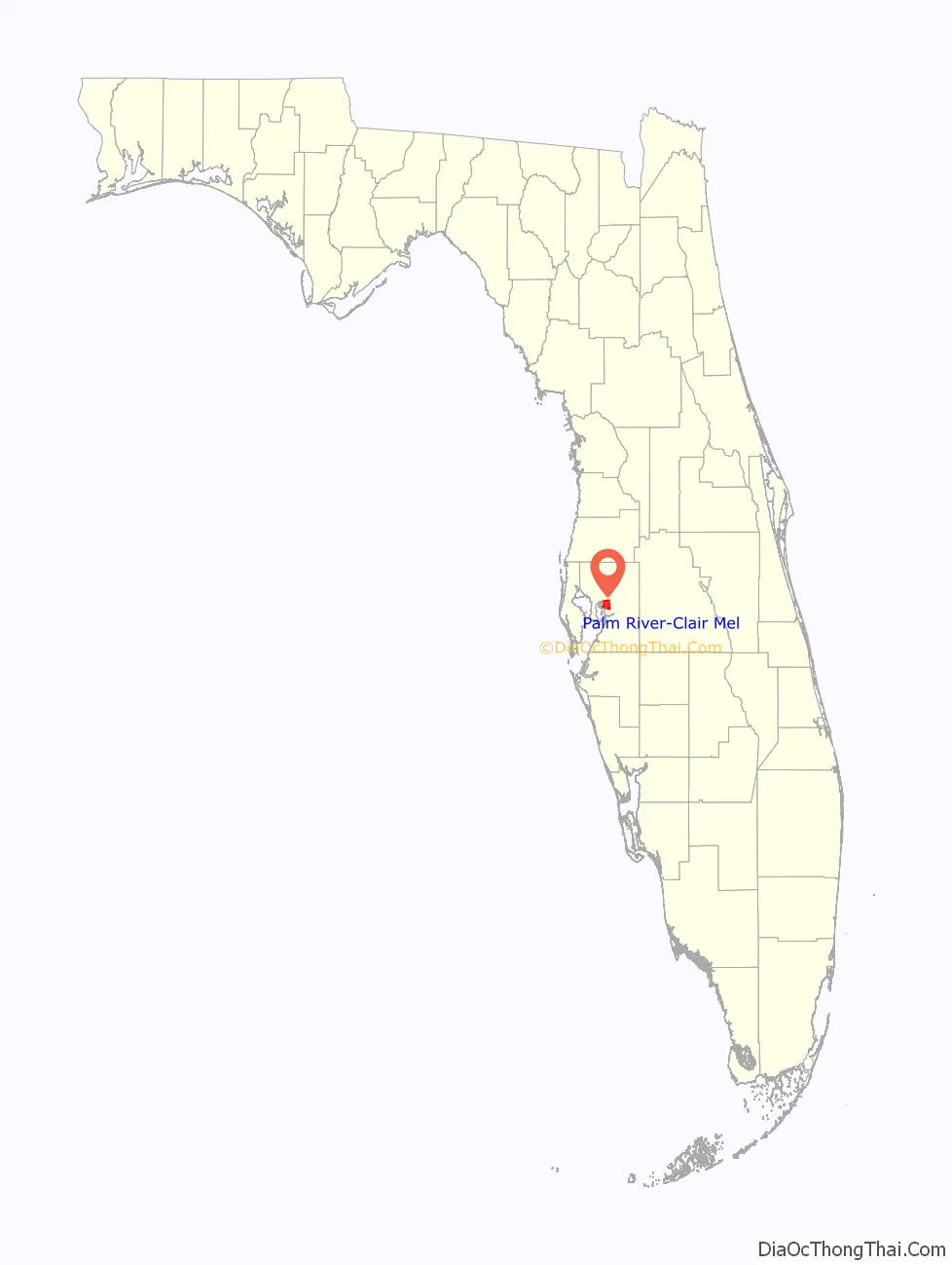
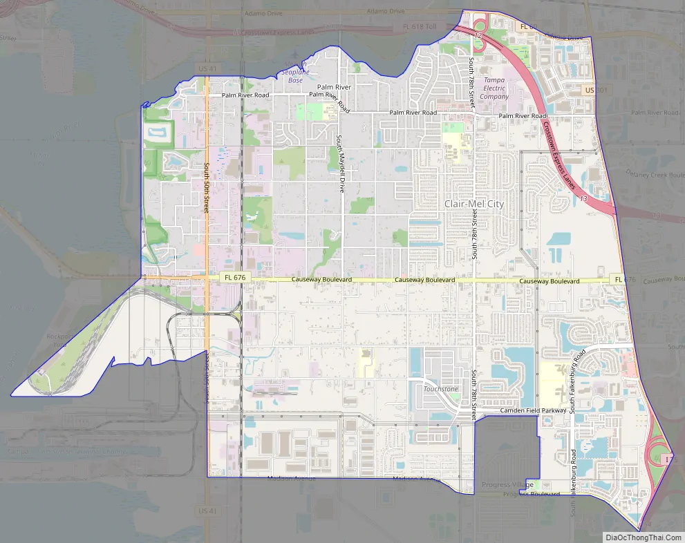
Palm River-Clair Mel Road Map
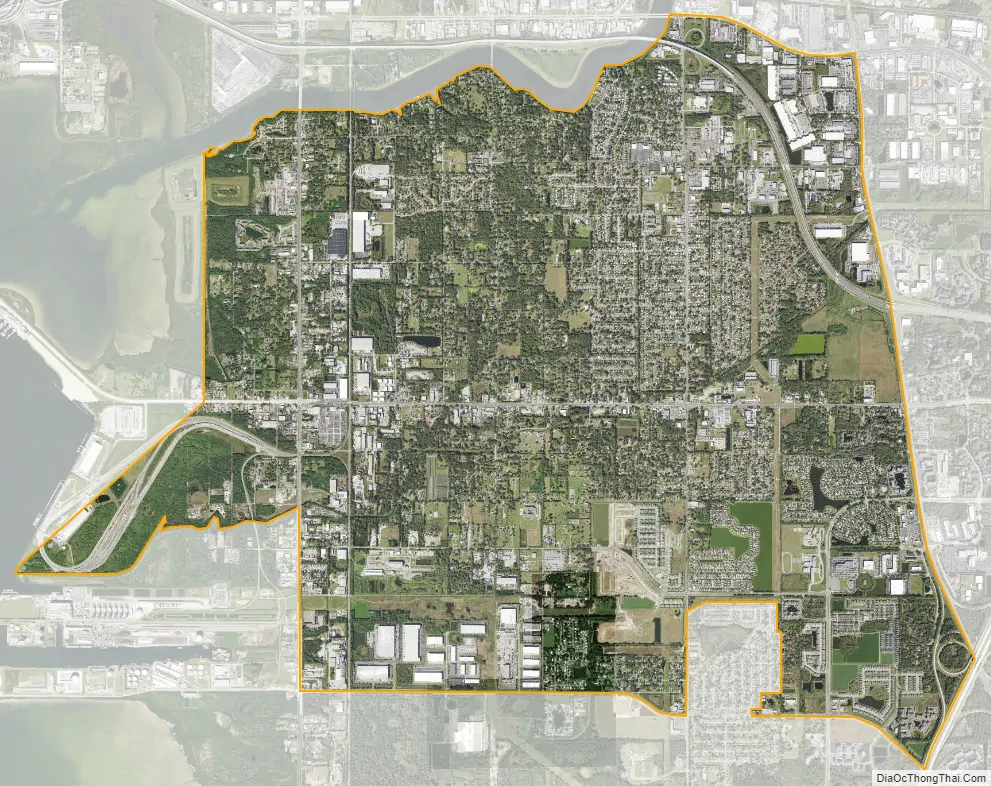
Palm River-Clair Mel city Satellite Map
Geography
Palm River-Clair Mel is located just west of the geographic center of Hillsborough County at 27°55′41″N 82°22′44″W / 27.92806°N 82.37889°W / 27.92806; -82.37889 (27.928150, -82.378900), or approximately 6 miles (10 km) southeast of downtown Tampa. The CDP is bordered to the north and west by the city of Tampa, to the east by Brandon, to the southeast by Riverview, and to the south by Progress Village. The Palm River forms the northern boundary of the CDP.
U.S. Route 41 runs through the western part of the CDP, leading north into the eastern part of Tampa and south to Gibsonton. U.S. Route 41 Business runs west from US 41 and crosses East Bay/McKay Bay for a more direct route to downtown Tampa. U.S. Route 301 forms the eastern edge of the CDP, running north to East Lake-Orient Park and south to Riverview.
According to the United States Census Bureau, the Palm River-Clair Mel CDP has a total area of 11.7 square miles (30.4 km), of which 11.5 square miles (29.9 km) are land and 0.2 square miles (0.5 km), or 1.77%, are water.
See also
Map of Florida State and its subdivision:- Alachua
- Baker
- Bay
- Bradford
- Brevard
- Broward
- Calhoun
- Charlotte
- Citrus
- Clay
- Collier
- Columbia
- Desoto
- Dixie
- Duval
- Escambia
- Flagler
- Franklin
- Gadsden
- Gilchrist
- Glades
- Gulf
- Hamilton
- Hardee
- Hendry
- Hernando
- Highlands
- Hillsborough
- Holmes
- Indian River
- Jackson
- Jefferson
- Lafayette
- Lake
- Lee
- Leon
- Levy
- Liberty
- Madison
- Manatee
- Marion
- Martin
- Miami-Dade
- Monroe
- Nassau
- Okaloosa
- Okeechobee
- Orange
- Osceola
- Palm Beach
- Pasco
- Pinellas
- Polk
- Putnam
- Saint Johns
- Saint Lucie
- Santa Rosa
- Sarasota
- Seminole
- Sumter
- Suwannee
- Taylor
- Union
- Volusia
- Wakulla
- Walton
- Washington
- Alabama
- Alaska
- Arizona
- Arkansas
- California
- Colorado
- Connecticut
- Delaware
- District of Columbia
- Florida
- Georgia
- Hawaii
- Idaho
- Illinois
- Indiana
- Iowa
- Kansas
- Kentucky
- Louisiana
- Maine
- Maryland
- Massachusetts
- Michigan
- Minnesota
- Mississippi
- Missouri
- Montana
- Nebraska
- Nevada
- New Hampshire
- New Jersey
- New Mexico
- New York
- North Carolina
- North Dakota
- Ohio
- Oklahoma
- Oregon
- Pennsylvania
- Rhode Island
- South Carolina
- South Dakota
- Tennessee
- Texas
- Utah
- Vermont
- Virginia
- Washington
- West Virginia
- Wisconsin
- Wyoming


