Perry is a city and the county seat of Taylor County, Florida, United States. As of 2010, the population recorded by the U.S. Census Bureau is 7,017. The city was named for Madison Perry, fourth Governor of the State of Florida and a Confederate colonel during the American Civil War.
| Name: | Perry city |
|---|---|
| LSAD Code: | 25 |
| LSAD Description: | city (suffix) |
| State: | Florida |
| County: | Taylor County |
| Elevation: | 46 ft (14 m) |
| Total Area: | 9.43 sq mi (24.43 km²) |
| Land Area: | 9.43 sq mi (24.43 km²) |
| Water Area: | 0.00 sq mi (0.00 km²) |
| Total Population: | 6,898 |
| Population Density: | 731.34/sq mi (282.37/km²) |
| ZIP code: | 32347-32348 |
| Area code: | 850 |
| FIPS code: | 1256150 |
| GNISfeature ID: | 0288724 |
| Website: | cityofperry.net |
Online Interactive Map
Click on ![]() to view map in "full screen" mode.
to view map in "full screen" mode.
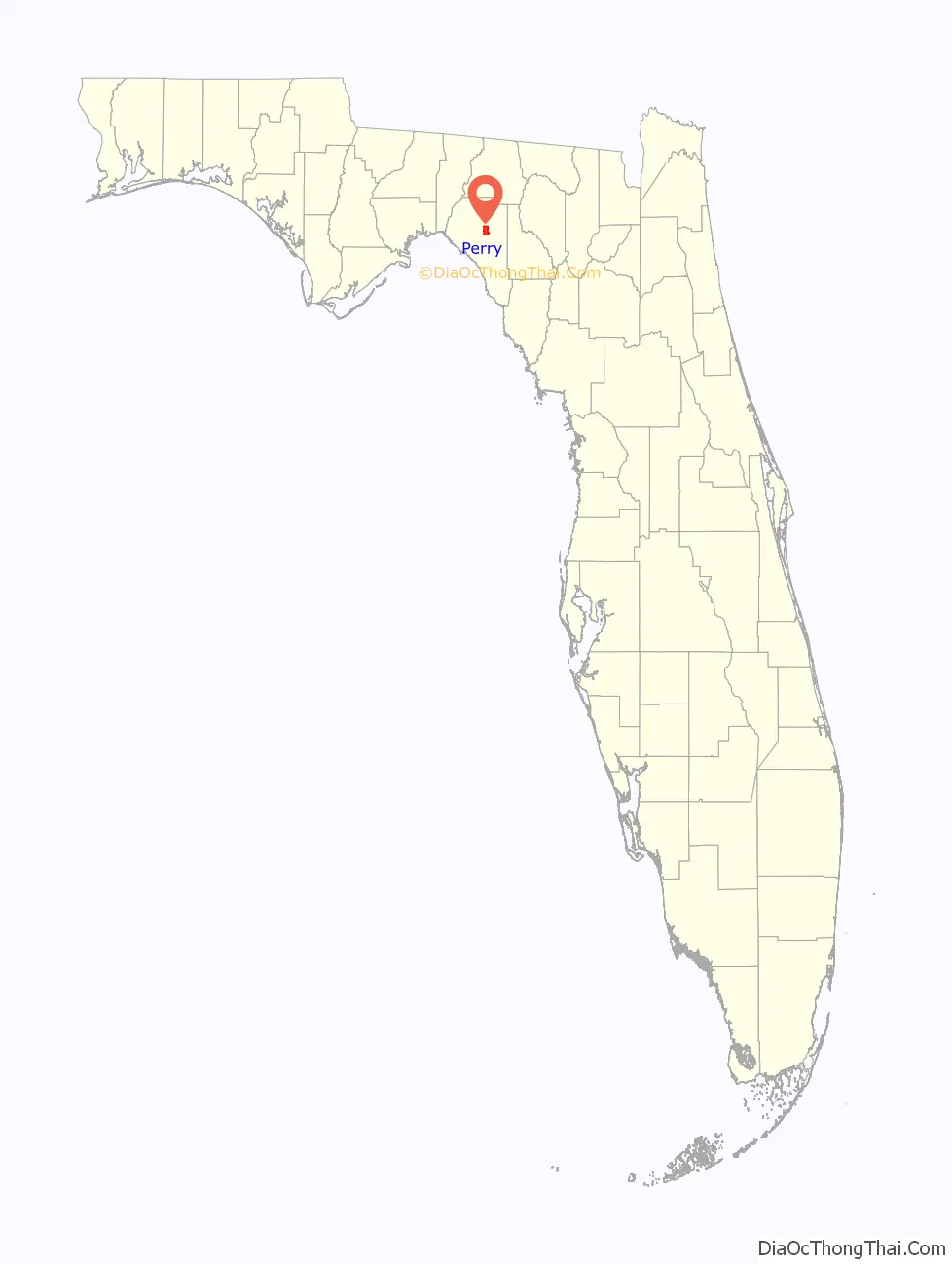
Perry location map. Where is Perry city?

History
In 1922, Perry was a very small town of less than 2,000 people. During this time, a murder happened and three people were hanged for the crimes. Private retribution against the suspected families and those that gave them support ensued. The Perry Massacre occurred in Perry on 14 and 15 December 1922, during which whites hung Charles Wright and attacked the black community of Perry after the murder of a white schoolteacher. On the day following Wright’s lynching two more black men were shot and hanged; whites then burned the town’s black school, Masonic lodge, church, amusement hall, and several families’ homes.
Firefighters battling a blaze at a natural gas plant in August 1998 were injured when an explosion ripped through the area, sending a mammoth fireball into the sky. The flames destroyed at least six houses and several vehicles and forced the evacuation of 100 homes within two miles of the plant. Four firefighters were hospitalized with non-life-threatening injuries.
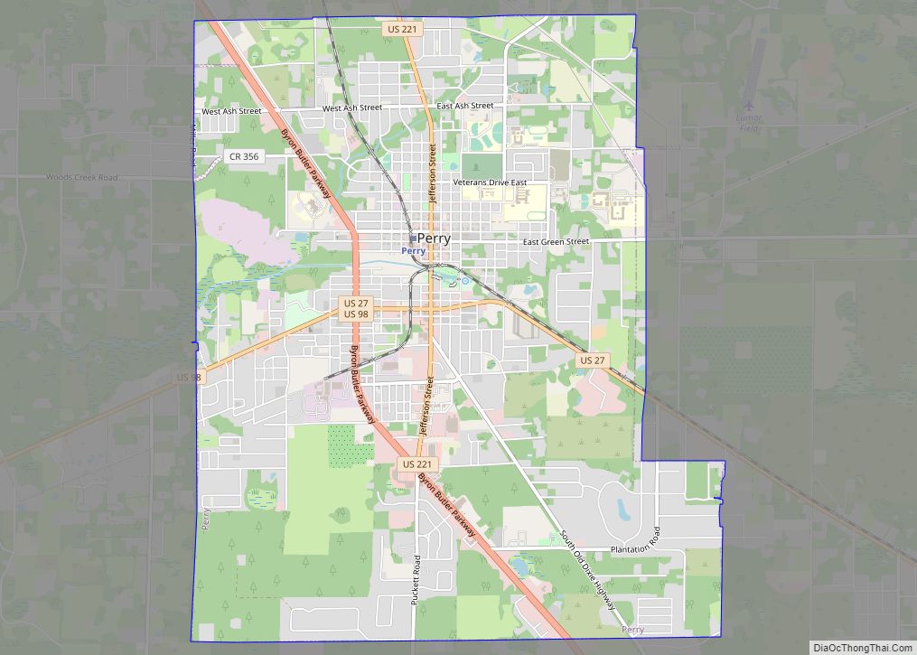
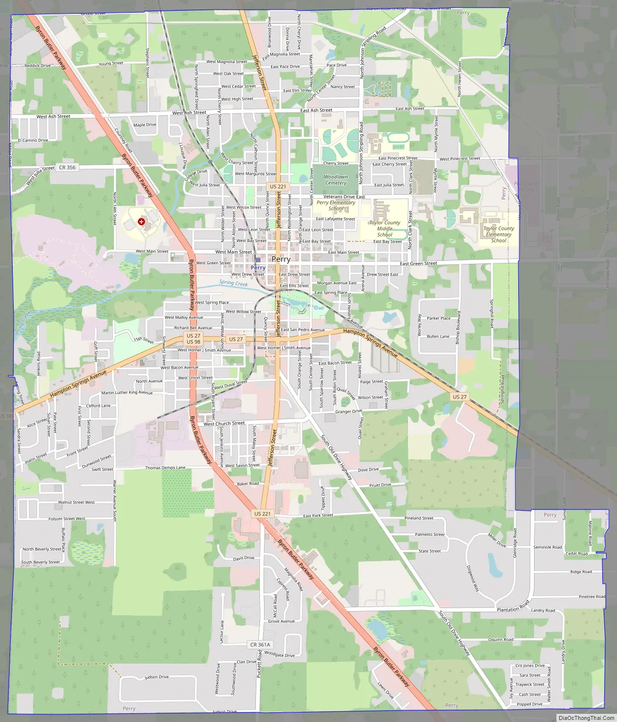
Perry Road Map
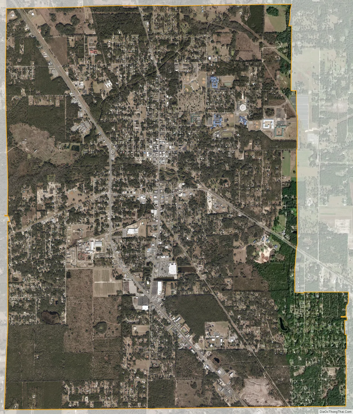
Perry city Satellite Map
Geography
Perry is located at 30°06′52″N 83°34′57″W / 30.114311°N 83.582609°W / 30.114311; -83.582609.
According to the United States Census Bureau, the city has a total area of 9.3 square miles (24 km), all land.
Perry is approximately 50 miles (80 km) southeast of Tallahassee.
Climate
See also
Map of Florida State and its subdivision:- Alachua
- Baker
- Bay
- Bradford
- Brevard
- Broward
- Calhoun
- Charlotte
- Citrus
- Clay
- Collier
- Columbia
- Desoto
- Dixie
- Duval
- Escambia
- Flagler
- Franklin
- Gadsden
- Gilchrist
- Glades
- Gulf
- Hamilton
- Hardee
- Hendry
- Hernando
- Highlands
- Hillsborough
- Holmes
- Indian River
- Jackson
- Jefferson
- Lafayette
- Lake
- Lee
- Leon
- Levy
- Liberty
- Madison
- Manatee
- Marion
- Martin
- Miami-Dade
- Monroe
- Nassau
- Okaloosa
- Okeechobee
- Orange
- Osceola
- Palm Beach
- Pasco
- Pinellas
- Polk
- Putnam
- Saint Johns
- Saint Lucie
- Santa Rosa
- Sarasota
- Seminole
- Sumter
- Suwannee
- Taylor
- Union
- Volusia
- Wakulla
- Walton
- Washington
- Alabama
- Alaska
- Arizona
- Arkansas
- California
- Colorado
- Connecticut
- Delaware
- District of Columbia
- Florida
- Georgia
- Hawaii
- Idaho
- Illinois
- Indiana
- Iowa
- Kansas
- Kentucky
- Louisiana
- Maine
- Maryland
- Massachusetts
- Michigan
- Minnesota
- Mississippi
- Missouri
- Montana
- Nebraska
- Nevada
- New Hampshire
- New Jersey
- New Mexico
- New York
- North Carolina
- North Dakota
- Ohio
- Oklahoma
- Oregon
- Pennsylvania
- Rhode Island
- South Carolina
- South Dakota
- Tennessee
- Texas
- Utah
- Vermont
- Virginia
- Washington
- West Virginia
- Wisconsin
- Wyoming