Pine Castle is a census-designated place and unincorporated area in Orange County, Florida, United States. It is part of the Orlando–Kissimmee–Sanford, Florida Metropolitan Statistical Area.
| Name: | Pine Castle CDP |
|---|---|
| LSAD Code: | 57 |
| LSAD Description: | CDP (suffix) |
| State: | Florida |
| County: | Orange County |
| Elevation: | 98 ft (30 m) |
| Total Area: | 2.69 sq mi (6.98 km²) |
| Land Area: | 2.42 sq mi (6.26 km²) |
| Water Area: | 0.28 sq mi (0.71 km²) |
| Total Population: | 11,122 |
| Population Density: | 4,597.77/sq mi (1,775.27/km²) |
| ZIP code: | 32809 |
| Area code: | 407, 689 |
| FIPS code: | 1256500 |
| GNISfeature ID: | 0288827 |
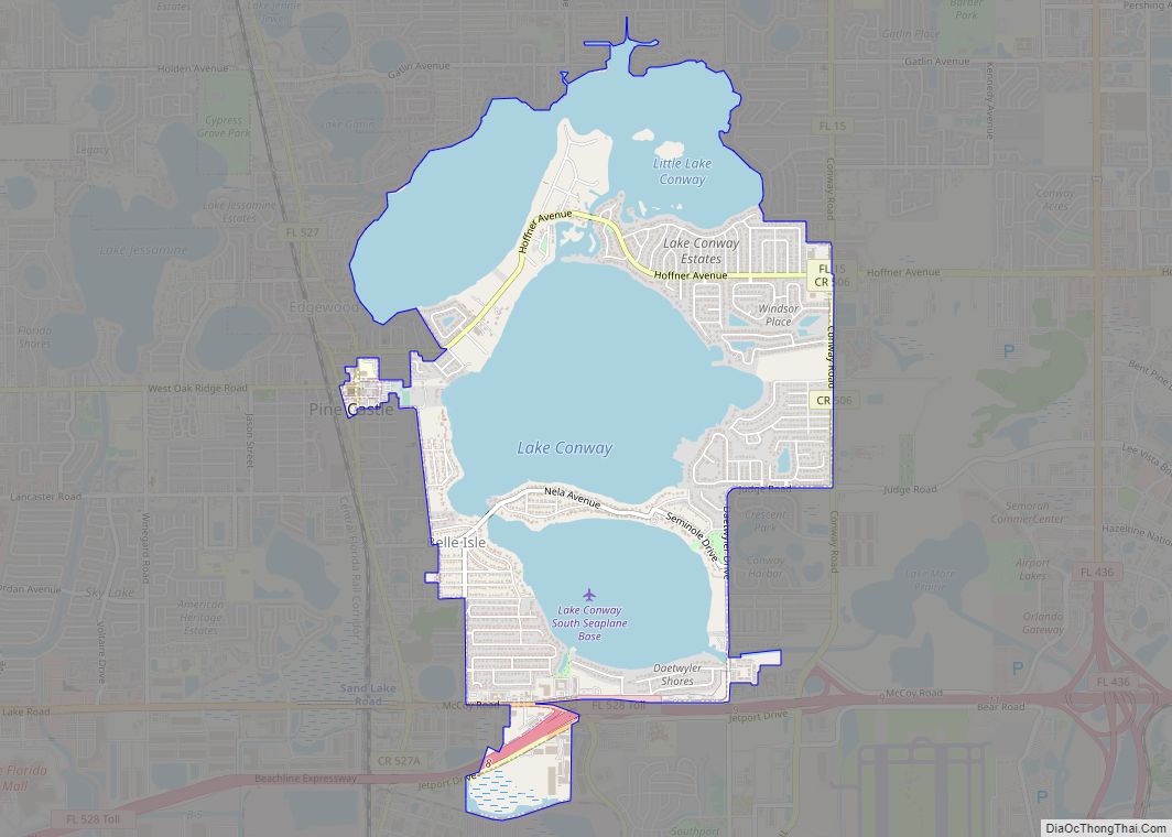
Online Interactive Map
Click on ![]() to view map in "full screen" mode.
to view map in "full screen" mode.
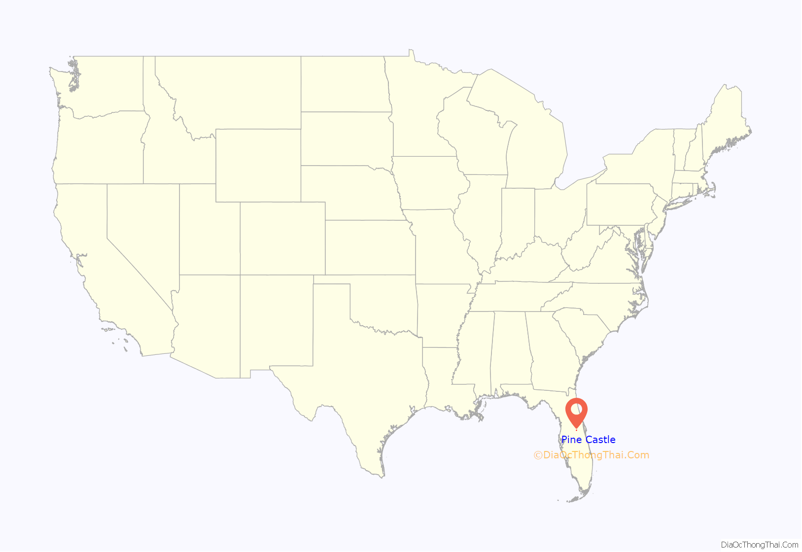
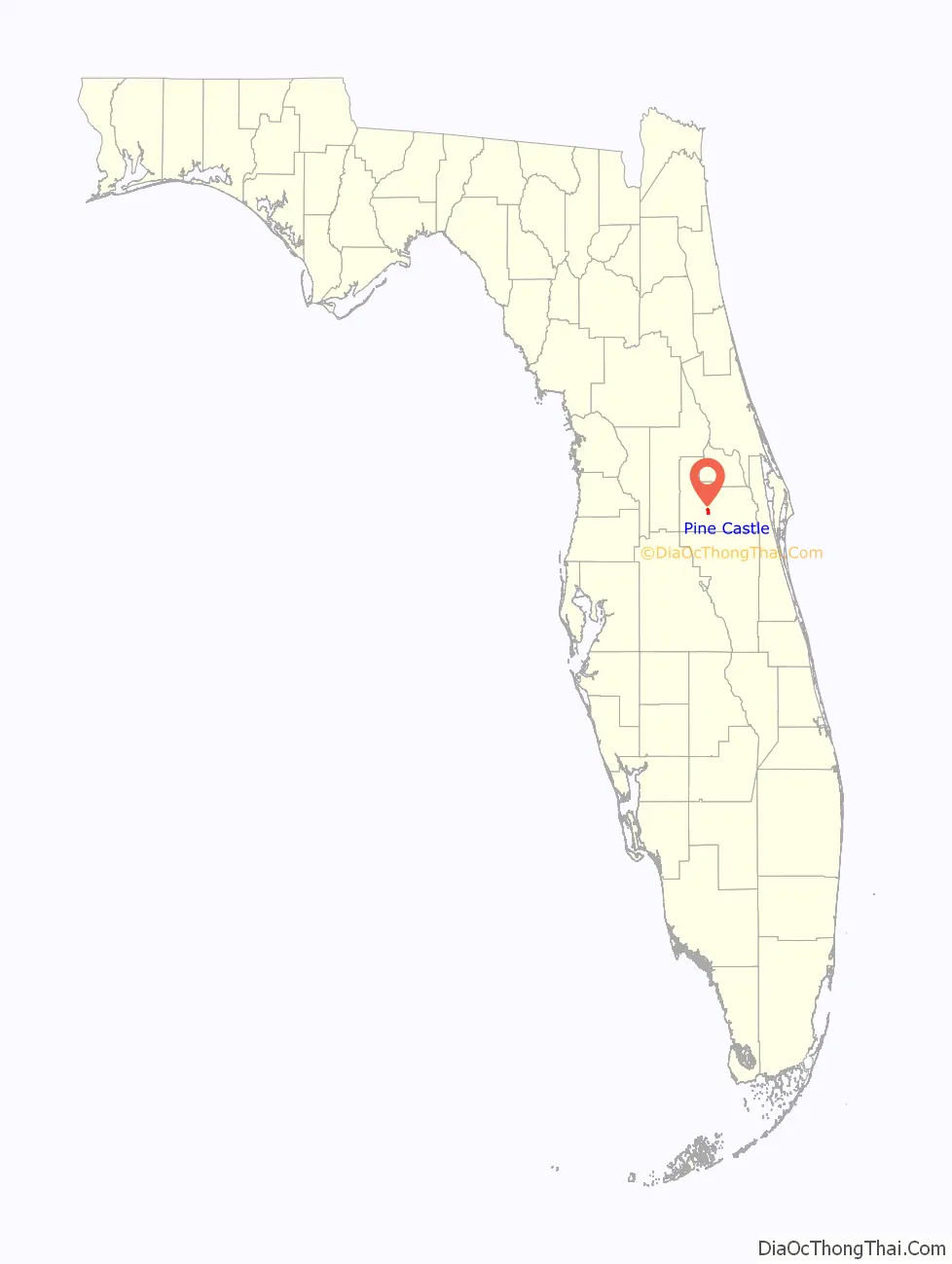
Pine Castle location map. Where is Pine Castle CDP?
History
Initially settled in 1870, the town’s development has been shaped by that of Orlando, approximately 5 miles (8 km) to the north. From just before 1882 the South Florida Railroad mainline, which became part of the Plant System in 1893 and the Atlantic Coast Line Railroad in 1902, provided regular rapid passenger and freight service. The town officially incorporated in 1925, but later reverted to unincorporated development. The population was 10,805 at the 2010 census. Passenger trains operated by successor Seaboard Coast Line A Line from 1967 then Amtrak after 1971 bypassed the local depot, with nearest stops in Orlando and Kissimmee. Passenger rail service returned with the opening of SunRail’s Sand Lake Road station in 2014.
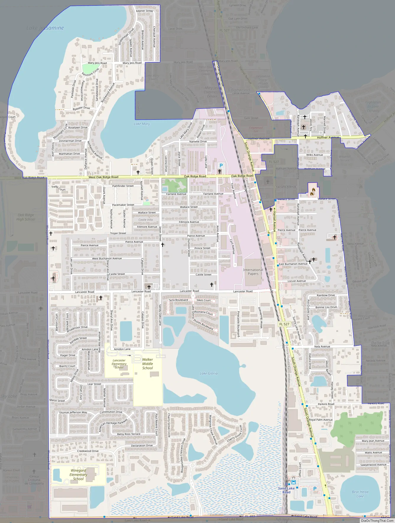
Pine Castle Road Map
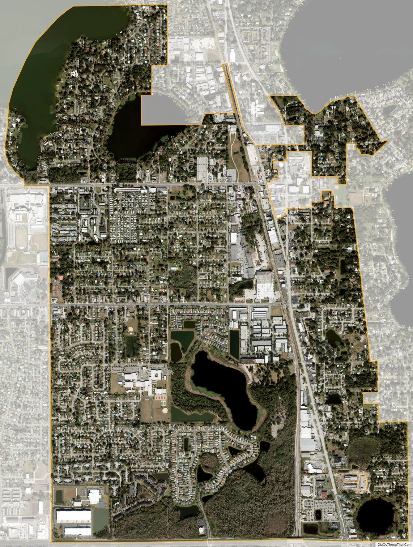
Pine Castle city Satellite Map
Geography
Pine Castle is located at 28°28′6″N 81°22′30″W / 28.46833°N 81.37500°W / 28.46833; -81.37500 (28.468432, -81.374992).
According to the United States Census Bureau, the CDP has a total area of 7.3 km (2.8 mi), of which 6.8 km (2.6 mi) is land and 0.5 km (0.2 mi) (7.42%) is water.
See also
Map of Florida State and its subdivision:- Alachua
- Baker
- Bay
- Bradford
- Brevard
- Broward
- Calhoun
- Charlotte
- Citrus
- Clay
- Collier
- Columbia
- Desoto
- Dixie
- Duval
- Escambia
- Flagler
- Franklin
- Gadsden
- Gilchrist
- Glades
- Gulf
- Hamilton
- Hardee
- Hendry
- Hernando
- Highlands
- Hillsborough
- Holmes
- Indian River
- Jackson
- Jefferson
- Lafayette
- Lake
- Lee
- Leon
- Levy
- Liberty
- Madison
- Manatee
- Marion
- Martin
- Miami-Dade
- Monroe
- Nassau
- Okaloosa
- Okeechobee
- Orange
- Osceola
- Palm Beach
- Pasco
- Pinellas
- Polk
- Putnam
- Saint Johns
- Saint Lucie
- Santa Rosa
- Sarasota
- Seminole
- Sumter
- Suwannee
- Taylor
- Union
- Volusia
- Wakulla
- Walton
- Washington
- Alabama
- Alaska
- Arizona
- Arkansas
- California
- Colorado
- Connecticut
- Delaware
- District of Columbia
- Florida
- Georgia
- Hawaii
- Idaho
- Illinois
- Indiana
- Iowa
- Kansas
- Kentucky
- Louisiana
- Maine
- Maryland
- Massachusetts
- Michigan
- Minnesota
- Mississippi
- Missouri
- Montana
- Nebraska
- Nevada
- New Hampshire
- New Jersey
- New Mexico
- New York
- North Carolina
- North Dakota
- Ohio
- Oklahoma
- Oregon
- Pennsylvania
- Rhode Island
- South Carolina
- South Dakota
- Tennessee
- Texas
- Utah
- Vermont
- Virginia
- Washington
- West Virginia
- Wisconsin
- Wyoming