Sebring (/ˈsiːbrɪŋ/ SEE-bring) is a city in south-central Florida and is the county seat of Highlands County, Florida, United States, nicknamed “The City on the Circle”, in reference to Circle Drive, the center of the Sebring Downtown Historic District. It is the county seat of Highlands County, and is the principal city of the Sebring Metropolitan Statistical Area. As of the 2020 census, the population was 10,729; however, the broader Sebring metropolitan area had a 2020 population of 103,296, making it the 21st largest metropolitan area in the state of Florida. The disparity in population between the city proper and the metropolitan area is due to the relatively small size of the annexed area of the city, with most all of the landmass west of Lake Jackson technically in unincorporated Highlands County
Sebring is centered around Lake Jackson, with the Downtown Historic District directly on the waterfront. Due to its Florida scrub terrain, Lake Jackson has natural white sand beaches, and is a popular boating and swimming destination. Sebring is the home of the Sebring International Raceway, best known as the host of the 12 Hours of Sebring, an annual WeatherTech SportsCar Championship race that attracts fans and teams from around the world. Nearby Highlands Hammock State Park is a popular attraction, and was the first state park created in Florida. Additionally, Sebring became a popular development and tourist destination of the 1920s, hailed as the “Coral Gables of Central Florida”. Many grandiose Mediterranean buildings of that time period still exist within the city, the most notable being the Harder Hall Hotel and Resort.
| Name: | Sebring city |
|---|---|
| LSAD Code: | 25 |
| LSAD Description: | city (suffix) |
| State: | Florida |
| County: | Highlands County |
| Elevation: | 139 ft (41 m) |
| Total Area: | 16.44 sq mi (42.58 km²) |
| Land Area: | 10.59 sq mi (27.42 km²) |
| Water Area: | 5.85 sq mi (15.16 km²) 37.8% |
| Total Population: | 10,729 |
| Population Density: | 1,013.41/sq mi (391.30/km²) |
| ZIP code: | 33870-33872, 33875-33876 |
| Area code: | 863 |
| FIPS code: | 1264875 |
| GNISfeature ID: | 0290806 |
| Website: | www.mysebring.com |
Online Interactive Map
Click on ![]() to view map in "full screen" mode.
to view map in "full screen" mode.
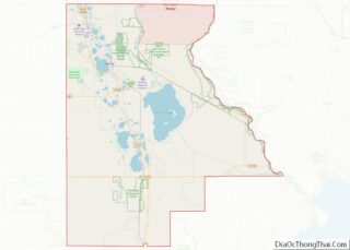
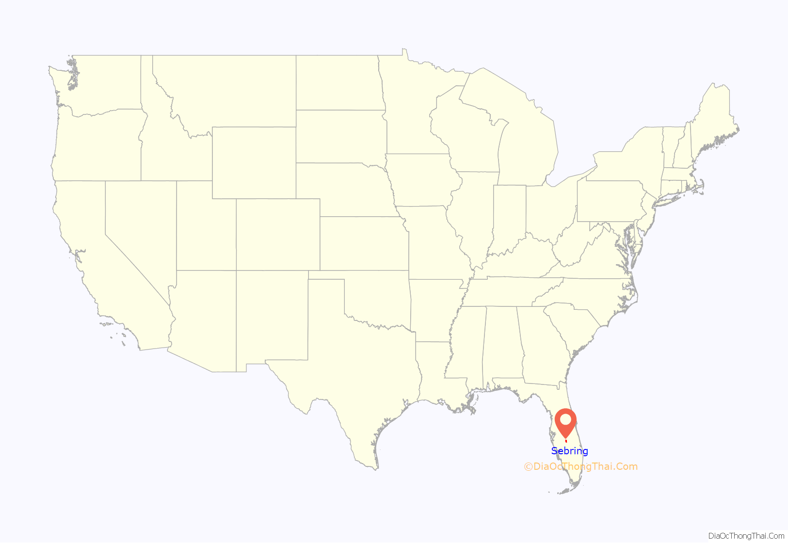
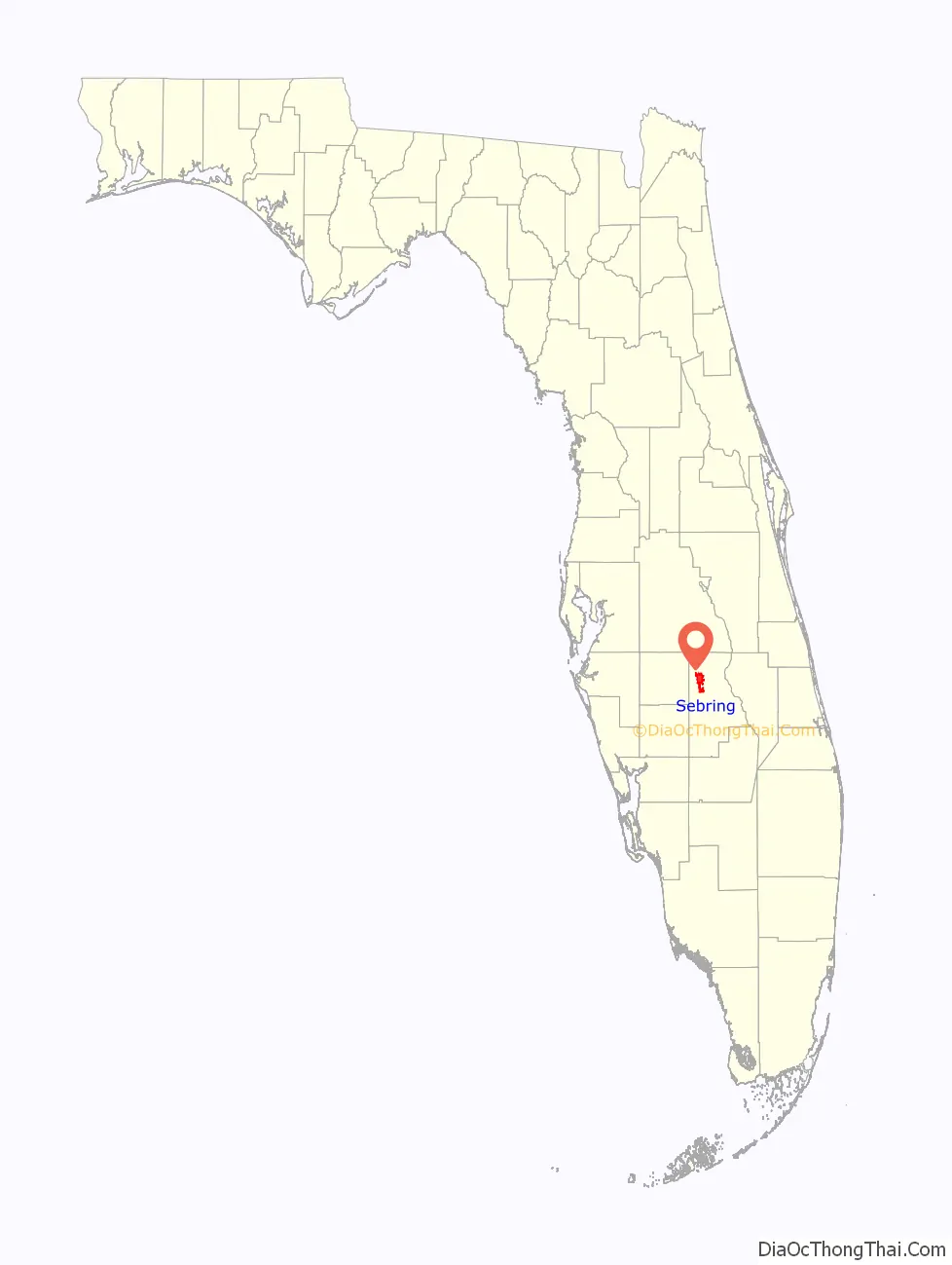
Sebring location map. Where is Sebring city?
History
Sebring was founded in 1912. It was named after George E. Sebring (1859–1927), a pottery manufacturer from Ohio who developed the city. He had a circular plan as the focal point for the city. It was chartered by the state of Florida in 1913, and was selected as the county seat of Highlands County when the county was created in 1921. The village of Sebring, Ohio, is also named for George E. Sebring and his family.
Sebring is known for its collection of historic and historically designated buildings. The Sebring Train Station, Sebring Fire Station, and the Highlands County Courthouse are all National Register of Historic Places buildings that are still in service, as well as the entire Sebring Downtown Historic District, consisting of shops, restaurants, offices, businesses and apartments all bordered by the water. Harder Hall Resort and the Kenilworth Lodge are both surviving examples of large, extravagant boom time hotels.
On January 23, 2019, a SunTrust Bank branch in Sebring was the site of a mass shooting allegedly perpetrated by Zephen Xaver, a 21-year-old Sebring resident and former correctional officer trainee. Five people were killed by Xaver; four employees of the bank and one customer.
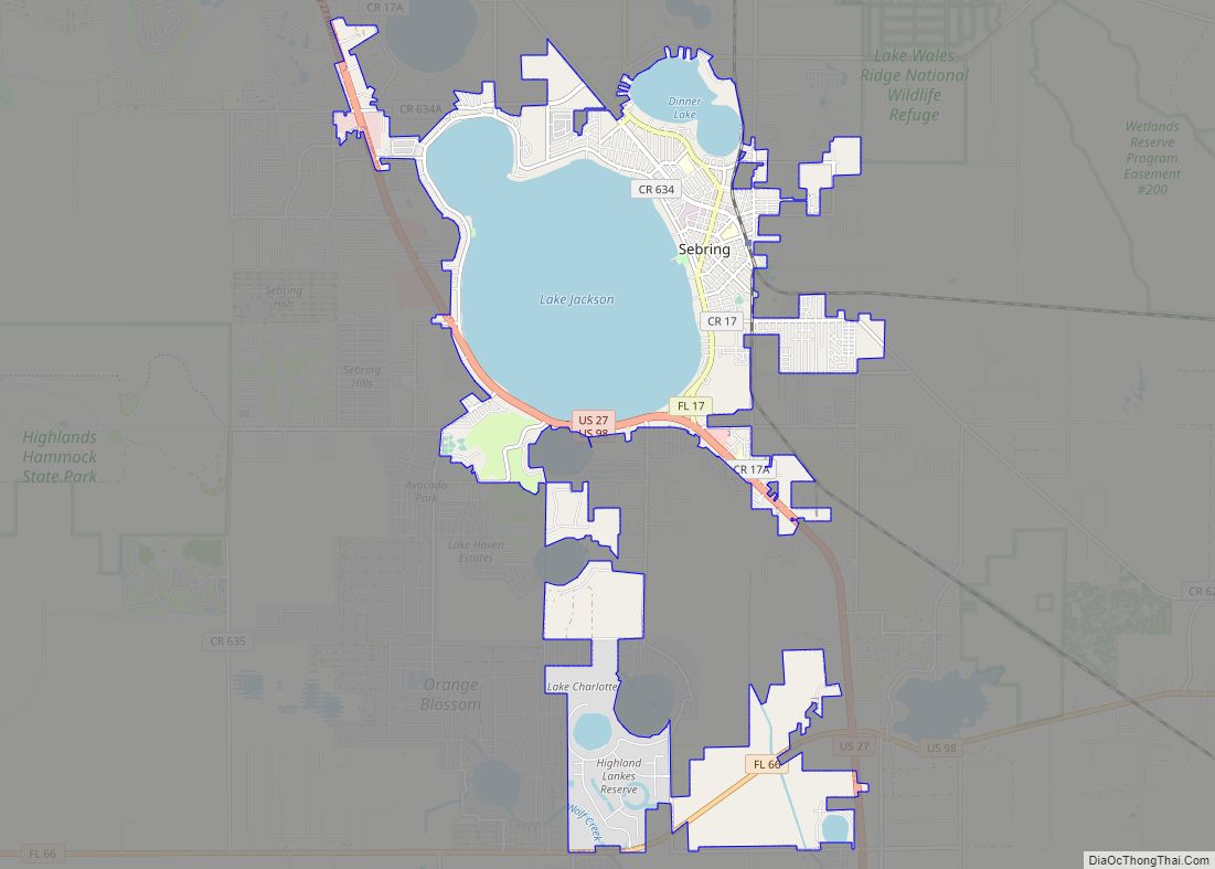
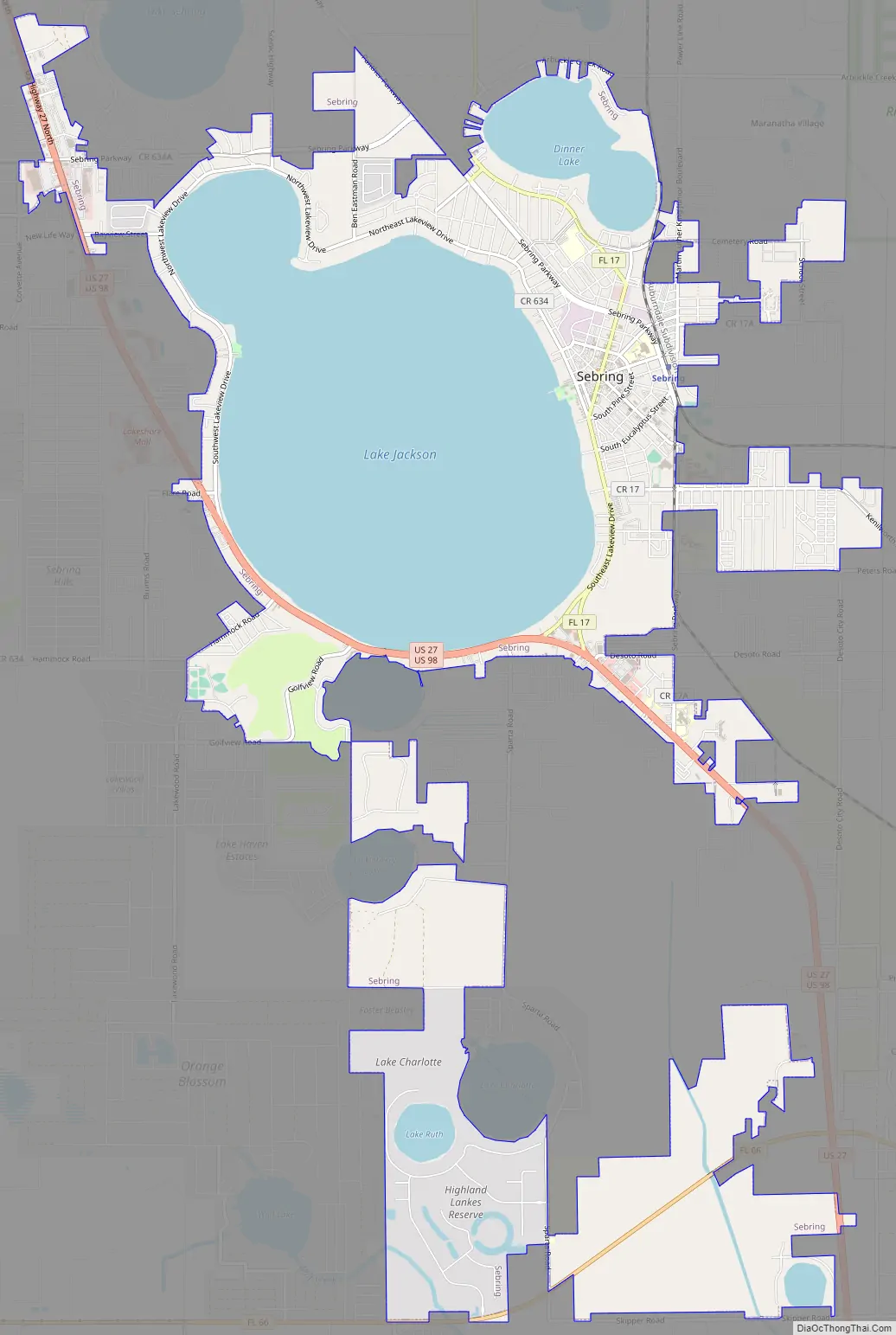
Sebring Road Map
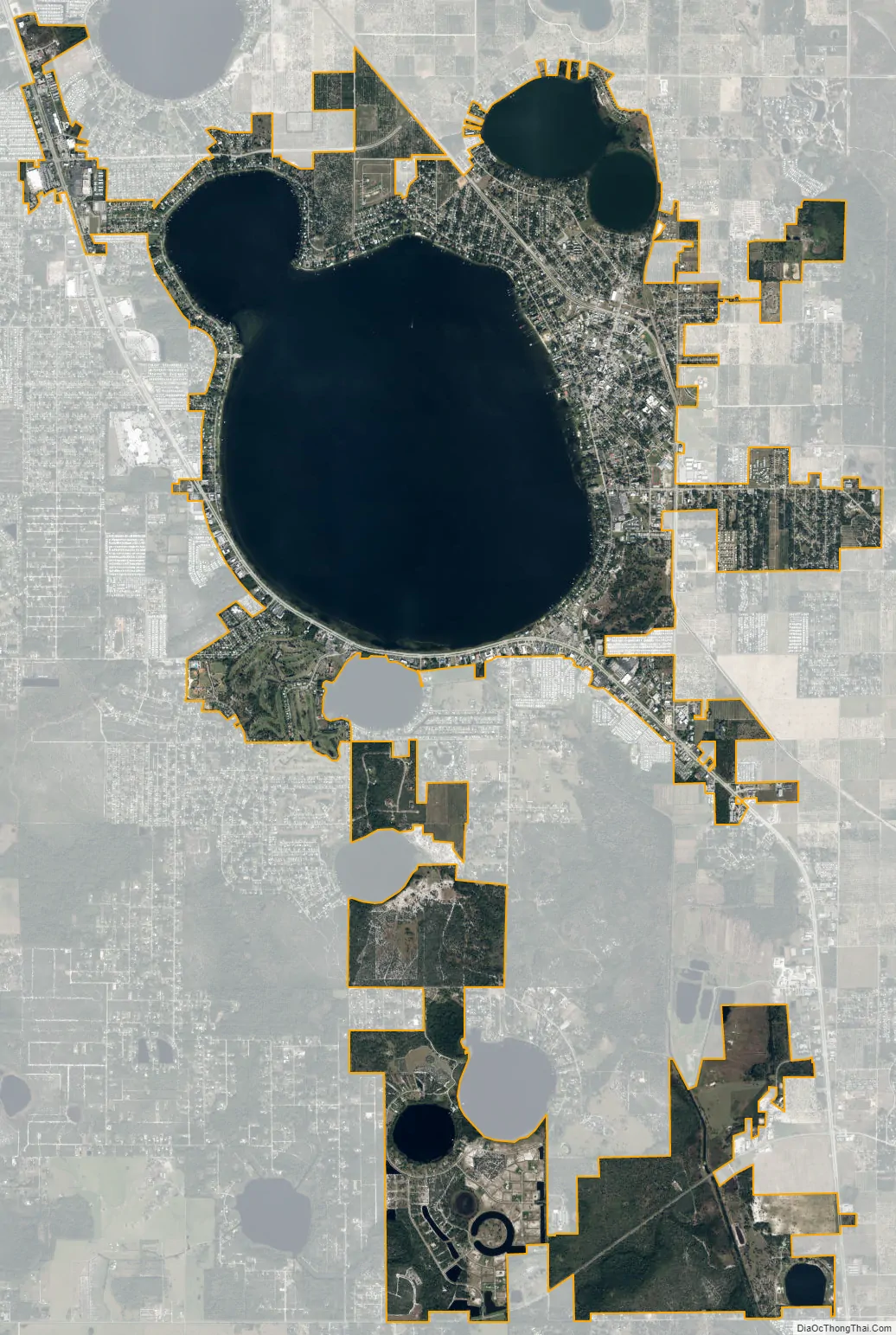
Sebring city Satellite Map
Geography
Sebring is located in northwestern Highlands County at 27°29′44″N 81°26′40″W / 27.49556°N 81.44444°W / 27.49556; -81.44444. According to the Census Bureau, the city has a total area of 16.0 square miles (41.5 km), 10.0 square miles (25.8 km) of which are land and 6.1 square miles (15.7 km) of which are water. Water comprises 37.8% of the city’s total area.
The city’s geography is dominated by 9,212-acre (37 km) Lake Jackson, but 420-acre (1.7 km) Dinner Lake and 137-acre (0.6 km) Little Lake Jackson are also within the city limits. Highlands County has more than 84 lakes, most of which are located in unincorporated areas of the county. Sebring lies near the southern end of the Lake Wales Ridge, a chain of ancient islands that is the native habitat for many rare plants and animals. Most of the area is rural and part of the Florida scrub ecosystem, with smaller areas of hammocks and cypress swamps, similar to those found at Highlands Hammock State Park, 4 miles (6 km) west of Sebring.
Sebring’s climate is a humid subtropical climate (Köppen climate classification Cfa), with hot, humid summers and mild, dry winters. Unlike most places with a similar climate classification, Sebring’s rainfall is clearly seasonal, with approximately 57 percent of the total rainfall occurring in the June–September summer period. However, the variation between the wettest and driest months does not reach the threshold required for climate classification Cwa, which requires the wettest month to have ten times the precipitation of the driest month.
See also
Map of Florida State and its subdivision:- Alachua
- Baker
- Bay
- Bradford
- Brevard
- Broward
- Calhoun
- Charlotte
- Citrus
- Clay
- Collier
- Columbia
- Desoto
- Dixie
- Duval
- Escambia
- Flagler
- Franklin
- Gadsden
- Gilchrist
- Glades
- Gulf
- Hamilton
- Hardee
- Hendry
- Hernando
- Highlands
- Hillsborough
- Holmes
- Indian River
- Jackson
- Jefferson
- Lafayette
- Lake
- Lee
- Leon
- Levy
- Liberty
- Madison
- Manatee
- Marion
- Martin
- Miami-Dade
- Monroe
- Nassau
- Okaloosa
- Okeechobee
- Orange
- Osceola
- Palm Beach
- Pasco
- Pinellas
- Polk
- Putnam
- Saint Johns
- Saint Lucie
- Santa Rosa
- Sarasota
- Seminole
- Sumter
- Suwannee
- Taylor
- Union
- Volusia
- Wakulla
- Walton
- Washington
- Alabama
- Alaska
- Arizona
- Arkansas
- California
- Colorado
- Connecticut
- Delaware
- District of Columbia
- Florida
- Georgia
- Hawaii
- Idaho
- Illinois
- Indiana
- Iowa
- Kansas
- Kentucky
- Louisiana
- Maine
- Maryland
- Massachusetts
- Michigan
- Minnesota
- Mississippi
- Missouri
- Montana
- Nebraska
- Nevada
- New Hampshire
- New Jersey
- New Mexico
- New York
- North Carolina
- North Dakota
- Ohio
- Oklahoma
- Oregon
- Pennsylvania
- Rhode Island
- South Carolina
- South Dakota
- Tennessee
- Texas
- Utah
- Vermont
- Virginia
- Washington
- West Virginia
- Wisconsin
- Wyoming