Steinhatchee (/ˈstiːnhætʃi/ (listen) STEEN-hatch-ee) is a Gulf coastal community in the southern part of Taylor County, Florida, United States. Steinhatchee is 38 miles (61 km) south of the county seat of Perry. Just across the Steinhatchee River is Jena, which is in Dixie County. Steinhatchee is 19.27 miles north of the town of Cross City. The name Steinhatchee was derived from the Creek este enhvccē meaning river (hvccē) of person (este). Since the early 19th century, the village of Steinhatchee played an integral part in the foresting industry, particularly cedar used for making pencils, as well as fishing, crabbing and scalloping. The Steinhatchee River also flows by the community and into the Gulf of Mexico.
| Name: | Steinhatchee CDP |
|---|---|
| LSAD Code: | 57 |
| LSAD Description: | CDP (suffix) |
| State: | Florida |
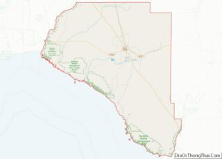
| County: | Taylor County |
| Total Area: | 8.56 km² (3.306 sq mi) |
| Land Area: | 8.28 km² (3.198 sq mi) |
| Water Area: | 0.28 km² (0.108 sq mi) |
| Total Population: | 1,049 |
| ZIP code: | 32359 |
| Area code: | 352 |
| FIPS code: | 1268625 |
Online Interactive Map
Click on ![]() to view map in "full screen" mode.
to view map in "full screen" mode.
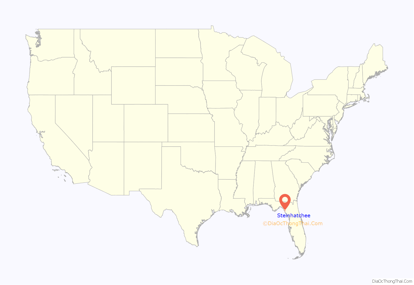
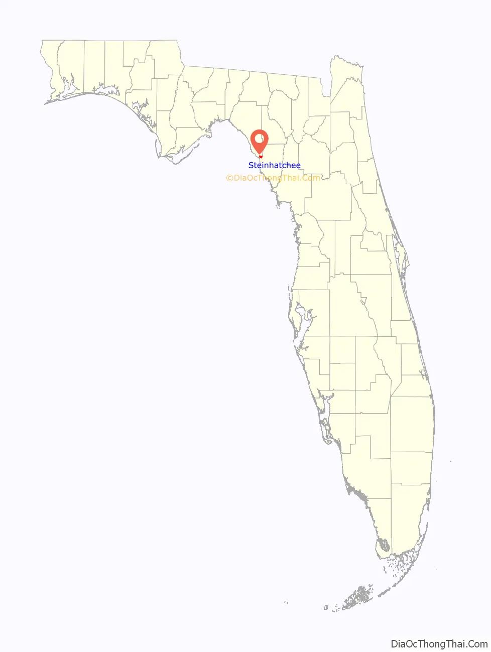
Steinhatchee location map. Where is Steinhatchee CDP?
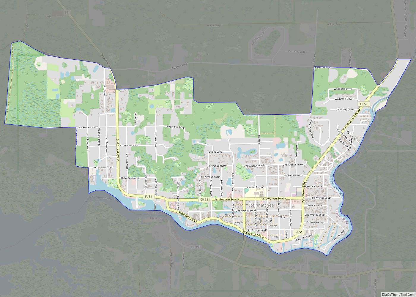
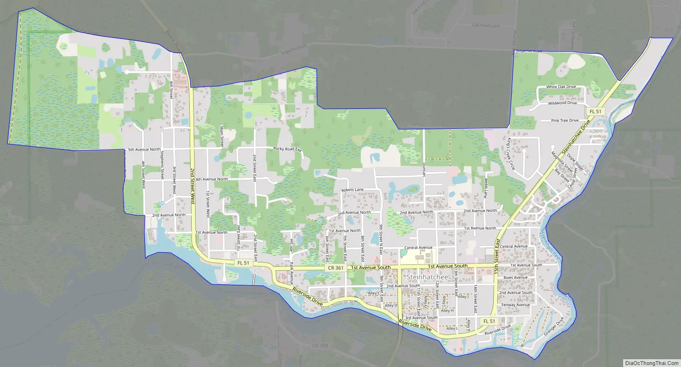
Steinhatchee Road Map
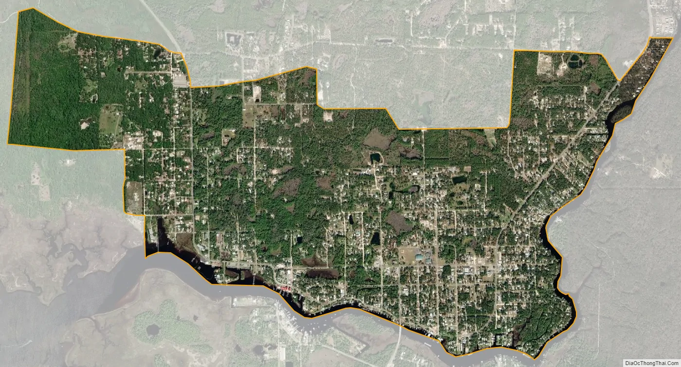
Steinhatchee city Satellite Map
See also
Map of Florida State and its subdivision:- Alachua
- Baker
- Bay
- Bradford
- Brevard
- Broward
- Calhoun
- Charlotte
- Citrus
- Clay
- Collier
- Columbia
- Desoto
- Dixie
- Duval
- Escambia
- Flagler
- Franklin
- Gadsden
- Gilchrist
- Glades
- Gulf
- Hamilton
- Hardee
- Hendry
- Hernando
- Highlands
- Hillsborough
- Holmes
- Indian River
- Jackson
- Jefferson
- Lafayette
- Lake
- Lee
- Leon
- Levy
- Liberty
- Madison
- Manatee
- Marion
- Martin
- Miami-Dade
- Monroe
- Nassau
- Okaloosa
- Okeechobee
- Orange
- Osceola
- Palm Beach
- Pasco
- Pinellas
- Polk
- Putnam
- Saint Johns
- Saint Lucie
- Santa Rosa
- Sarasota
- Seminole
- Sumter
- Suwannee
- Taylor
- Union
- Volusia
- Wakulla
- Walton
- Washington
- Alabama
- Alaska
- Arizona
- Arkansas
- California
- Colorado
- Connecticut
- Delaware
- District of Columbia
- Florida
- Georgia
- Hawaii
- Idaho
- Illinois
- Indiana
- Iowa
- Kansas
- Kentucky
- Louisiana
- Maine
- Maryland
- Massachusetts
- Michigan
- Minnesota
- Mississippi
- Missouri
- Montana
- Nebraska
- Nevada
- New Hampshire
- New Jersey
- New Mexico
- New York
- North Carolina
- North Dakota
- Ohio
- Oklahoma
- Oregon
- Pennsylvania
- Rhode Island
- South Carolina
- South Dakota
- Tennessee
- Texas
- Utah
- Vermont
- Virginia
- Washington
- West Virginia
- Wisconsin
- Wyoming