Taylor Creek is a census-designated place (CDP) in Okeechobee County, Florida, United States. The population was 4,348 at the 2010 census.
| Name: | Taylor Creek CDP |
|---|---|
| LSAD Code: | 57 |
| LSAD Description: | CDP (suffix) |
| State: | Florida |
| County: | Okeechobee County |
| Elevation: | 16 ft (5 m) |
| Total Area: | 3.44 sq mi (8.91 km²) |
| Land Area: | 3.05 sq mi (7.89 km²) |
| Water Area: | 0.39 sq mi (1.01 km²) |
| Total Population: | 4,470 |
| Population Density: | 1,466.54/sq mi (566.19/km²) |
| ZIP code: | 34974 |
| Area code: | 863 |
| FIPS code: | 1271300 |
| GNISfeature ID: | 1867217 |
Online Interactive Map
Click on ![]() to view map in "full screen" mode.
to view map in "full screen" mode.
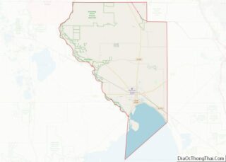
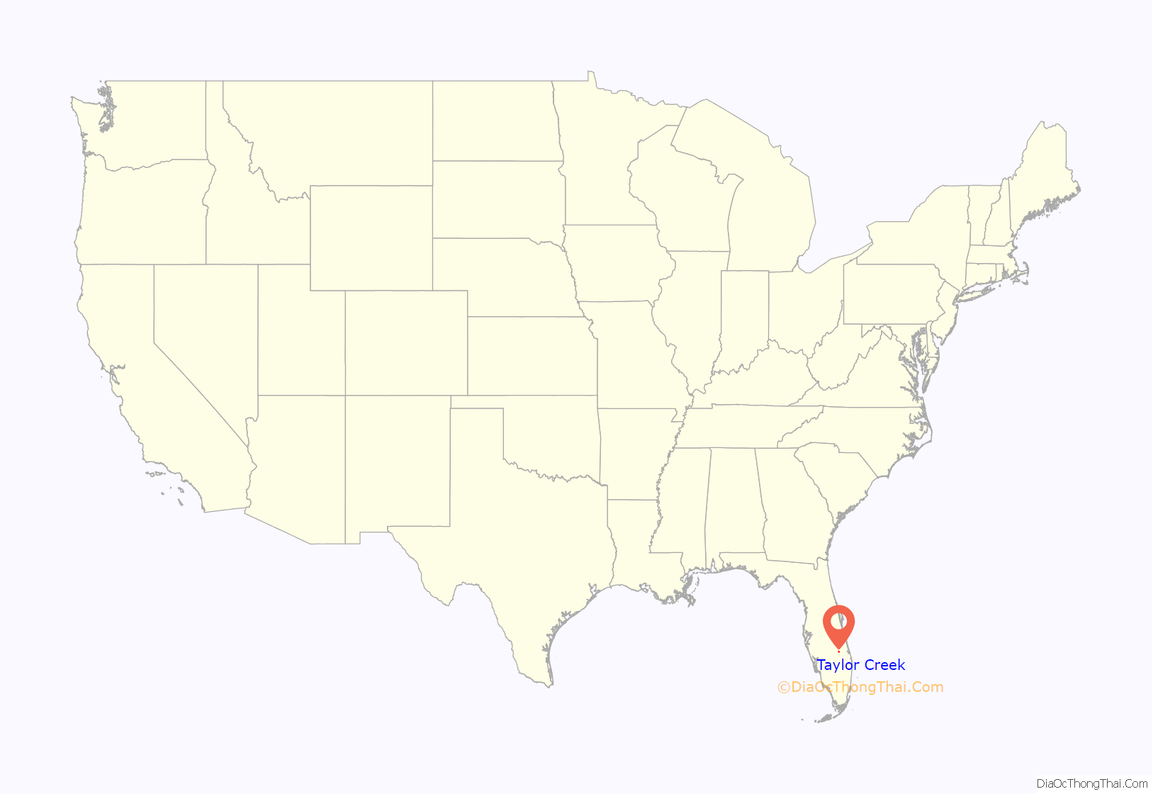
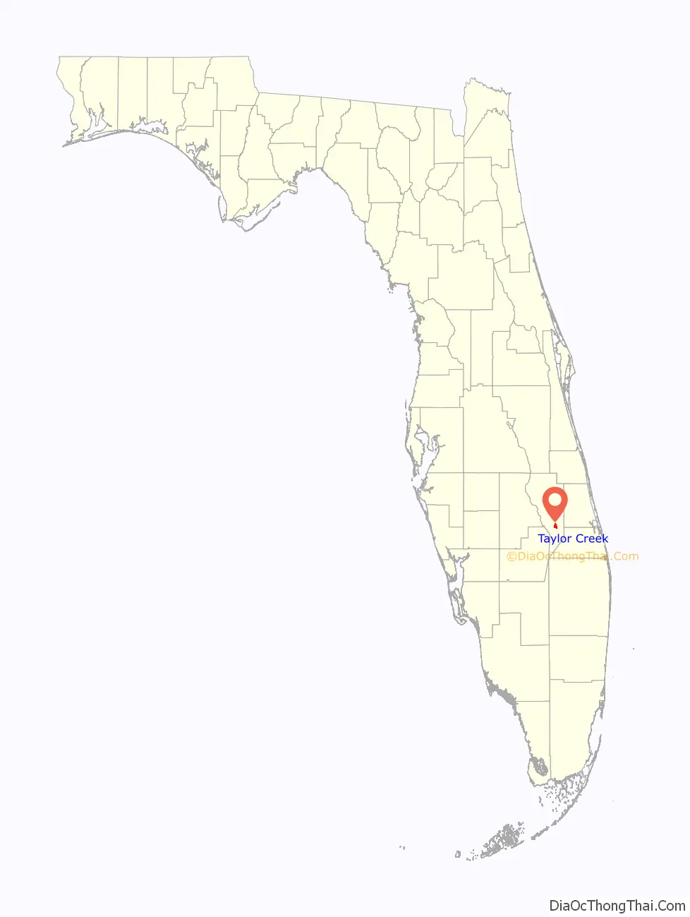
Taylor Creek location map. Where is Taylor Creek CDP?
History
In 1855, Taylor Creek was the site for a meeting of Seminole. The aim of the meeting was to discuss how the confederation should respond to increasing pressure from the United States government, and the result was the start of the Third Seminole War.
In October 1896, the first Euro-American settlers, Peter and Louisiana Raulerson, moved down to the area from Fort Basinger, Florida.
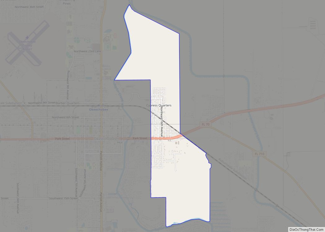
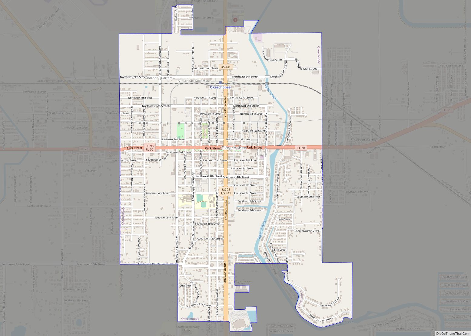
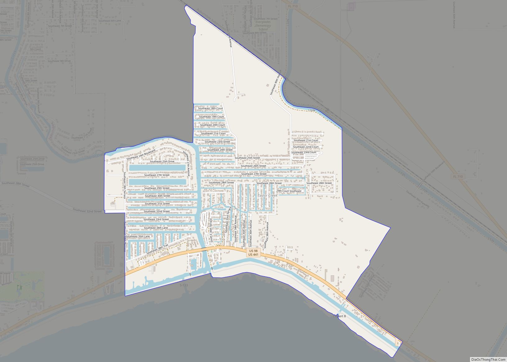
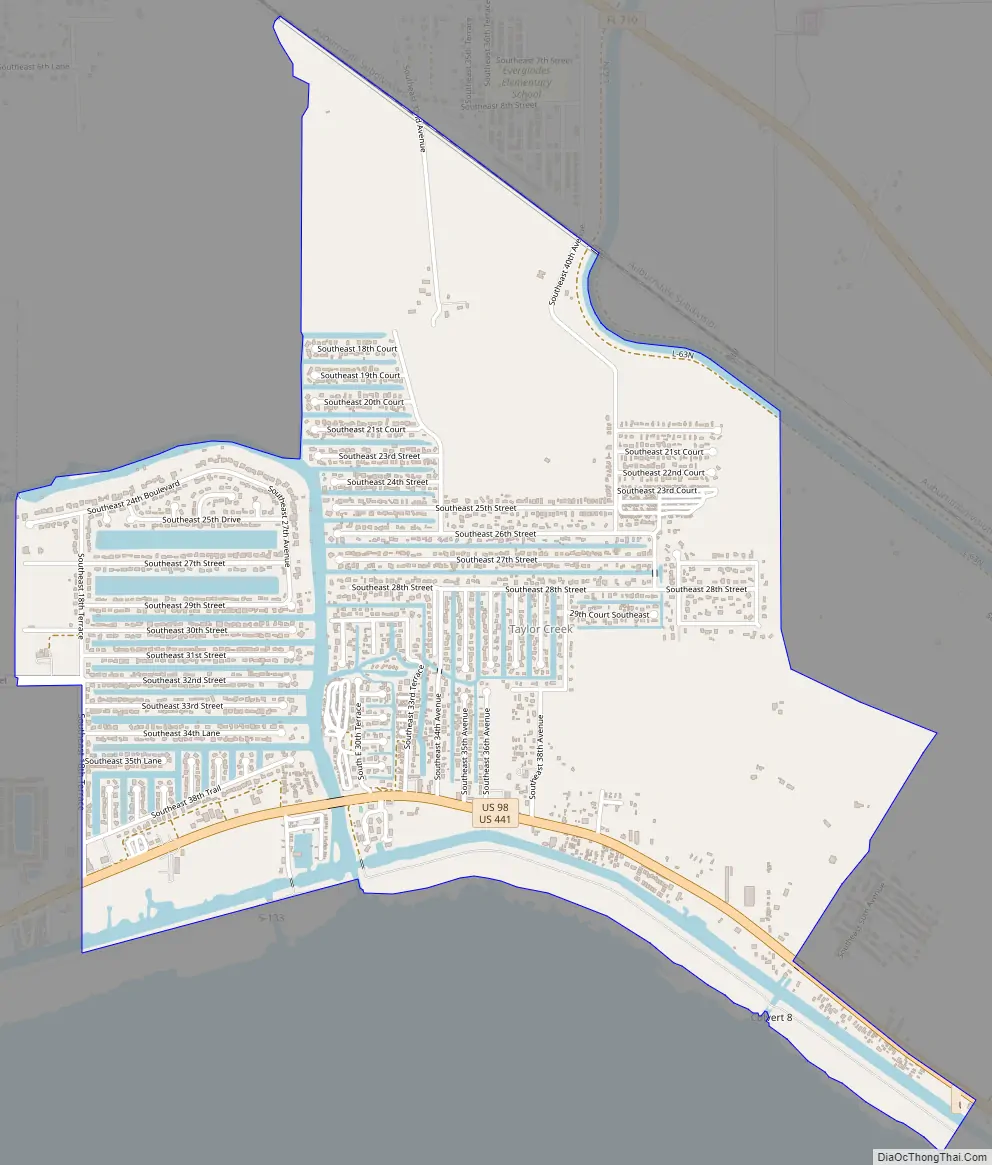
Taylor Creek Road Map
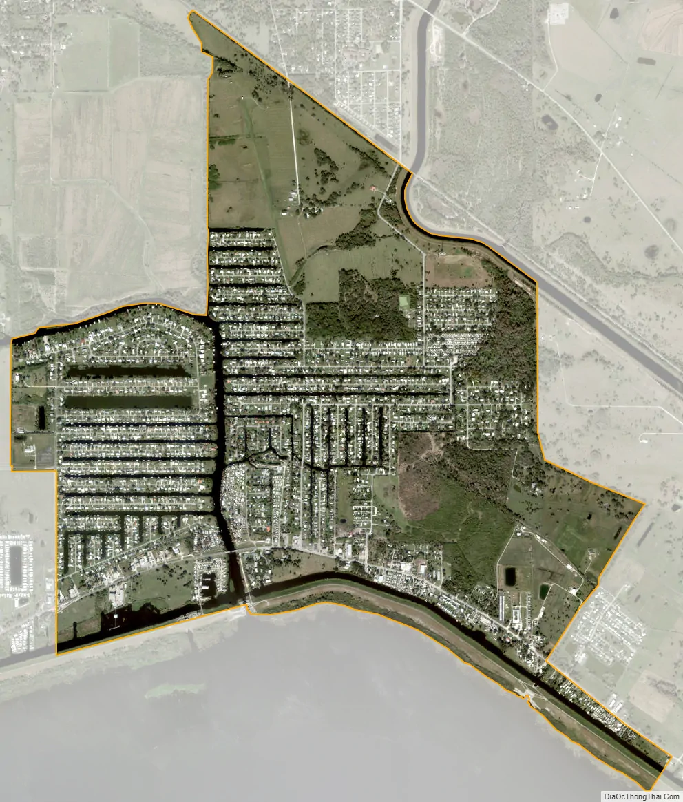
Taylor Creek city Satellite Map
Geography
The community lies along the north side of Lake Okeechobee. The area is served by US routes 98 and 441 and state routes 700 and 15.
According to the United States Census Bureau, the CDP has a total area of 4.2 square miles (11 km), of which 4.0 square miles (10 km) is land and 0.2 square miles (0.52 km) (3.61%) is water.
See also
Map of Florida State and its subdivision:- Alachua
- Baker
- Bay
- Bradford
- Brevard
- Broward
- Calhoun
- Charlotte
- Citrus
- Clay
- Collier
- Columbia
- Desoto
- Dixie
- Duval
- Escambia
- Flagler
- Franklin
- Gadsden
- Gilchrist
- Glades
- Gulf
- Hamilton
- Hardee
- Hendry
- Hernando
- Highlands
- Hillsborough
- Holmes
- Indian River
- Jackson
- Jefferson
- Lafayette
- Lake
- Lee
- Leon
- Levy
- Liberty
- Madison
- Manatee
- Marion
- Martin
- Miami-Dade
- Monroe
- Nassau
- Okaloosa
- Okeechobee
- Orange
- Osceola
- Palm Beach
- Pasco
- Pinellas
- Polk
- Putnam
- Saint Johns
- Saint Lucie
- Santa Rosa
- Sarasota
- Seminole
- Sumter
- Suwannee
- Taylor
- Union
- Volusia
- Wakulla
- Walton
- Washington
- Alabama
- Alaska
- Arizona
- Arkansas
- California
- Colorado
- Connecticut
- Delaware
- District of Columbia
- Florida
- Georgia
- Hawaii
- Idaho
- Illinois
- Indiana
- Iowa
- Kansas
- Kentucky
- Louisiana
- Maine
- Maryland
- Massachusetts
- Michigan
- Minnesota
- Mississippi
- Missouri
- Montana
- Nebraska
- Nevada
- New Hampshire
- New Jersey
- New Mexico
- New York
- North Carolina
- North Dakota
- Ohio
- Oklahoma
- Oregon
- Pennsylvania
- Rhode Island
- South Carolina
- South Dakota
- Tennessee
- Texas
- Utah
- Vermont
- Virginia
- Washington
- West Virginia
- Wisconsin
- Wyoming