Windermere is a town in Orange County, Florida, United States. As of the 2020 census, the town population was 3,030. It is part of the Orlando Metropolitan Statistical Area.
| Name: | Windermere town |
|---|---|
| LSAD Code: | 43 |
| LSAD Description: | town (suffix) |
| State: | Florida |
| County: | Orange County |
| Elevation: | 121 ft (37 m) |
| Total Area: | 2.69 sq mi (6.96 km²) |
| Land Area: | 1.93 sq mi (5.01 km²) |
| Water Area: | 0.75 sq mi (1.95 km²) |
| Total Population: | 3,030 |
| Population Density: | 1,567.51/sq mi (605.16/km²) |
| ZIP code: | 34786 |
| Area code: | 407, 689 |
| FIPS code: | 1278050 |
| GNISfeature ID: | 0293401 |
| Website: | www.town.windermere.fl.us |
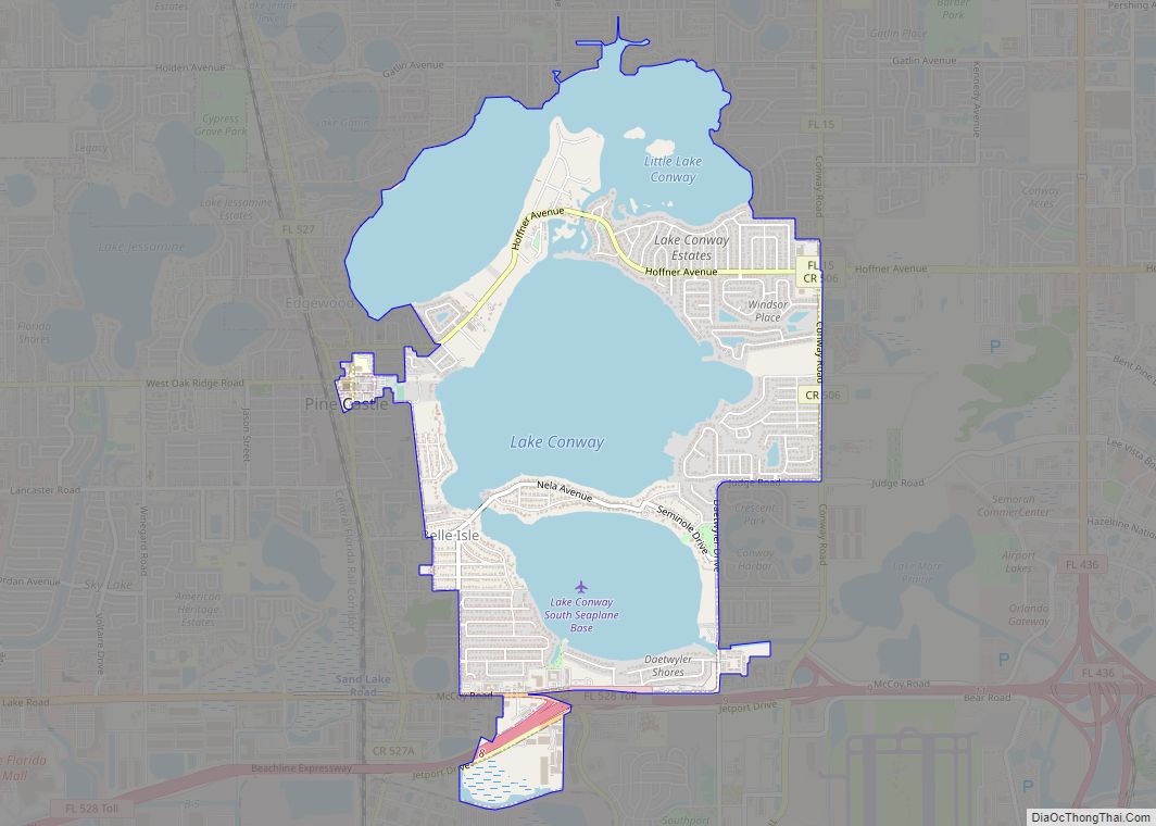
Online Interactive Map
Click on ![]() to view map in "full screen" mode.
to view map in "full screen" mode.
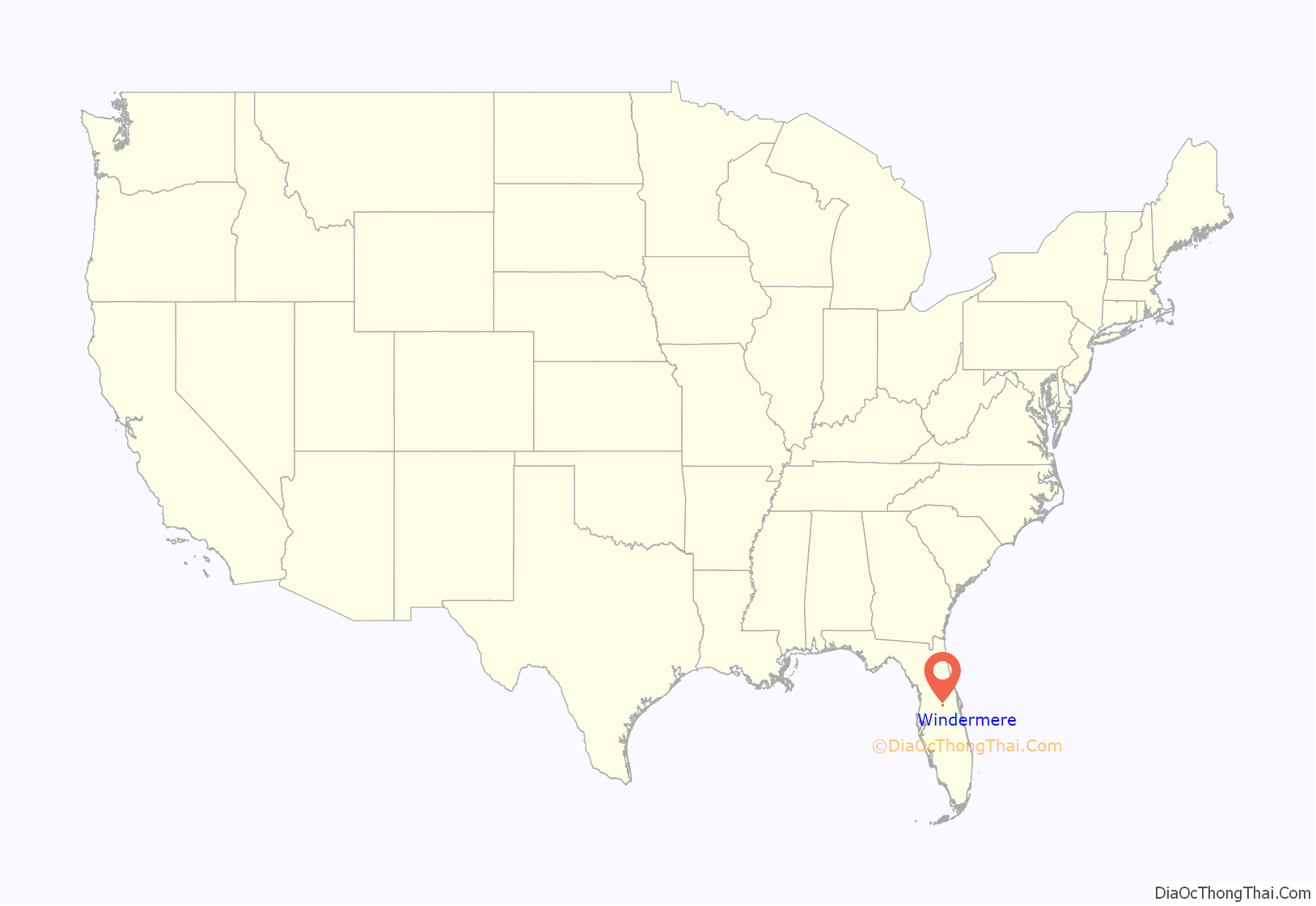
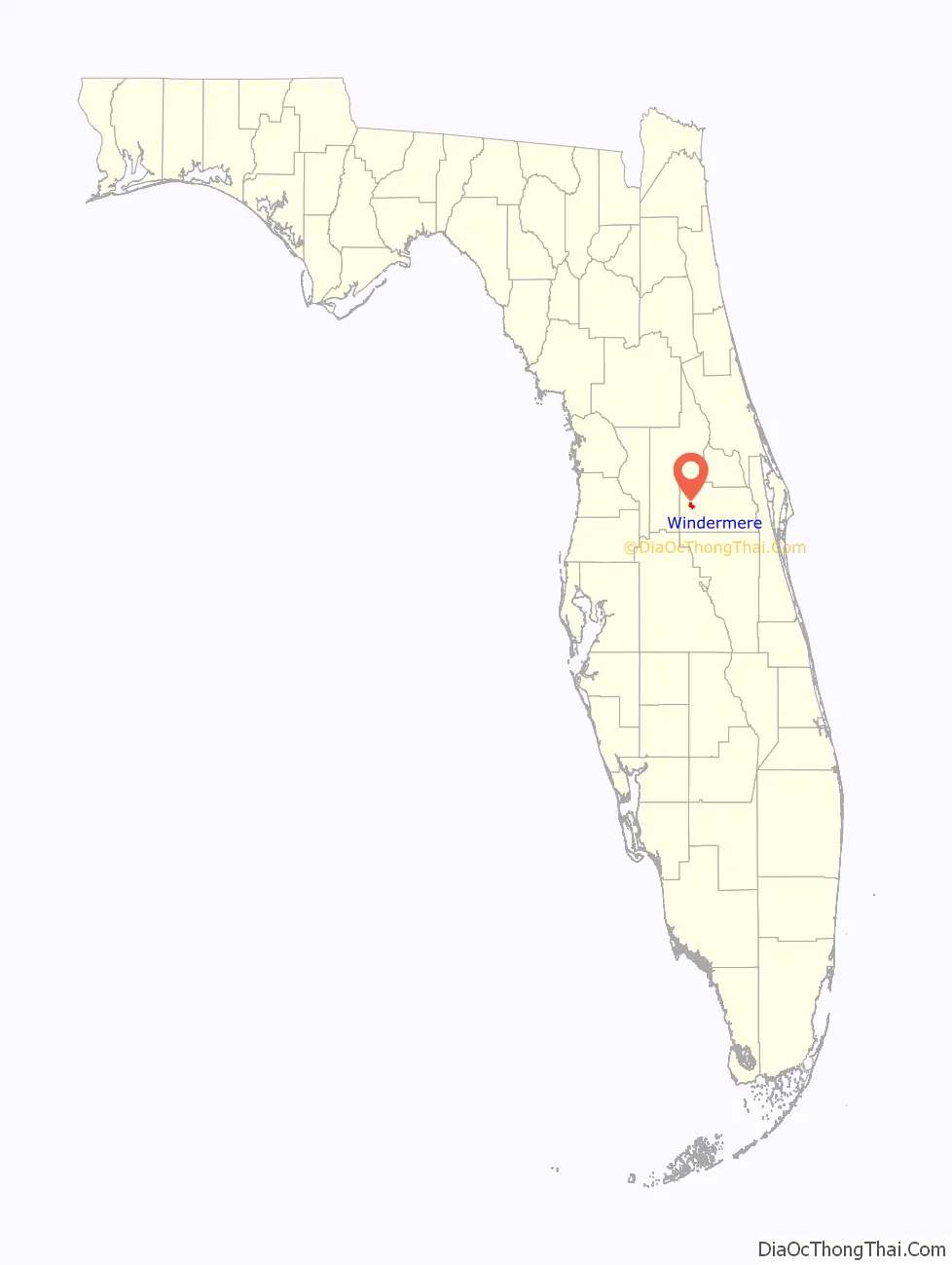
Windermere location map. Where is Windermere town?
History
A post office opened in Windermere in 1888. The post office closed in 1901, and reopened in 1911. Windermere was established as a residential development in 1889 and chartered in 1925.
During late 2007, the town of Windermere filed a proposal to annex Isleworth and Butler Bay, both wealthy subdivisions. This was met with extensive debate from town residents and an objection from Orange County, which stood to lose millions of dollars of property tax revenue. After lengthy discussions, and battles with the county, Isleworth remained unincorporated, but Butler Bay was annexed into Windermere, with over 90% of its residents approving annexation via a mail-in ballot.
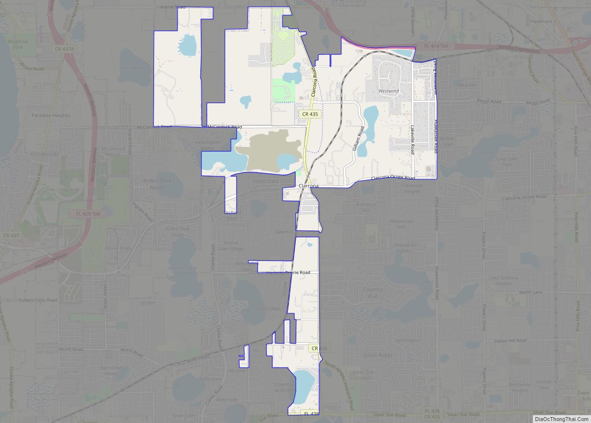
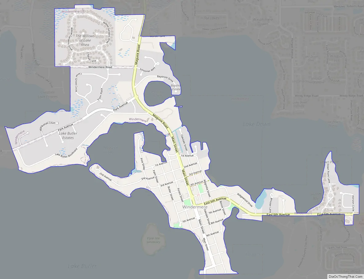
Windermere Road Map
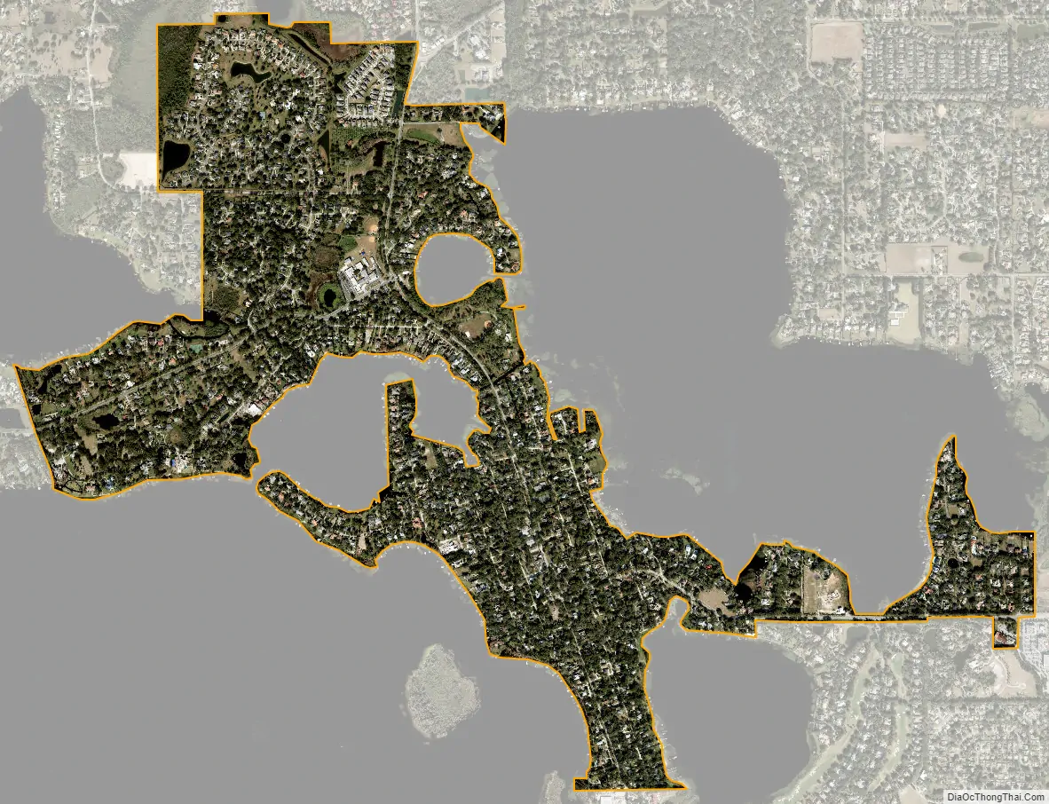
Windermere city Satellite Map
Geography
According to the United States Census Bureau, the town has a total area of 1.57 square miles (4.07 km), of which 1.56 square miles (4.03 km) is land and 0.015 square miles (0.04 km), or 0.98%, is water.
Climate
The record high temperature in Windermere is 101 °F, which took place in 1998, and the record low temperature is 19 °F, which took place in 1985.
See also
Map of Florida State and its subdivision:- Alachua
- Baker
- Bay
- Bradford
- Brevard
- Broward
- Calhoun
- Charlotte
- Citrus
- Clay
- Collier
- Columbia
- Desoto
- Dixie
- Duval
- Escambia
- Flagler
- Franklin
- Gadsden
- Gilchrist
- Glades
- Gulf
- Hamilton
- Hardee
- Hendry
- Hernando
- Highlands
- Hillsborough
- Holmes
- Indian River
- Jackson
- Jefferson
- Lafayette
- Lake
- Lee
- Leon
- Levy
- Liberty
- Madison
- Manatee
- Marion
- Martin
- Miami-Dade
- Monroe
- Nassau
- Okaloosa
- Okeechobee
- Orange
- Osceola
- Palm Beach
- Pasco
- Pinellas
- Polk
- Putnam
- Saint Johns
- Saint Lucie
- Santa Rosa
- Sarasota
- Seminole
- Sumter
- Suwannee
- Taylor
- Union
- Volusia
- Wakulla
- Walton
- Washington
- Alabama
- Alaska
- Arizona
- Arkansas
- California
- Colorado
- Connecticut
- Delaware
- District of Columbia
- Florida
- Georgia
- Hawaii
- Idaho
- Illinois
- Indiana
- Iowa
- Kansas
- Kentucky
- Louisiana
- Maine
- Maryland
- Massachusetts
- Michigan
- Minnesota
- Mississippi
- Missouri
- Montana
- Nebraska
- Nevada
- New Hampshire
- New Jersey
- New Mexico
- New York
- North Carolina
- North Dakota
- Ohio
- Oklahoma
- Oregon
- Pennsylvania
- Rhode Island
- South Carolina
- South Dakota
- Tennessee
- Texas
- Utah
- Vermont
- Virginia
- Washington
- West Virginia
- Wisconsin
- Wyoming