Osborne is a city in and the county seat of Osborne County, Kansas, United States. As of the 2020 census, the population of the city was 1,335.
| Name: | Osborne city |
|---|---|
| LSAD Code: | 25 |
| LSAD Description: | city (suffix) |
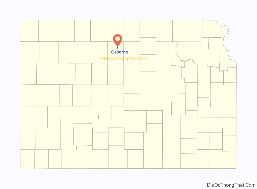
| State: | Kansas |
| County: | Osborne County |
| Founded: | 1871 |
| Incorporated: | 1878 |
| Elevation: | 1,552 ft (473 m) |
| Total Area: | 1.54 sq mi (3.99 km²) |
| Land Area: | 1.54 sq mi (3.99 km²) |
| Water Area: | 0.00 sq mi (0.00 km²) |
| Total Population: | 1,335 |
| Population Density: | 870/sq mi (330/km²) |
| ZIP code: | 67473 |
| Area code: | 785 |
| FIPS code: | 2053325 |
| Website: | discoverosborne.com |
Online Interactive Map
Click on ![]() to view map in "full screen" mode.
to view map in "full screen" mode.
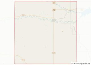
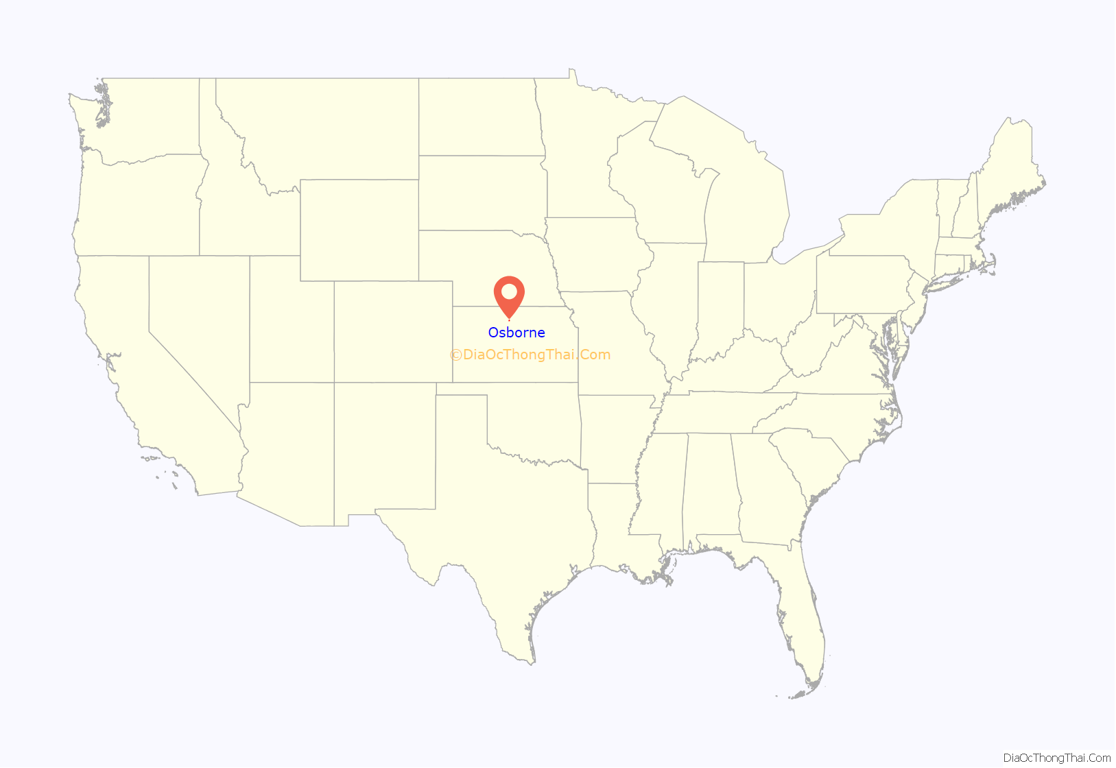
Osborne location map. Where is Osborne city?
History
Settlers from southeastern Pennsylvania founded Osborne City in May 1871. They named the settlement after Vincent B. Osborne, a Union Army veteran of the American Civil War, after whom Osborne County also is named. Osborne City became the permanent county seat in November 1872. A district judge officially proclaimed it a city in May 1873, but the townspeople failed to legally organize a government. Five years later, a second attempt was successful, and the settlement incorporated as a city in 1878. “City” was dropped from its name by the mid-1890s.
A bridge was built at Osborne over the Solomon River in 1878.
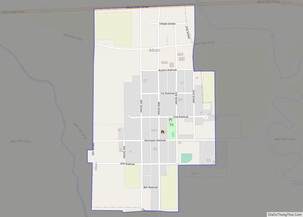
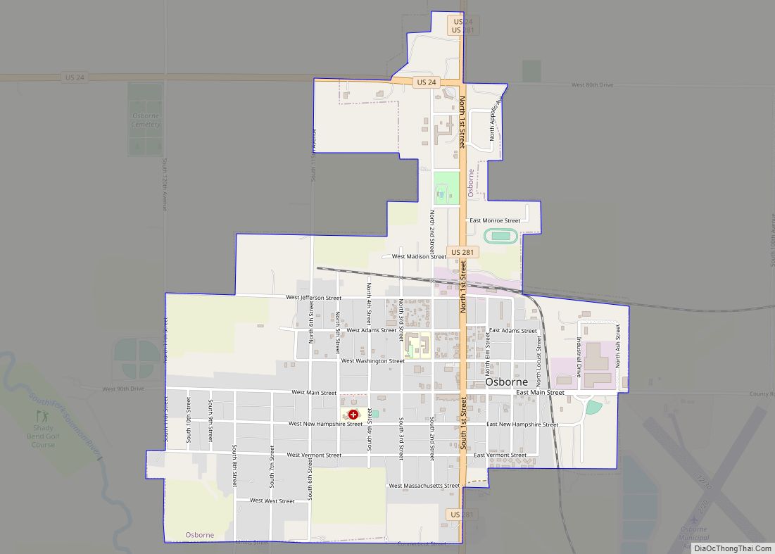
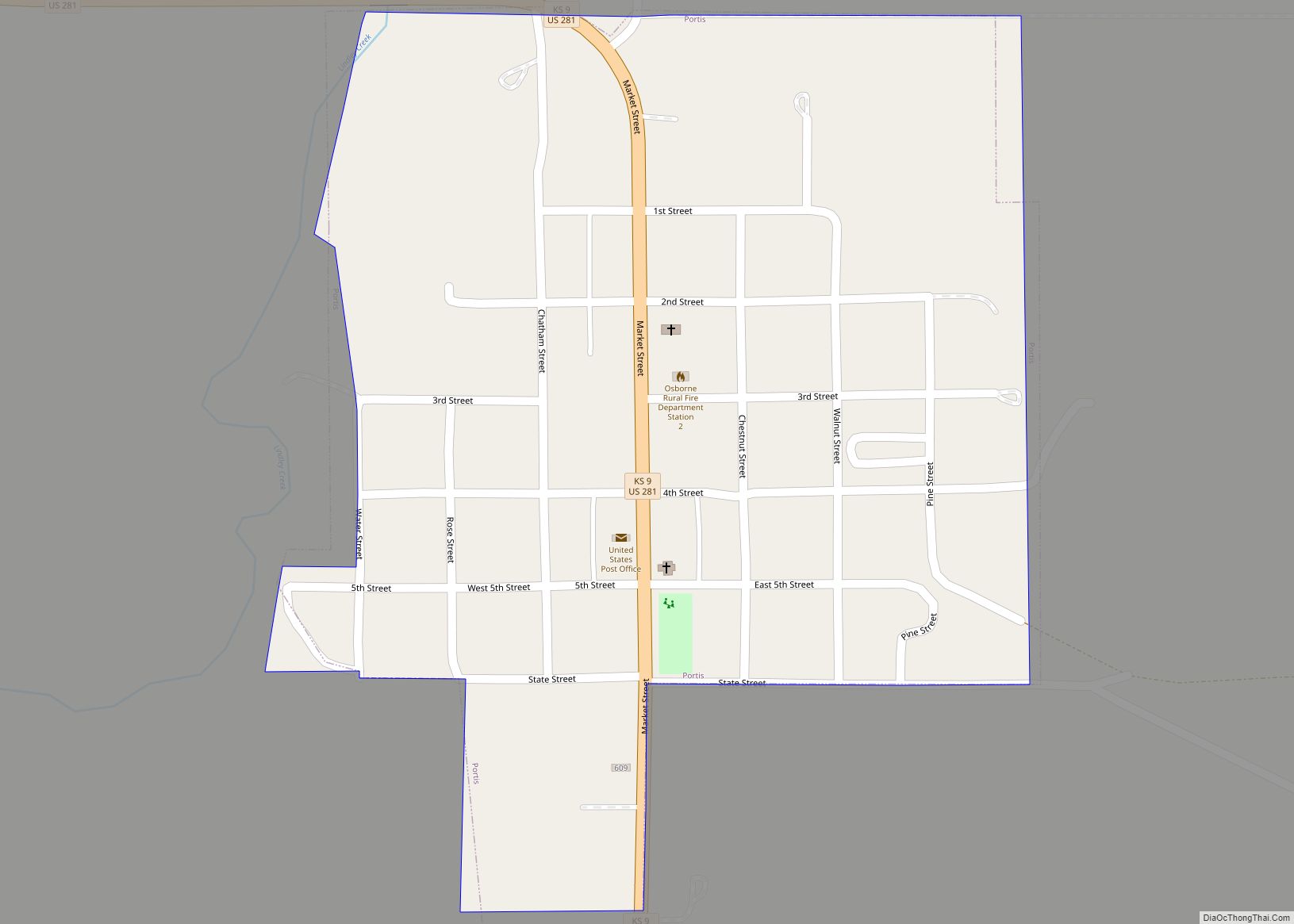
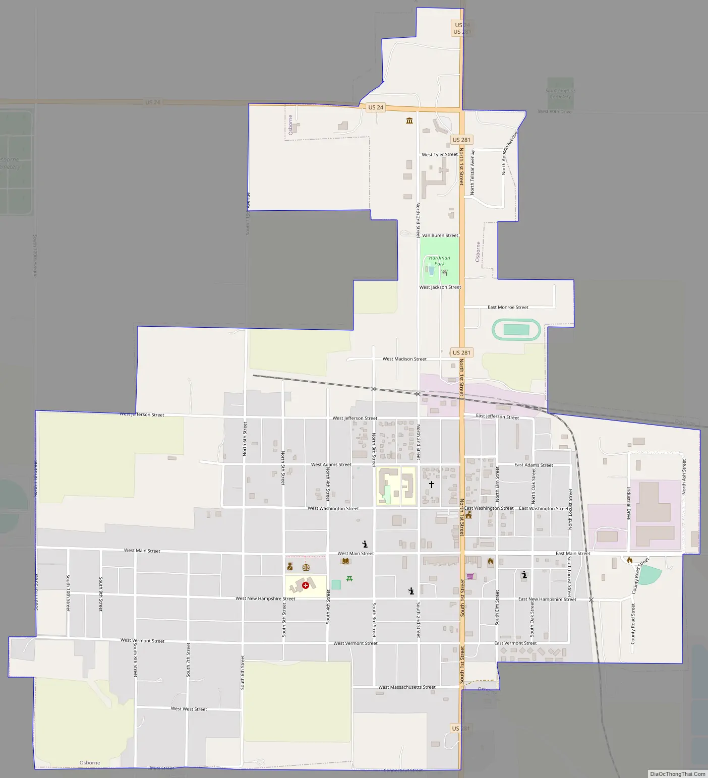
Osborne Road Map
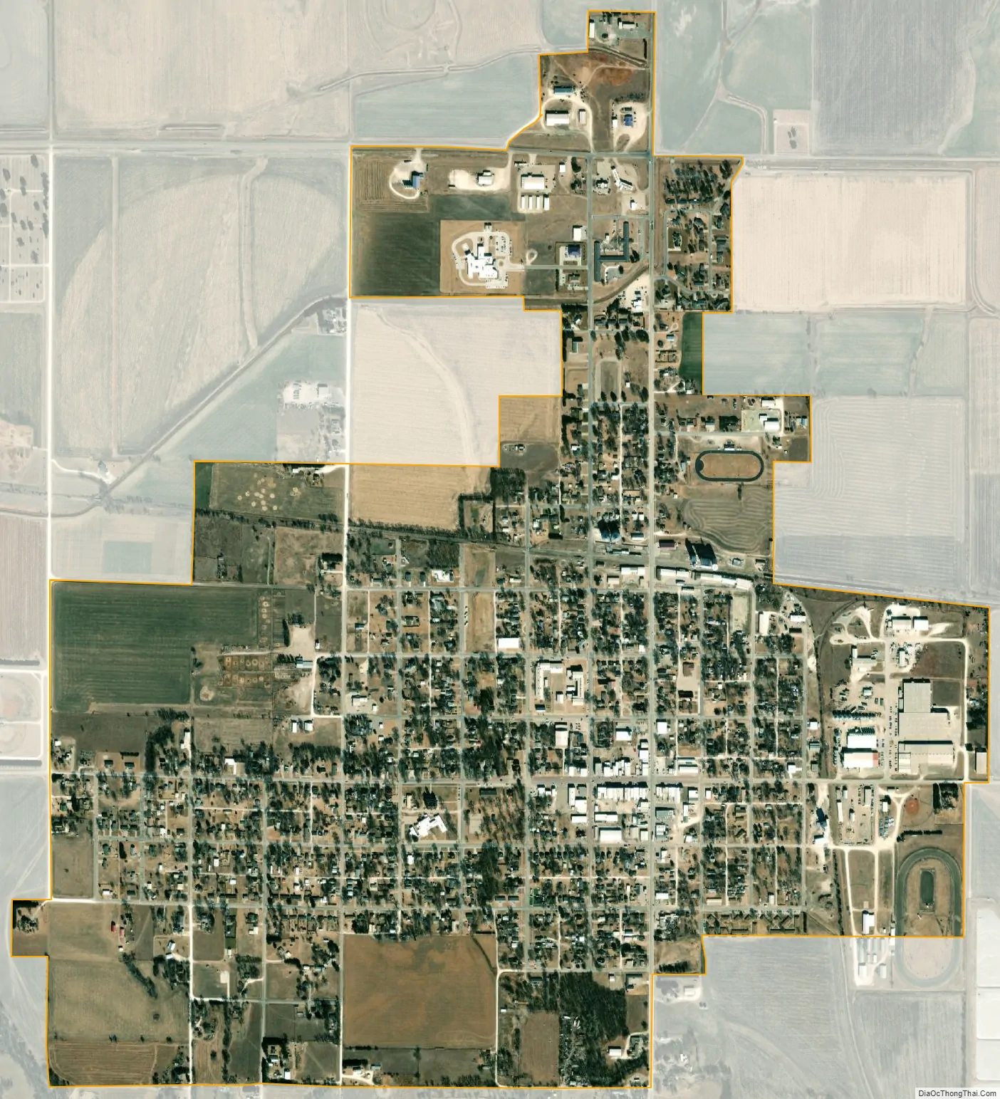
Osborne city Satellite Map
Geography
Osborne is located at 39°26′26″N 98°41′50″W / 39.44056°N 98.69722°W / 39.44056; -98.69722 (39.440651, -98.697118), at an elevation of 1,552 feet (473 m). Located at the intersection of U.S. Route 281 and U.S. Route 24 in north-central Kansas, it is approximately 134 miles (216 km) northwest of Wichita, 219 miles (352 km) west-northwest of Kansas City, and 339 miles (546 km) east of Denver.
Osborne lies on the north side of the South Fork Solomon River in the Smoky Hills region of the Great Plains. The Osborne Canal, part of the U.S. Bureau of Reclamation’s Webster Unit Project, runs east along the northern edge of the city.
According to the United States Census Bureau, the city has a total area of 1.56 square miles (4.04 km), all of it land.
Climate
On average in Osborne, July is the warmest month, January is the coldest month, and May is the wettest month. The hottest temperature recorded in Osborne was 116 °F (47 °C) in 1940; the coldest temperature recorded was -31 °F (-35 °C) in 1989.
See also
Map of Kansas State and its subdivision:- Allen
- Anderson
- Atchison
- Barber
- Barton
- Bourbon
- Brown
- Butler
- Chase
- Chautauqua
- Cherokee
- Cheyenne
- Clark
- Clay
- Cloud
- Coffey
- Comanche
- Cowley
- Crawford
- Decatur
- Dickinson
- Doniphan
- Douglas
- Edwards
- Elk
- Ellis
- Ellsworth
- Finney
- Ford
- Franklin
- Geary
- Gove
- Graham
- Grant
- Gray
- Greeley
- Greenwood
- Hamilton
- Harper
- Harvey
- Haskell
- Hodgeman
- Jackson
- Jefferson
- Jewell
- Johnson
- Kearny
- Kingman
- Kiowa
- Labette
- Lane
- Leavenworth
- Lincoln
- Linn
- Logan
- Lyon
- Marion
- Marshall
- McPherson
- Meade
- Miami
- Mitchell
- Montgomery
- Morris
- Morton
- Nemaha
- Neosho
- Ness
- Norton
- Osage
- Osborne
- Ottawa
- Pawnee
- Phillips
- Pottawatomie
- Pratt
- Rawlins
- Reno
- Republic
- Rice
- Riley
- Rooks
- Rush
- Russell
- Saline
- Scott
- Sedgwick
- Seward
- Shawnee
- Sheridan
- Sherman
- Smith
- Stafford
- Stanton
- Stevens
- Sumner
- Thomas
- Trego
- Wabaunsee
- Wallace
- Washington
- Wichita
- Wilson
- Woodson
- Wyandotte
- Alabama
- Alaska
- Arizona
- Arkansas
- California
- Colorado
- Connecticut
- Delaware
- District of Columbia
- Florida
- Georgia
- Hawaii
- Idaho
- Illinois
- Indiana
- Iowa
- Kansas
- Kentucky
- Louisiana
- Maine
- Maryland
- Massachusetts
- Michigan
- Minnesota
- Mississippi
- Missouri
- Montana
- Nebraska
- Nevada
- New Hampshire
- New Jersey
- New Mexico
- New York
- North Carolina
- North Dakota
- Ohio
- Oklahoma
- Oregon
- Pennsylvania
- Rhode Island
- South Carolina
- South Dakota
- Tennessee
- Texas
- Utah
- Vermont
- Virginia
- Washington
- West Virginia
- Wisconsin
- Wyoming