Abita Springs is a town in St. Tammany Parish, Louisiana, United States. The population was 2,365 at the 2010 census, up from 1,957 in 2000. It is part of the New Orleans–Metairie–Kenner Metropolitan Statistical Area.
| Name: | Abita Springs town |
|---|---|
| LSAD Code: | 43 |
| LSAD Description: | town (suffix) |
| State: | Louisiana |
| County: | St. Tammany Parish |
| Incorporated: | 1903 |
| Total Area: | 4.60 sq mi (11.91 km²) |
| Land Area: | 4.59 sq mi (11.88 km²) |
| Water Area: | 0.01 sq mi (0.02 km²) |
| Total Population: | 2,631 |
| Population Density: | 573.45/sq mi (221.39/km²) |
| Area code: | 985 |
| FIPS code: | 2200240 |
| Website: | www.townofabitasprings.com |
Online Interactive Map
Click on ![]() to view map in "full screen" mode.
to view map in "full screen" mode.
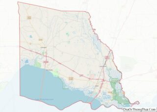
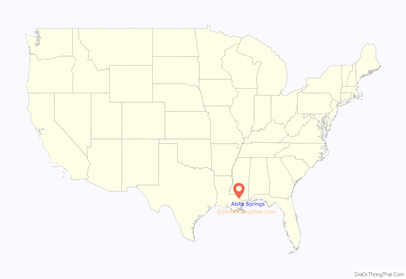
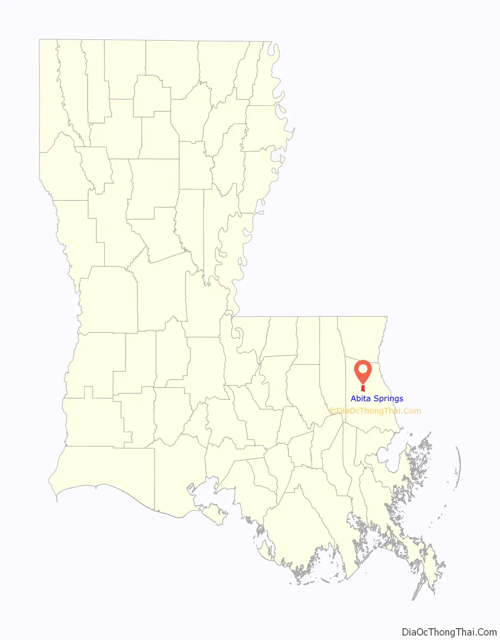
Abita Springs location map. Where is Abita Springs town?
History
Abita Springs was originally a Choctaw Indian village, taking its name from nearby medicinal springs. The Choctaw burial and execution grounds, which were in use up until around 1880, are located nearby.
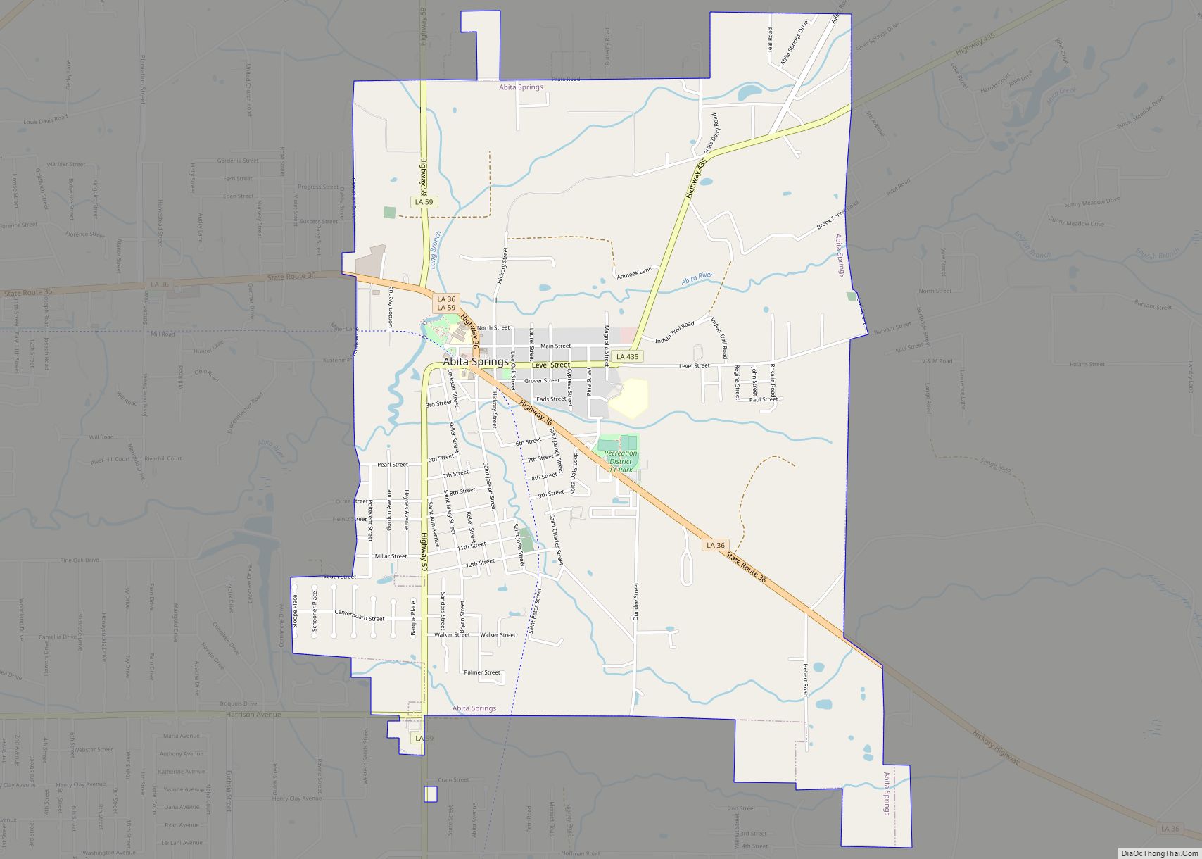
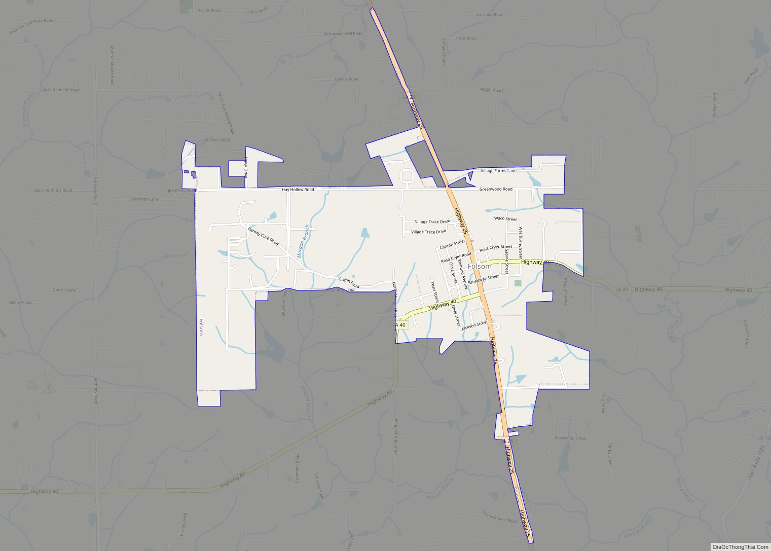
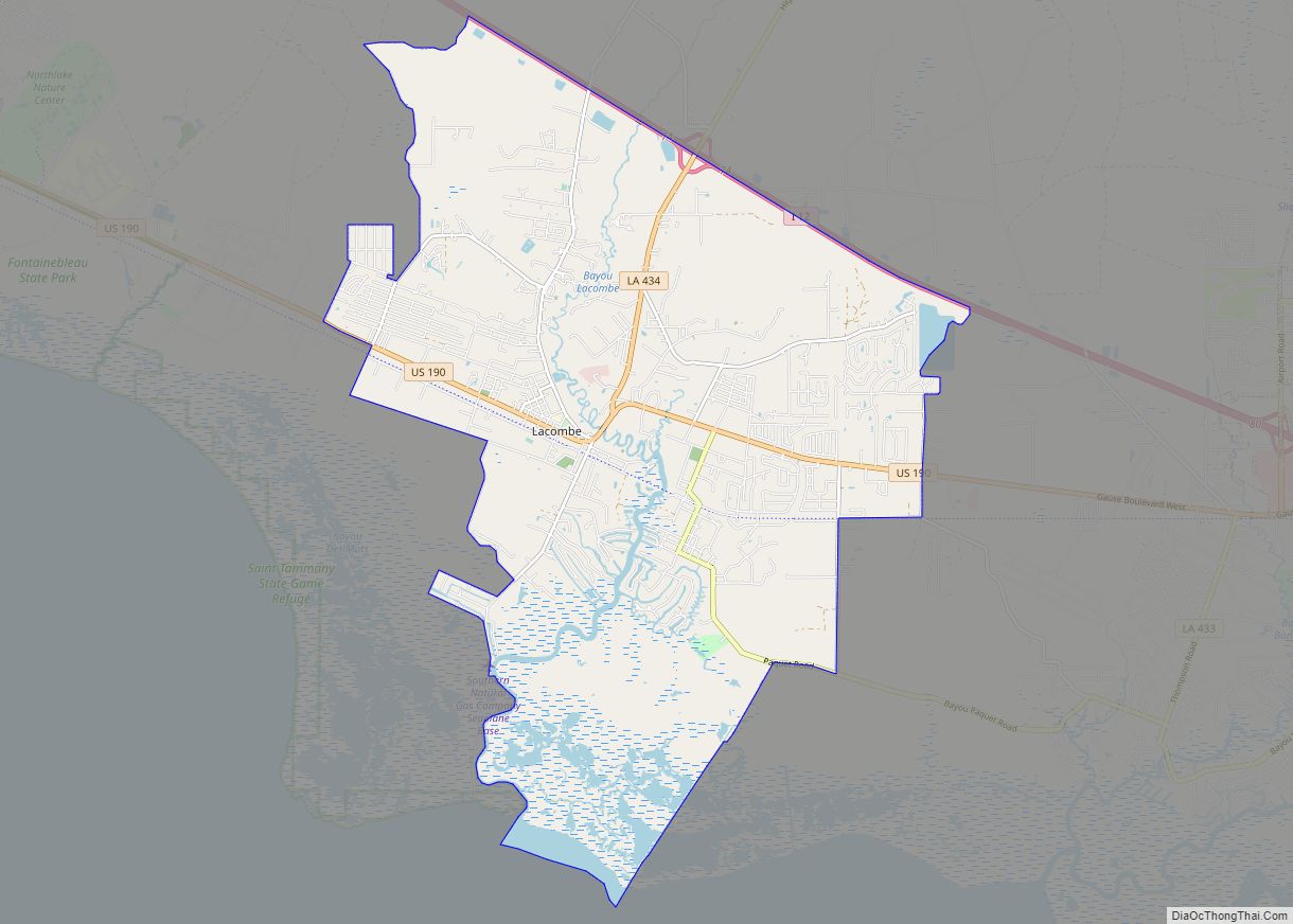
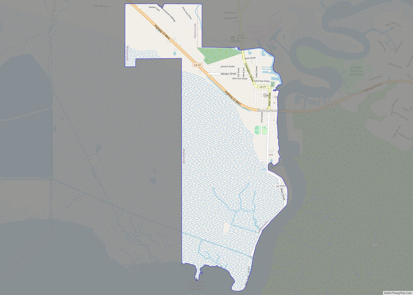
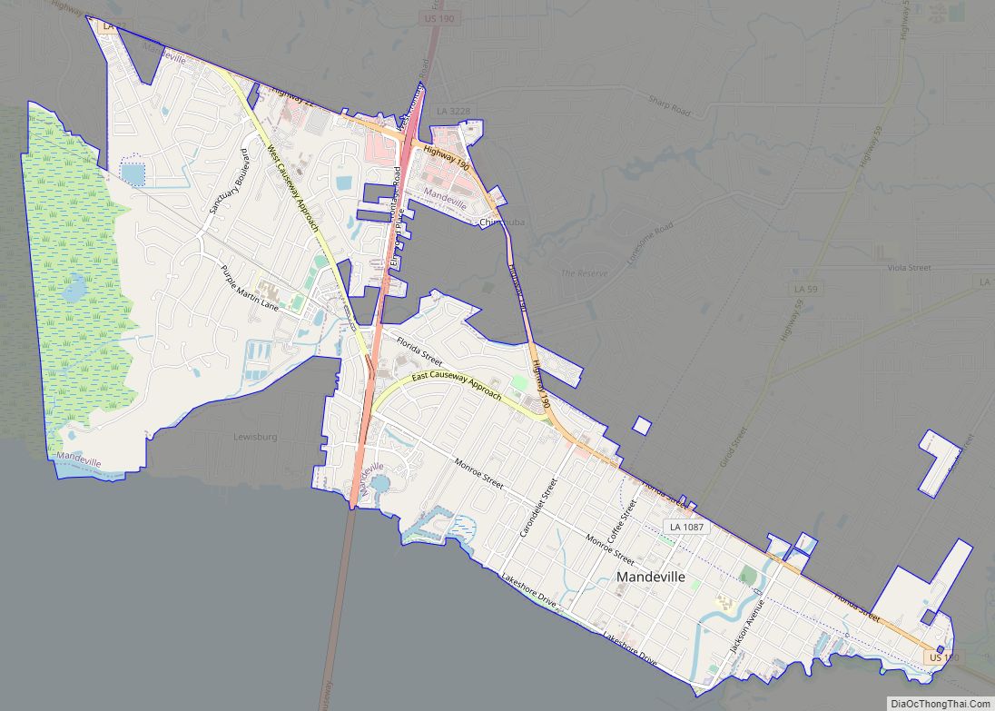
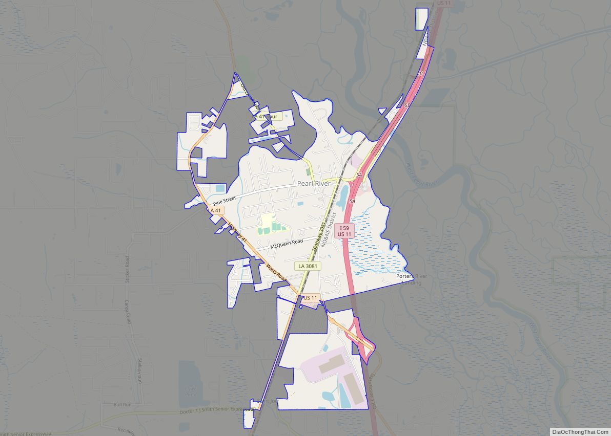
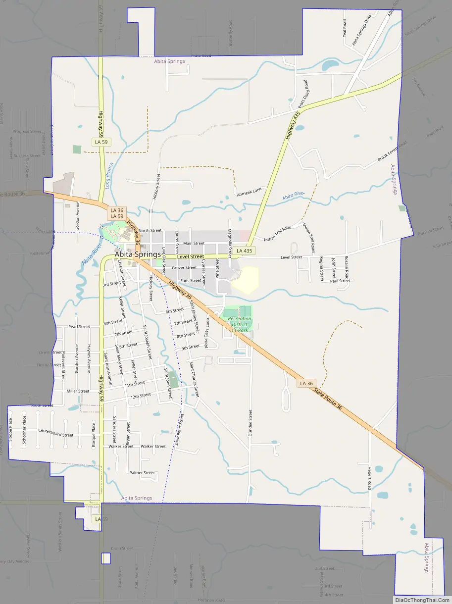
Abita Springs Road Map
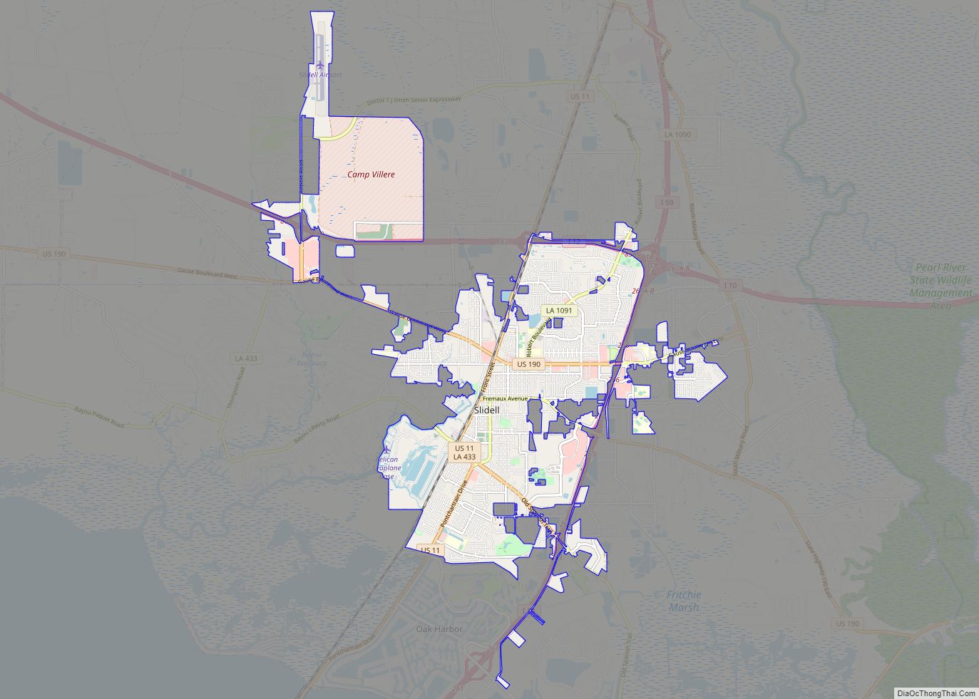
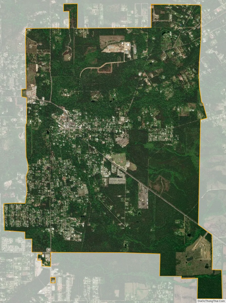
Abita Springs city Satellite Map
Geography
Abita Springs is located at 30°28′34″N 90°2′6″W / 30.47611°N 90.03500°W / 30.47611; -90.03500 (30.476233, -90.035138).
According to the United States Census Bureau, the town has a total area of 4.5 square miles (11.6 km), all land.
See also
Map of Louisiana State and its subdivision:- Acadia
- Allen
- Ascension
- Assumption
- Avoyelles
- Beauregard
- Bienville
- Bossier
- Caddo
- Calcasieu
- Caldwell
- Cameron
- Catahoula
- Claiborne
- Concordia
- De Soto
- East Baton Rouge
- East Carroll
- East Feliciana
- Evangeline
- Franklin
- Grant
- Iberia
- Iberville
- Jackson
- Jefferson
- Jefferson Davis
- La Salle
- Lafayette
- Lafourche
- Lincoln
- Livingston
- Madison
- Morehouse
- Natchitoches
- Orleans
- Ouachita
- Plaquemines
- Pointe Coupee
- Rapides
- Red River
- Richland
- Sabine
- Saint Bernard
- Saint Charles
- Saint Helena
- Saint James
- Saint John the Baptist
- Saint Landry
- Saint Martin
- Saint Mary
- Saint Tammany
- Tangipahoa
- Tensas
- Terrebonne
- Union
- Vermilion
- Vernon
- Washington
- Webster
- West Baton Rouge
- West Carroll
- West Feliciana
- Winn
- Alabama
- Alaska
- Arizona
- Arkansas
- California
- Colorado
- Connecticut
- Delaware
- District of Columbia
- Florida
- Georgia
- Hawaii
- Idaho
- Illinois
- Indiana
- Iowa
- Kansas
- Kentucky
- Louisiana
- Maine
- Maryland
- Massachusetts
- Michigan
- Minnesota
- Mississippi
- Missouri
- Montana
- Nebraska
- Nevada
- New Hampshire
- New Jersey
- New Mexico
- New York
- North Carolina
- North Dakota
- Ohio
- Oklahoma
- Oregon
- Pennsylvania
- Rhode Island
- South Carolina
- South Dakota
- Tennessee
- Texas
- Utah
- Vermont
- Virginia
- Washington
- West Virginia
- Wisconsin
- Wyoming