Slidell /slaɪˈdɛl/ is a city on the northeast shore of Lake Pontchartrain in St. Tammany Parish, Louisiana, United States. The population was 28,781 at the 2020 census. It is part of the New Orleans−Metairie−Kenner metropolitan statistical area.
| Name: | Slidell city |
|---|---|
| LSAD Code: | 25 |
| LSAD Description: | city (suffix) |
| State: | Louisiana |
| County: | St. Tammany Parish |
| Total Area: | 15.38 sq mi (39.83 km²) |
| Land Area: | 15.04 sq mi (38.96 km²) |
| Water Area: | 0.34 sq mi (0.87 km²) |
| Total Population: | 28,781 |
| Population Density: | 1,913.50/sq mi (738.82/km²) |
| ZIP code: | 70458, 70459, 70460, 70461, 70469 |
| Area code: | 985 |
| FIPS code: | 2270805 |
| Website: | myslidell.com |
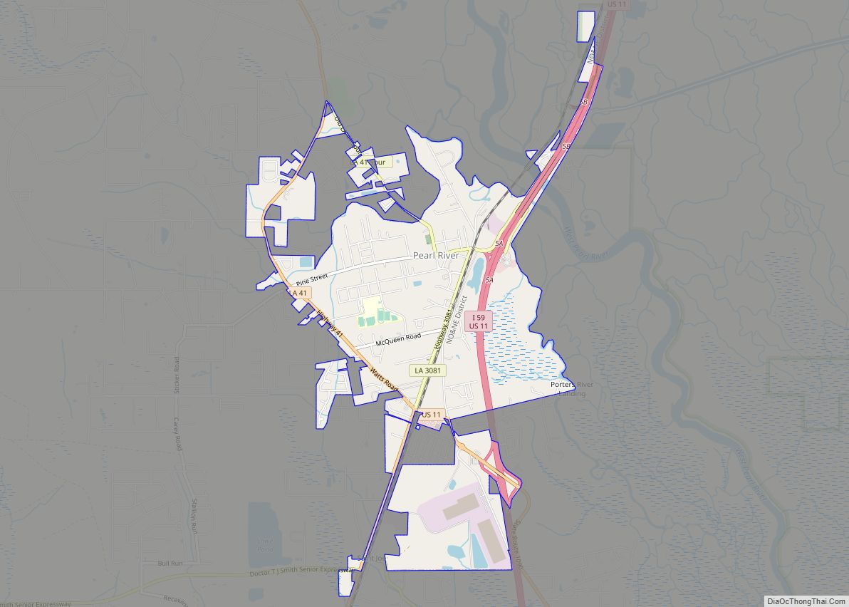
Online Interactive Map
Click on ![]() to view map in "full screen" mode.
to view map in "full screen" mode.
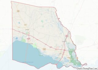
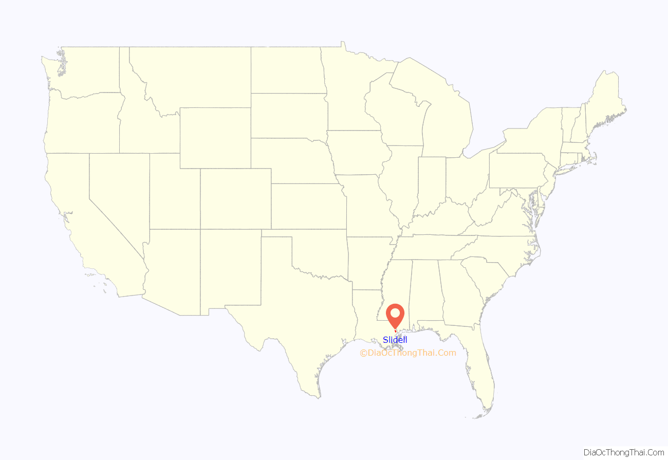
Slidell location map. Where is Slidell city?
History
Beginning
One of the earlier settlers to the area was Foster Willie. Along with a younger brother, Wesley Coke Asbury Gause, Judge Wingate, and several others, he left Shallotte, North Carolina, on February 18, and arrived at Pearlington, Mississippi, on April 14, 1836. Wesley and his family remained there, while John and family crossed the Pearl River and built a log cabin on the west bank, a little further south. He then began a lumber mill in the fledgling town later known as Slidell. His traveling back and forth from lumber yard to home created a road known today as Gause Boulevard, a major east–west street in the town. The lumber yard was where Gause Boulevard crosses the railroad track. The log cabin was built at the east end of the road, just a few yards from the river. The house stood until the late 1990s, and a small family burial plot still remains where John is buried between his two wives, Lydia Russ and Johanna Frederica VanHeemskerk.
Slidell was founded on the north shore of Lake Pontchartrain in 1882 and 1883 during construction of the New Orleans and Northeastern Railroad (N.O.N.E.). The N.O.N.E. line connected New Orleans to Meridian, Mississippi. The town was named in honor of American politician and Confederate ambassador to France John Slidell, and officially chartered by the Louisiana State Legislature in 1888.
20th century and beyond
Around 1910, Slidell began a period of economic and industrial growth. A large creosote plant was built, and Slidell became home to the Fritz Salmen Brickyard, a major producer of bricks later named St. Joe Brick. A lumber mill and shipyard were also built. Following the construction of Interstate 10, Interstate 59, and Interstate 12, Slidell became a major crossroads for those traversing the Gulf States.
In 1915, the creosote plant burned to the ground. The plant was rebuilt on Bayou Lane, closer to a water source and a fire station. Eventually, creosote polluted the bayou, a source of drinking water for many of Slidell’s residents. The creosote plant was abandoned in 1986 and became an EPA Superfund site. The canal was dredged and waste incinerated until completion of the cleanup in the 1990s. At that time a boat launch was built and Heritage Park was constructed on the former site.
With the advent of the U.S. space program in the 1960s, NASA opened the Michoud Assembly Facility in New Orleans, the John C. Stennis Space Center in nearby Bay St. Louis, Mississippi, and a NASA computer center on Gause Boulevard. This nearly tripled Slidell’s population over ten years, and the city became a major suburb of New Orleans. The National Weather Service forecast office for the New Orleans and Baton Rouge area is also in Slidell. Slidell is the headquarters of Vesco Tennis Courts, a privately held firm specializing in construction of hard surfaces for outdoor sports facilities.
The city has hosted several parade krewes each Carnival season.
On August 29, 2005, Slidell suffered extensive damage from Hurricane Katrina, as the storm made final landfall on the morning of August 29, 2005. The municipal area is about 2 miles (3 km) inland, and parts of the city experienced a storm surge in excess of 10 feet (3.0 m). The unincorporated areas of St. Tammany Parish, to the south and east, often called Slidell, experienced a storm surge of 13 to 16 feet (4.0 to 4.9 m).
Slidell Museum
The Slidell Museum is a small museum that highlights the founding of the city as a railroad town. Located in Olde Town Slidell on 1st Street, the museum is open Tuesday through Saturday. Admission is free to the public.
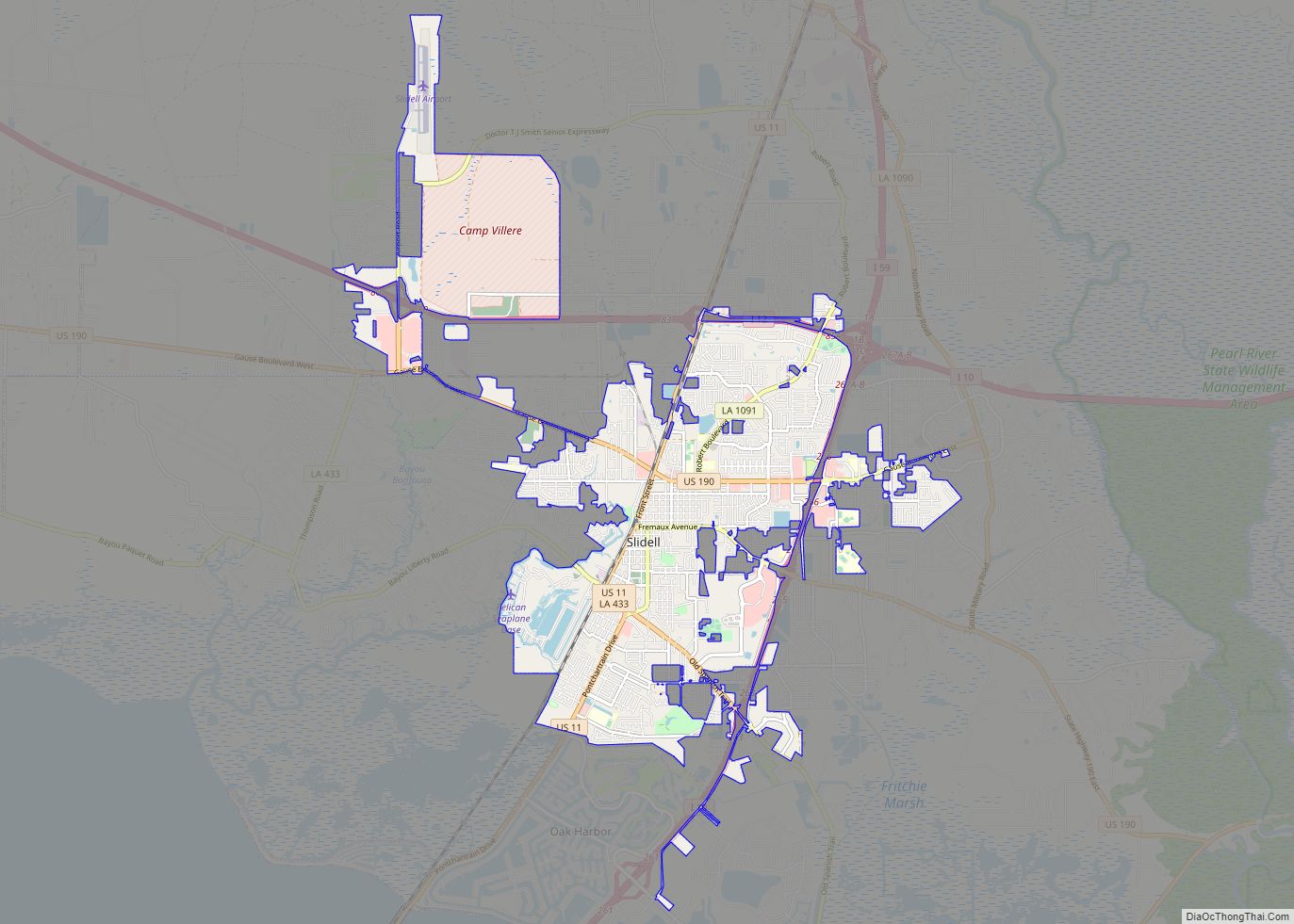
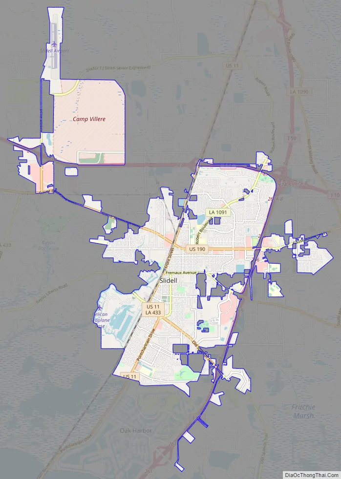
Slidell Road Map
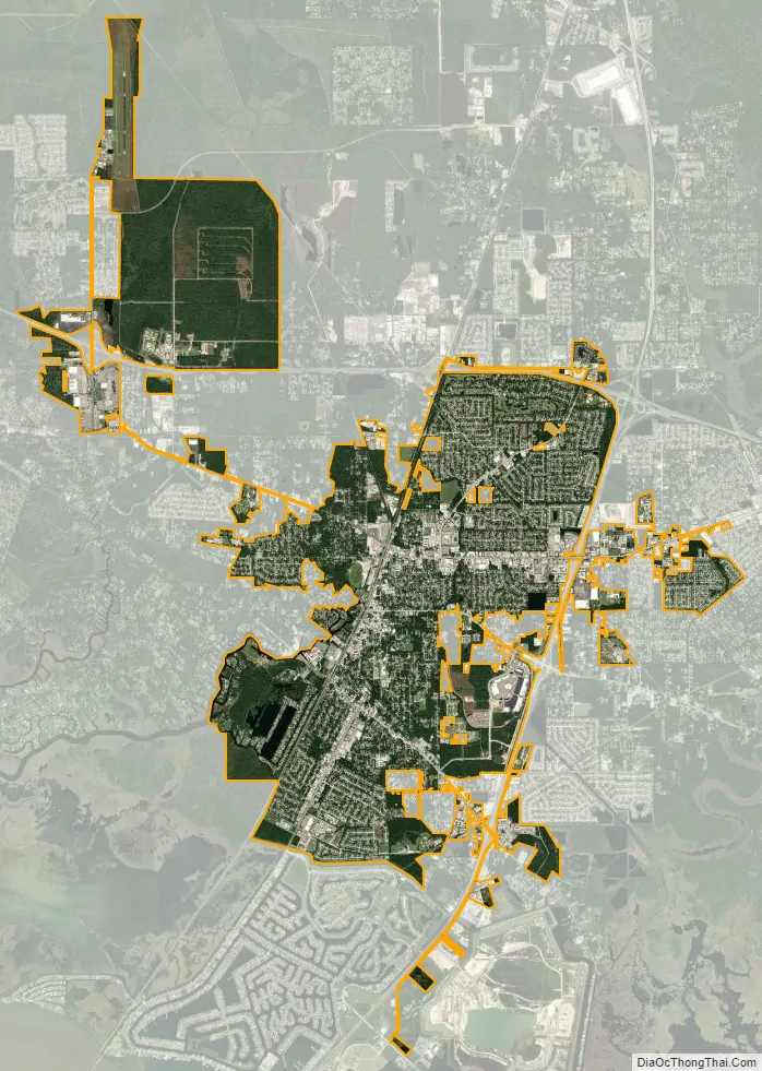
Slidell city Satellite Map
Geography
Slidell is located at 30°16′45″N 89°46′40″W / 30.27917°N 89.77778°W / 30.27917; -89.77778 (30.279040, -89.777744), and has an elevation of 13 feet (4.0 m). It is in southeastern St. Tammany Parish, located approximately 3 miles (5 km) north of Lake Pontchartrain. The city forms part of the Greater New Orleans area. According to the United States Census Bureau, the city has a total area of 15.2 square miles (39.4 km), of which 14.8 square miles (38.4 km) is land and 0.35 square miles (0.9 km), or 2.39%, is water.
Climate
Slidell has a humid subtropical climate, with short, generally mild winters (slightly cooler than the southshore part of the New Orleans area) and hot, humid summers. Precipitation in winter usually accompanies the passage of a cold front. Hurricanes pose a threat to the area, and the city is vulnerable because of its low elevation.
See also
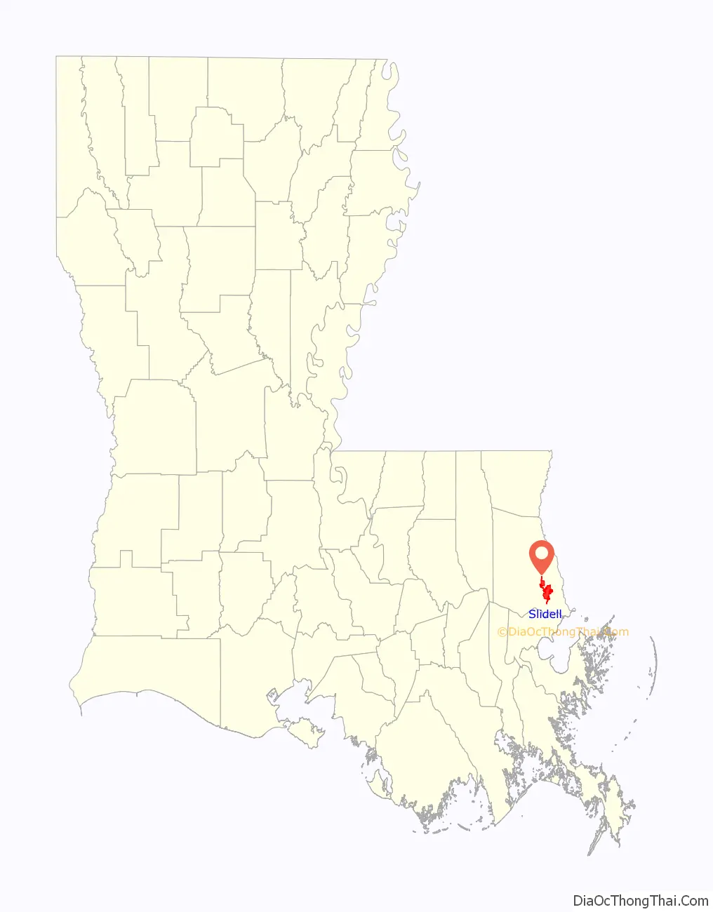
Map of Louisiana State and its subdivision:- Acadia
- Allen
- Ascension
- Assumption
- Avoyelles
- Beauregard
- Bienville
- Bossier
- Caddo
- Calcasieu
- Caldwell
- Cameron
- Catahoula
- Claiborne
- Concordia
- De Soto
- East Baton Rouge
- East Carroll
- East Feliciana
- Evangeline
- Franklin
- Grant
- Iberia
- Iberville
- Jackson
- Jefferson
- Jefferson Davis
- La Salle
- Lafayette
- Lafourche
- Lincoln
- Livingston
- Madison
- Morehouse
- Natchitoches
- Orleans
- Ouachita
- Plaquemines
- Pointe Coupee
- Rapides
- Red River
- Richland
- Sabine
- Saint Bernard
- Saint Charles
- Saint Helena
- Saint James
- Saint John the Baptist
- Saint Landry
- Saint Martin
- Saint Mary
- Saint Tammany
- Tangipahoa
- Tensas
- Terrebonne
- Union
- Vermilion
- Vernon
- Washington
- Webster
- West Baton Rouge
- West Carroll
- West Feliciana
- Winn
- Alabama
- Alaska
- Arizona
- Arkansas
- California
- Colorado
- Connecticut
- Delaware
- District of Columbia
- Florida
- Georgia
- Hawaii
- Idaho
- Illinois
- Indiana
- Iowa
- Kansas
- Kentucky
- Louisiana
- Maine
- Maryland
- Massachusetts
- Michigan
- Minnesota
- Mississippi
- Missouri
- Montana
- Nebraska
- Nevada
- New Hampshire
- New Jersey
- New Mexico
- New York
- North Carolina
- North Dakota
- Ohio
- Oklahoma
- Oregon
- Pennsylvania
- Rhode Island
- South Carolina
- South Dakota
- Tennessee
- Texas
- Utah
- Vermont
- Virginia
- Washington
- West Virginia
- Wisconsin
- Wyoming