Jefferson City is an unincorporated community and census-designated place (CDP) in Jefferson County, Montana, United States. The population was 472 at the 2010 census. It is part of the Helena Micropolitan Statistical Area.
The community began as a stop along the Fort Benton and Virginia City stage line. It took its name when Jefferson County was named one of Montana Territory’s original counties on February 2, 1865.
Summer activities include the Tizer Botanic Gardens & Arboretum with its 100 varieties of roses and 150 varieties of clematis.
| Name: | Jefferson City CDP |
|---|---|
| LSAD Code: | 57 |
| LSAD Description: | CDP (suffix) |
| State: | Montana |
| County: | Jefferson County |
| Elevation: | 4,564 ft (1,391 m) |
| Total Area: | 23.22 sq mi (60.13 km²) |
| Land Area: | 23.22 sq mi (60.13 km²) |
| Water Area: | 0.00 sq mi (0.00 km²) |
| Total Population: | 597 |
| Population Density: | 25.71/sq mi (9.93/km²) |
| ZIP code: | 59638 |
| Area code: | 406 |
| FIPS code: | 3039400 |
| GNISfeature ID: | 0785437 |
Online Interactive Map
Click on ![]() to view map in "full screen" mode.
to view map in "full screen" mode.
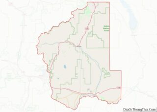
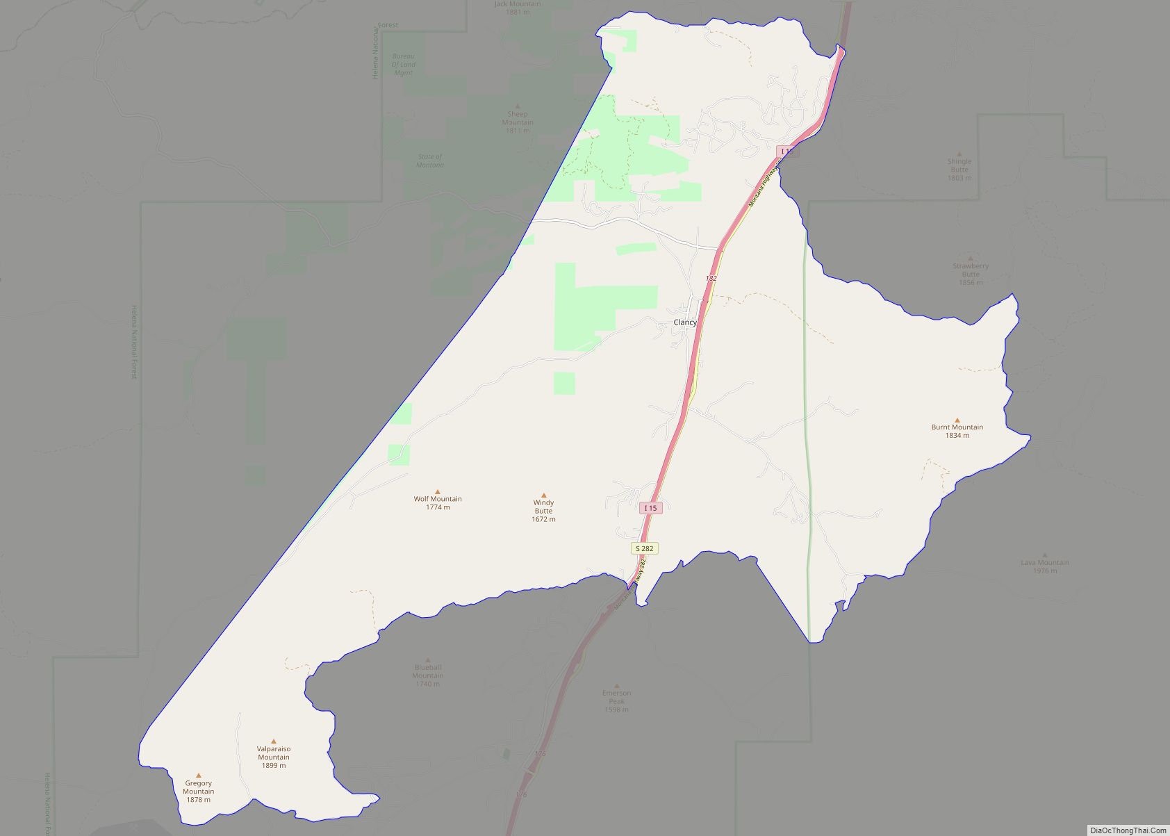
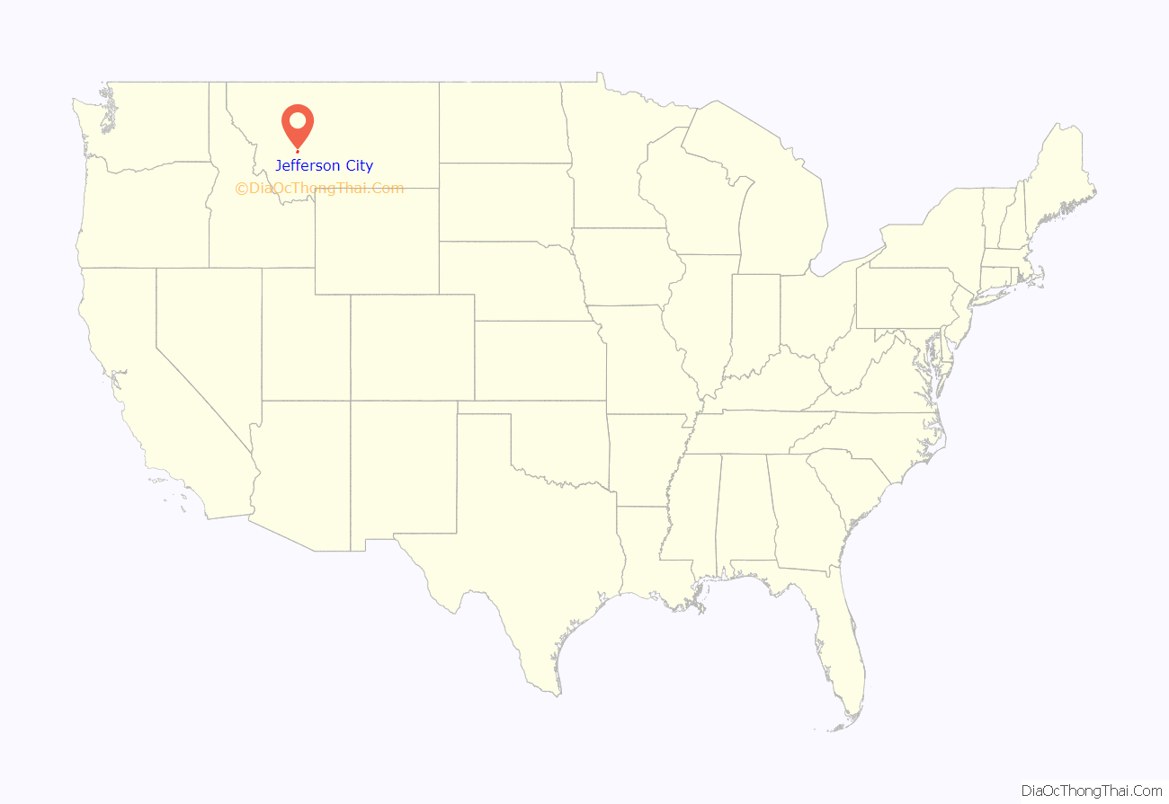
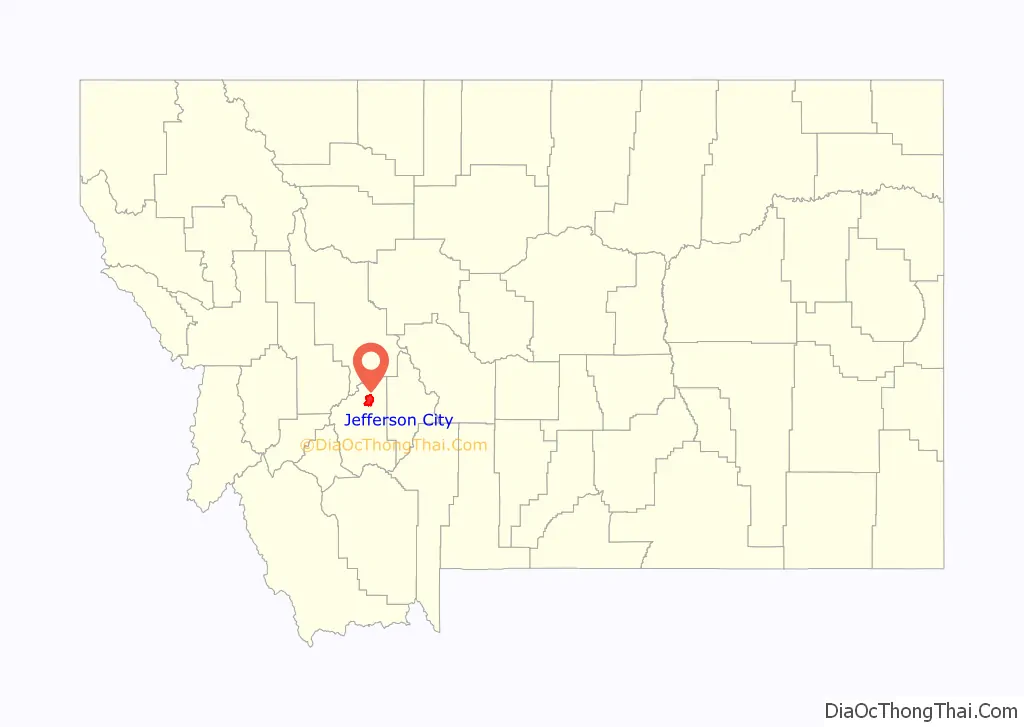
Jefferson City location map. Where is Jefferson City CDP?
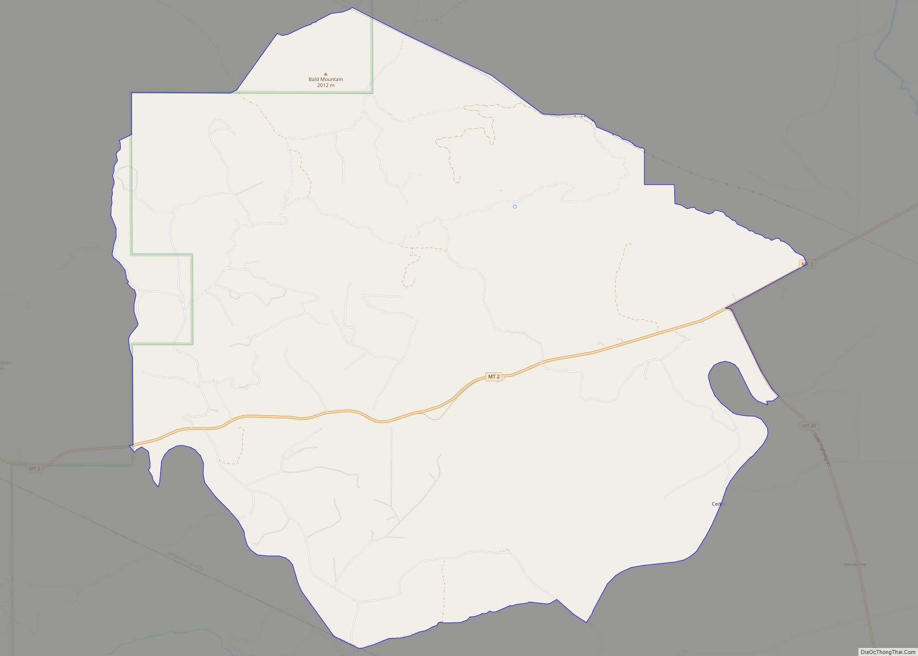
Jefferson City Road Map

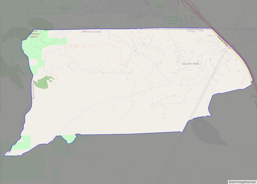
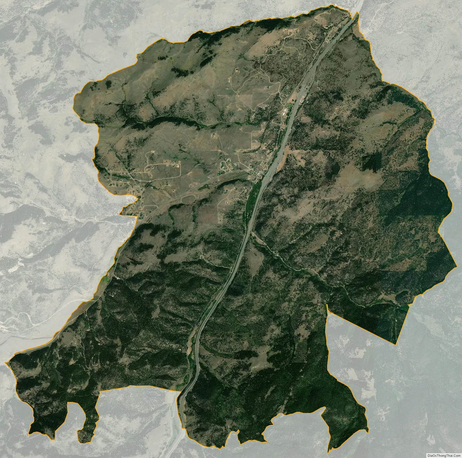
Jefferson City city Satellite Map
Geography
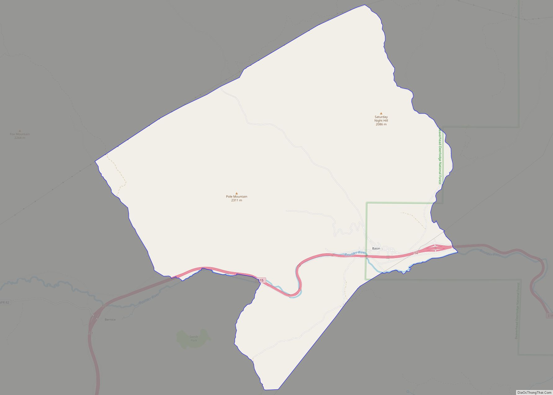
Jefferson City is located in northern Jefferson County at 46°23′12″N 112°02′28″W / 46.386685°N 112.041154°W / 46.386685; -112.041154 (46.386685, -112.041154), in the valley of Prickly Pear Creek. It is bordered to the north by Clancy. Interstate 15 passes through the community, with access from Exit 176. I-15 leads north 18 miles (29 km) to Helena and south 12 miles (19 km) to Boulder, the Jefferson county seat.
According to the United States Census Bureau, the Jefferson City CDP has a total area of 23.2 square miles (60.1 km), all land.
See also
Map of Montana State and its subdivision:- Beaverhead
- Big Horn
- Blaine
- Broadwater
- Carbon
- Carter
- Cascade
- Chouteau
- Custer
- Daniels
- Dawson
- Deer Lodge
- Fallon
- Fergus
- Flathead
- Gallatin
- Garfield
- Glacier
- Golden Valley
- Granite
- Hill
- Jefferson
- Judith Basin
- Lake
- Lewis and Clark
- Liberty
- Lincoln
- Madison
- McCone
- Meagher
- Mineral
- Missoula
- Musselshell
- Park
- Petroleum
- Phillips
- Pondera
- Powder River
- Powell
- Prairie
- Ravalli
- Richland
- Roosevelt
- Rosebud
- Sanders
- Sheridan
- Silver Bow
- Stillwater
- Sweet Grass
- Teton
- Toole
- Treasure
- Valley
- Wheatland
- Wibaux
- Yellowstone
- Alabama
- Alaska
- Arizona
- Arkansas
- California
- Colorado
- Connecticut
- Delaware
- District of Columbia
- Florida
- Georgia
- Hawaii
- Idaho
- Illinois
- Indiana
- Iowa
- Kansas
- Kentucky
- Louisiana
- Maine
- Maryland
- Massachusetts
- Michigan
- Minnesota
- Mississippi
- Missouri
- Montana
- Nebraska
- Nevada
- New Hampshire
- New Jersey
- New Mexico
- New York
- North Carolina
- North Dakota
- Ohio
- Oklahoma
- Oregon
- Pennsylvania
- Rhode Island
- South Carolina
- South Dakota
- Tennessee
- Texas
- Utah
- Vermont
- Virginia
- Washington
- West Virginia
- Wisconsin
- Wyoming