West Havre is a census-designated place (CDP) in Hill County, Montana, United States. The population was 316 at the 2010 census, up from 284 in 2000.
| Name: | West Havre CDP |
|---|---|
| LSAD Code: | 57 |
| LSAD Description: | CDP (suffix) |
| State: | Montana |
| County: | Hill County |
| Elevation: | 2,612 ft (796 m) |
| Total Area: | 1.89 sq mi (4.90 km²) |
| Land Area: | 1.89 sq mi (4.90 km²) |
| Water Area: | 0.00 sq mi (0.00 km²) |
| Total Population: | 290 |
| Population Density: | 153.28/sq mi (59.19/km²) |
| Area code: | 406 |
| FIPS code: | 3079098 |
| GNISfeature ID: | 1853192 |
Online Interactive Map
Click on ![]() to view map in "full screen" mode.
to view map in "full screen" mode.
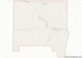
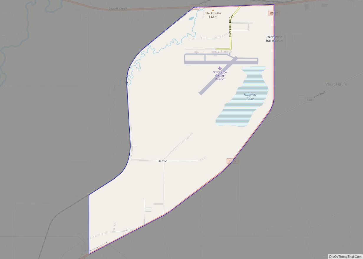
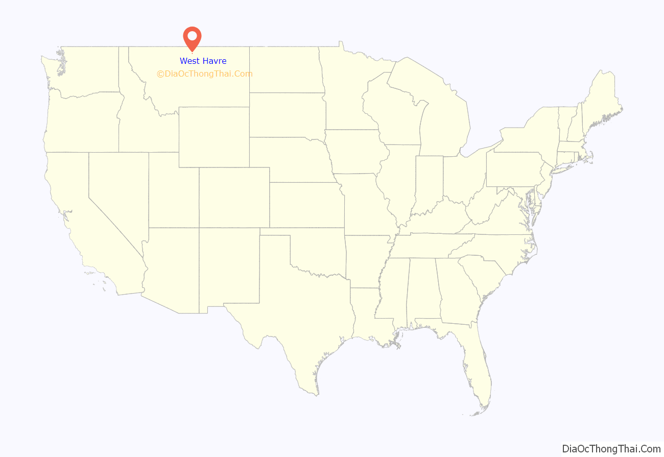
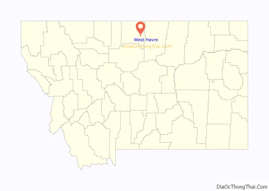
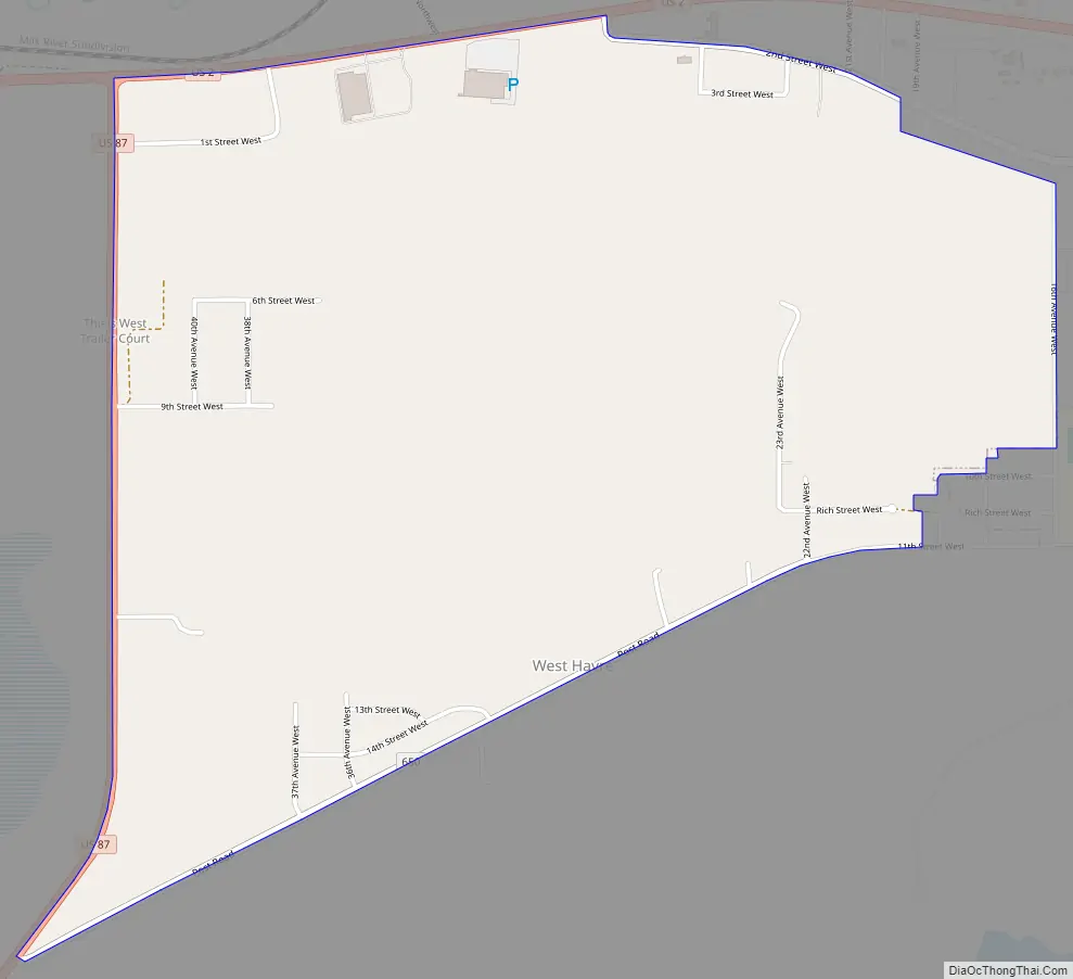
West Havre location map. Where is West Havre CDP?
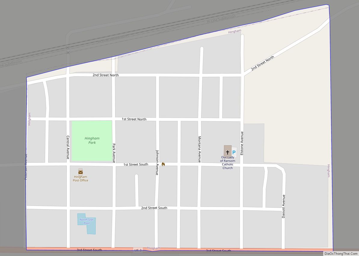
West Havre Road Map
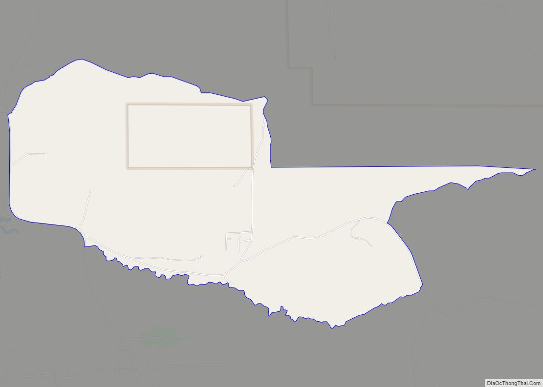
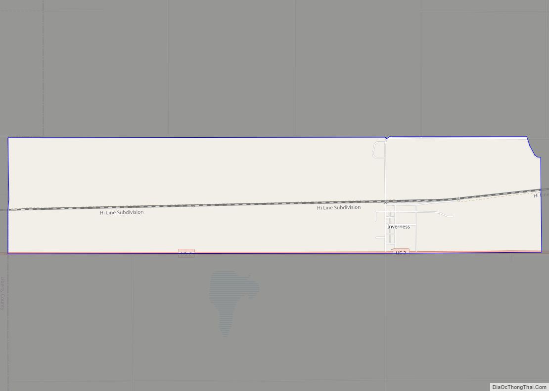
West Havre city Satellite Map

Geography
West Havre is located in eastern Hill County at 48°32′17″N 109°44′2″W / 48.53806°N 109.73389°W / 48.53806; -109.73389 (48.537996, -109.733872). It is bordered to the east by the city of Havre, and to the west by unincorporated Herron. U.S. Route 2 forms the northern edge of the West Havre CDP, leading east into Havre and west 100 miles (161 km) to Shelby. U.S. Route 87 has its northern terminus at US 2 at the northwest corner of West Havre, and leads southwest 110 miles (180 km) to Great Falls.
According to the United States Census Bureau, the West Havre CDP has a total area of 1.9 square miles (4.9 km), all land.
See also
Map of Montana State and its subdivision:- Beaverhead
- Big Horn
- Blaine
- Broadwater
- Carbon
- Carter
- Cascade
- Chouteau
- Custer
- Daniels
- Dawson
- Deer Lodge
- Fallon
- Fergus
- Flathead
- Gallatin
- Garfield
- Glacier
- Golden Valley
- Granite
- Hill
- Jefferson
- Judith Basin
- Lake
- Lewis and Clark
- Liberty
- Lincoln
- Madison
- McCone
- Meagher
- Mineral
- Missoula
- Musselshell
- Park
- Petroleum
- Phillips
- Pondera
- Powder River
- Powell
- Prairie
- Ravalli
- Richland
- Roosevelt
- Rosebud
- Sanders
- Sheridan
- Silver Bow
- Stillwater
- Sweet Grass
- Teton
- Toole
- Treasure
- Valley
- Wheatland
- Wibaux
- Yellowstone
- Alabama
- Alaska
- Arizona
- Arkansas
- California
- Colorado
- Connecticut
- Delaware
- District of Columbia
- Florida
- Georgia
- Hawaii
- Idaho
- Illinois
- Indiana
- Iowa
- Kansas
- Kentucky
- Louisiana
- Maine
- Maryland
- Massachusetts
- Michigan
- Minnesota
- Mississippi
- Missouri
- Montana
- Nebraska
- Nevada
- New Hampshire
- New Jersey
- New Mexico
- New York
- North Carolina
- North Dakota
- Ohio
- Oklahoma
- Oregon
- Pennsylvania
- Rhode Island
- South Carolina
- South Dakota
- Tennessee
- Texas
- Utah
- Vermont
- Virginia
- Washington
- West Virginia
- Wisconsin
- Wyoming