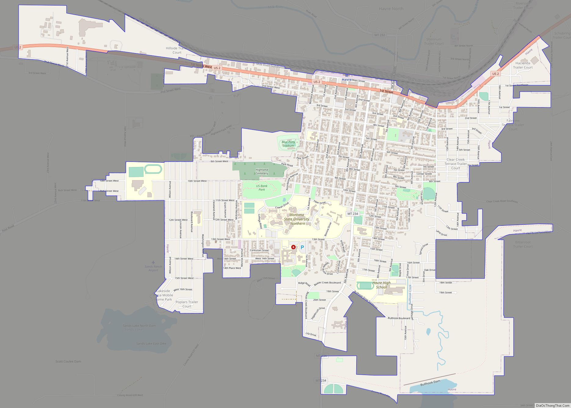
Havre (/ˈhævər/ HAV-ər) is the county seat and largest city in Hill County, Montana, United States. Havre is nicknamed the crown jewel of the Hi-Line. It is said to be named after the city of Le Havre in France. As of the 2020 census the population was 9,362.
| Name: | Havre city |
|---|---|
| LSAD Code: | 25 |
| LSAD Description: | city (suffix) |
| State: | Montana |
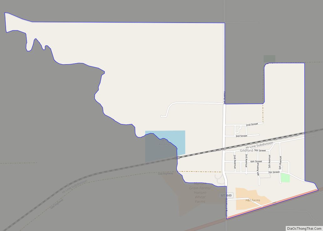
| County: | Hill County |
| Elevation: | 2,536 ft (773 m) |
| Total Area: | 3.71 sq mi (9.61 km²) |
| Land Area: | 3.71 sq mi (9.61 km²) |
| Water Area: | 0.00 sq mi (0.00 km²) |
| Total Population: | 9,362 |
| Population Density: | 2,524.13/sq mi (974.57/km²) |
| ZIP code: | 59501 |
| Area code: | 406 |
| FIPS code: | 3035050 |
| GNISfeature ID: | 0772203 |
| Website: | ci.havre.mt.us |
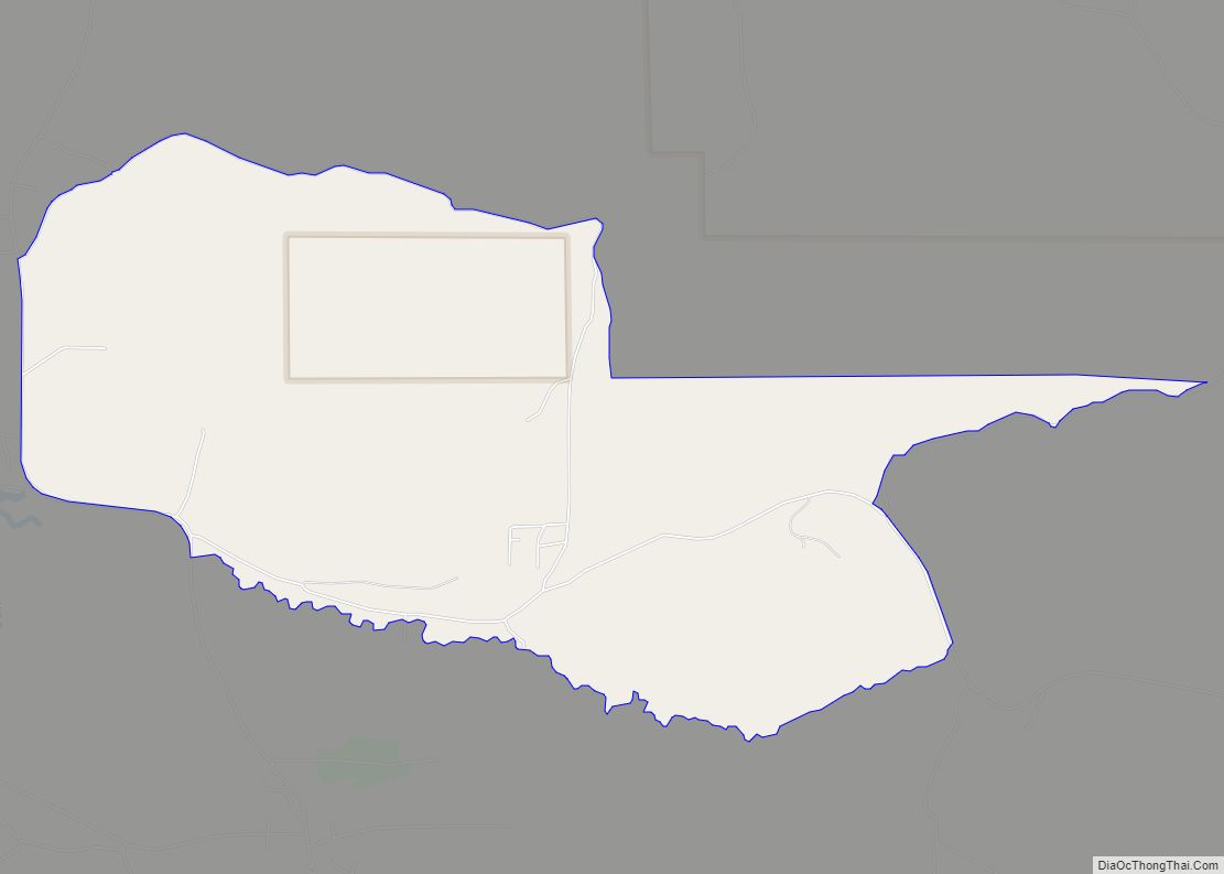
Online Interactive Map
Click on ![]() to view map in "full screen" mode.
to view map in "full screen" mode.
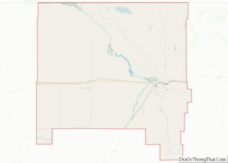
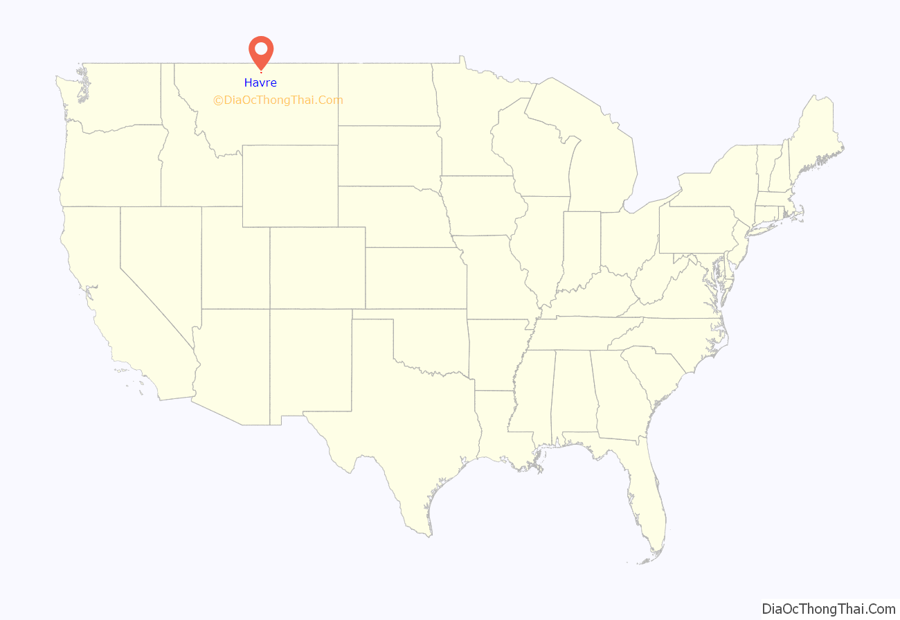
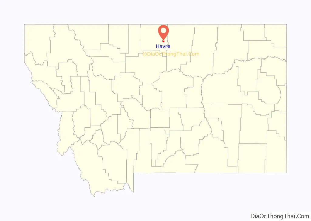
Havre location map. Where is Havre city?
History
Havre was incorporated in north-central Montana on 5 September 1893. In August 1893, twenty-six people voted to incorporate Havre as a city on September 5 of that year. The townsite was platted south of the railroad tracks on parts of Descelles’ and Simon Pepin’s ranches. Like many railroad towns, Havre’s streets were set in a grid formation, with the east–west orientation of the railroad serving as the northern boundary of the town running parallel to the south by Main Street, which fronted the railroad tracks, followed by First through Third Streets. The avenues ran perpendicular to the tracks with Third Avenue running south from the Great Northern depot. The depot served as the gateway to the commercial district of Havre. First Street between Second Avenue and Fourth Avenue served as the main commercial street, and Third Avenue became the main avenue. The buildings in Havre during the 1890s were typical first-generation structures and mainly consisted of tar papered wood-framed shacks. Built close together, these buildings were false-fronted and one story high, with a few scattered one-and-a-half and two-story buildings, like the Windsor Hotel on the south side of First Street between Third and Fourth Avenues.
Along with its annex, the Windsor, at two stories, was the tallest building on First Street until brick structures were constructed in the mid-1890s. Havre had many businesses typical of a frontier town including saloons, barbers, restaurants, Chinese laundries, cobblers, bakeries, mercantiles, hardware stores, and hotels. Havre was founded primarily to serve as a major railroad service center for the Great Northern Railway built by James J. Hill with the city’s location midway between Seattle and Minneapolis-St. Paul. A statue of Hill stands near the Havre Amtrak station to commemorate the key contributions his railroad has made to Havre’s and Montana’s history. Next to the station on display is Great Northern S-2 Class #2584, a 4-8-4 “Northern” type steam locomotive that served the station while it was in passenger service.
Originally named “Bullhook Bottoms”, the town held a series of meetings to determine a new name. The original settlers were given the final decision, and due to a strong French influence, the town was renamed “Havre”. To decide on a new name, the town held a meeting. Though that first meeting ended in a brawl, the second meeting was more successful. There, the citizenry agreed that only the original five homesteaders, Gus Decelles, Exor Pepin (nephew of Simon Pepin), Tom McDevitt, Joe Demars and Charlie Goutchie would be allowed to vote. After several suggestions, including “France” to acknowledge their common heritage, Gus Decelles then suggested Havre after his parents’ hometown of Le Havre, France. “Havre”, which means “the haven or harbor”, won the vote.
Simon Pepin (1840–1914), the “Father of Havre”, was born in Quebec and emigrated to Montana in 1863, where he became a contractor, furnishing supplies for the construction of Fort Custer, Fort Assinniboine, and Fort Maginnis. Pepin purchased ranch land near Fort Assinniboine. When James J. Hill built the Great Northern Railway across northern Montana, he built several locomotive shops on property Pepin owned at the site of Havre. Pepin became a major contributor to Havre’s economic growth through his cattle, real estate, and banking enterprises.
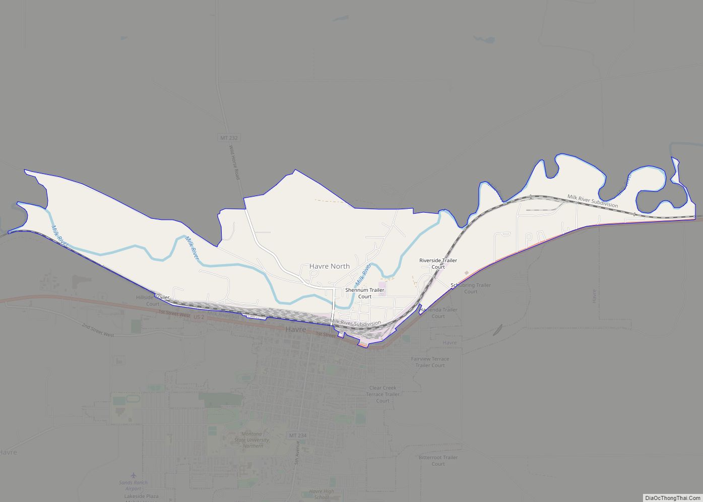
Havre is the eighth-largest city in Montana, and the largest city in the Montana section of the Hi-Line. With the nearest larger city, Great Falls, about 120 miles (190 km) to the south, Havre serves as a medical and business center for the Montana section of the Hi-Line. U.S. Highway 87 has its northern terminus at Havre. U.S. Highway 2, running east–west, is the city’s main street. The largest employers are Northern Montana Hospital, Montana State University–Northern, and the Burlington Northern and Santa Fe Railway (BNSF). Throughout much of the twentieth century, BNSF was the most prominent employer in the city, but the company scaled back its workforce in Havre in the 1990s. The Milk River (tributary of the Missouri River) runs through the town, and the Bears Paw Mountains can be seen to the south.
Small grids of purple squares can be seen in some of the sidewalks downtown. These are skylights for an underground mall built in the city at least a hundred years ago. Throughout its history, this underground area has been host to a brothel, a Chinese laundromat, a saloon, a drugstore, at least three opium dens, and rooms used for smuggling alcohol during Prohibition. When fire destroyed Havre’s business district in 1904, legitimate above-ground businesses joined the illicit businesses operating in the underground while the new brick buildings were built in the streets above. The underground area, now designated “Havre Beneath the Streets”, currently operates as a tourist attraction.
The Wahkpa Chu’gn buffalo jump, or bison kill, is located behind the Holiday Village Shopping Center near the northwest corner of Havre. Over 2,000 years old, it is one of the largest and best-preserved buffalo jumps anywhere. In prehistoric times, Native Americans would drive bison over the edge of the cliff, killing or severely injuring the animals. Afterward, the Native Americans skinned the animals and preserved the meat. The buffalo jump is now an archaeological site and a small tourist attraction.
The buffalo jump is located at the southern edge of the Havre Badlands, a badlands formation that runs alongside the Milk River to the west of the city. Small fossils, including seashells and petrified wood, can be found in the limestone sediment in this area.
Fort Assinniboine is 6 miles (10 km) southwest of Havre. The fort served as one of Montana’s principal military posts from 1879 through the Prohibition era. The fort was one of many used by the United States to protect against potential attacks from Native Americans and to block incursions from Canada. At its peak, the fort housed and employed 489 soldiers in 104 buildings.
Also near Havre is the Bear’s Paw Battlefield site of the Battle of Bear Paw, where the Nez Perce were attacked and defeated by the U.S. Cavalry. Chief Joseph surrendered to the Cavalry and made a famous speech ending with the line, “From where the sun now stands, I will fight no more forever.”
In 2018, two natural-born U.S. citizens were detained by U.S. Customs and Border Protection agents; in 2020, they settled with CBP for an undisclosed sum.
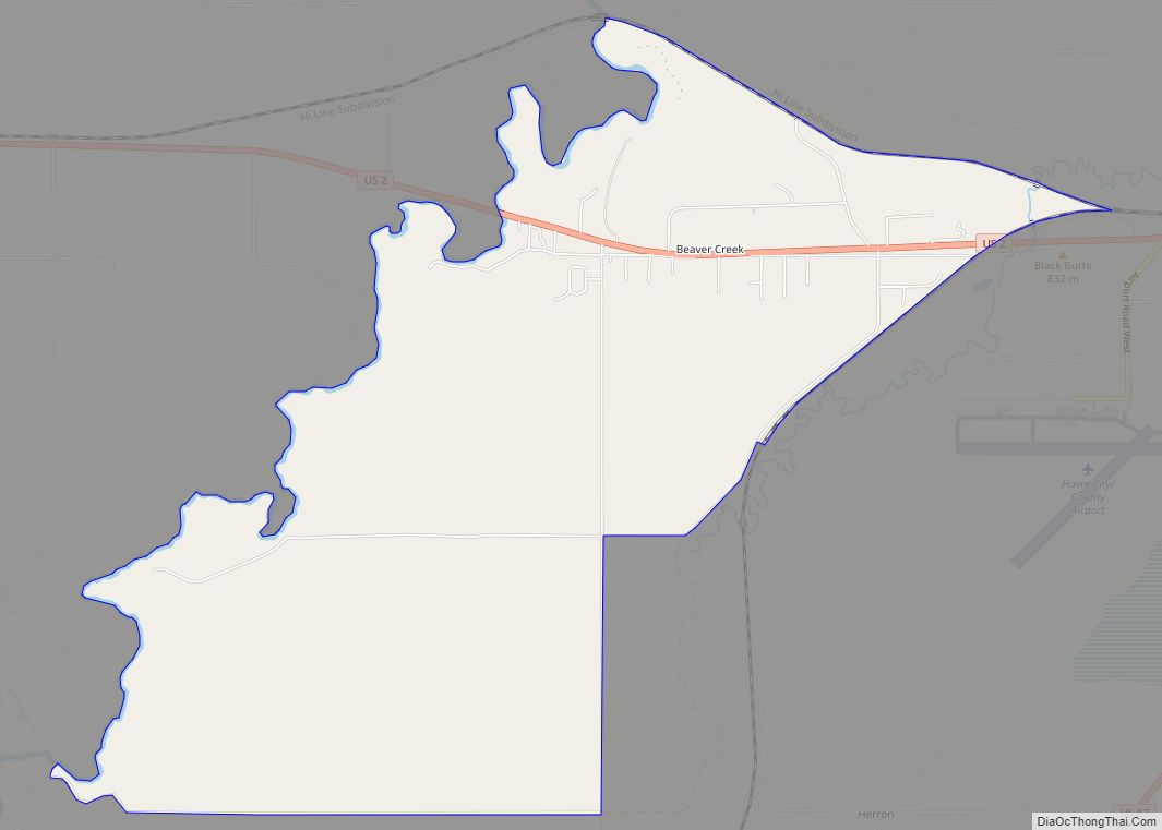
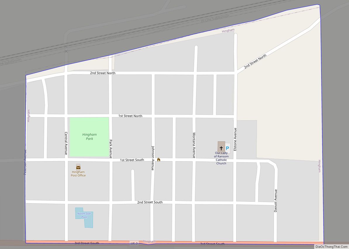
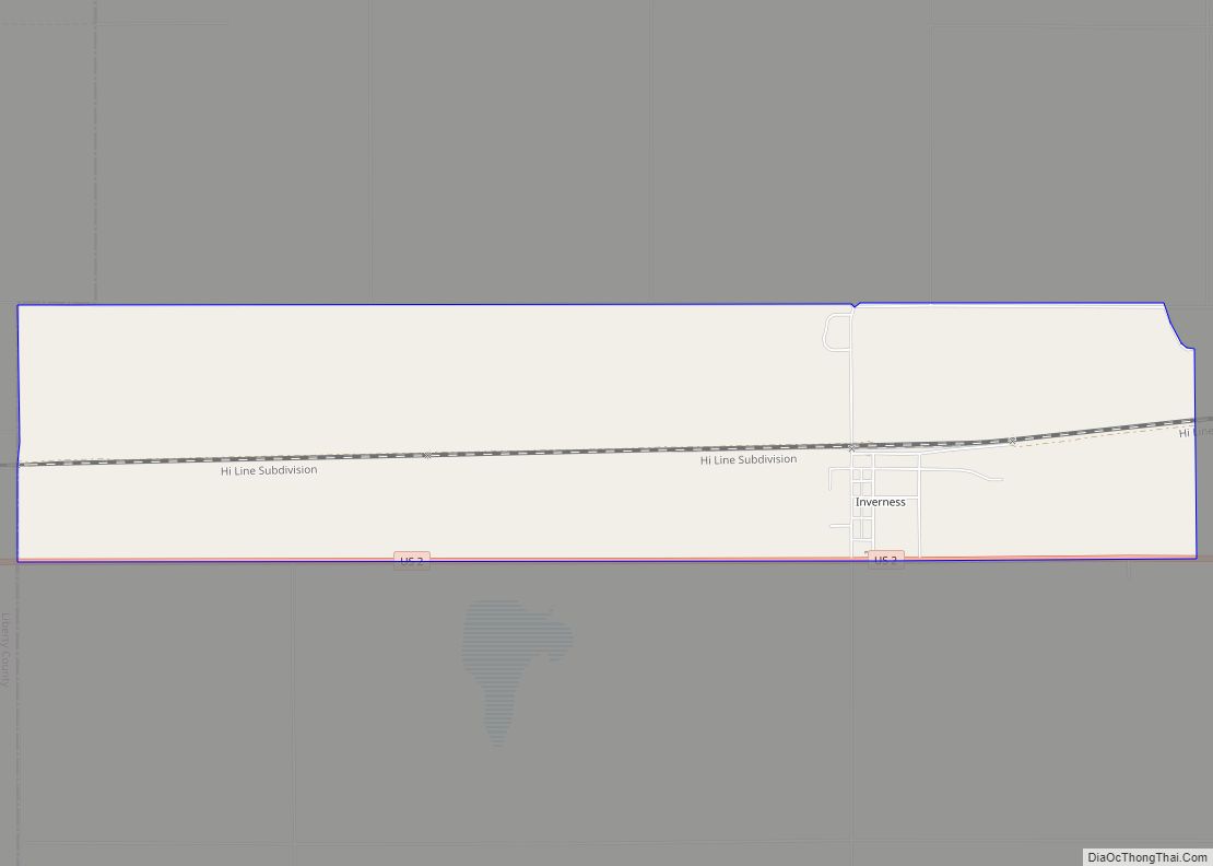
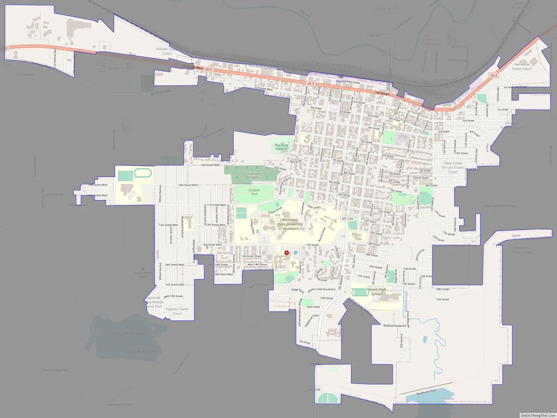
Havre Road Map
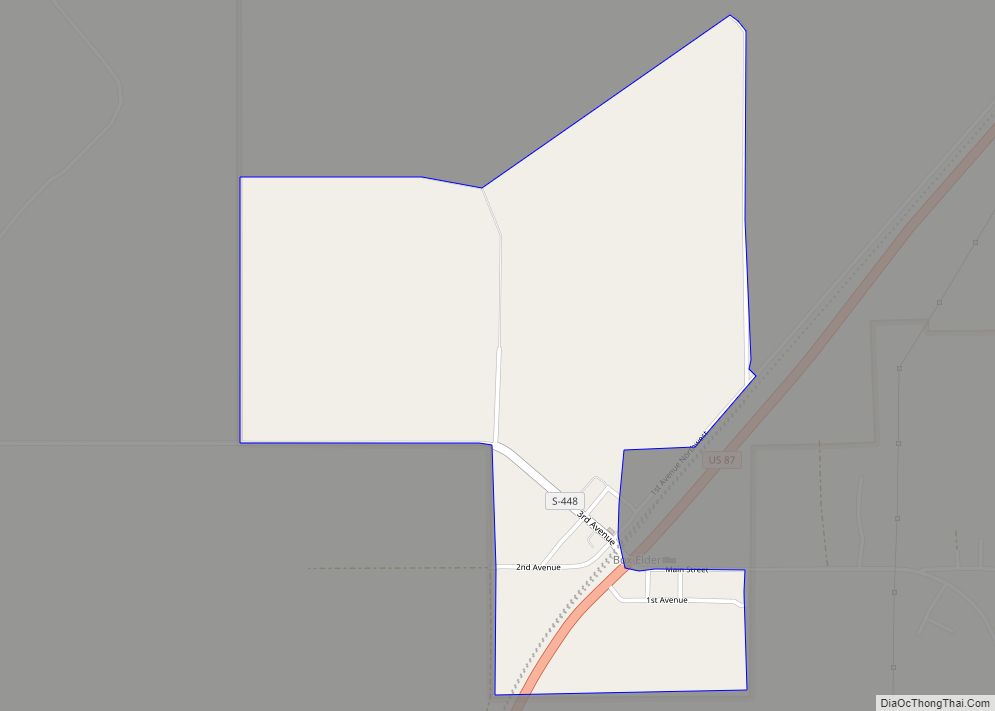
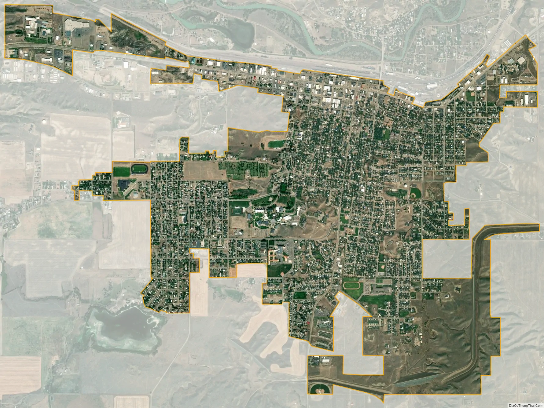
Havre city Satellite Map
Geography
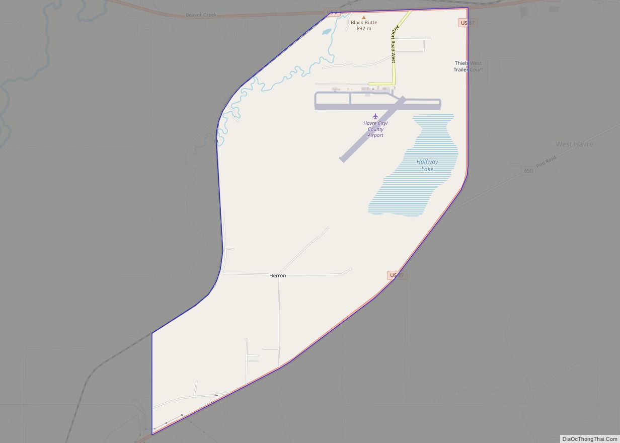
Havre is located in eastern Hill County at 48°33′N 109°41′W / 48.550°N 109.683°W / 48.550; -109.683 (48.5454, -109.6775). U.S. Route 2 (1st Street) is the main road through the city, running east to west near the city’s northern border. Route 2 leads east 87 miles (140 km) to Malta and west 102 miles (164 km) to Shelby and Interstate 15. U.S. Route 87 has its northern terminus in West Havre, 3 miles (5 km) west of downtown Havre. US 87 leads southwest 110 miles (180 km) to Great Falls. Montana Secondary Highway 234 leads south from the center of Havre 30 miles (48 km) to the Bear Paw Ski Bowl in the Bears Paw Mountains.
According to the United States Census Bureau, Havre has a total area of 3.28 square miles (8.50 km), all land.
Climate
Havre experiences a semi-arid climate (Köppen BSk) with long, cold, dry winters and hot summers with cool nights. Winter weather can vary greatly from brutal cold when Arctic air moves in from Canada, to temperatures far above 32 °F or 0 °C due to chinook winds – for instance the coldest month (and only one to never top freezing) of January 1916 averaged −13.3 °F or −25.2 °C and February 1936 during a notorious cold wave −12.8 °F or −24.9 °C, but February 1954 averaged as high as 37.1 °F or 2.8 °C and January 1919, 34.1 °F or 1.2 °C. The hottest temperature recorded in Havre is 111 °F or 43.9 °C on August 5, 1961, and the coldest −57 °F or −49.4 °C on January 27, 1916.
See also
Map of Montana State and its subdivision:- Beaverhead
- Big Horn
- Blaine
- Broadwater
- Carbon
- Carter
- Cascade
- Chouteau
- Custer
- Daniels
- Dawson
- Deer Lodge
- Fallon
- Fergus
- Flathead
- Gallatin
- Garfield
- Glacier
- Golden Valley
- Granite
- Hill
- Jefferson
- Judith Basin
- Lake
- Lewis and Clark
- Liberty
- Lincoln
- Madison
- McCone
- Meagher
- Mineral
- Missoula
- Musselshell
- Park
- Petroleum
- Phillips
- Pondera
- Powder River
- Powell
- Prairie
- Ravalli
- Richland
- Roosevelt
- Rosebud
- Sanders
- Sheridan
- Silver Bow
- Stillwater
- Sweet Grass
- Teton
- Toole
- Treasure
- Valley
- Wheatland
- Wibaux
- Yellowstone
- Alabama
- Alaska
- Arizona
- Arkansas
- California
- Colorado
- Connecticut
- Delaware
- District of Columbia
- Florida
- Georgia
- Hawaii
- Idaho
- Illinois
- Indiana
- Iowa
- Kansas
- Kentucky
- Louisiana
- Maine
- Maryland
- Massachusetts
- Michigan
- Minnesota
- Mississippi
- Missouri
- Montana
- Nebraska
- Nevada
- New Hampshire
- New Jersey
- New Mexico
- New York
- North Carolina
- North Dakota
- Ohio
- Oklahoma
- Oregon
- Pennsylvania
- Rhode Island
- South Carolina
- South Dakota
- Tennessee
- Texas
- Utah
- Vermont
- Virginia
- Washington
- West Virginia
- Wisconsin
- Wyoming