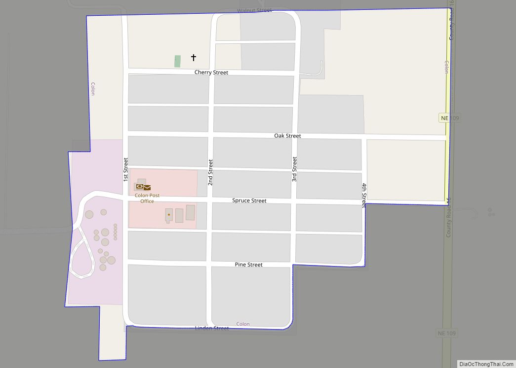
Colon is a village in Saunders County, Nebraska, United States. The population was 107 at the 2020 census. Amenities include a post office and bank branch. Colon is seven miles north of the county seat Wahoo.
| Name: | Colon village |
|---|---|
| LSAD Code: | 47 |
| LSAD Description: | village (suffix) |
| State: | Nebraska |
| County: | Saunders County |
| Elevation: | 1,243 ft (379 m) |
| Total Area: | 0.13 sq mi (0.34 km²) |
| Land Area: | 0.13 sq mi (0.34 km²) |
| Water Area: | 0.00 sq mi (0.00 km²) |
| Total Population: | 107 |
| Population Density: | 816.79/sq mi (316.06/km²) |
| ZIP code: | 68018 |
| Area code: | 402 |
| FIPS code: | 3110005 |
| GNISfeature ID: | 2398602 |
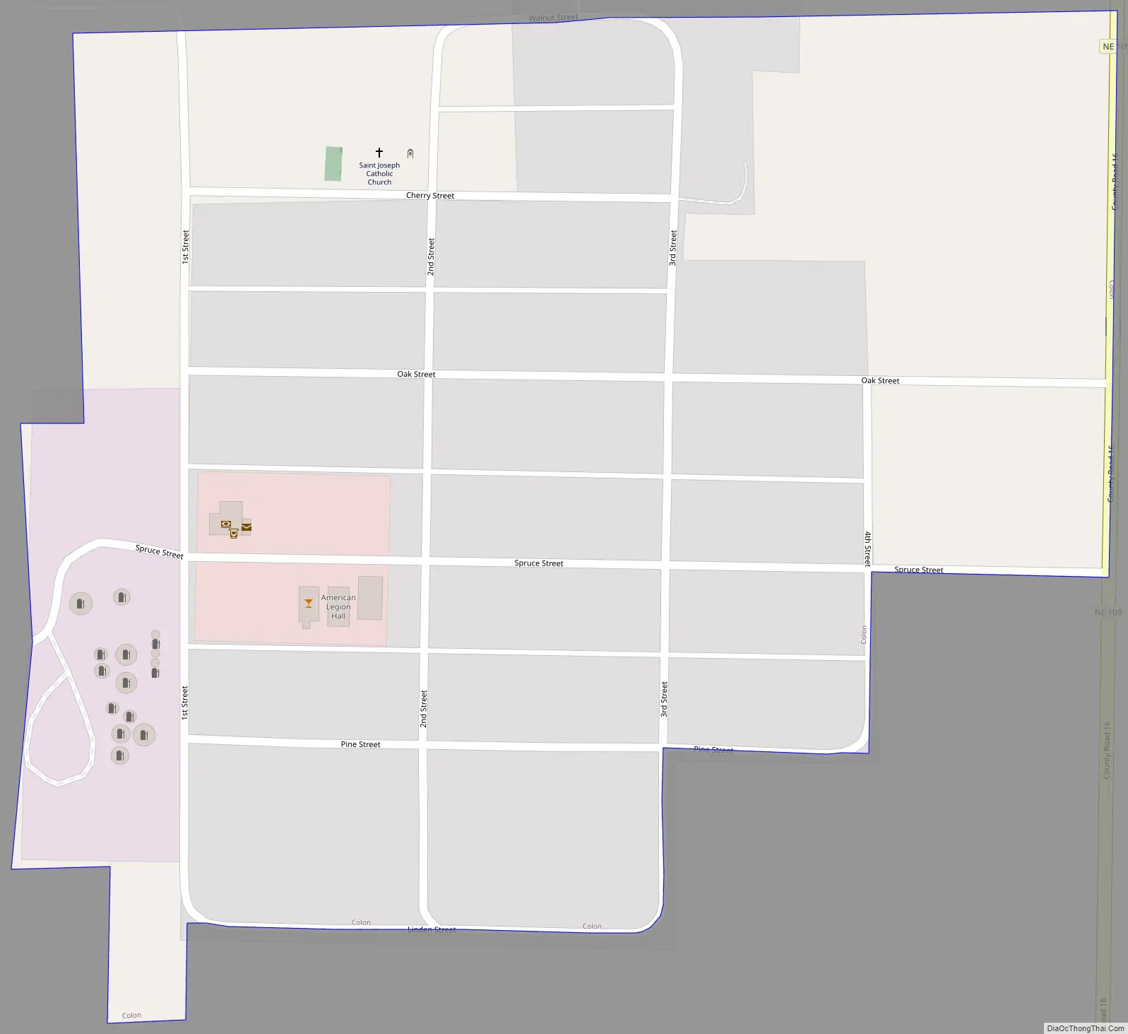
Online Interactive Map
Click on ![]() to view map in "full screen" mode.
to view map in "full screen" mode.
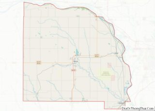
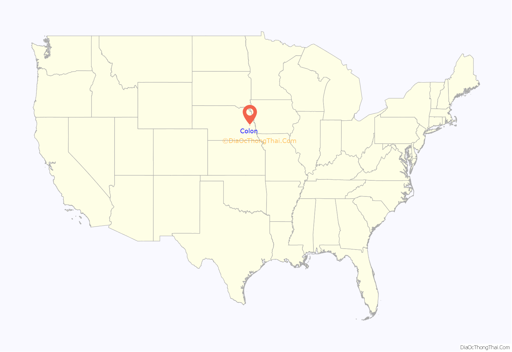
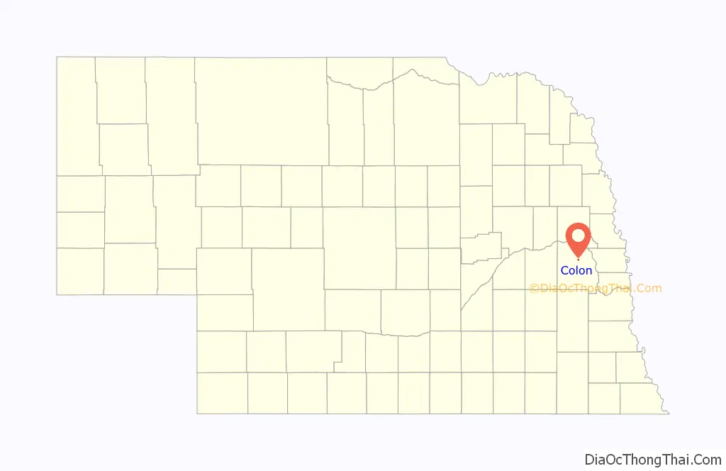
Colon location map. Where is Colon village?
History
First established in 1879, Colon removed to its current site in 1886 when the railroad was extended to that point. The town was named after Colon, Michigan, by the first postmaster, who was a native of that state. Colon was incorporated as a village in 1894.
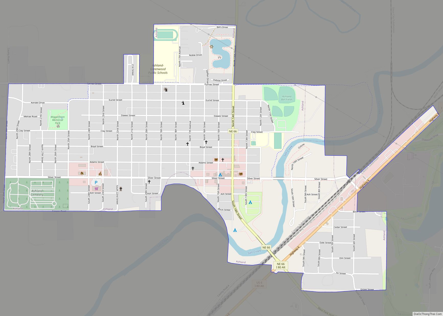
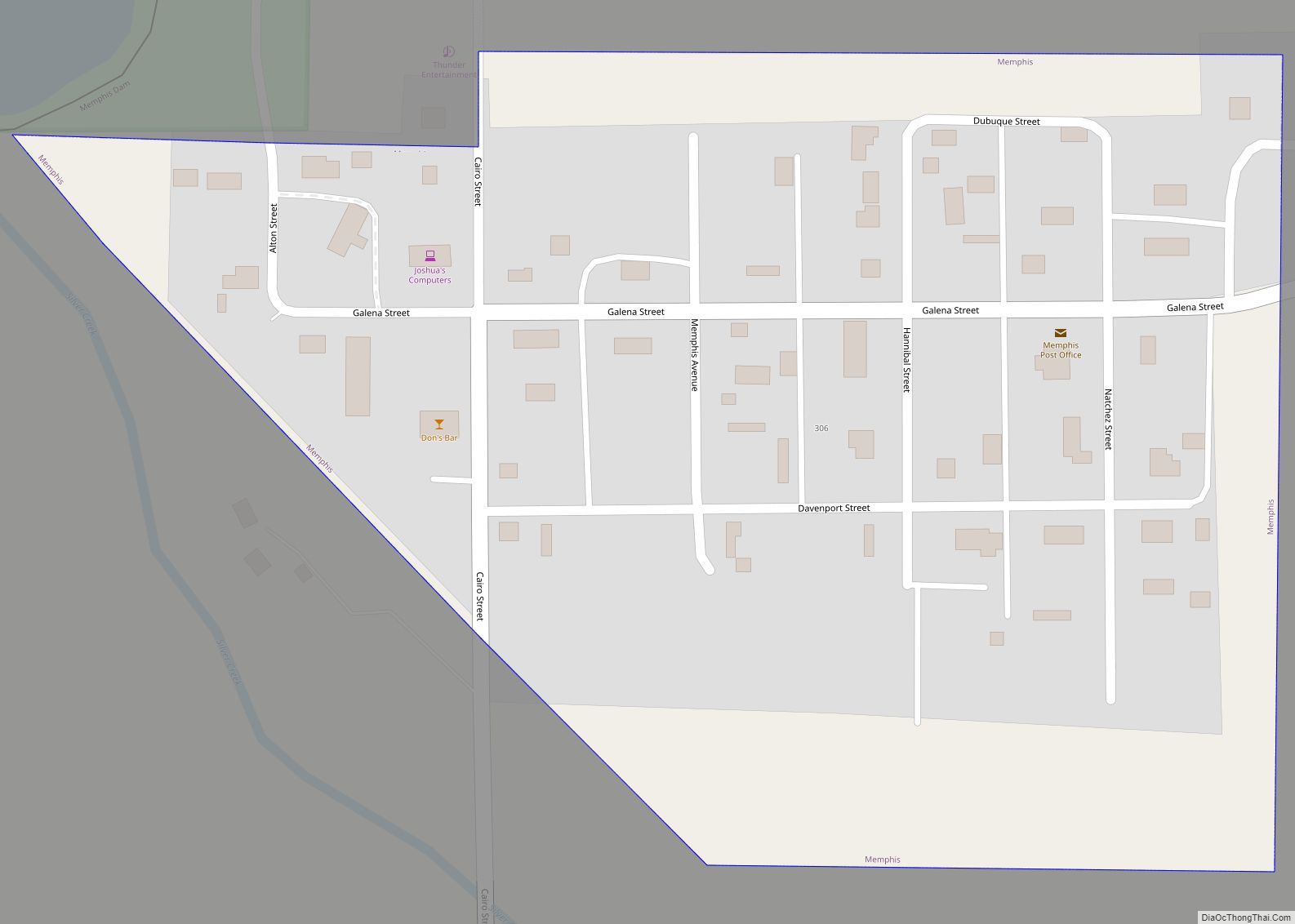
Colon Road Map
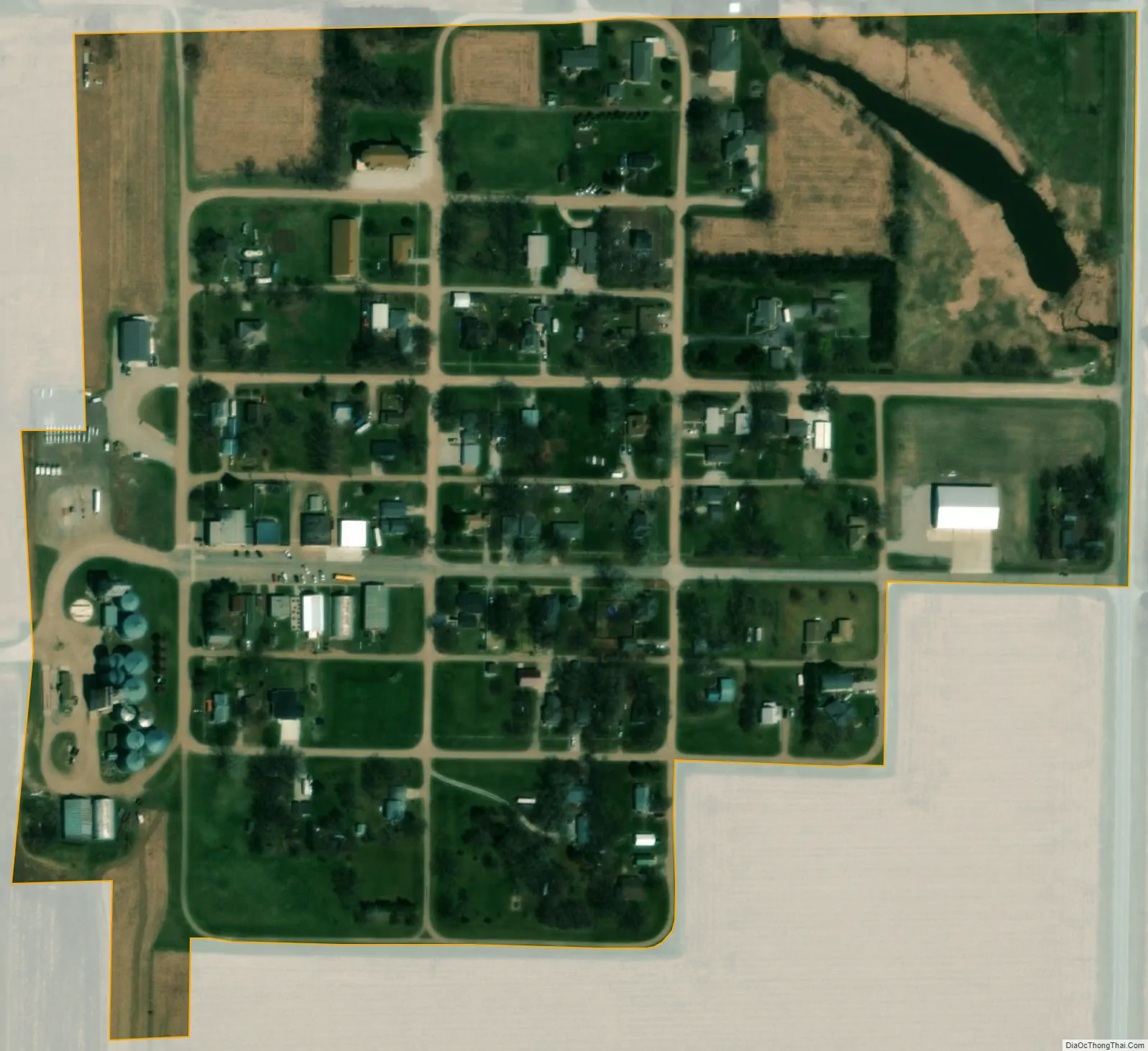
Colon city Satellite Map
Geography
According to the United States Census Bureau, the village has a total area of 0.13 square miles (0.34 km), all land.
Colon is five miles (8.0 km) west of U.S. Route 77.
See also
Map of Nebraska State and its subdivision:- Adams
- Antelope
- Arthur
- Banner
- Blaine
- Boone
- Box Butte
- Boyd
- Brown
- Buffalo
- Burt
- Butler
- Cass
- Cedar
- Chase
- Cherry
- Cheyenne
- Clay
- Colfax
- Cuming
- Custer
- Dakota
- Dawes
- Dawson
- Deuel
- Dixon
- Dodge
- Douglas
- Dundy
- Fillmore
- Franklin
- Frontier
- Furnas
- Gage
- Garden
- Garfield
- Gosper
- Grant
- Greeley
- Hall
- Hamilton
- Harlan
- Hayes
- Hitchcock
- Holt
- Hooker
- Howard
- Jefferson
- Johnson
- Kearney
- Keith
- Keya Paha
- Kimball
- Knox
- Lancaster
- Lincoln
- Logan
- Loup
- Madison
- McPherson
- Merrick
- Morrill
- Nance
- Nemaha
- Nuckolls
- Otoe
- Pawnee
- Perkins
- Phelps
- Pierce
- Platte
- Polk
- Red Willow
- Richardson
- Rock
- Saline
- Sarpy
- Saunders
- Scotts Bluff
- Seward
- Sheridan
- Sherman
- Sioux
- Stanton
- Thayer
- Thomas
- Thurston
- Valley
- Washington
- Wayne
- Webster
- Wheeler
- York
- Alabama
- Alaska
- Arizona
- Arkansas
- California
- Colorado
- Connecticut
- Delaware
- District of Columbia
- Florida
- Georgia
- Hawaii
- Idaho
- Illinois
- Indiana
- Iowa
- Kansas
- Kentucky
- Louisiana
- Maine
- Maryland
- Massachusetts
- Michigan
- Minnesota
- Mississippi
- Missouri
- Montana
- Nebraska
- Nevada
- New Hampshire
- New Jersey
- New Mexico
- New York
- North Carolina
- North Dakota
- Ohio
- Oklahoma
- Oregon
- Pennsylvania
- Rhode Island
- South Carolina
- South Dakota
- Tennessee
- Texas
- Utah
- Vermont
- Virginia
- Washington
- West Virginia
- Wisconsin
- Wyoming