Genoa (pron. je NO uh) is a city in Nance County, Nebraska, United States. The population was 1,003 at the 2010 census. The city was founded by Mormons in 1857. In the fall of 1859, the Mormon Colony was forced to abandon Genoa when the town and surrounding area were incorporated into the newly created Pawnee Reservation. The Pawnee Indian Agency utilized the structures vacated by the Mormons.
| Name: | Genoa city |
|---|---|
| LSAD Code: | 25 |
| LSAD Description: | city (suffix) |
| State: | Nebraska |
| County: | Nance County |
| Elevation: | 1,585 ft (483 m) |
| Total Area: | 0.80 sq mi (2.07 km²) |
| Land Area: | 0.79 sq mi (2.05 km²) |
| Water Area: | 0.01 sq mi (0.02 km²) |
| Total Population: | 894 |
| Population Density: | 1,127.36/sq mi (435.34/km²) |
| ZIP code: | 68640 |
| Area code: | 402 |
| FIPS code: | 3118475 |
| GNISfeature ID: | 0829484 |
| Website: | www.ci.genoa.ne.us |
Online Interactive Map
Click on ![]() to view map in "full screen" mode.
to view map in "full screen" mode.
Genoa location map. Where is Genoa city?
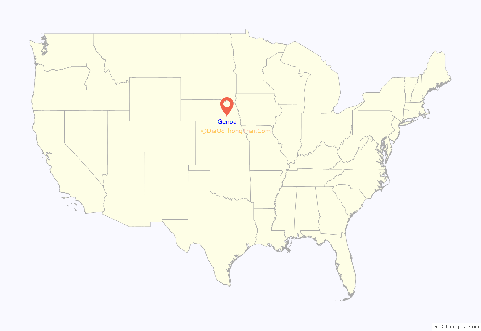
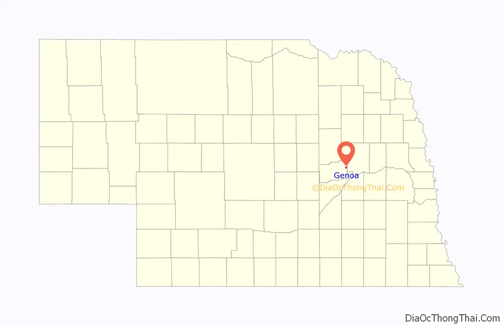
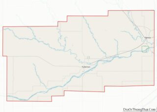
Genoa Road Map
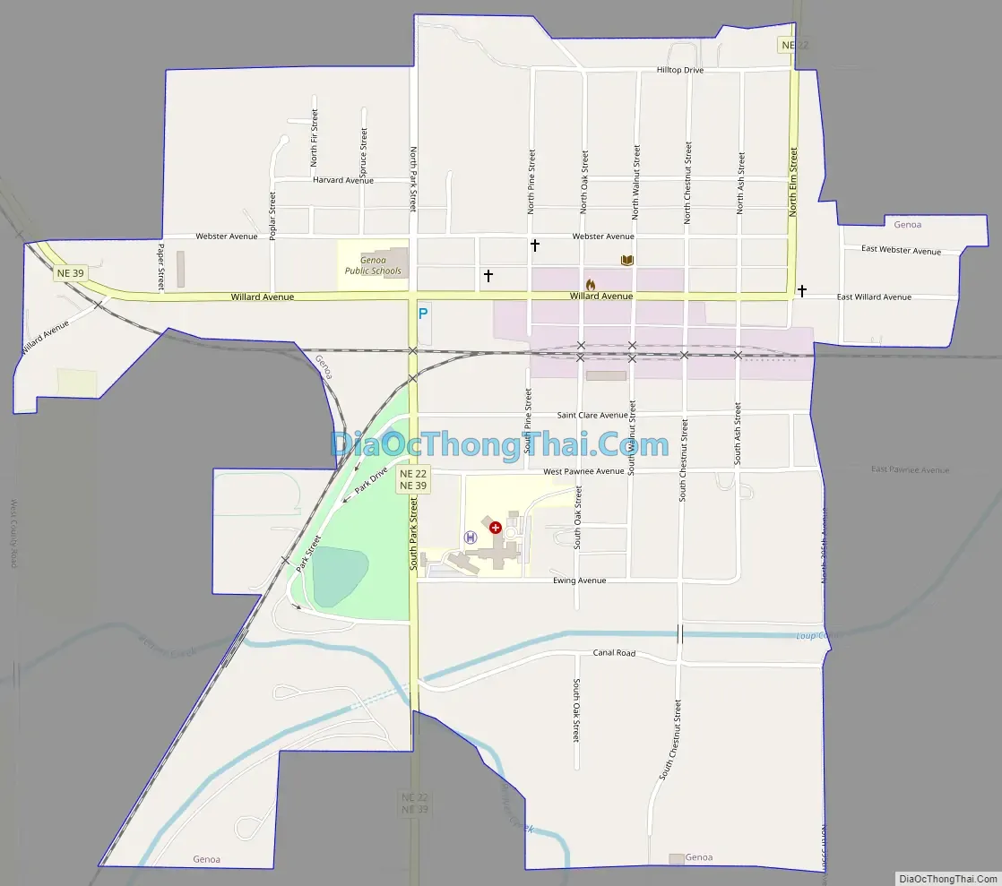
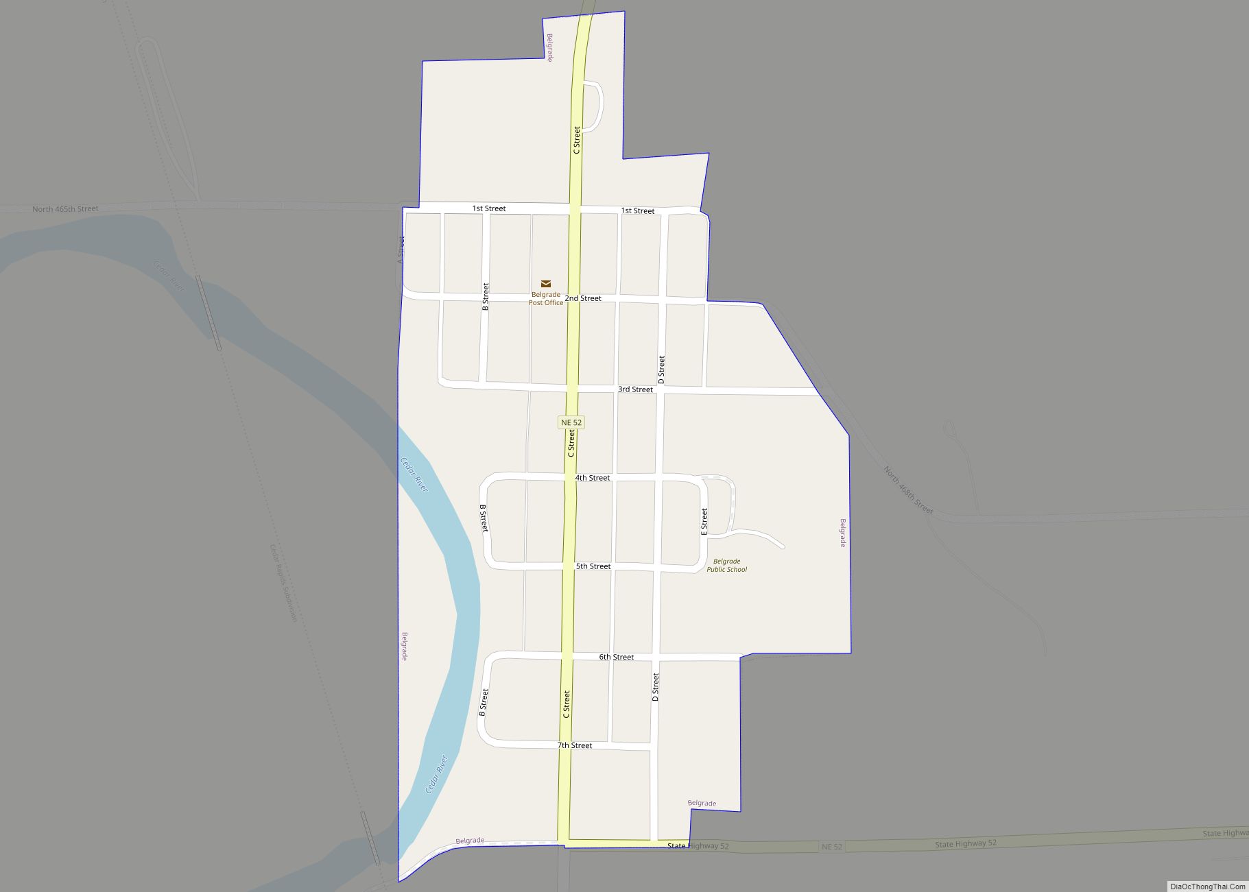
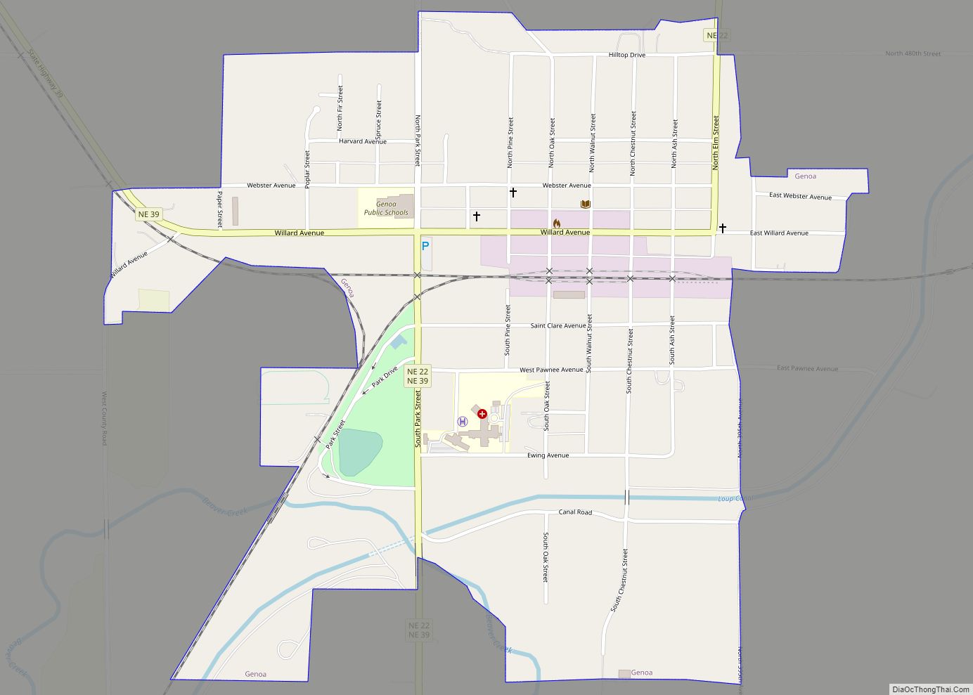
Genoa city Satellite Map

Geography
Genoa is located at 41°27′N 97°44′W / 41.450°N 97.733°W / 41.450; -97.733 (41.45, -97.73).
According to the United States Census Bureau, the city has a total area of 0.80 square miles (2.07 km), of which, 0.79 square miles (2.05 km) is land and 0.01 square miles (0.03 km) is water.
Climate
See also
Map of Nebraska State and its subdivision:- Adams
- Antelope
- Arthur
- Banner
- Blaine
- Boone
- Box Butte
- Boyd
- Brown
- Buffalo
- Burt
- Butler
- Cass
- Cedar
- Chase
- Cherry
- Cheyenne
- Clay
- Colfax
- Cuming
- Custer
- Dakota
- Dawes
- Dawson
- Deuel
- Dixon
- Dodge
- Douglas
- Dundy
- Fillmore
- Franklin
- Frontier
- Furnas
- Gage
- Garden
- Garfield
- Gosper
- Grant
- Greeley
- Hall
- Hamilton
- Harlan
- Hayes
- Hitchcock
- Holt
- Hooker
- Howard
- Jefferson
- Johnson
- Kearney
- Keith
- Keya Paha
- Kimball
- Knox
- Lancaster
- Lincoln
- Logan
- Loup
- Madison
- McPherson
- Merrick
- Morrill
- Nance
- Nemaha
- Nuckolls
- Otoe
- Pawnee
- Perkins
- Phelps
- Pierce
- Platte
- Polk
- Red Willow
- Richardson
- Rock
- Saline
- Sarpy
- Saunders
- Scotts Bluff
- Seward
- Sheridan
- Sherman
- Sioux
- Stanton
- Thayer
- Thomas
- Thurston
- Valley
- Washington
- Wayne
- Webster
- Wheeler
- York
- Alabama
- Alaska
- Arizona
- Arkansas
- California
- Colorado
- Connecticut
- Delaware
- District of Columbia
- Florida
- Georgia
- Hawaii
- Idaho
- Illinois
- Indiana
- Iowa
- Kansas
- Kentucky
- Louisiana
- Maine
- Maryland
- Massachusetts
- Michigan
- Minnesota
- Mississippi
- Missouri
- Montana
- Nebraska
- Nevada
- New Hampshire
- New Jersey
- New Mexico
- New York
- North Carolina
- North Dakota
- Ohio
- Oklahoma
- Oregon
- Pennsylvania
- Rhode Island
- South Carolina
- South Dakota
- Tennessee
- Texas
- Utah
- Vermont
- Virginia
- Washington
- West Virginia
- Wisconsin
- Wyoming