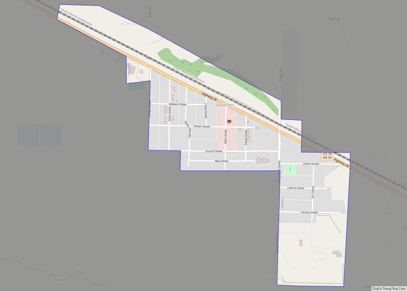
Lewellen is a village in Garden County, Nebraska, United States. The population was 224 at the 2010 census.
| Name: | Lewellen village |
|---|---|
| LSAD Code: | 47 |
| LSAD Description: | village (suffix) |
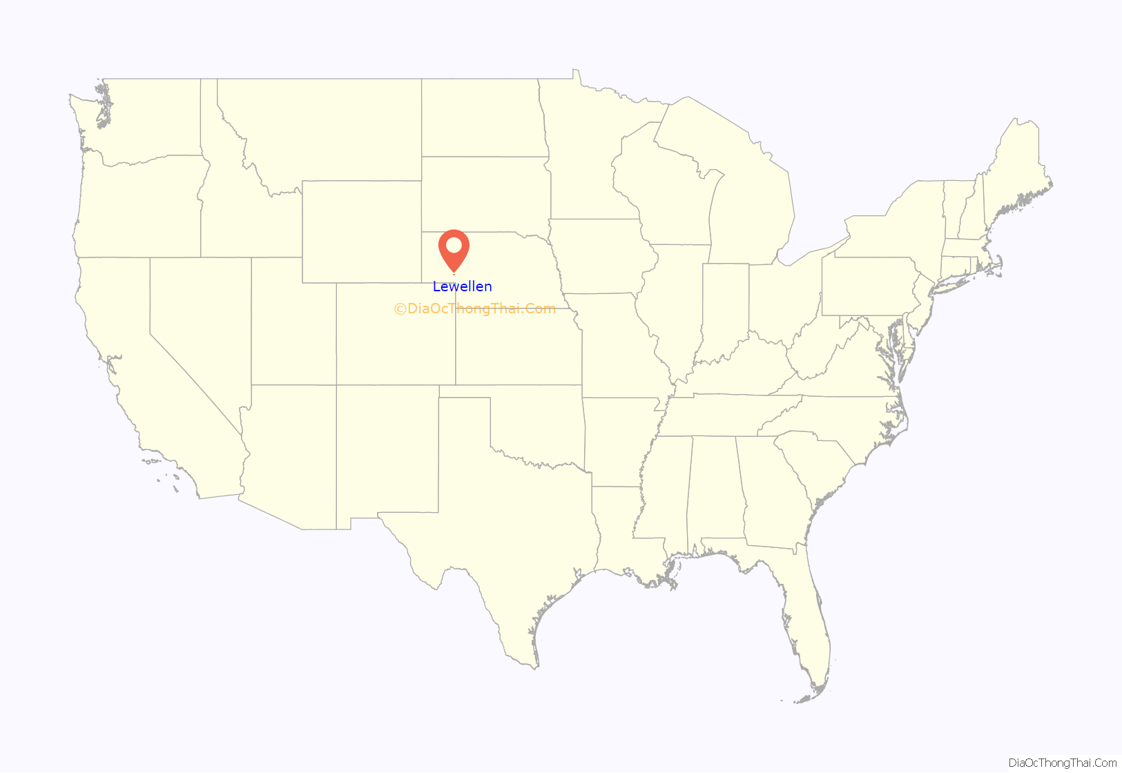
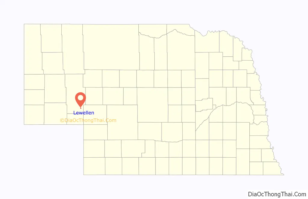
| State: | Nebraska |
| County: | Garden County |
| Elevation: | 3,317 ft (1,011 m) |
| Total Area: | 0.37 sq mi (0.96 km²) |
| Land Area: | 0.37 sq mi (0.96 km²) |
| Water Area: | 0.00 sq mi (0.00 km²) |
| Total Population: | 175 |
| Population Density: | 472.97/sq mi (182.55/km²) |
| ZIP code: | 69147 |
| Area code: | 308 |
| FIPS code: | 3126805 |
| GNISfeature ID: | 0830687 |
Online Interactive Map
Click on ![]() to view map in "full screen" mode.
to view map in "full screen" mode.
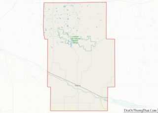
Lewellen location map. Where is Lewellen village?
History
The site of the September 1855 Battle of Ash Hollow (also called the Battle of Blue Water Creek and Harney Massacre), part of the First Sioux War, is near the modern-day settlement of Lewellen. The United States Army, with 600 troops under the command of William Selby Harney, made a surprise punitive attack on a Brule Sioux encampment led by Chief Little Thunder, in retaliation for the Grattan incident. Army infantry and cavalry killed a total of 86 people, including women and children, and taking another 70 women and children as captives.
Samuel P. Delatour arrived in the area in 1884, founding a ranch at Blue Creek. Lewellen was platted (laid out) in 1906, around the time the railroad was extended to that point. Originally part of the Deuel County, Lewellen became part of Garden County in 1910. It was named for Frank Lewellen, who arrived in the area in 1886 and established a small store and post office. The population by the end of 1919 was about 400.
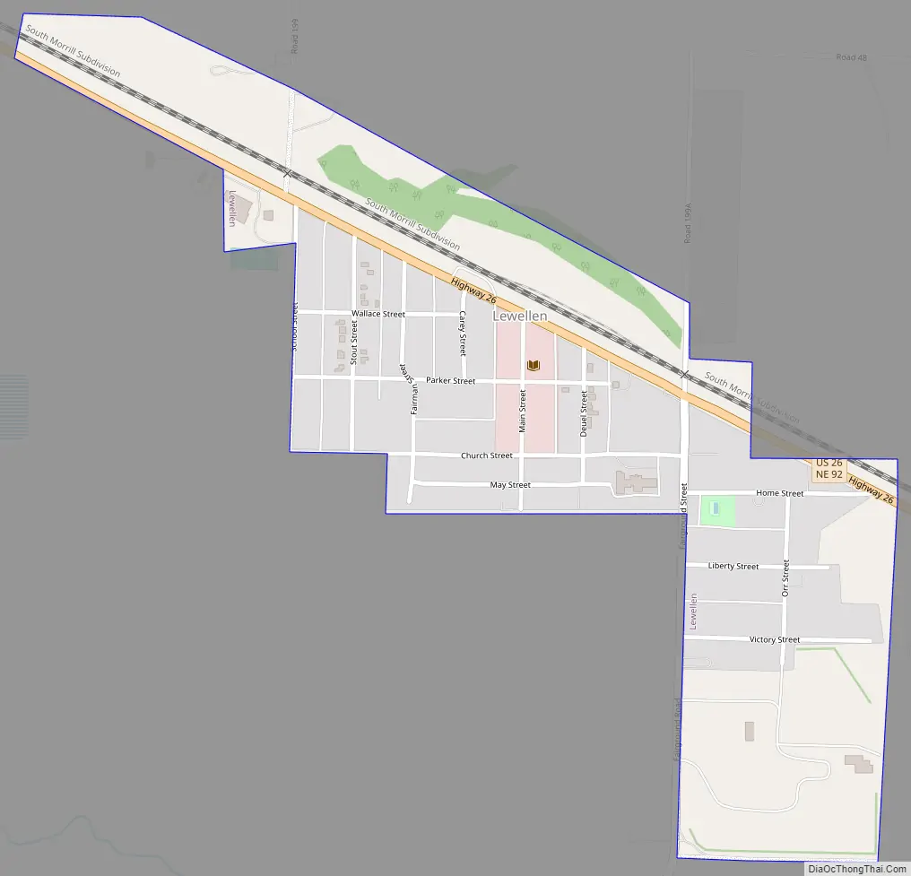
Lewellen Road Map
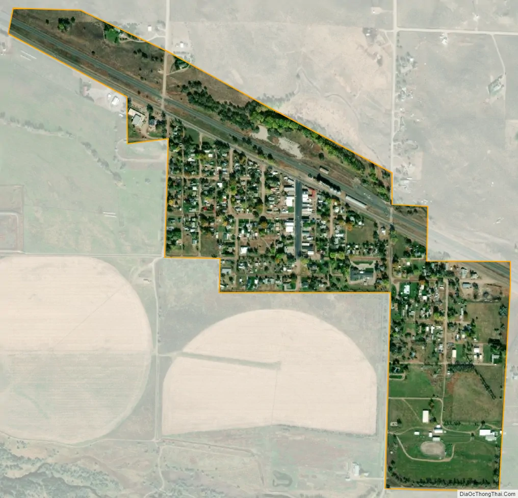
Lewellen city Satellite Map
Geography
Lewellen is located at 41°19′50″N 102°8′44″W / 41.33056°N 102.14556°W / 41.33056; -102.14556 (41.330692, -102.145487).
According to the United States Census Bureau, the village has a total area of 0.37 square miles (0.96 km), all land.
See also
Map of Nebraska State and its subdivision:- Adams
- Antelope
- Arthur
- Banner
- Blaine
- Boone
- Box Butte
- Boyd
- Brown
- Buffalo
- Burt
- Butler
- Cass
- Cedar
- Chase
- Cherry
- Cheyenne
- Clay
- Colfax
- Cuming
- Custer
- Dakota
- Dawes
- Dawson
- Deuel
- Dixon
- Dodge
- Douglas
- Dundy
- Fillmore
- Franklin
- Frontier
- Furnas
- Gage
- Garden
- Garfield
- Gosper
- Grant
- Greeley
- Hall
- Hamilton
- Harlan
- Hayes
- Hitchcock
- Holt
- Hooker
- Howard
- Jefferson
- Johnson
- Kearney
- Keith
- Keya Paha
- Kimball
- Knox
- Lancaster
- Lincoln
- Logan
- Loup
- Madison
- McPherson
- Merrick
- Morrill
- Nance
- Nemaha
- Nuckolls
- Otoe
- Pawnee
- Perkins
- Phelps
- Pierce
- Platte
- Polk
- Red Willow
- Richardson
- Rock
- Saline
- Sarpy
- Saunders
- Scotts Bluff
- Seward
- Sheridan
- Sherman
- Sioux
- Stanton
- Thayer
- Thomas
- Thurston
- Valley
- Washington
- Wayne
- Webster
- Wheeler
- York
- Alabama
- Alaska
- Arizona
- Arkansas
- California
- Colorado
- Connecticut
- Delaware
- District of Columbia
- Florida
- Georgia
- Hawaii
- Idaho
- Illinois
- Indiana
- Iowa
- Kansas
- Kentucky
- Louisiana
- Maine
- Maryland
- Massachusetts
- Michigan
- Minnesota
- Mississippi
- Missouri
- Montana
- Nebraska
- Nevada
- New Hampshire
- New Jersey
- New Mexico
- New York
- North Carolina
- North Dakota
- Ohio
- Oklahoma
- Oregon
- Pennsylvania
- Rhode Island
- South Carolina
- South Dakota
- Tennessee
- Texas
- Utah
- Vermont
- Virginia
- Washington
- West Virginia
- Wisconsin
- Wyoming