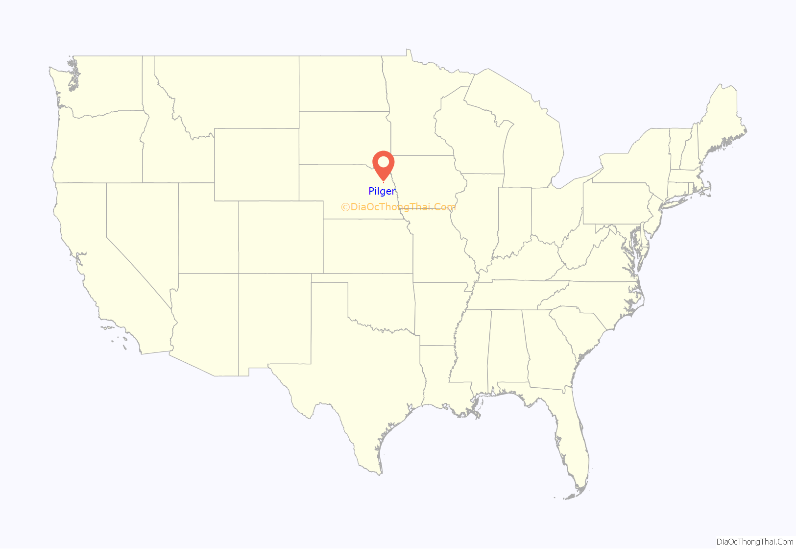
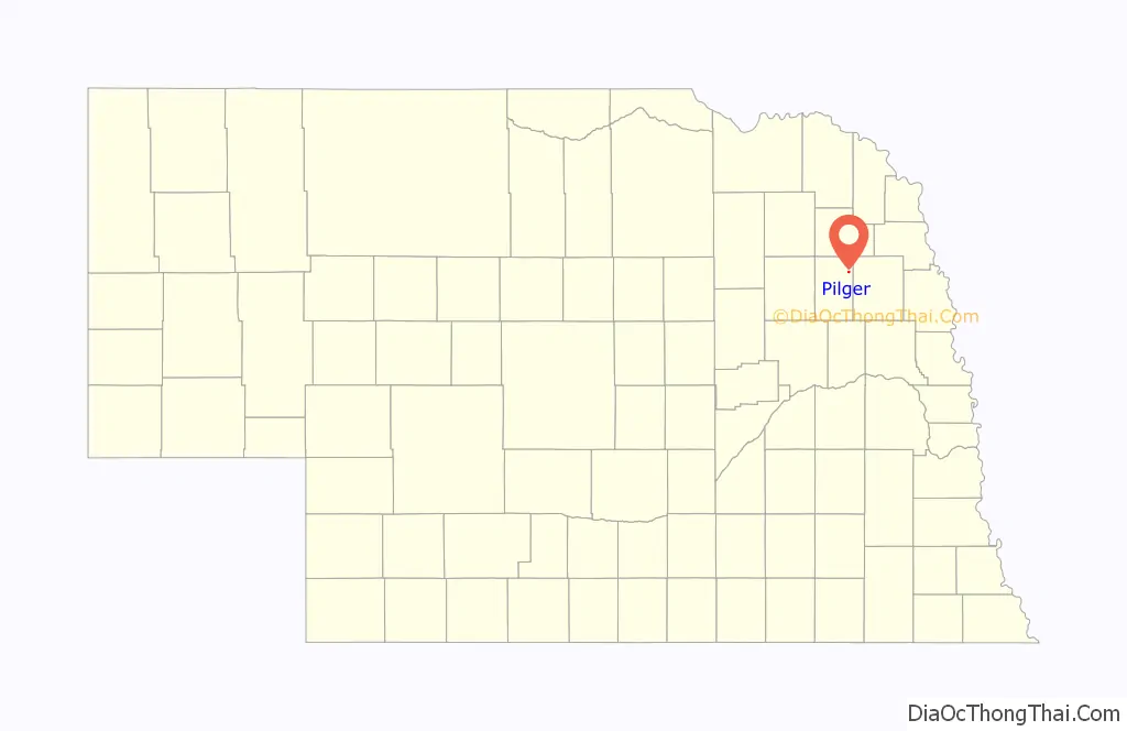
Pilger is a village in Stanton County, Nebraska, United States. As of the 2010 census, the population was 352. It is located approximately 85 miles northwest of Omaha.
| Name: | Pilger village |
|---|---|
| LSAD Code: | 47 |
| LSAD Description: | village (suffix) |
| State: | Nebraska |
| County: | Stanton County |
| Incorporated: | 1887 |
| Elevation: | 1,407 ft (429 m) |
| Total Area: | 0.29 sq mi (0.76 km²) |
| Land Area: | 0.29 sq mi (0.76 km²) |
| Water Area: | 0.00 sq mi (0.00 km²) |
| Total Population: | 240 |
| Population Density: | 813.56/sq mi (314.14/km²) |
| ZIP code: | 68768 |
| Area code: | 402 |
| FIPS code: | 3139135 |
| GNISfeature ID: | 0832104 |
Online Interactive Map
Click on ![]() to view map in "full screen" mode.
to view map in "full screen" mode.
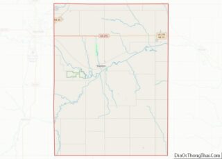
Pilger location map. Where is Pilger village?
History
Pilger was platted in 1880 when the railroad was extended to that point. It was named after Peter Pilger, the owner of the original townsite. Pilger was incorporated as a village in 1887. The Chicago & North Western ended railroad service in the spring of 1982; after flooding damaged many sections of the track & declining freight traffic volumes (which was ongoing since the mid-1970s) led to the track being abandoned. The track was removed a few years later.
2014 tornadoes
Shortly after 4 p.m. on June 16, 2014, the town was struck by an EF4 tornado. Two people, including a five-year-old girl, were killed, and sixteen were critically injured. Another tornado, also rated EF4, passed just east of the town. Pilger was left devastated, and it was later estimated that over half of the buildings were destroyed or severely damaged.
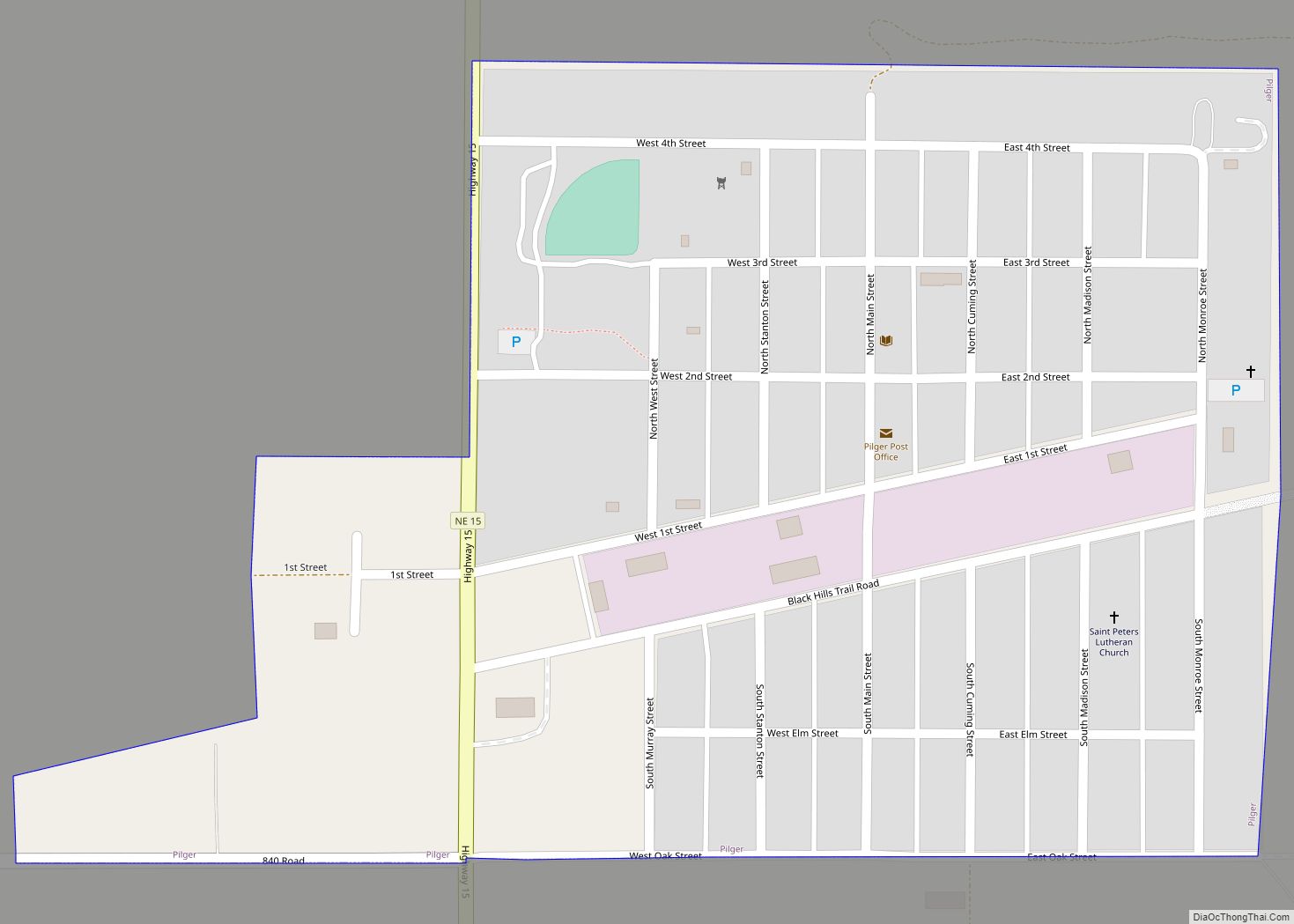
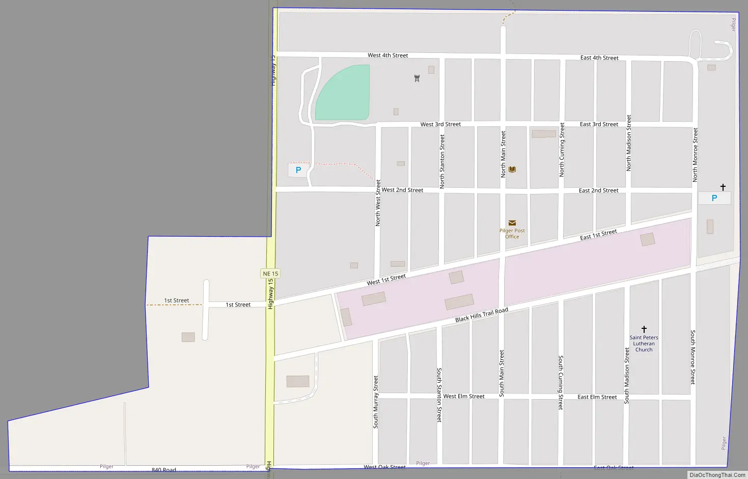
Pilger Road Map
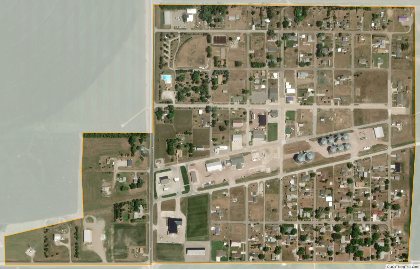
Pilger city Satellite Map
Geography
Pilger is located at 42°0′31″N 97°3′14″W / 42.00861°N 97.05389°W / 42.00861; -97.05389 (42.0086158, -97.0539311). According to the United States Census Bureau, the village has a total area of 0.30 square miles (0.78 km), all land.
See also
Map of Nebraska State and its subdivision:- Adams
- Antelope
- Arthur
- Banner
- Blaine
- Boone
- Box Butte
- Boyd
- Brown
- Buffalo
- Burt
- Butler
- Cass
- Cedar
- Chase
- Cherry
- Cheyenne
- Clay
- Colfax
- Cuming
- Custer
- Dakota
- Dawes
- Dawson
- Deuel
- Dixon
- Dodge
- Douglas
- Dundy
- Fillmore
- Franklin
- Frontier
- Furnas
- Gage
- Garden
- Garfield
- Gosper
- Grant
- Greeley
- Hall
- Hamilton
- Harlan
- Hayes
- Hitchcock
- Holt
- Hooker
- Howard
- Jefferson
- Johnson
- Kearney
- Keith
- Keya Paha
- Kimball
- Knox
- Lancaster
- Lincoln
- Logan
- Loup
- Madison
- McPherson
- Merrick
- Morrill
- Nance
- Nemaha
- Nuckolls
- Otoe
- Pawnee
- Perkins
- Phelps
- Pierce
- Platte
- Polk
- Red Willow
- Richardson
- Rock
- Saline
- Sarpy
- Saunders
- Scotts Bluff
- Seward
- Sheridan
- Sherman
- Sioux
- Stanton
- Thayer
- Thomas
- Thurston
- Valley
- Washington
- Wayne
- Webster
- Wheeler
- York
- Alabama
- Alaska
- Arizona
- Arkansas
- California
- Colorado
- Connecticut
- Delaware
- District of Columbia
- Florida
- Georgia
- Hawaii
- Idaho
- Illinois
- Indiana
- Iowa
- Kansas
- Kentucky
- Louisiana
- Maine
- Maryland
- Massachusetts
- Michigan
- Minnesota
- Mississippi
- Missouri
- Montana
- Nebraska
- Nevada
- New Hampshire
- New Jersey
- New Mexico
- New York
- North Carolina
- North Dakota
- Ohio
- Oklahoma
- Oregon
- Pennsylvania
- Rhode Island
- South Carolina
- South Dakota
- Tennessee
- Texas
- Utah
- Vermont
- Virginia
- Washington
- West Virginia
- Wisconsin
- Wyoming