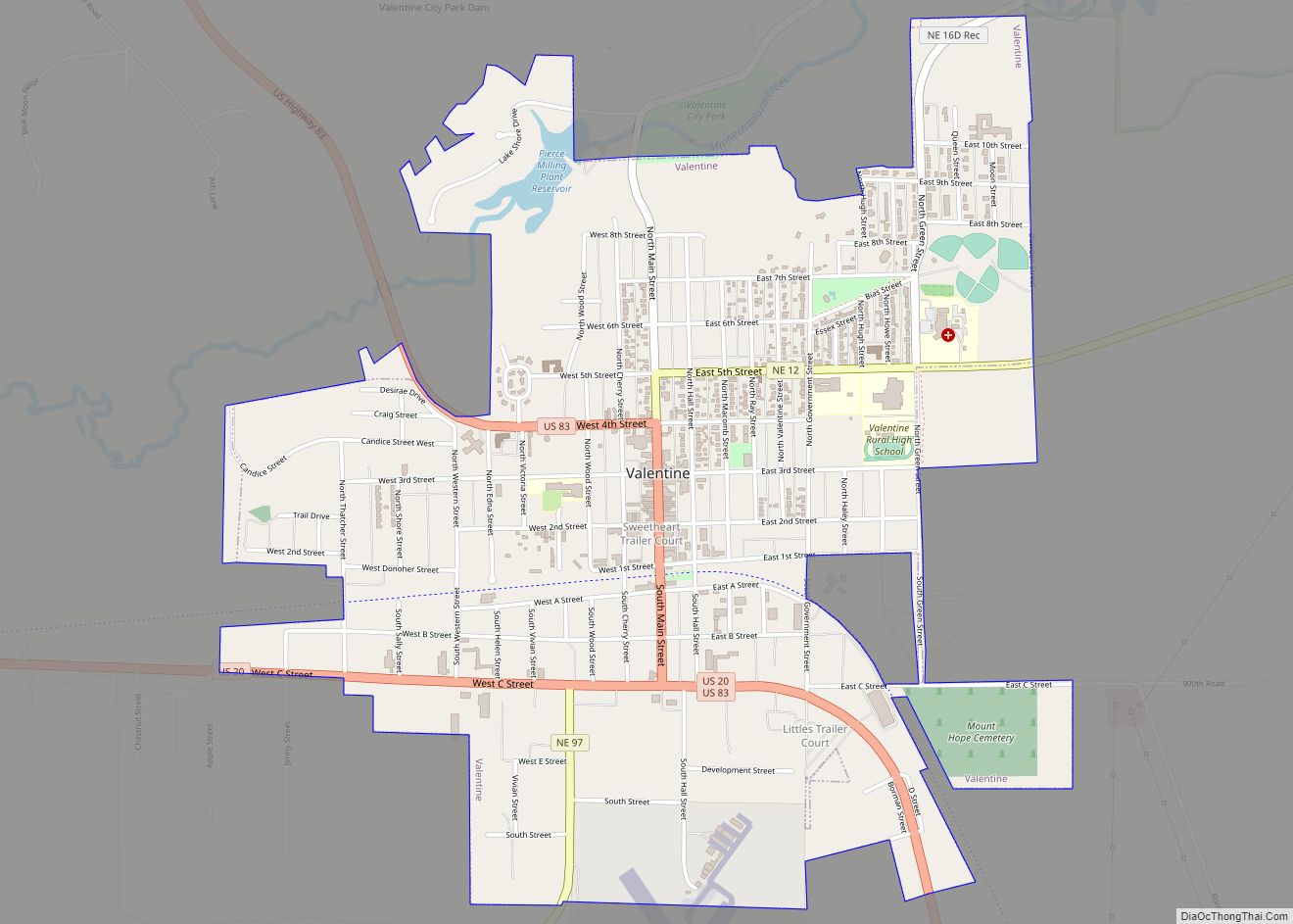
Valentine is a city in Cherry County, Nebraska, United States. The population was 2,737 at the 2010 census. It is the county seat of Cherry County.
| Name: | Valentine city |
|---|---|
| LSAD Code: | 25 |
| LSAD Description: | city (suffix) |
| State: | Nebraska |
| County: | Cherry County |
| Elevation: | 2,582 ft (787 m) |
| Total Area: | 2.65 sq mi (6.85 km²) |
| Land Area: | 2.63 sq mi (6.82 km²) |
| Water Area: | 0.01 sq mi (0.03 km²) |
| Total Population: | 2,633 |
| Population Density: | 999.24/sq mi (385.84/km²) |
| ZIP code: | 69201 |
| Area code: | 402 |
| FIPS code: | 3149950 |
| GNISfeature ID: | 0834323 |
| Website: | heartcity.com |
Online Interactive Map
Click on ![]() to view map in "full screen" mode.
to view map in "full screen" mode.
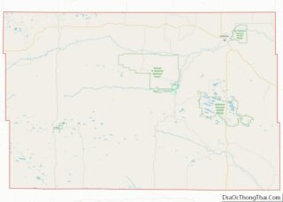
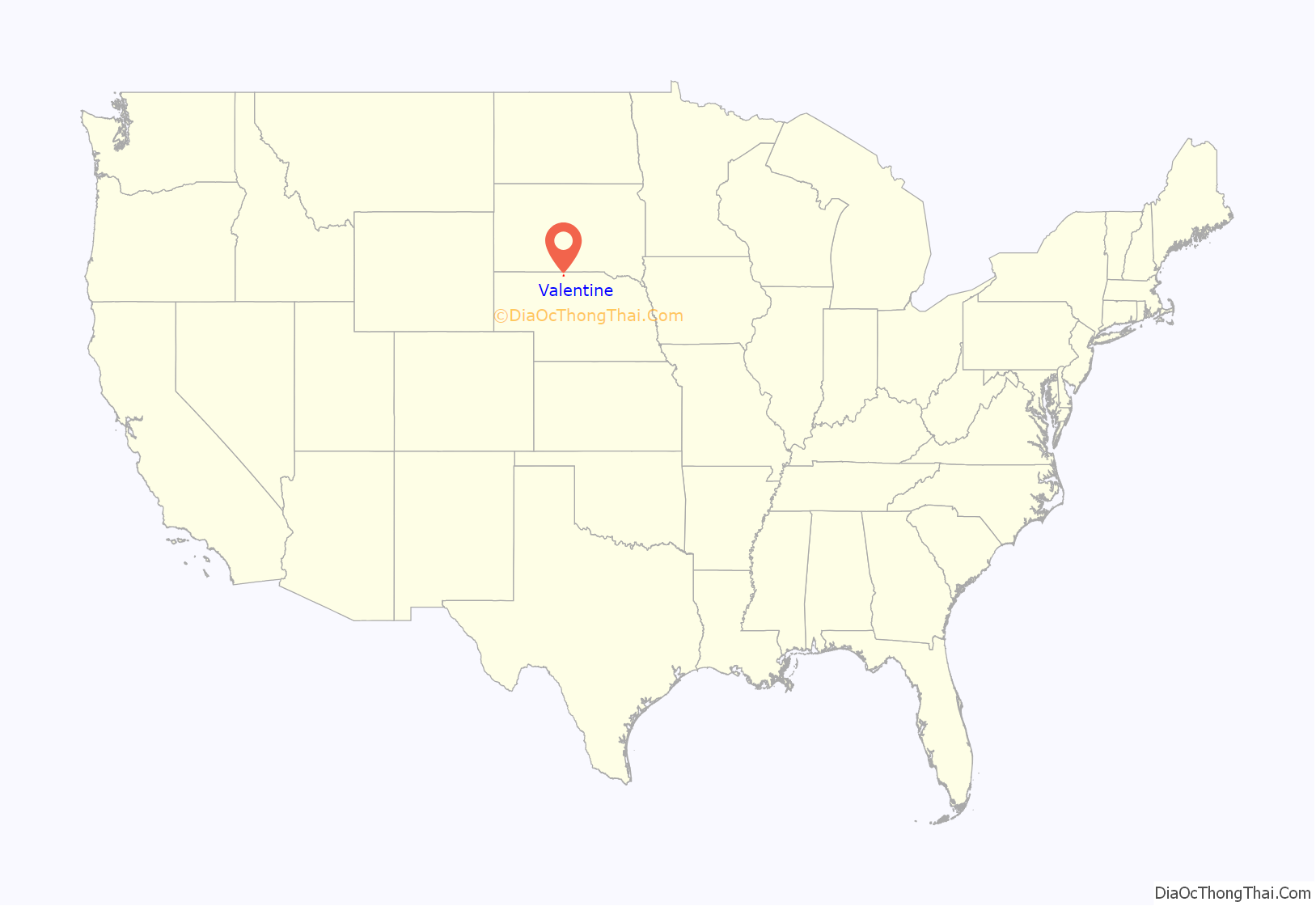
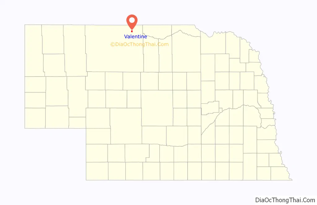
Valentine location map. Where is Valentine city?
History
Valentine was founded in 1882. The Valentine post office was established on December 4, 1882. The Sioux City and Pacific Railroad was extended to that point and train service began on April 1, 1883. It was named for Edward K. Valentine, a Nebraska representative.
As late as 1967, Valentine was split between two time zones. As described in one news report, “The mountain and central time zones meet at the center of Main Street, so an hour separates the two curb lines.” According to the report, when clocks were required to be set back one hour for daylight saving time, Valentine’s post office (which was in the central zone) split the difference and turned back its clock by only half an hour.
Valentine participates in an annual re-mailing program where thousands of pieces of mail flow into the local United States Post Office so that they can be re-mailed with a special Valentine’s Day postmark and verse.
In 2007, National Geographic Adventure magazine included Valentine in its list of the best 100 adventure towns and cities.
In the Lakota language, Valentine is known as Oínažiŋ or Mnináȟaȟa Otȟúŋwahe, meaning “station stopping place” or “water and waterfall city”.
Valentine Road Map
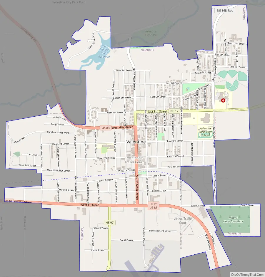
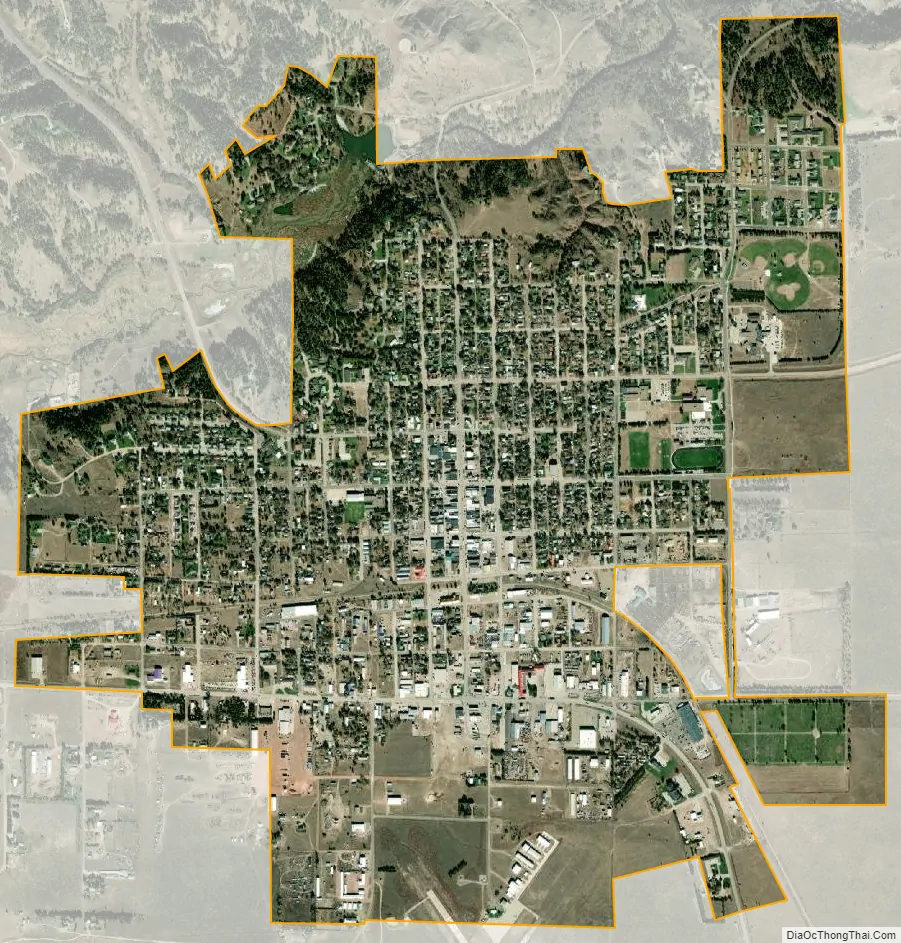
Valentine city Satellite Map
Geography
Valentine is located at 42°52′25″N 100°33′1″W / 42.87361°N 100.55028°W / 42.87361; -100.55028 (42.873686, −100.550308). According to the United States Census Bureau, the city has a total area of 2.25 square miles (5.83 km), of which 2.22 square miles (5.75 km) is land and 0.03 square miles (0.08 km) is water.
Valentine is immediately north of the Niobrara River, on the northern edge of the Sandhills physiographic region. Merritt Reservoir, created by a dam on the Snake River, is located approximately 48 km (30 mi) southwest of Valentine. Snake River Falls, the largest waterfall in Nebraska, is located on the Snake River between the reservoir (a few miles downstream) and Valentine. Smith Falls, the tallest waterfall in Nebraska, is located on a small stream tributary to the Niobrara River about 15 miles (24 km) east of Valentine in Smith Falls State Park.
Just south of Valentine, a pair of bridges span the Niobrara River. The modern bridge carries traffic north and south along U.S. Route 83. Just to the west, an arched cantilever truss bridge named the Bryan Bridge is also open to through traffic. Designed by Josef Sorkin and built in 1932, the Bryan Bridge is made of steel and is listed on the National Register of Historic Places. A large red neon heart (a star during the Christmas season) is found on the pine-covered Minnechaduza Creek canyon wall at the north end of Main Street.
Climate
With a humid continental climate (Köppen Dwa), Valentine experiences extremes of heat and cold annually; it is part of USDA Hardiness zone 4b. The normal monthly mean temperature ranges from 24.5 °F (−4.2 °C) in January to 75.7 °F (24.3 °C) in July. On an average year, there are 7 afternoons that reach 100 °F (37.8 °C) or higher, 41.3 days that reach 90 °F (32.2 °C) or higher, 41.2 afternoons that do not climb above freezing, and 17.9 mornings with a low of 0 °F (−17.8 °C) or below. The average window for freezing temperatures is September 25 thru May 11, allowing a growing season of 136 days. Extreme temperatures officially range from −39 °F or −39.4 °C on December 22, 1989, to 114 °F or 45.6 °C on July 2, 1990, with temperatures reaching 110 °F or 43.3 °C as recently as July 21, 2012; the record cold daily maximum is −17 °F (−27.2 °C) on January 12, 1916, while, conversely, the record warm daily minimum is 81 °F (27.2 °C) on July 24, 1940, and July 25, 1899.
Precipitation is low, with an annual average of around 20.90 inches or 531 millimetres, but not quite low enough for the climate here to be classified as semi-arid; it has ranged from 10.14 inches or 257.6 millimetres in 1894 to 32.68 inches or 830.1 millimetres in 1977. The very dry winters – as dry as the driest desert areas of the Southwest – mean snowfall is modest, averaging 34.2 inches or 0.87 metres per season (peaking in February and March), and has historically ranged from 12.7 inches or 0.32 metres in 1984–85 to 88.5 inches or 2.2 metres in 1919–20; the average window for measurable (≥0.1 inches or 0.0025 metres) snowfall is October 27 thru April 11, with May snow being rare.
See also
Map of Nebraska State and its subdivision:- Adams
- Antelope
- Arthur
- Banner
- Blaine
- Boone
- Box Butte
- Boyd
- Brown
- Buffalo
- Burt
- Butler
- Cass
- Cedar
- Chase
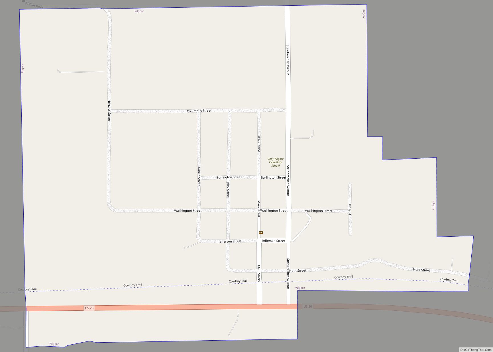
- Cherry
- Cheyenne
- Clay
- Colfax
- Cuming
- Custer
- Dakota
- Dawes
- Dawson
- Deuel
- Dixon
- Dodge
- Douglas
- Dundy
- Fillmore
- Franklin
- Frontier
- Furnas
- Gage
- Garden
- Garfield
- Gosper
- Grant
- Greeley
- Hall
- Hamilton
- Harlan
- Hayes
- Hitchcock
- Holt
- Hooker
- Howard
- Jefferson
- Johnson
- Kearney
- Keith
- Keya Paha
- Kimball
- Knox
- Lancaster
- Lincoln
- Logan
- Loup
- Madison
- McPherson
- Merrick
- Morrill
- Nance
- Nemaha
- Nuckolls
- Otoe
- Pawnee
- Perkins
- Phelps
- Pierce
- Platte
- Polk
- Red Willow
- Richardson
- Rock
- Saline
- Sarpy
- Saunders
- Scotts Bluff
- Seward
- Sheridan
- Sherman
- Sioux
- Stanton
- Thayer
- Thomas
- Thurston
- Valley
- Washington
- Wayne
- Webster
- Wheeler
- York
- Alabama
- Alaska
- Arizona
- Arkansas
- California
- Colorado
- Connecticut
- Delaware
- District of Columbia
- Florida
- Georgia
- Hawaii
- Idaho
- Illinois
- Indiana
- Iowa
- Kansas
- Kentucky
- Louisiana
- Maine
- Maryland
- Massachusetts
- Michigan
- Minnesota
- Mississippi
- Missouri
- Montana
- Nebraska
- Nevada
- New Hampshire
- New Jersey
- New Mexico
- New York
- North Carolina
- North Dakota
- Ohio
- Oklahoma
- Oregon
- Pennsylvania
- Rhode Island
- South Carolina
- South Dakota
- Tennessee
- Texas
- Utah
- Vermont
- Virginia
- Washington
- West Virginia
- Wisconsin
- Wyoming