Duquesne (/djuːˈkeɪn/ dew-KAYN) is a city along the Monongahela River in Allegheny County, Pennsylvania, United States, within the Pittsburgh metropolitan area. The population was 5,254 at the 2020 census.
| Name: | Duquesne city |
|---|---|
| LSAD Code: | 25 |
| LSAD Description: | city (suffix) |
| State: | Pennsylvania |
| County: | Allegheny County |
| Incorporated: | September 12, 1891 (borough) |
| Total Area: | 2.01 sq mi (5.21 km²) |
| Land Area: | 1.82 sq mi (4.70 km²) |
| Water Area: | 0.20 sq mi (0.51 km²) |
| Total Population: | 5,254 |
| Population Density: | 2,893.17/sq mi (1,116.98/km²) |
| ZIP code: | 15110 |
| Area code: | 412 |
| FIPS code: | 4220432 |
Online Interactive Map
Click on ![]() to view map in "full screen" mode.
to view map in "full screen" mode.
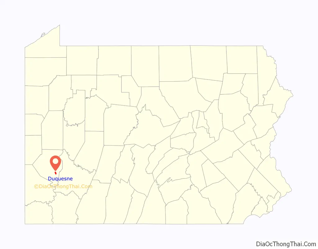
Duquesne location map. Where is Duquesne city?

History
The city of Duquesne was settled in 1789 and incorporated in 1891. The city derives its name from Fort Duquesne.
Duquesne Works, a productive steel mill that was part of Carnegie Steel Corporation and later part of U.S. Steel, was the heart and soul of Duquesne during its brightest moments in the early 20th century. Duquesne was home to the largest blast furnace in the world, named the “Dorothy Six”. Bob Dylan´s song Duquesne Whistle (Tempest, 2012) is dedicated to it.
The city’s population peaked in 1930, then declined with deindustrialization beginning in the 1960s. Today a stark post-industrial landscape, Duquesne has fewer total residents (5,565 at the 2010 U.S. census) than were the city’s mill workers in 1948. According to the McKeesport Daily News, Duquesne has the worst performing schools in the state of Pennsylvania. Duquesne was designated a financially distressed municipality in 1991 by the state.
Duquesne Road Map
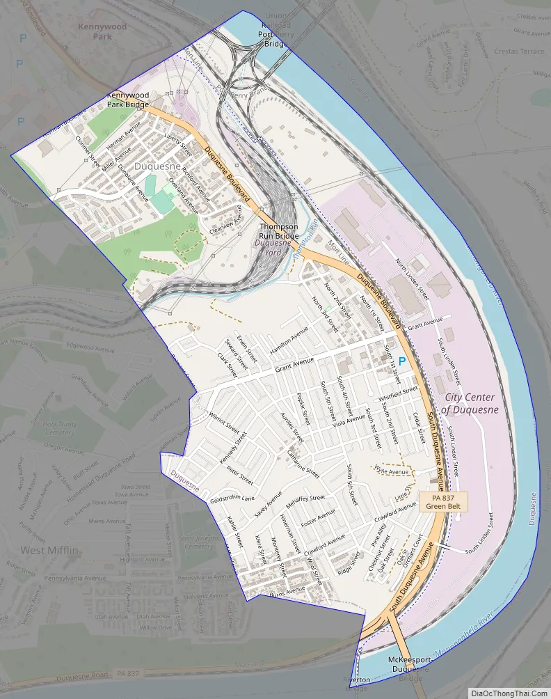
Duquesne city Satellite Map

Geography
Duquesne is located along the Monongahela River, approximately 12 miles (19 km) south of Pittsburgh.
According to the United States Census Bureau, the city has a total area of 2.0 square miles (5.2 km), of which 1.8 square miles (4.7 km) is land and 0.2 square miles (0.52 km), or 10.84%, is water.
See also
Map of Pennsylvania State and its subdivision:- Adams
- Allegheny
- Armstrong
- Beaver
- Bedford
- Berks
- Blair
- Bradford
- Bucks
- Butler
- Cambria
- Cameron
- Carbon
- Centre
- Chester
- Clarion
- Clearfield
- Clinton
- Columbia
- Crawford
- Cumberland
- Dauphin
- Delaware
- Elk
- Erie
- Fayette
- Forest
- Franklin
- Fulton
- Greene
- Huntingdon
- Indiana
- Jefferson
- Juniata
- Lackawanna
- Lancaster
- Lawrence
- Lebanon
- Lehigh
- Luzerne
- Lycoming
- Mc Kean
- Mercer
- Mifflin
- Monroe
- Montgomery
- Montour
- Northampton
- Northumberland
- Perry
- Philadelphia
- Pike
- Potter
- Schuylkill
- Snyder
- Somerset
- Sullivan
- Susquehanna
- Tioga
- Union
- Venango
- Warren
- Washington
- Wayne
- Westmoreland
- Wyoming
- York
- Alabama
- Alaska
- Arizona
- Arkansas
- California
- Colorado
- Connecticut
- Delaware
- District of Columbia
- Florida
- Georgia
- Hawaii
- Idaho
- Illinois
- Indiana
- Iowa
- Kansas
- Kentucky
- Louisiana
- Maine
- Maryland
- Massachusetts
- Michigan
- Minnesota
- Mississippi
- Missouri
- Montana
- Nebraska
- Nevada
- New Hampshire
- New Jersey
- New Mexico
- New York
- North Carolina
- North Dakota
- Ohio
- Oklahoma
- Oregon
- Pennsylvania
- Rhode Island
- South Carolina
- South Dakota
- Tennessee
- Texas
- Utah
- Vermont
- Virginia
- Washington
- West Virginia
- Wisconsin
- Wyoming


