Belton is a city in eastern Anderson County, South Carolina, United States. The population was 4,134 at the 2010 census.
| Name: | Belton city |
|---|---|
| LSAD Code: | 25 |
| LSAD Description: | city (suffix) |
| State: | South Carolina |
| County: | Anderson County |
| Elevation: | 883 ft (269 m) |
| Total Area: | 3.79 sq mi (9.80 km²) |
| Land Area: | 3.78 sq mi (9.79 km²) |
| Water Area: | 0.01 sq mi (0.02 km²) |
| Total Population: | 4,335 |
| Population Density: | 1,147.43/sq mi (443.01/km²) |
| ZIP code: | 29627 |
| Area code: | 864 |
| FIPS code: | 4505365 |
| GNISfeature ID: | 1246736 |
| Website: | www.cityofbeltonsc.com |
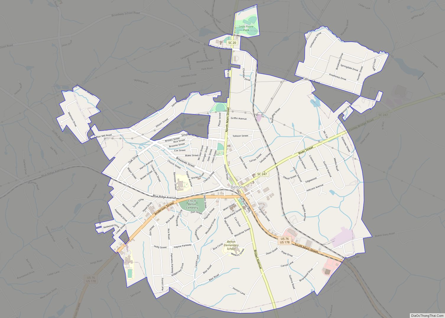
Online Interactive Map
Click on ![]() to view map in "full screen" mode.
to view map in "full screen" mode.
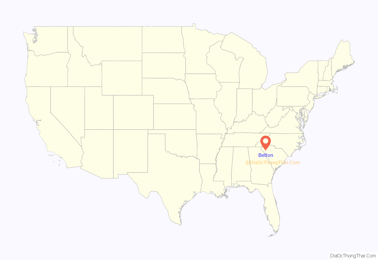
Belton location map. Where is Belton city?
History
In 1845 a group was created to connect the Piedmont region of South Carolina by rail to the existing rail system which then ran from Columbia to Charleston. The expanded rail line ran through what was to become Belton, with a spur line which ran to the nearby town of Anderson. Because of the population explosion that occurred by the time the railroad had been completed in 1853, the state incorporated the town in 1855, with the boundaries being located within a half mile radius from the new railroad depot.
The city was given the name of Belton after the first president of the Columbia and Greenville Railroad from Newberry, John Belton O’Neal.
The city prospered not only due to the railroad junction, but also because of the area’s cotton crop, which led to the establishment of cotton mills.
In 1908, a municipal water system was established. A 155-foot (47 m) reinforced concrete tower with a 165,000-US-gallon (625 m) capacity was built. Known as the Belton Standpipe, the tower is still in use today. It was listed on the National Register of Historic Places on November 5, 1987. The standpipe is the inspiration for the yearly Belton Standpipe Festival, first held in 1987 as a fundraising event.
In bygone years Belton was the cotton ginning center for South Carolina, with many cotton mills that were part of the heritage.
Belton boasts an arts center that holds regular art exhibitions open to the public. The arts center adds much character and artistic vibrancy to the city, and is available for event rentals and hosting many city events. The old train depot has been completely refurbished and is currently used as a comfortable function venue. Part of the depot is a museum filled with old Belton history.
Tennis is an integral part of Belton’s culture. The South Carolina Palmetto championships are held in Belton each year, using local residential tennis courts as part of the competition.
In addition to the Belton Standpipe, the Belton Depot and Chamberlain-Kay House are listed on the National Register of Historic Places.
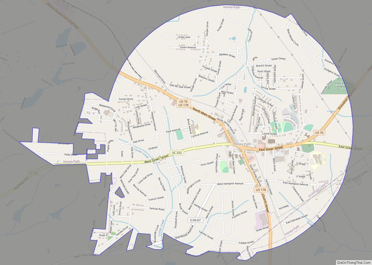
Belton Road Map
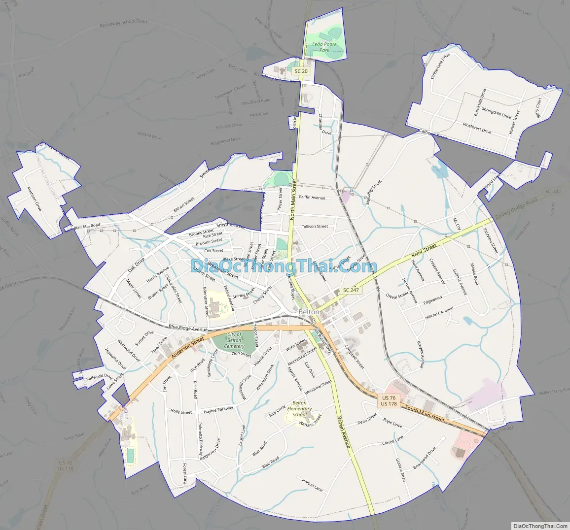
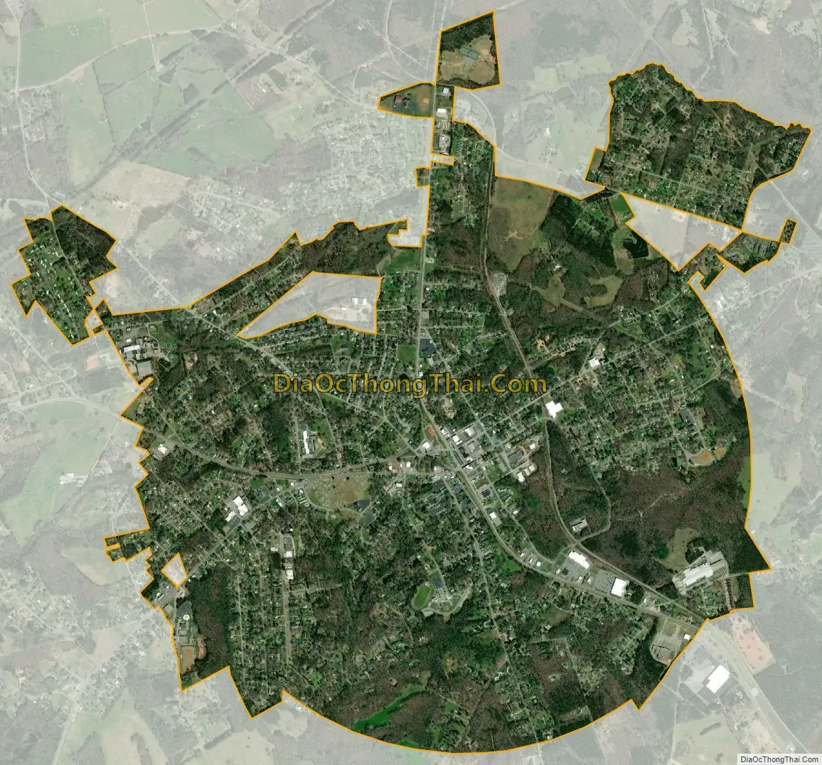
Belton city Satellite Map
Geography
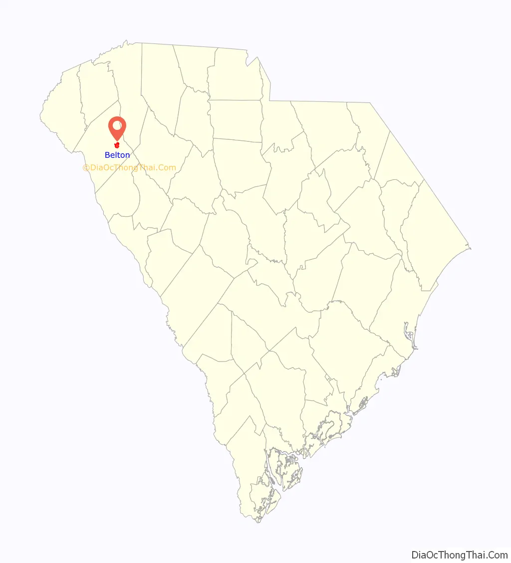
Belton is located in eastern Anderson County at 34°31′32″N 82°29′46″W / 34.52556°N 82.49611°W / 34.52556; -82.49611 (34.525630, -82.496129). It is 11 miles (18 km) east of Anderson, the county seat, by U.S. Routes 76 and 178. Honea Path is 8 miles (13 km) to the southeast by the same highway, and South Carolina Highway 20 leads 26 miles (42 km) north to Greenville.
According to the United States Census Bureau, the city has a total area of 3.9 square miles (10.0 km), of which 0.012 square miles (0.03 km), or 0.33%, is water.
See also
Map of South Carolina State and its subdivision:- Abbeville
- Aiken
- Allendale
- Anderson
- Bamberg
- Barnwell
- Beaufort
- Berkeley
- Calhoun
- Charleston
- Cherokee
- Chester
- Chesterfield
- Clarendon
- Colleton
- Darlington
- Dillon
- Dorchester
- Edgefield
- Fairfield
- Florence
- Georgetown
- Greenville
- Greenwood
- Hampton
- Horry
- Jasper
- Kershaw
- Lancaster
- Laurens
- Lee
- Lexington
- Marion
- Marlboro
- McCormick
- Newberry
- Oconee
- Orangeburg
- Pickens
- Richland
- Saluda
- Spartanburg
- Sumter
- Union
- Williamsburg
- York
- Alabama
- Alaska
- Arizona
- Arkansas
- California
- Colorado
- Connecticut
- Delaware
- District of Columbia
- Florida
- Georgia
- Hawaii
- Idaho
- Illinois
- Indiana
- Iowa
- Kansas
- Kentucky
- Louisiana
- Maine
- Maryland
- Massachusetts
- Michigan
- Minnesota
- Mississippi
- Missouri
- Montana
- Nebraska
- Nevada
- New Hampshire
- New Jersey
- New Mexico
- New York
- North Carolina
- North Dakota
- Ohio
- Oklahoma
- Oregon
- Pennsylvania
- Rhode Island
- South Carolina
- South Dakota
- Tennessee
- Texas
- Utah
- Vermont
- Virginia
- Washington
- West Virginia
- Wisconsin
- Wyoming