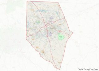
Cross Anchor is a Census-designated place in Spartanburg County, South Carolina, United States. The population in the 2010 United States Census was 126.
| Name: | Cross Anchor CDP |
|---|---|
| LSAD Code: | 57 |
| LSAD Description: | CDP (suffix) |
| State: | South Carolina |
| County: | Spartanburg County |
| Elevation: | 663 ft (202 m) |
| Total Area: | 0.78 sq mi (2.01 km²) |
| Land Area: | 0.77 sq mi (2.00 km²) |
| Water Area: | 0.00 sq mi (0.01 km²) |
| Total Population: | 116 |
| Population Density: | 149.87/sq mi (57.89/km²) |
| ZIP code: | 29335 |
| Area code: | 864 |
| FIPS code: | 4517845 |
| GNISfeature ID: | 2629823 |
Online Interactive Map
Click on ![]() to view map in "full screen" mode.
to view map in "full screen" mode.
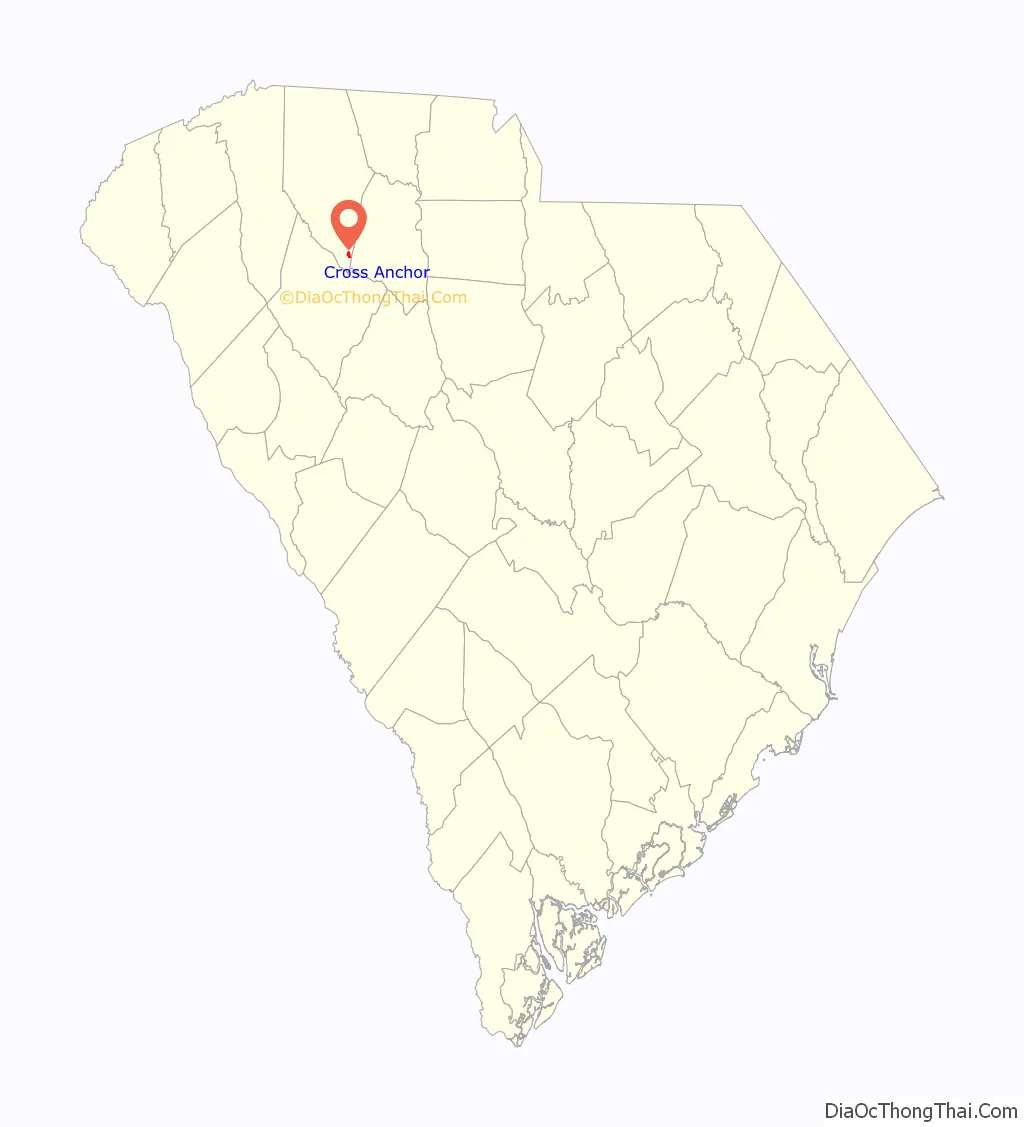
Cross Anchor location map. Where is Cross Anchor CDP?

History
A community post office called Cross Anchor has been in operation since 1809. Cross Anchor may have been named for an old tavern sign depicting two anchors crossed. Alternatively, one Union County historian has stated the name originates from two British brothers who sailed to South Carolina before moving inland. Upon arriving in the Upstate region of the state, the brother who piloted the ship decided to settle in Cross Anchor, naming the community in honor of his role in the brothers’ journey. The other brother, who possessed the ship’s keys, named and settled the nearby community of Cross Keys.
The Musgrove Mill State Historic Site, located in Cross Anchor, was listed on the National Register of Historic Places in 1975.
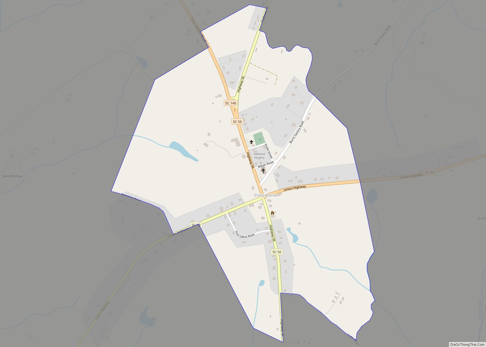
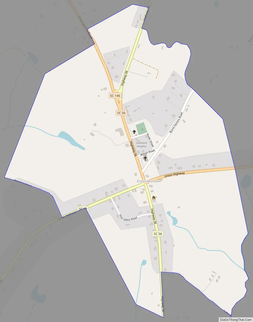
Cross Anchor Road Map
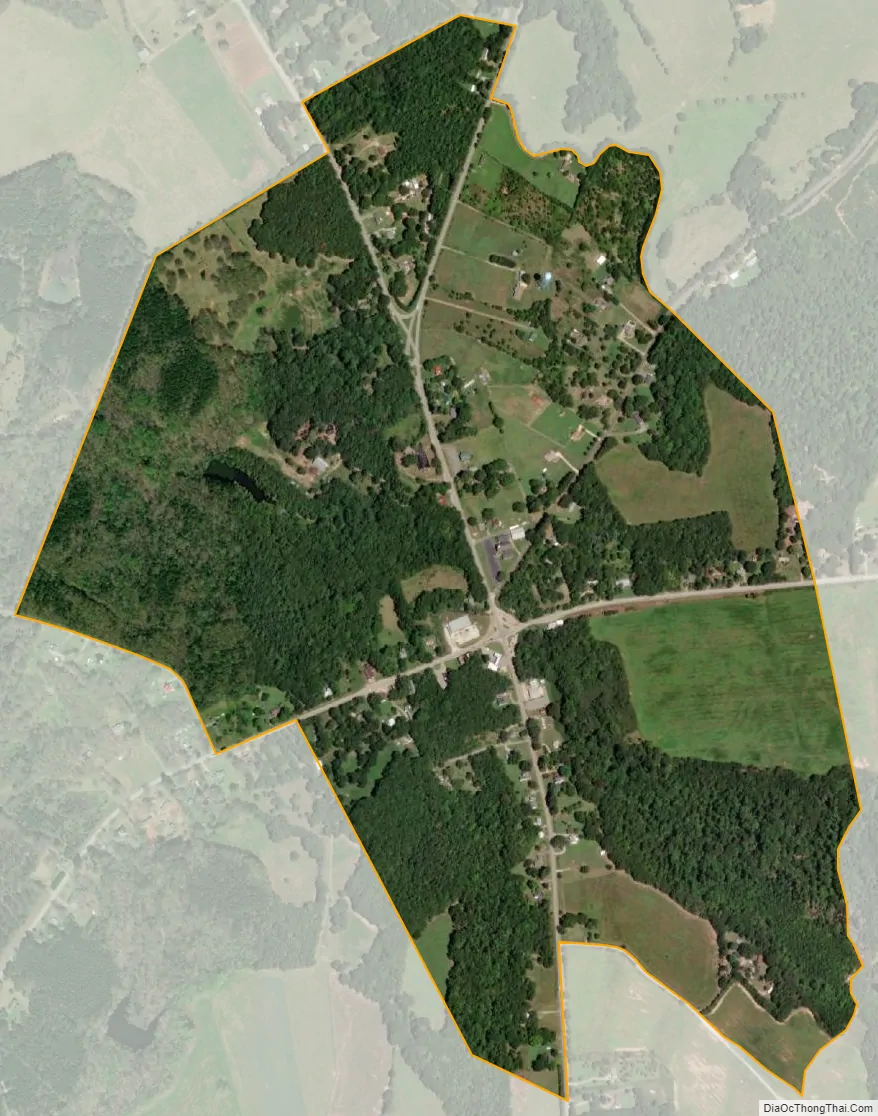
Cross Anchor city Satellite Map
Geography
Cross Anchor is located in extreme southern Spartanburg County. The community’s central location is the intersection of South Carolina Highways 49 and 56 where one traffic light exists. Nearby towns include Woodruff, Clinton, Union, and Pauline. Interstate 26 (approximately 8 miles from the town center) allows for easy access to Spartanburg to the north, and the capital, Columbia, to the south.
The elevation is 679 feet above mean sea level.
See also
Map of South Carolina State and its subdivision:- Abbeville
- Aiken
- Allendale
- Anderson
- Bamberg
- Barnwell
- Beaufort
- Berkeley
- Calhoun
- Charleston
- Cherokee
- Chester
- Chesterfield
- Clarendon
- Colleton
- Darlington
- Dillon
- Dorchester
- Edgefield
- Fairfield
- Florence
- Georgetown
- Greenville
- Greenwood
- Hampton
- Horry
- Jasper
- Kershaw
- Lancaster
- Laurens
- Lee
- Lexington
- Marion
- Marlboro
- McCormick
- Newberry
- Oconee
- Orangeburg
- Pickens
- Richland
- Saluda
- Spartanburg
- Sumter
- Union
- Williamsburg
- York
- Alabama
- Alaska
- Arizona
- Arkansas
- California
- Colorado
- Connecticut
- Delaware
- District of Columbia
- Florida
- Georgia
- Hawaii
- Idaho
- Illinois
- Indiana
- Iowa
- Kansas
- Kentucky
- Louisiana
- Maine
- Maryland
- Massachusetts
- Michigan
- Minnesota
- Mississippi
- Missouri
- Montana
- Nebraska
- Nevada
- New Hampshire
- New Jersey
- New Mexico
- New York
- North Carolina
- North Dakota
- Ohio
- Oklahoma
- Oregon
- Pennsylvania
- Rhode Island
- South Carolina
- South Dakota
- Tennessee
- Texas
- Utah
- Vermont
- Virginia
- Washington
- West Virginia
- Wisconsin
- Wyoming