Estill is a town in Hampton County, South Carolina, United States. The population was 2,040 at the 2010 census.
| Name: | Estill town |
|---|---|
| LSAD Code: | 43 |
| LSAD Description: | town (suffix) |
| State: | South Carolina |
| County: | Hampton County |
| Elevation: | 112 ft (34 m) |
| Total Area: | 3.23 sq mi (8.37 km²) |
| Land Area: | 3.23 sq mi (8.37 km²) |
| Water Area: | 0.00 sq mi (0.00 km²) |
| Total Population: | 1,821 |
| Population Density: | 563.78/sq mi (217.69/km²) |
| ZIP code: | 29918, 29939 |
| Area code: | 803, 839 |
| FIPS code: | 4523830 |
| GNISfeature ID: | 1222302 |
| Website: | www.townofestill.sc.gov |
Online Interactive Map
Click on ![]() to view map in "full screen" mode.
to view map in "full screen" mode.
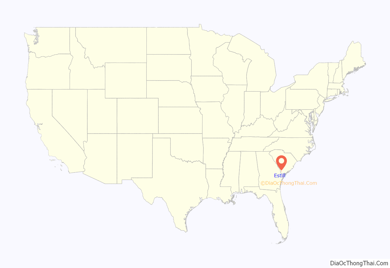
Estill location map. Where is Estill town?
History
The town of Estill is located in the southern half of Hampton County. The town is named for Colonel John Holbrook Estill. Estill was formed in 1900 when the railroad, later Seaboard Air Line Railroad, needed a rail line between Augusta, Georgia and Savannah, Georgia. Upon construction of the rail line, the new town of Estill was incorporated in 1905.
The John Lawton House and Lawtonville Baptist Church are listed on the National Register of Historic Places.
Federal Correctional Institution, Estill is located near the town.
2020 Tornado
In the early morning hours of April 13, 2020, a large, violent EF4 Tornado struck areas just south of Estill. The tornado (which packed winds of 175 MPH) killed 5 and injured around 60 people. The nearby community of Nixville, South Carolina suffered a direct hit from the tornado, and sustained the brunt of the twister’s impacts. The Federal Correctional Institution, Estill also sustained damage, resulting in many of the prison’s inmates being temporarily transferred to the United States Penitentiary, Lewisburg in Lewisburg, Pennsylvania. The tornado was the first violent tornado in South Carolina since 1995.
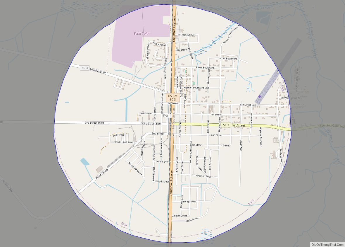
Estill Road Map
Estill city Satellite Map
Geography
Estill is located 52 miles (84 km) north of Savannah, Georgia, 64 miles (103 km) northwest of Hilton Head Island and 93 miles (150 km) west of Charleston. The major industries are timber and agriculture.
See also
Map of South Carolina State and its subdivision:- Abbeville
- Aiken
- Allendale
- Anderson
- Bamberg
- Barnwell
- Beaufort
- Berkeley
- Calhoun
- Charleston
- Cherokee
- Chester
- Chesterfield
- Clarendon
- Colleton
- Darlington
- Dillon
- Dorchester
- Edgefield
- Fairfield
- Florence
- Georgetown
- Greenville
- Greenwood
- Hampton
- Horry
- Jasper
- Kershaw
- Lancaster
- Laurens
- Lee
- Lexington
- Marion
- Marlboro
- McCormick
- Newberry
- Oconee
- Orangeburg
- Pickens
- Richland
- Saluda
- Spartanburg
- Sumter
- Union
- Williamsburg
- York
- Alabama
- Alaska
- Arizona
- Arkansas
- California
- Colorado
- Connecticut
- Delaware
- District of Columbia
- Florida
- Georgia
- Hawaii
- Idaho
- Illinois
- Indiana
- Iowa
- Kansas
- Kentucky
- Louisiana
- Maine
- Maryland
- Massachusetts
- Michigan
- Minnesota
- Mississippi
- Missouri
- Montana
- Nebraska
- Nevada
- New Hampshire
- New Jersey
- New Mexico
- New York
- North Carolina
- North Dakota
- Ohio
- Oklahoma
- Oregon
- Pennsylvania
- Rhode Island
- South Carolina
- South Dakota
- Tennessee
- Texas
- Utah
- Vermont
- Virginia
- Washington
- West Virginia
- Wisconsin
- Wyoming
