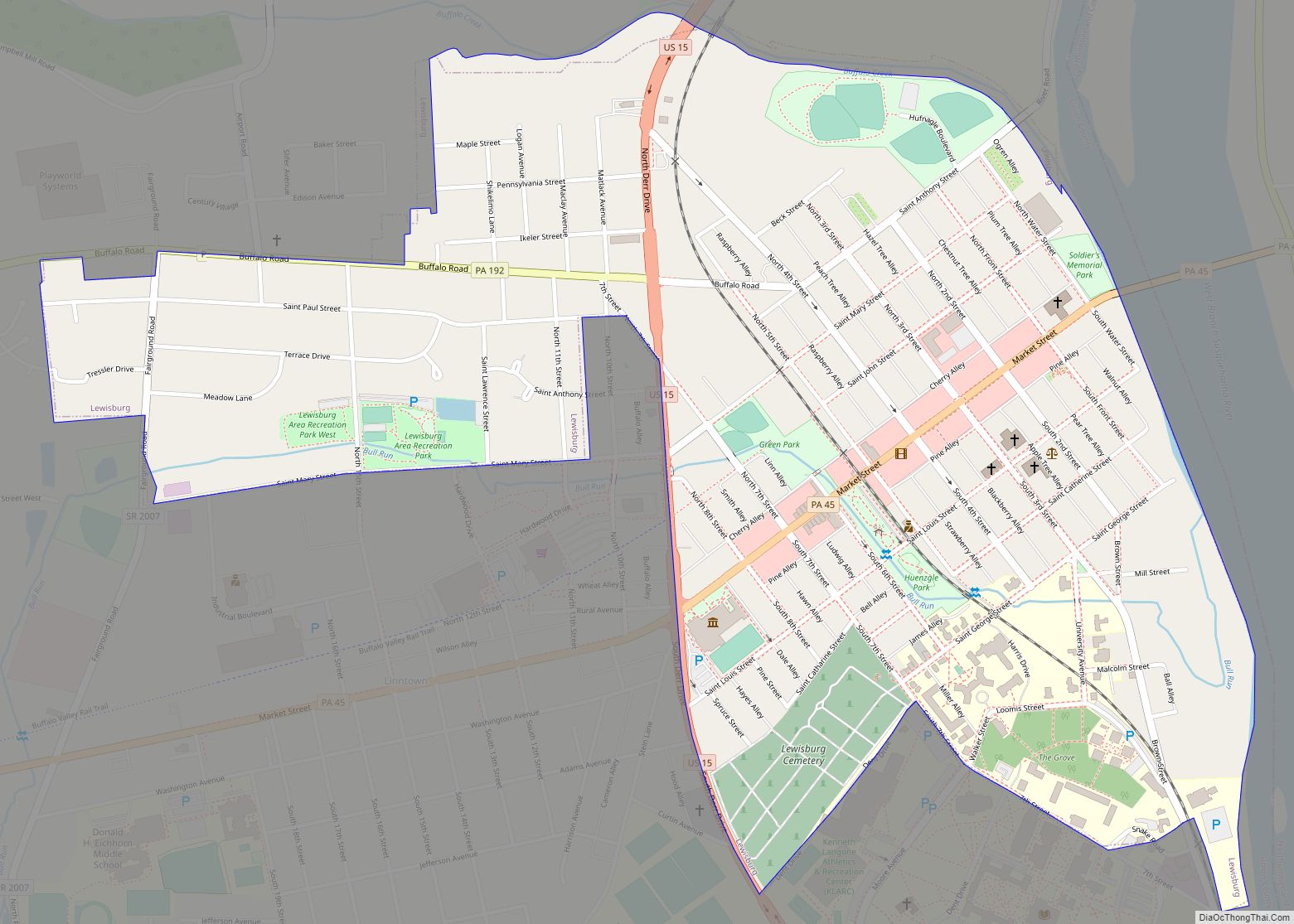
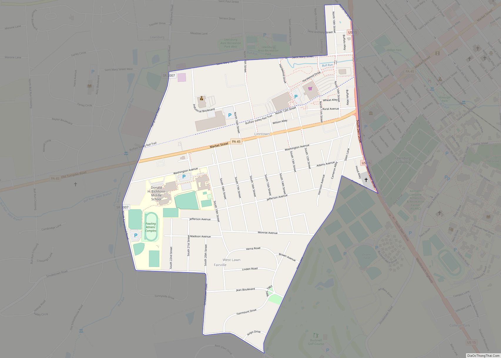
Lewisburg is a borough in Union County, Pennsylvania, United States, 30 miles (48 km) south by southeast of Williamsport and 60 miles (97 km) north of Harrisburg. In the past, it was the commercial center for a fertile grain and general farming region. The population was 5,158 as of the 2020 census. It is the county seat of Union County. Located in central Pennsylvania’s Susquehanna River Valley, on the West Branch Susquehanna River, Lewisburg is northwest of Sunbury. It is home to Bucknell University and is near the Lewisburg Federal Penitentiary. Its 19th-century downtown is on the National Register of Historic Places. Lewisburg is the principal city of the Lewisburg, PA Micropolitan Statistical Area, and is also part of the larger Bloomsburg-Berwick-Sunbury, PA Combined Statistical Area.
| Name: | Lewisburg borough |
|---|---|
| LSAD Code: | 21 |
| LSAD Description: | borough (suffix) |
| State: | Pennsylvania |
| County: | Union County |
| Total Area: | 0.97 sq mi (2.52 km²) |
| Land Area: | 0.97 sq mi (2.52 km²) |
| Water Area: | 0.00 sq mi (0.00 km²) |
| Total Population: | 5,158 |
| Population Density: | 5,301.13/sq mi (2,046.36/km²) |
| Area code: | 570 |
| FIPS code: | 4242976 |
| Website: | www.lewisburgborough.org |
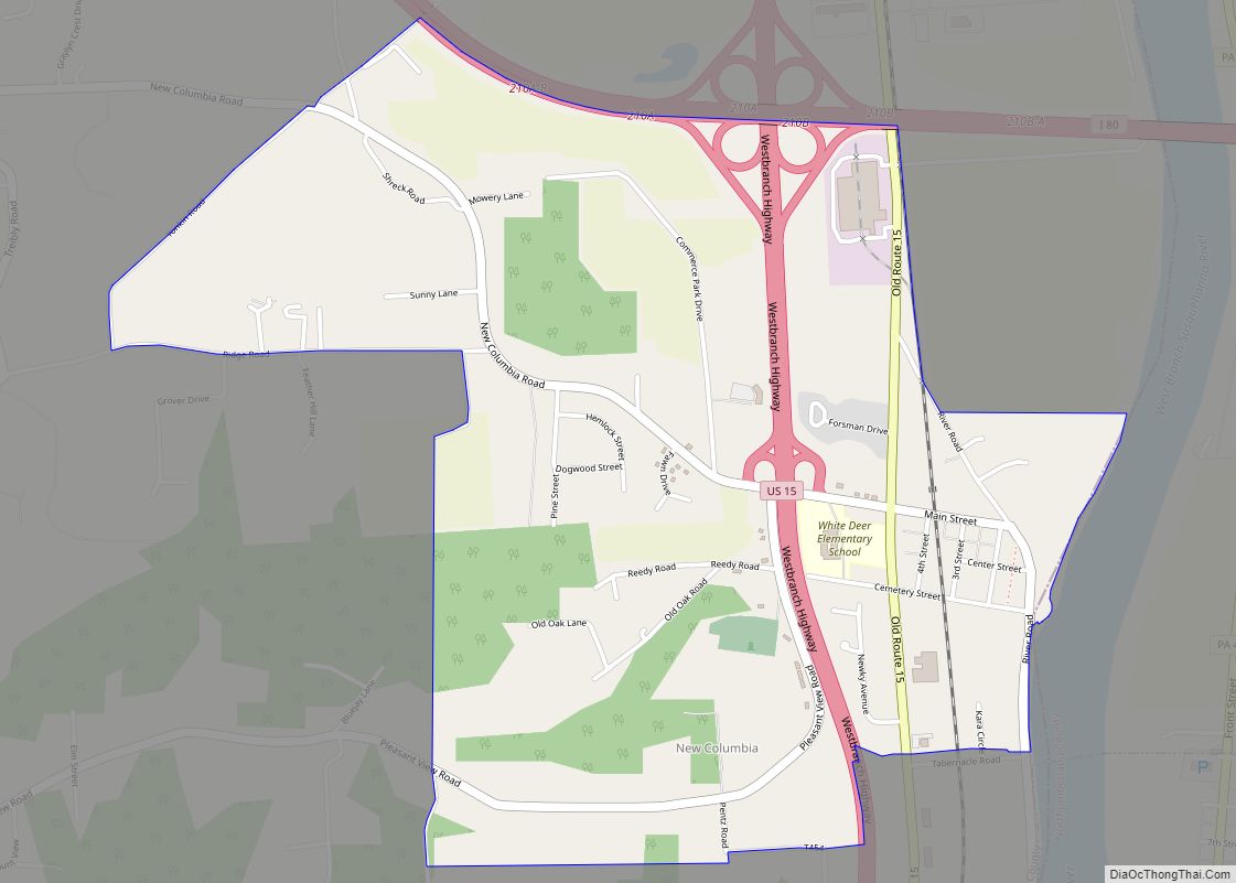
Online Interactive Map
Click on ![]() to view map in "full screen" mode.
to view map in "full screen" mode.
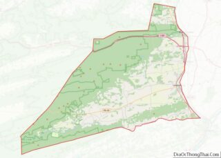
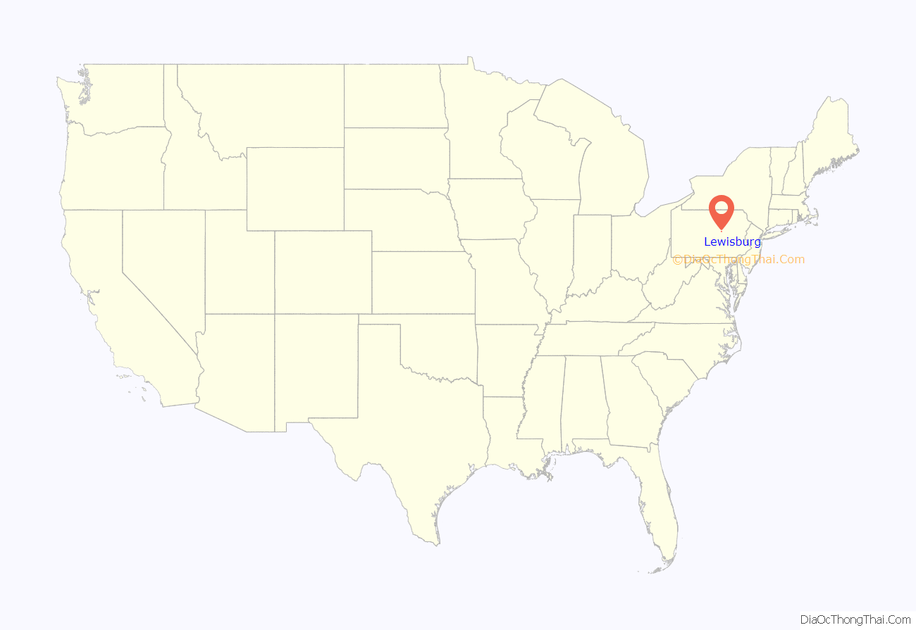
Lewisburg location map. Where is Lewisburg borough?
History
Lewisburg was founded in 1785 by Ludwig Derr. A settler of the area (since as early as 1763–1769), Derr had purchased several tracts of land from the William Penn family and other neighboring land owners, the largest of which was known as “The Prescott”. Having been on the land for such a long time, Derr had befriended the local Native Americans of the area. His relationship with these indigenous peoples was so well founded that, even as many of the other local settlers’ homesteads were routinely sacked by Native Americans, Derr’s lands remained free from attacks. Subsequently, in 1784, he worked with Samuel Weiser to lay out his combined land tracts, and create Derrstown. The name was later changed to Lewisburgh when Snyder County was created from Union County in 1855 (according to a local Keystone marker sign), but was known on original plans and deeds as Lewisburg before that time (also see note below).
Much has been considered regarding ‘how’ the name changed from Derrstown to Lewisburg. The most likely truth is that Derr’s first name “Ludwig” translated into English as “Louis” but, being of German descent, it was spelled “Lewis”. Later, after Derr’s death, the traditional Germanic “burgh” was appended to his first name to create Lewisburgh.
Note: U.S. Postal Service records contradict this story. The post office was named Lewisburgh when it was established in 1796; in 1893, the name was shortened to Lewisburg.
The street names that run east and west are a local urban mystery. St. George, St. Catherine, and St. Louis etc. appear to be named for saints. While Lutherans, such as Derr was, recognize historic catholic saints, the street names are more likely named for Derr’s family members (whose names coincided with saints). Those streets are consecutively parallel, and emanate from what was then Derr’s home, and the location of the first available lot sold (which were both situated on, what is now, Mill Street). George was Ludwig’s son, his wife Catherine and Ludwig/Lewis (sic) himself. The other original street names that still exist are St. John, St. Mary and St. Anthony, which may be the names of other children from families with whom Derr’s own family were friends. However, there is an indication that Derr also had a daughter named Mary. Overall, however, the premise is further supported by the notion that the German word for street is Strasse (Straße, abbreviated St). At the time, street names were pronounced as Strasse Mary or Strasse George. Later, when signs were made to note the street names, the abbreviation for Strasse was allowed to remain, but the US/English abbreviation was redundantly added to the signs.
The second mystery surrounding Lewisburg is the disappearance of its founder Ludwig Derr. After selling several lots of land, Derr set off for Philadelphia to sell additional lots. Shortly after arriving, records indicate some of his lots had sold. However, Ludwig Derr simply disappears from history in that city. Derr’s son George went to Philadelphia to search for his father, but returned a short time later, unsuccessful.
Over the centuries, Lewisburg has been a center of commerce in Union County. The West Branch Susquehanna River was used for logging and shipping, and remains of old factories and other ancient stone structures exist along the river banks. Prior to, and during, the Civil War, many abolitionists lived in the area, and several locations within the town of Lewisburg served as stopping points on the famous Underground Railroad.
The Lewisburg Historic District, Chamberlin Iron Front Building, Packwood House-American Hotel, and Reading Railroad Freight Station are listed on the National Register of Historic Places.
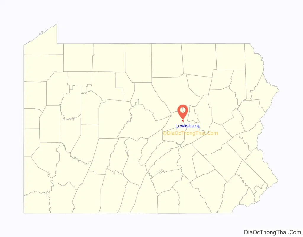
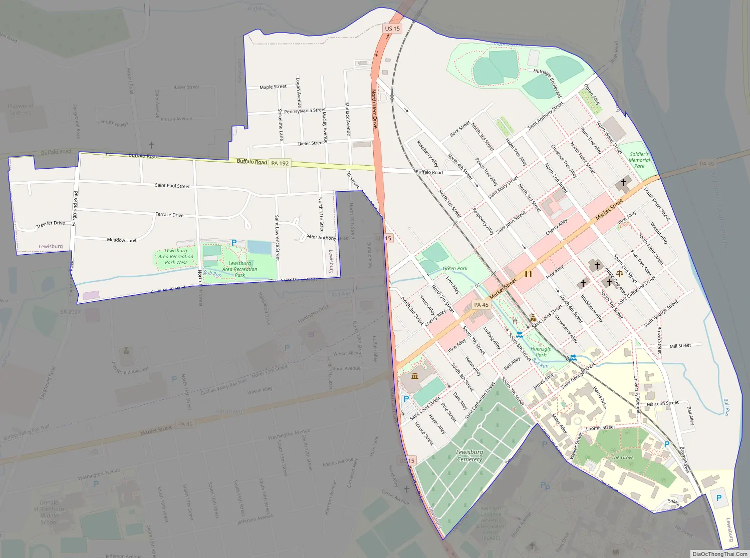
Lewisburg Road Map
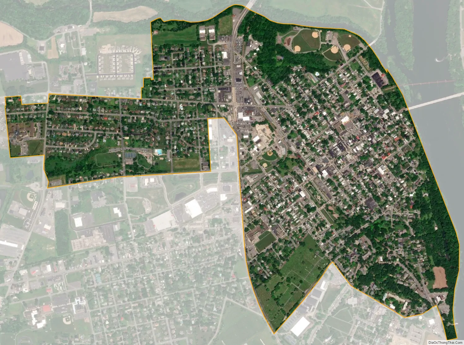
Lewisburg city Satellite Map
Geography
Lewisburg is located at 40°57′50″N 76°53′17″W / 40.96389°N 76.88806°W / 40.96389; -76.88806 (40.963895, -76.888154).
According to the United States Census Bureau, the borough has a total area of 1.0 square mile (2.6 km), all land.
See also
Map of Pennsylvania State and its subdivision:- Adams
- Allegheny
- Armstrong
- Beaver
- Bedford
- Berks
- Blair
- Bradford
- Bucks
- Butler
- Cambria
- Cameron
- Carbon
- Centre
- Chester
- Clarion
- Clearfield
- Clinton
- Columbia
- Crawford
- Cumberland
- Dauphin
- Delaware
- Elk
- Erie
- Fayette
- Forest
- Franklin
- Fulton
- Greene
- Huntingdon
- Indiana
- Jefferson
- Juniata
- Lackawanna
- Lancaster
- Lawrence
- Lebanon
- Lehigh
- Luzerne
- Lycoming
- Mc Kean
- Mercer
- Mifflin
- Monroe
- Montgomery
- Montour
- Northampton
- Northumberland
- Perry
- Philadelphia
- Pike
- Potter
- Schuylkill
- Snyder
- Somerset
- Sullivan
- Susquehanna
- Tioga
- Union
- Venango
- Warren
- Washington
- Wayne
- Westmoreland
- Wyoming
- York
- Alabama
- Alaska
- Arizona
- Arkansas
- California
- Colorado
- Connecticut
- Delaware
- District of Columbia
- Florida
- Georgia
- Hawaii
- Idaho
- Illinois
- Indiana
- Iowa
- Kansas
- Kentucky
- Louisiana
- Maine
- Maryland
- Massachusetts
- Michigan
- Minnesota
- Mississippi
- Missouri
- Montana
- Nebraska
- Nevada
- New Hampshire
- New Jersey
- New Mexico
- New York
- North Carolina
- North Dakota
- Ohio
- Oklahoma
- Oregon
- Pennsylvania
- Rhode Island
- South Carolina
- South Dakota
- Tennessee
- Texas
- Utah
- Vermont
- Virginia
- Washington
- West Virginia
- Wisconsin
- Wyoming