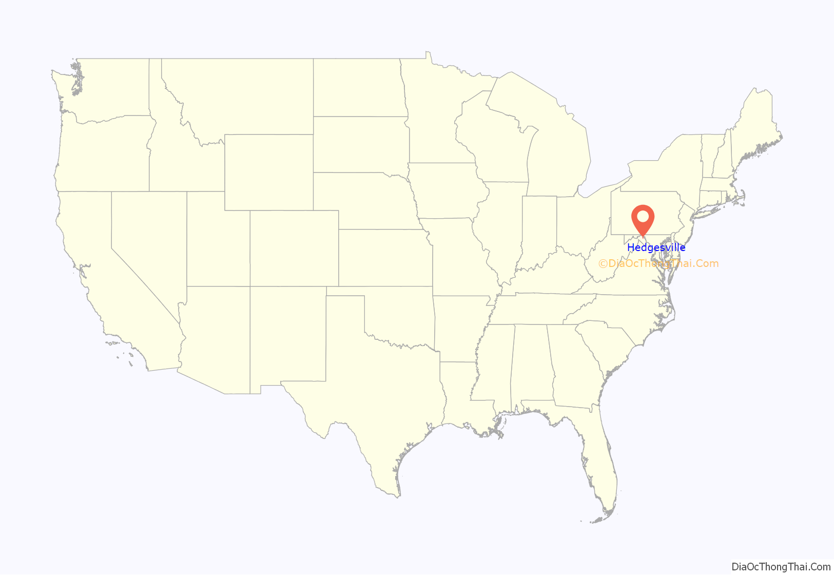
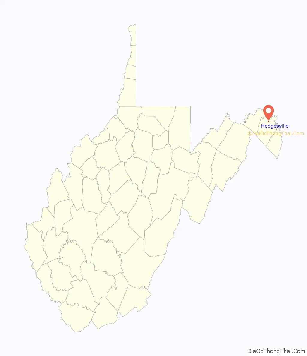
Hedgesville is a town in Berkeley County, West Virginia, United States, in the state’s Eastern Panhandle region. The population was 318 at the 2010 census. The town sits on WV 9, and is roughly 13 miles east of Berkeley Springs. In addition to its legal definition, Hedgesville has come to be the common name for the large and sparsely inhabited area of West Virginia’s Eastern Panhandle bordered by the Potomac River to the North and East, a southern border defined roughly by an imaginary line from the city of Martinsburg to the tip of Virginia, and Berkeley Springs to the West.
| Name: | Hedgesville town |
|---|---|
| LSAD Code: | 43 |
| LSAD Description: | town (suffix) |
| State: | West Virginia |
| County: | Berkeley County |
| Elevation: | 69 ft (195 m) |
| Total Area: | 0.13 sq mi (0.34 km²) |
| Land Area: | 0.13 sq mi (0.34 km²) |
| Water Area: | 0.00 sq mi (0.00 km²) |
| Total Population: | 318 |
| Population Density: | 2,267.18/sq mi (872.39/km²) |
| ZIP code: | 25427 |
| Area code: | 304 |
| FIPS code: | 5436220 |
| GNISfeature ID: | 1554676 |
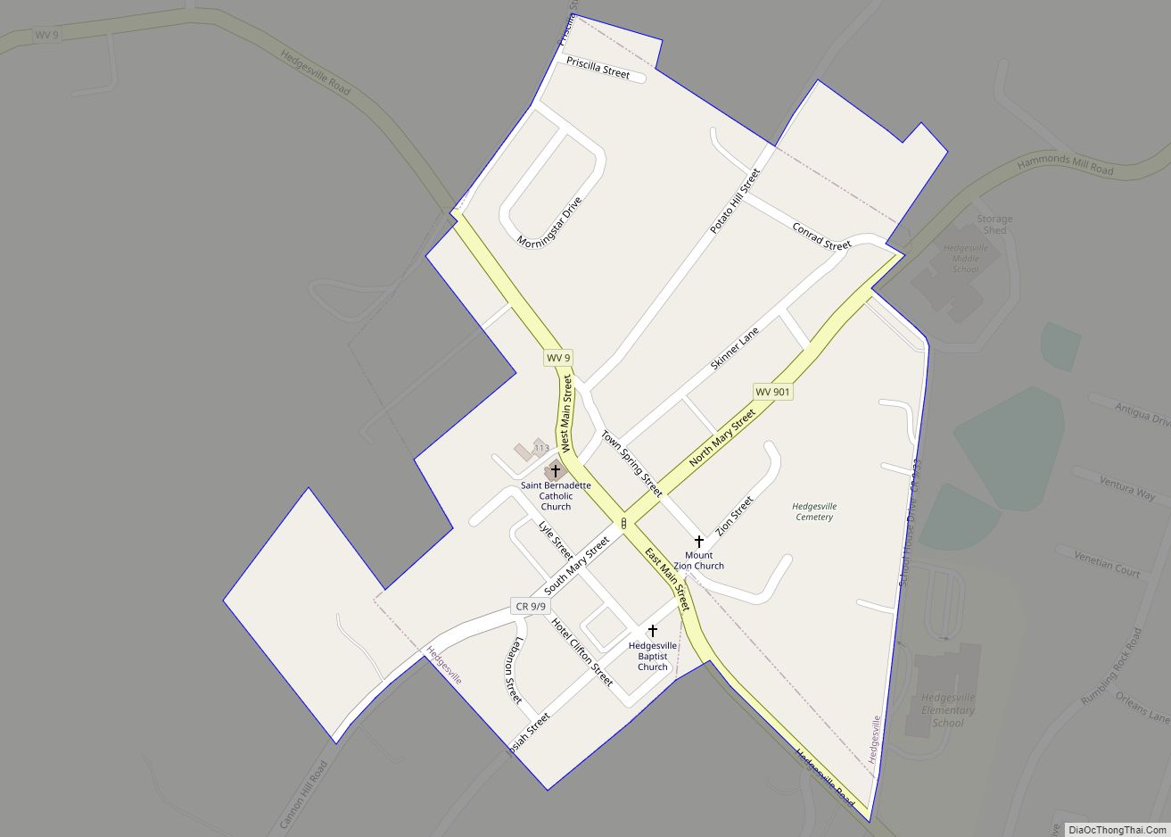
Online Interactive Map
Click on ![]() to view map in "full screen" mode.
to view map in "full screen" mode.
Hedgesville location map. Where is Hedgesville town?
History
The Hedgesville area was originally settled by William Snodgrass, who arrived in the American colonies in 1700. William Snodgrass is buried in the cemetery of Tuscarora Presbyterian Church in Berkeley County, West Virginia. Officially established by an act of the Virginia General Assembly on February 11, 1836, the Town of Hedgesville was laid out in 1832 along the old Warm Springs Road (now West Virginia Route 9) and named for the prominent local Hedges family. In 1854, Hedgesville was officially incorporated by the General Assembly. The act of incorporation provided for a town council consisting of seven trustees, but the act was amended in 1858 so that a mayor could be added to the council. Hedgesville is a National Register Historic District. Prior to that, in the 18th Century, it was home to the Tuscarora people.
On August 17, 2004, President George W. Bush made a re-election campaign stop and photo-op at Hedgesville High School.
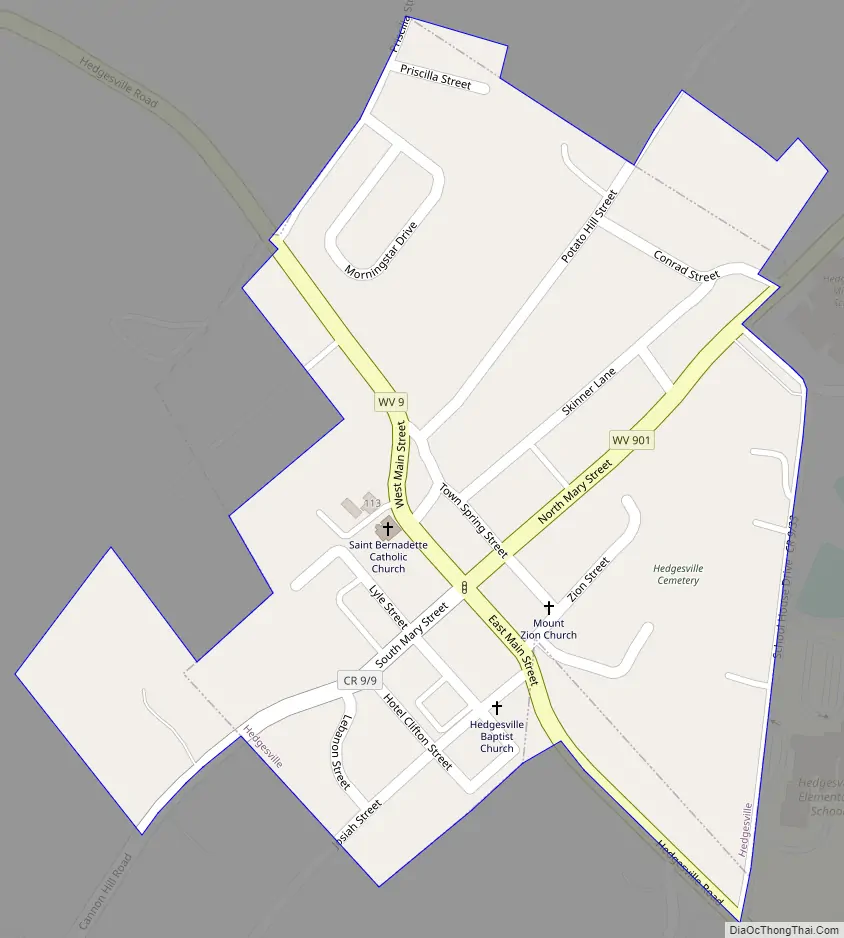
Hedgesville Road Map
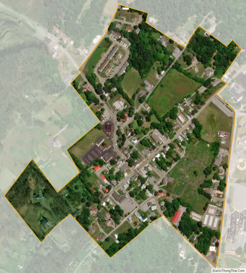
Hedgesville city Satellite Map
Geography
Hedgesville is located at 39°33′15″N 77°59′42″W / 39.55417°N 77.99500°W / 39.55417; -77.99500 (39.554188, -77.994967).
According to the United States Census Bureau, the town has a total area of 0.13 square miles (0.34 km), all land.
See also
Map of West Virginia State and its subdivision:- Barbour
- Berkeley
- Boone
- Braxton
- Brooke
- Cabell
- Calhoun
- Clay
- Doddridge
- Fayette
- Gilmer
- Grant
- Greenbrier
- Hampshire
- Hancock
- Hardy
- Harrison
- Jackson
- Jefferson
- Kanawha
- Lewis
- Lincoln
- Logan
- Marion
- Marshall
- Mason
- McDowell
- Mercer
- Mineral
- Mingo
- Monongalia
- Monroe
- Morgan
- Nicholas
- Ohio
- Pendleton
- Pleasants
- Pocahontas
- Preston
- Putnam
- Raleigh
- Randolph
- Ritchie
- Roane
- Summers
- Taylor
- Tucker
- Tyler
- Upshur
- Wayne
- Webster
- Wetzel
- Wirt
- Wood
- Wyoming
- Alabama
- Alaska
- Arizona
- Arkansas
- California
- Colorado
- Connecticut
- Delaware
- District of Columbia
- Florida
- Georgia
- Hawaii
- Idaho
- Illinois
- Indiana
- Iowa
- Kansas
- Kentucky
- Louisiana
- Maine
- Maryland
- Massachusetts
- Michigan
- Minnesota
- Mississippi
- Missouri
- Montana
- Nebraska
- Nevada
- New Hampshire
- New Jersey
- New Mexico
- New York
- North Carolina
- North Dakota
- Ohio
- Oklahoma
- Oregon
- Pennsylvania
- Rhode Island
- South Carolina
- South Dakota
- Tennessee
- Texas
- Utah
- Vermont
- Virginia
- Washington
- West Virginia
- Wisconsin
- Wyoming