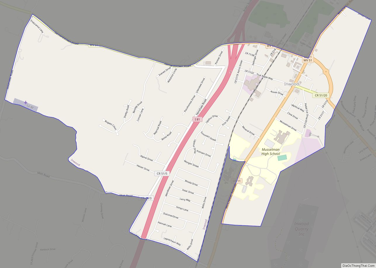
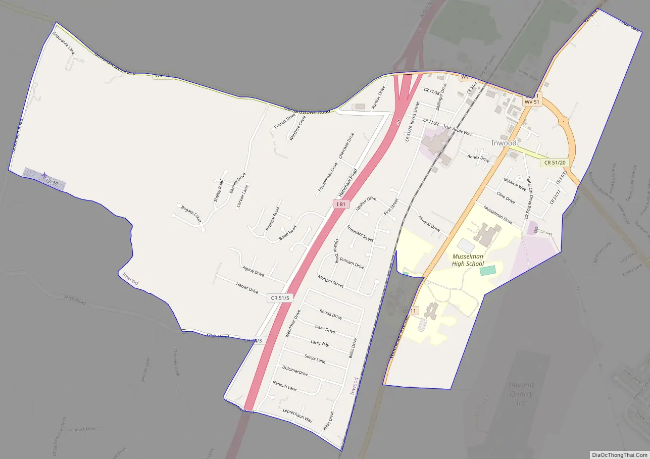
Inwood is a census-designated place (CDP) in Berkeley County, West Virginia, United States, located south of Martinsburg in the lower Shenandoah Valley. The population was 2,954 at the 2010 census. It is located on U.S. Route 11.
| Name: | Inwood CDP |
|---|---|
| LSAD Code: | 57 |
| LSAD Description: | CDP (suffix) |
| State: | West Virginia |
| County: | Berkeley County |
| Elevation: | 568 ft (173 m) |
| Total Area: | 2.9 sq mi (7.4 km²) |
| Land Area: | 2.9 sq mi (7.4 km²) |
| Water Area: | 0.0 sq mi (0.0 km²) |
| Total Population: | 2,954 |
| Population Density: | 1,000/sq mi (400/km²) |
| ZIP code: | 25428 |
| Area code: | 304, 681 |
| FIPS code: | 5440204 |
| GNISfeature ID: | 1540713 |
Online Interactive Map
Click on ![]() to view map in "full screen" mode.
to view map in "full screen" mode.
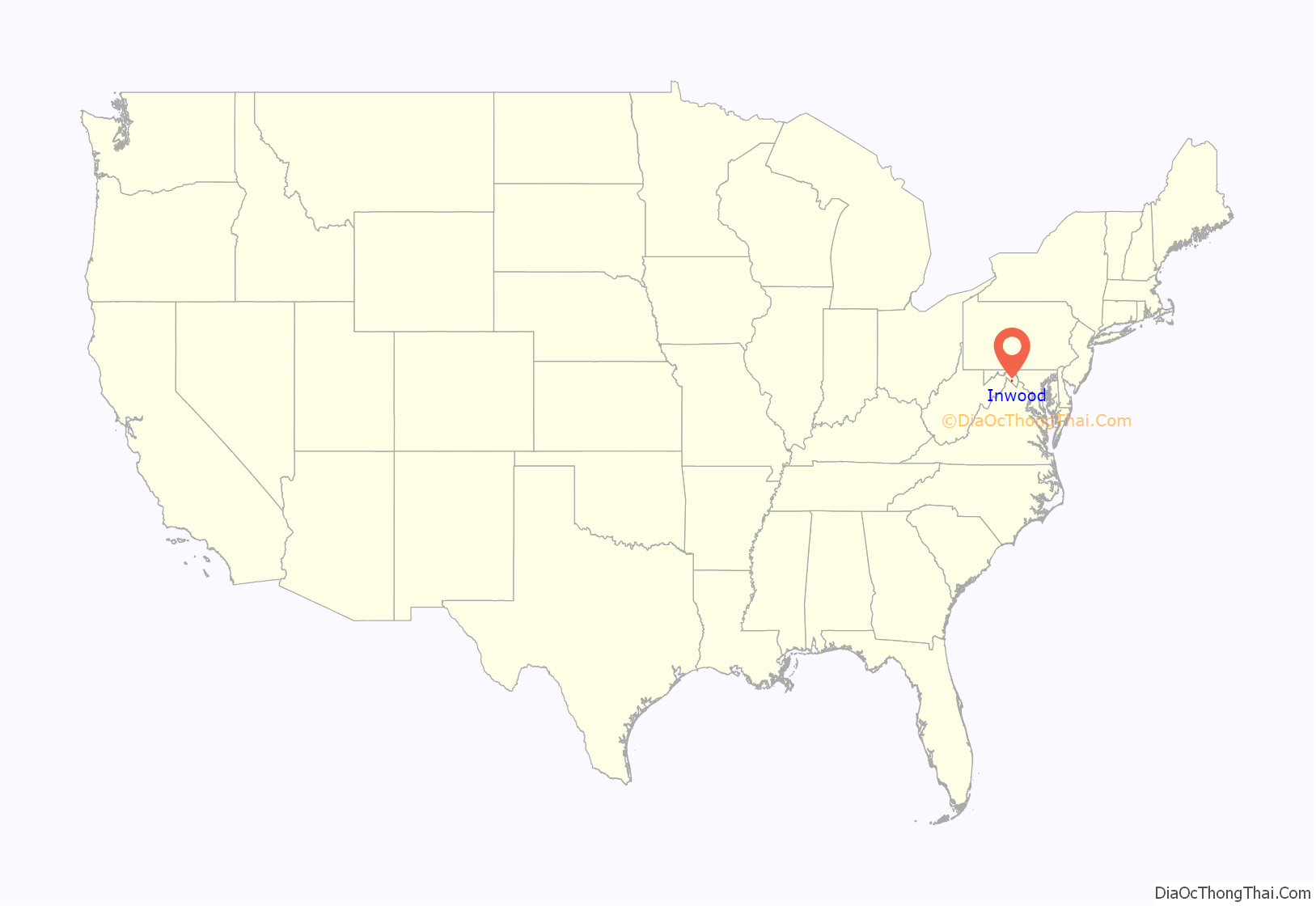
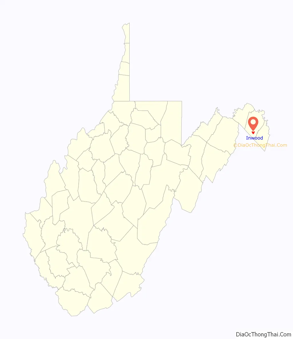
Inwood location map. Where is Inwood CDP?
History
In the late 1880s, coinciding with the arrival of the Cumberland Valley Railroad (CVRR) extension, a resort that became known as Inwood Park was established on the property of the Strong family of south Berkeley County, West Virginia. On May 5, 1890, the Inwood Post Office opened and the village grew around the Park. From 1892 – 1913, an annual event called the Inwood Fair was held at the Park. This event drew in the range of 7,000 – 12,000 people.
The Cumberland Valley Railroad station in Inwood also included a grain elevator, which ensured that much of the local agricultural products would be brought to Inwood to be shipped elsewhere. Other products shipped from Inwood via the CVRR were wood products, such as bark (for tanning) and railroad ties from the area west of the town. The station at Inwood was one of the most profitable stations on the CVRR line.
The town of Inwood was originally called Gerrard. There are two stories as to how the town got its name. One story is that it was named for the Park located there – Inwood Park, the park “in the woods” – therefore INWOOD park.
The other story is that Inwood’s name was changed when Jonathan Newton Thatcher, of Gerrard, wanted to open a post office in the town. Washington D.C. post authorities told Thatcher that he would have to rename the town of Gerrard, since it would conflict with mail going to Gerrardstown, a town 4 miles west. When Thatcher’s cousin from Inwood, California, showed him a letter with his home address on it, he decided to use the name “Inwood” for the town. He wrote to Washington D.C. to get the town’s name changed from Gerrard to Inwood and to get a post office established there. Jonathan Thatcher was the first postmaster for the new Inwood, West Virginia.
In the early years of the 20th century, a local prominent citizen and politician, Gray Silver, was instrumental in establishing a co-op among the area’s many orchardists. The principal crop among those orchardists was apples, because they were less likely to be damaged during shipment and the fact that they could last for long periods of time when stored properly. Through federal funds and the influence of Gray Silver, a school where various aspects of growing apples was established at Inwood.
Gray Silver was also instrumental in putting together a group of investors to bring a commercial apple plant to Inwood.
In 1920, the C.H. Musselman Company of Biglerville, Pennsylvania, opened an apple processing plant at Inwood. This was convenient to the many apple orchards of the Shenandoah Valley and the former Cumberland Valley Railroad, by this time part of the Pennsylvania Railroad line. By the late 1920s, the Musselman plant in Inwood exclusively produced apple sauce, the first apple processing plant of its kind.
Inwood Road Map
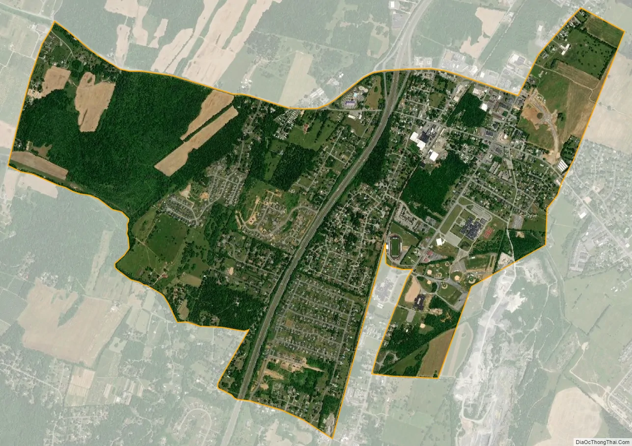
Inwood city Satellite Map
Geography
According to the United States Census Bureau, the CDP has a total area of 2.9 square miles (7.5 km), all land.
See also
Map of West Virginia State and its subdivision:- Barbour
- Berkeley
- Boone
- Braxton
- Brooke
- Cabell
- Calhoun
- Clay
- Doddridge
- Fayette
- Gilmer
- Grant
- Greenbrier
- Hampshire
- Hancock
- Hardy
- Harrison
- Jackson
- Jefferson
- Kanawha
- Lewis
- Lincoln
- Logan
- Marion
- Marshall
- Mason
- McDowell
- Mercer
- Mineral
- Mingo
- Monongalia
- Monroe
- Morgan
- Nicholas
- Ohio
- Pendleton
- Pleasants
- Pocahontas
- Preston
- Putnam
- Raleigh
- Randolph
- Ritchie
- Roane
- Summers
- Taylor
- Tucker
- Tyler
- Upshur
- Wayne
- Webster
- Wetzel
- Wirt
- Wood
- Wyoming
- Alabama
- Alaska
- Arizona
- Arkansas
- California
- Colorado
- Connecticut
- Delaware
- District of Columbia
- Florida
- Georgia
- Hawaii
- Idaho
- Illinois
- Indiana
- Iowa
- Kansas
- Kentucky
- Louisiana
- Maine
- Maryland
- Massachusetts
- Michigan
- Minnesota
- Mississippi
- Missouri
- Montana
- Nebraska
- Nevada
- New Hampshire
- New Jersey
- New Mexico
- New York
- North Carolina
- North Dakota
- Ohio
- Oklahoma
- Oregon
- Pennsylvania
- Rhode Island
- South Carolina
- South Dakota
- Tennessee
- Texas
- Utah
- Vermont
- Virginia
- Washington
- West Virginia
- Wisconsin
- Wyoming