Mannington is a city in Marion County, West Virginia, United States, located in the hills of North Central West Virginia. The population was 1,961 at the 2020 census. In its earliest years it was called Forks of Buffalo or Koon Town, but has been called Mannington since 1856.
| Name: | Mannington city |
|---|---|
| LSAD Code: | 25 |
| LSAD Description: | city (suffix) |
| State: | West Virginia |
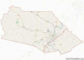
| County: | Marion County |
| Elevation: | 974 ft (297 m) |
| Total Area: | 1.14 sq mi (2.95 km²) |
| Land Area: | 1.09 sq mi (2.83 km²) |
| Water Area: | 0.05 sq mi (0.12 km²) |
| Total Population: | 1,961 |
| Population Density: | 1,850.87/sq mi (714.74/km²) |
| ZIP code: | 26582 |
| Area code: | 304/681 |
| FIPS code: | 5451100 |
| GNISfeature ID: | 1542721 |
| Website: | www.cityofmannington.com |
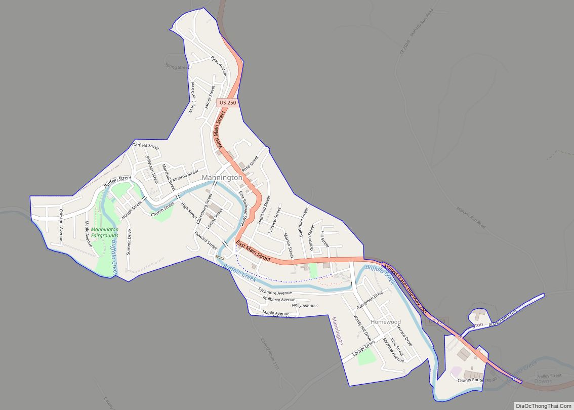
Online Interactive Map
Click on ![]() to view map in "full screen" mode.
to view map in "full screen" mode.
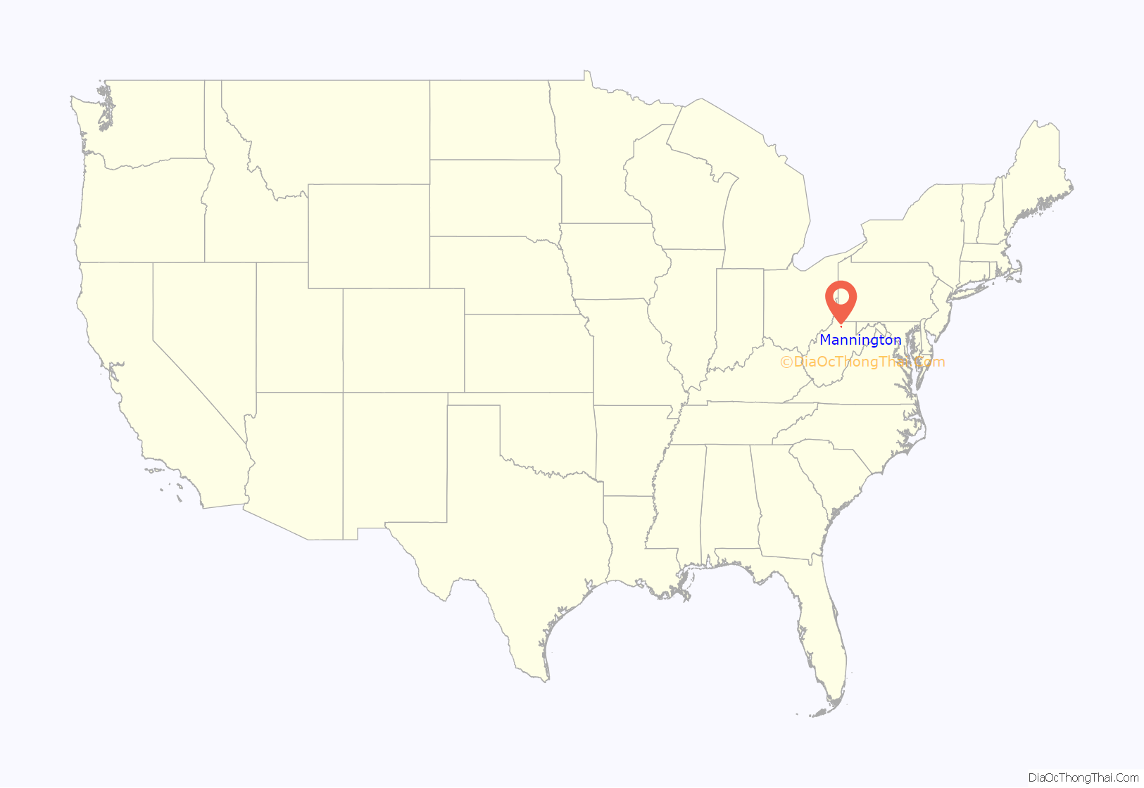
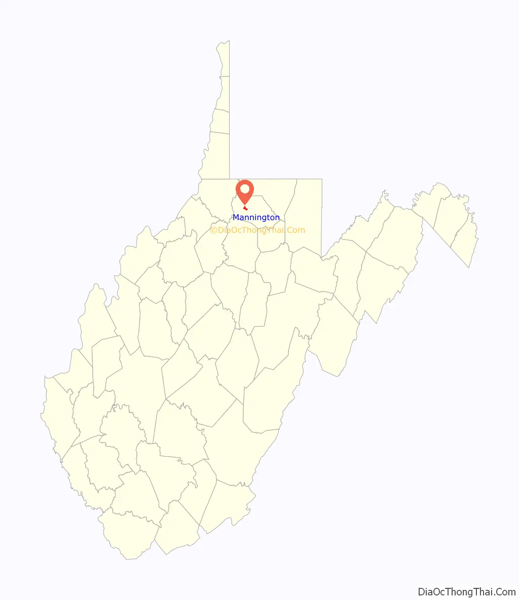
Mannington location map. Where is Mannington city?
History
Early history
At the time of the first settlement, the west fork of Buffalo Creek was known as Warrior’s Fork, while the North Fork has historically borne the name of Pyle’s Fork. One of the first settlers in the area was John Ice, who was born in the valley of the South Branch of the Potomac River in what was then Virginia. As a child, Ice and his father searched in vain for his mother, two sisters and brother who had been captured by Native Americans. The mother was never found, although the children ultimately were. Only John’s brother, known from then on as “Indian Billy” returned to the family. The sisters chose to remain with their one time captors (Prichard 1983).
Native American activity was not uncommon in the area and many settlers and travelers met their fate at the hands of the Native Americans, including John Madison, the cousin of James Madison the future president, who was killed on a surveying trip in the area in 1783. Although not necessarily as a result of this, James Madison did procure, as an investment, some land on Brush Run and Pyles Fork just north of Forks of Buffalo.
The earliest population concentration did not occur in what is now Mannington, but rather approximately two miles west of Dent’s Run. Most of the land now falling within the city limits, some 1,360 acres (5.5 km), was owned by Robert Rutherford, a Revolutionary War financier and an intimate friend of George Washington. In 1799, Rutherford sold his Forks of Buffalo holdings to James Brown of Berkeley County, Virginia, who, after experiencing financial setbacks, eventually sold the property at public sale in 1824 to a group of Baltimore, Maryland, investors which included William Baker. Baker apparently bought out his partners and, in turn, sold the parcel to James Hanway, a surveyor living in Monongalia County, who parceled the land and began selling it. This final transaction occurred in 1840 and it was then that the area now known as Mannington had its genesis.
After the parceling of the land around the Forks of Buffalo, interest in the area increased as did the population. A number of log houses began to be built, with the accompanying entrepreneurial activities that one might expect in an early settlement. By 1850 a tavern owned by George and Samuel Koon appeared in the heart of the burgeoning town. Not long after the tavern was opened, the Forks of Buffalo began to be known as Koon Town. While the local inhabitants may have used the newer name, the United States government failed to do so, in 1850 naming their first postal office in the community the Forks of Buffalo Post Office. It was not until 1856 that the village officially became known as Mannington, named after Charles Manning, a civil engineer with the Baltimore and Ohio (B&O) Railroad. Manning was well liked by the community and the inhabitants were eager to have a more “dignified” name for a growing town on the new railroad line.
The coming of the railroad heralded the introduction of heavier industry in the Mannington area. Logging and coal were two of the obvious industries which were developed along the railroad line, but there were a great many peripheral industries which appeared as well. Tree bark was used by the tanneries, which, in turn, produced a wide range of leather goods. New planing mills, sawmills, and woodworking plants were started, and the availability of transportation also witnessed an increase in cattle, sheep and crop production.
During the American Civil War, the B&O railroad, of vital interest to both of the conflicting sides, sustained more damage than Mannington proper did. While Confederate forces succeeded in burning several of the railroad bridges at the very beginning of the conflict, reinforcements from the Union insured the integrity of the Mannington section of the line for the remainder of the war.
Oil and gas boom
A new chapter in Mannington’s history began in 1889 with the first oil drilling, following recommendations made by Dr. Israel C. White, a well-known geologist who later became West Virginia State Geologist. Although many felt that the area was unfavorable for oil reserves, White persisted and soon gained enough local support to drill. Following the first strike, late in 1889, real estate prices soared 100% in two days in a boom-town mentality. The Mannington field became one of the largest in the state, with the largest well producing about 1,600 barrels per day (250 m/d).
Dr. White also pushed for natural gas exploration. It was this venture, more successful than any before or since, that was most responsible for Mannington’s growth. The population increased from approximately 700 people in the late 19th century to over 4,000 by 1917. By 1900, Mannington was a thriving town, complete with its own trolley system, electricity, theaters, schools, fire department, telephones and other amenities. The Mannington School Building, constructed in 1902–1903, was the pride of both the town and the state. In 1923, Albert Heck began the formation of the first community radio cable system from Mannington to its outlying areas.
Boom to bust
The 1929 stock market crash and the Depression severely affected Mannington’s economy. The trolley ceased operation in 1933, factory workers left as demand for products decreased, and the town’s population began to decline.
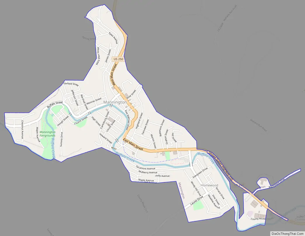
Mannington Road Map
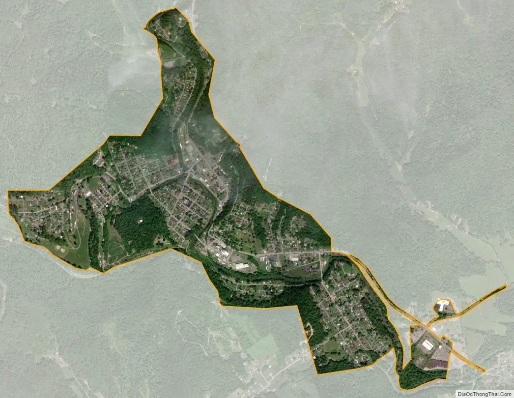
Mannington city Satellite Map
Geography
Mannington is located at 39°31′38″N 80°20′23″W / 39.52722°N 80.33972°W / 39.52722; -80.33972 (39.527340, -80.339742), along Buffalo Creek.
According to the United States Census Bureau, the city has a total area of 1.15 square miles (2.98 km), of which 1.10 square miles (2.85 km) is land and 0.05 square miles (0.13 km) is water.
Climate
The climate in this area is characterized by relatively high temperatures and evenly distributed precipitation throughout the year. According to the Köppen Climate Classification system, Mannington has a Humid subtropical climate, abbreviated “Cfa” on climate maps.
See also
Map of West Virginia State and its subdivision:- Barbour
- Berkeley
- Boone
- Braxton
- Brooke
- Cabell
- Calhoun
- Clay
- Doddridge
- Fayette
- Gilmer
- Grant
- Greenbrier
- Hampshire
- Hancock
- Hardy
- Harrison
- Jackson
- Jefferson
- Kanawha
- Lewis
- Lincoln
- Logan
- Marion
- Marshall
- Mason
- McDowell
- Mercer
- Mineral
- Mingo
- Monongalia
- Monroe
- Morgan
- Nicholas
- Ohio
- Pendleton
- Pleasants
- Pocahontas
- Preston
- Putnam
- Raleigh
- Randolph
- Ritchie
- Roane
- Summers
- Taylor
- Tucker
- Tyler
- Upshur
- Wayne
- Webster
- Wetzel
- Wirt
- Wood
- Wyoming
- Alabama
- Alaska
- Arizona
- Arkansas
- California
- Colorado
- Connecticut
- Delaware
- District of Columbia
- Florida
- Georgia
- Hawaii
- Idaho
- Illinois
- Indiana
- Iowa
- Kansas
- Kentucky
- Louisiana
- Maine
- Maryland
- Massachusetts
- Michigan
- Minnesota
- Mississippi
- Missouri
- Montana
- Nebraska
- Nevada
- New Hampshire
- New Jersey
- New Mexico
- New York
- North Carolina
- North Dakota
- Ohio
- Oklahoma
- Oregon
- Pennsylvania
- Rhode Island
- South Carolina
- South Dakota
- Tennessee
- Texas
- Utah
- Vermont
- Virginia
- Washington
- West Virginia
- Wisconsin
- Wyoming